Page 1 of 1
Getting VERY NASTY here... Pictures inside
Posted: Tue Jul 15, 2003 3:17 pm
by chadtm80
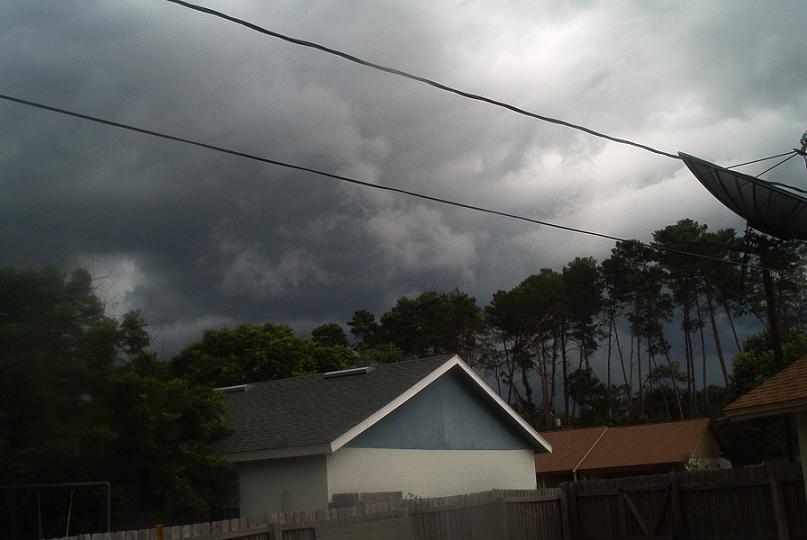
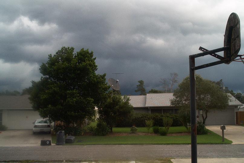
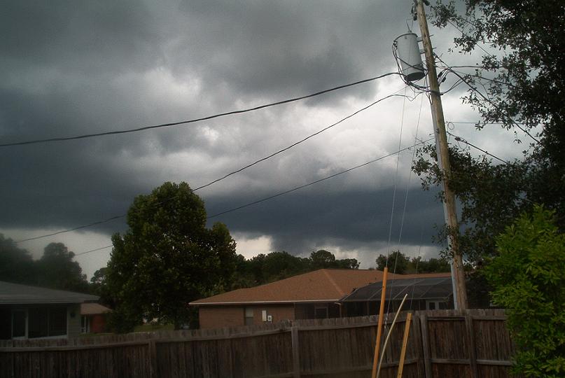
Pictures taken 10 min ago from my front and back yard.. Rolling in QUICK.. BIG BOOMERS!!!
Posted: Tue Jul 15, 2003 3:22 pm
by isobar
Wow, turn on the lights Chad. Looks like night time outside.
Impressive pics!
Posted: Tue Jul 15, 2003 3:22 pm
by therock1811
Looks nasty... stay safe!!!!!!!
Posted: Tue Jul 15, 2003 3:26 pm
by vbhoutex
ARe you having fun yet? Doesn't look that bad here in Hurricane land!!
Posted: Tue Jul 15, 2003 3:27 pm
by chadtm80
Raining Cats and dogs now


I am right under the dark red... SE of Daytona
Posted: Tue Jul 15, 2003 3:32 pm
by Lindaloo
Goodness... looks like tornado alley.
Posted: Tue Jul 15, 2003 3:50 pm
by chadtm80
I Love it

Posted: Tue Jul 15, 2003 4:18 pm
by Arizwx
Nice wall cloud/rotater setting up...later pic has a beauty of a 'Scud'..well done!
Posted: Tue Jul 15, 2003 4:18 pm
by Colin
WOW! :o Those are very impressive pics...stay safe!
Posted: Tue Jul 15, 2003 6:51 pm
by weatherwunder
Stay safe buddy!
Posted: Tue Jul 15, 2003 9:25 pm
by weatherlover427
What did you end up getting Chad?

Posted: Tue Jul 15, 2003 9:42 pm
by southerngale
Awesome pics Chad! How much rain did you get?
Posted: Wed Jul 16, 2003 12:07 am
by ColdFront77
There was some thunderstorm activity in my area as well. The sky didn't look as impressive as it did at your location, Chad... but the southern and western sky still had some ominous clouds, the lightning in the clouds to the north was more interesting than the southern sky.
This Severe Thunderstorm Warning was in effect:
BULLETIN - EAS ACTIVATION REQUESTED...CORRECTED LOCATION NEAR STORM
SEVERE THUNDERSTORM WARNING
NATIONAL WEATHER SERVICE MELBOURNE FL
527 PM EDT TUE JUL 15 2003
THE NATIONAL WEATHER SERVICE IN MELBOURNE HAS ISSUED A
* SEVERE THUNDERSTORM WARNING FOR...
CENTRAL LAKE COUNTY
NORTHWESTERN ORANGE COUNTY
IN EAST CENTRAL FLORIDA
* UNTIL 615 PM EDT
* AT 524 PM EDT...NATIONAL WEATHER SERVICE DOPPLER RADAR INDICATED A
SEVERE THUNDERSTORM OVER FERNDALE. THE STORM WAS NEARLY
STATIONARY.
OTHER LOCATIONS NEAR THIS STORM INCLUDE MONTEVERDE AND LAKE APOPKA.
SEVERE THUNDERSTORMS PRODUCE DAMAGING WINDS IN EXCESS OF 58 MILES AN
HOUR...DESTRUCTIVE HAIL...DEADLY LIGHTNING AND VERY HEAVY RAIN. IF
THE STORM APPROACHES YOU...MOVE TO AN INTERIOR ROOM ON THE LOWEST
FLOOR.
LAT...LON 2856 8180 2851 8160 2872 8149 2879 8176
Posted: Wed Jul 16, 2003 7:24 pm
by chadtm80
3.5 Inches!!
Posted: Wed Jul 16, 2003 7:47 pm
by therock1811
And you needed every bit too!!!!!!!!
Posted: Wed Jul 16, 2003 8:31 pm
by chadtm80
Yep!! I Love the Florida summer storms