SE TX/SW LA Discussion Thread - Mid 80's and sunny this week
Posted: Wed Mar 28, 2007 10:35 am
Here's the new thread, I didn't get all creative with the title though.
This is the latest from Jeff:
Classic spring severe weather pattern shaping up for the plains for the next several days.
Discussion:
Main issue today will be the wind as pressures fall in the lee of the Rockies and SE wind greatly increases over TX. Already getting gust near 40 over W TX and suspect with thermal mixing some area will gust above 50mph W of I-35. Over SE TX sustained speeds of 20-25mph will be common by afternoon. Strong onshore flow will continue through Friday afternoon with gulf seas building to 4-8 feet due to long southerly fetch. South wind flow should negate tidal build up as typically ESE and E winds result in the higher tides due to Ekman transport. With that said building wave action may result in some tidal run-up at times of high tide. Low level jet will crank every evening and continue overnight with area terminals experiencing strong speed shear in the lowest levels of the atmosphere.
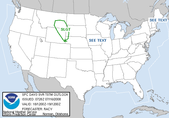
Dryline is sharpening over W TX through the central plains with very moist southerly flow extending from TX into South Dakota. Dryline will fire off by late afternoon with tornadoes being the threat in a linear line from WC TX through Kansas. Ejection of multiple short waves ahead of main upper low over SW US should result in daily severe threat over TX mainly W of I-35 through Friday. Threat may shift far enough east Friday night to include SE TX as main upper storm ejects into the central plains dragging the dryline toward the area. Will focus on this part of the forecast as this appears to be the main “action” time.
Active weather event should develop by Friday afternoon as strong lift ejects out of Mexico into SW TX where moist southerly flow with unstable and potentially high sheared air mass will be in place. Expect Mexican capping layer to erode by mid afternoon along the dryline as temps. climb into the mid to upper 80’s and large scale lift overspreads the region. Supercells should initiate by late afternoon near or east of the Rio Grande and develop/move ENE through Friday night on the edge of the large scale ascent and into favorable low level flow off the Gulf. Hodographs over S and SC TX favor tornadic storms with cells moving to the right of the mean flow (right moving cells). As is typical in such events, supercells will gradually transition into a line or line segments and may grown upscale into an MCS/bow echo as it moves toward the TX coastal bend and SE TX. Strong low level jet of 40-50kts being overspread by 80-80kts of WSW mid level flow should support storm organization and maintain the event through the overnight hours. Expect some form of a squall line/MCS/bow echo to cross SE TX very late Friday evening or Saturday morning with a severe and heavy rainfall threat. Pattern thereafter is somewhat muddled as models are hinting that energy will hang back over the SW US and the dryline will redevelop by Sunday over SW TX ahead of a returning boundary off the TX coast. This could spell problems for Sunday evening into Monday.
Heavy Rainfall:
GFS is suffering from heavy convective feedback bombs and is producing excessive rainfall over NW and C TX. Dryline position over the next 3 days will remain along and W of I-35 with the focus for very heavy daily rains along and W of I-35 and generally N of Austin. Max QPF from HPC is focused over the middle and upper Brazos basin which is on the rise from heavy rains on Monday. Excessive rainfall over the Brazos and Colorado basins may result in significant downstream main stem rises and potential problems given already swollen rivers and saturated grounds. Locally rainfall Friday night should result in a widespread 1-2 inches which should be handled as long as the line progresses through and does not slow.
Jeff Lindner
This is the latest from Jeff:
Classic spring severe weather pattern shaping up for the plains for the next several days.
Discussion:
Main issue today will be the wind as pressures fall in the lee of the Rockies and SE wind greatly increases over TX. Already getting gust near 40 over W TX and suspect with thermal mixing some area will gust above 50mph W of I-35. Over SE TX sustained speeds of 20-25mph will be common by afternoon. Strong onshore flow will continue through Friday afternoon with gulf seas building to 4-8 feet due to long southerly fetch. South wind flow should negate tidal build up as typically ESE and E winds result in the higher tides due to Ekman transport. With that said building wave action may result in some tidal run-up at times of high tide. Low level jet will crank every evening and continue overnight with area terminals experiencing strong speed shear in the lowest levels of the atmosphere.
Dryline is sharpening over W TX through the central plains with very moist southerly flow extending from TX into South Dakota. Dryline will fire off by late afternoon with tornadoes being the threat in a linear line from WC TX through Kansas. Ejection of multiple short waves ahead of main upper low over SW US should result in daily severe threat over TX mainly W of I-35 through Friday. Threat may shift far enough east Friday night to include SE TX as main upper storm ejects into the central plains dragging the dryline toward the area. Will focus on this part of the forecast as this appears to be the main “action” time.
Active weather event should develop by Friday afternoon as strong lift ejects out of Mexico into SW TX where moist southerly flow with unstable and potentially high sheared air mass will be in place. Expect Mexican capping layer to erode by mid afternoon along the dryline as temps. climb into the mid to upper 80’s and large scale lift overspreads the region. Supercells should initiate by late afternoon near or east of the Rio Grande and develop/move ENE through Friday night on the edge of the large scale ascent and into favorable low level flow off the Gulf. Hodographs over S and SC TX favor tornadic storms with cells moving to the right of the mean flow (right moving cells). As is typical in such events, supercells will gradually transition into a line or line segments and may grown upscale into an MCS/bow echo as it moves toward the TX coastal bend and SE TX. Strong low level jet of 40-50kts being overspread by 80-80kts of WSW mid level flow should support storm organization and maintain the event through the overnight hours. Expect some form of a squall line/MCS/bow echo to cross SE TX very late Friday evening or Saturday morning with a severe and heavy rainfall threat. Pattern thereafter is somewhat muddled as models are hinting that energy will hang back over the SW US and the dryline will redevelop by Sunday over SW TX ahead of a returning boundary off the TX coast. This could spell problems for Sunday evening into Monday.
Heavy Rainfall:
GFS is suffering from heavy convective feedback bombs and is producing excessive rainfall over NW and C TX. Dryline position over the next 3 days will remain along and W of I-35 with the focus for very heavy daily rains along and W of I-35 and generally N of Austin. Max QPF from HPC is focused over the middle and upper Brazos basin which is on the rise from heavy rains on Monday. Excessive rainfall over the Brazos and Colorado basins may result in significant downstream main stem rises and potential problems given already swollen rivers and saturated grounds. Locally rainfall Friday night should result in a widespread 1-2 inches which should be handled as long as the line progresses through and does not slow.
Jeff Lindner