Weather in Croatia:Goodbye 2013

Weather events from around the world plus Astronomy and Geology and other Natural events.

Moderator: S2k Moderators

Forum rules

The posts in this forum are NOT official forecast and should not be used as such. They are just the opinion of the poster and may or may not be backed by sound meteorological data. They are NOT endorsed by any professional institution or STORM2K.

Help Support Storm2K
Message
Author
User avatar
Crostorm
Category 5
Category 5
Posts: 2060
Age: 49
Joined: Mon Dec 25, 2006 3:51 pm
Location: Croatia-Europe
Contact:

Re: Weather in Croatia:Goodbye (Meteorological) 2010.

#141 Postby Crostorm » Thu Dec 30, 2010 2:52 pm

June

Last day climatological spring, 31 May and June marked the first days of the cyclone and its accompanying Fabian, marked cold front that moved across the country. Already in the first 24 hours the cyclone impacts have fallen in some places large amounts of rain. Most abundant rain fell and in Slavonia. In Slavonski Brod of 29 May to 5 June fell to 170 mm of rain. Of these, 150 mm fell in three days, from 30.5. to 2.6.
Balance due to floods in Slavonia, the first June has become alarming, and the rain still did not stop falling.
Flooded fields and local and county roads, and many houses. From the many flooded villages to evacuate the population of boats. Casting the many streams and rivers. River Bosut be poured on the outskirts of Vinkovci. The aid was sent to the affected population by the army. In many places declared a state of emergency and natural disasters. At the same time adding to the damage and withdrawal of water, began to follow a large water wave on the Danube, about two meters high, which was formed in Germany, Austria, Slovakia and Hungary.The wave came on 11th June, and the next two days, due to good preparation dike passed without major consequences for Vukovar and 13 June left Croatia.

Gradište, foto: Ivan Baboselac
Image

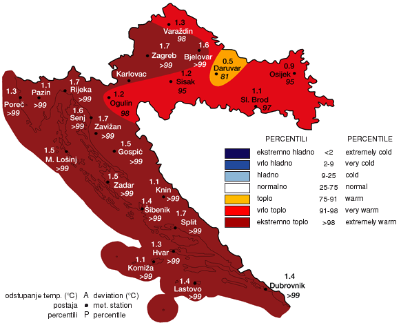
After leaving the cyclone Fabian, summer is taking more rampant and much of the country have affected the heat. The second part of the first week in June was all the more stable and warmer. The 10th June temperatures have risen almost everywhere above 30 ° C. The warmest was in Osijek (Klis) where it measured 32.9 ° C.
Saturday, 12 June passed the peak of the current heat wave. Maximum temperature in Osijek (Klis) and Slavonski Brod was 35.3 ° C, and Šibenik 35 ° C. That's the day the entire interior heated at temperatures of 32-34 ° C. It was hot along the coast, and only occasionally the highest daily temperature was slightly below 30 ° C. Heat, with temperatures reaching 32 ° C and continued up to half of June.
The transition from spring to summer calendar, starting from 16 June brought the stormy weather conditions that have culminated in the cyclone Gertrude, with whom he and prompted the spring calendar. After a few days premature summer heat erupted were severe storms across the country that have caused much damage.
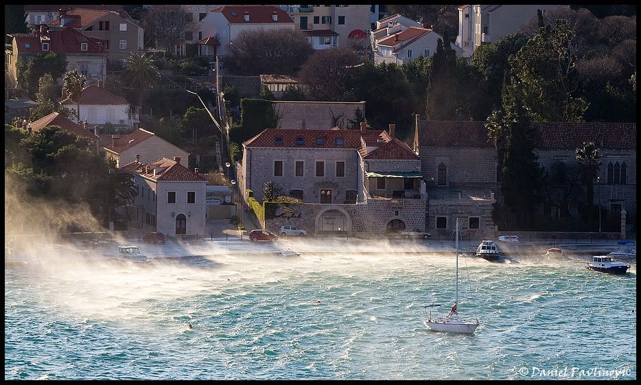
In particular, it was expressed cyclone Gertrude. We'll remember it in stormy wind in Zagreb, a series of waterspouth on the sea near Dubrovnik, the coldest day of the calendar first summer in Zagreb since the water data, record daily rainfall quantity in Osijek. Heavy rain that fell this week in Slavonia only brought new flooding .
The amount of rain that fell during that period was often very large. According to the DHMZ the highest in the period from 16 to 23 June fell to Zavizanu, 156 mm. For comparison, the monthly average is 139.3 mm. More than 100 liters of rain in that period are measured and Daruvar (152 mm), River Kozala (151 mm), Osijek Čepin (139 mm), Pula airport (111 mm), Gradište 105 mm, 104 mm and Parg Ogulin 101 mm .

Dubrovnik, 21.6.2010.
Image
0 likes   

User avatar
Crostorm
Category 5
Category 5
Posts: 2060
Age: 49
Joined: Mon Dec 25, 2006 3:51 pm
Location: Croatia-Europe
Contact:

Re: Weather in Croatia:Goodbye (Meteorological) 2010.

#142 Postby Crostorm » Thu Dec 30, 2010 3:07 pm

July

In this period there was no distinct storms. With plenty of sunshine temperatures often exceed 30 ° C, but up to half of the month have not climbed above 35 ° C. Pronounced heat wave occurred in the middle of the month and lasted about ten days, and it was briefly interrupted by a partial front from the northwest.
In the second decade of July draw us to severe heat wave which has seen its peak in mid month. On Thursday, 15 July, due to the use of air conditioners, has been achieved up to now the biggest summer daily consumption of electricity was only 10 percent lower than so far achieved the maximum winter demand. Temperatures across the country were more than 30 ° C, often 35 ° C. The night from Thursday to Friday (15./16.7.) was the warmest night in Zagreb in July after being officially measured air temperature, since 1949. The lowest air temperature that night and morning at station Zagreb Maksimir was 24.3 ° C. On Friday, 16 July temperatures in Knin climbed to 39.4 ° C, as in the previous part of the summer the highest temperature reached in the country. In the night from Friday to Saturday (16./17.7.) temperature in Senj not descended below 30.3 ° C. The heat in the whole country was ruled on Saturday 17.7.
At night on Sunday 18th July in the northwest, there were local thunder showers, which were interspersed throughout Sunday and into the north of the Adriatic, and in the hinterland of Dalmatia and Slavonia.
After passing a maximum daily temperature fronts in the interior and the (smaller) in the north Adriatic Sea decreased for ten or more degrees, while in Dalmatia remained hot with temperatures around 35 ° C. Front Hidalgo is not inflicted any serious long-term "kick" the summer because they are already after two days across the country re-measured temperatures above 30 ° C. 23rd July is the last day of the July heat wave. In 15 hours, according to data MHS Knin was the warmest with 37 ° C, Karlovac and Sisak were measured 36 ° C, Zagreb Maksimir Makarska and 35 ° C. At most other stations on the scale 32-34 ° C. In Zagreb, the maximum temperature that day reached a value of 35.6 ° C which was the highest value in the last three years.

The maximum temperature 15th July 2010.
Image

Mid summer calendar, which includes the last of July and first week of August, has gone with a very variable and unstable weather. In this period we saw off 4 cyclone.
Ida is the first cyclone (24-27.7.) issued the final end of July heat in the interior and the northern Adriatic in Dalmatia it did cyclone Jerko end of the month. Many parts of the country, both inland and along the Adriatic region during the stronger storms, rain and locally heavy rain.
In Karlovac County, in Ozalj and Draganic was due to large damage, tornado devastated this region. Severe storm accompanied by hail has also caught the municipality in Sisak-Lekenik moslavina. 29th July is more pronounced storm swept the north-west of Istria. In a few hours and fell over 100 mm of rain (Buje 120 mm). Umag has flooded the stadium more like the swimming pool than on the tennis court. Thunder showers and storms were in Dalmatia, from Zadar to Dubrovnik. Temperature last day of July ranged between 21 to 23 ° C and were much lower than those in the first two decades of the month for the hot weather.

The storm tore down trees near Ozalj
Image

Flooded stadium during the Umag ATP Tournament
Image
0 likes   

User avatar
Crostorm
Category 5
Category 5
Posts: 2060
Age: 49
Joined: Mon Dec 25, 2006 3:51 pm
Location: Croatia-Europe
Contact:

Re: Weather in Croatia:Goodbye (Meteorological) 2010.

#143 Postby Crostorm » Thu Dec 30, 2010 3:24 pm

August

Period of unstable weather in the last week of July and has continued in early August. In the middle of the summer calendar has succeeded to combine a few days of stable weather throughout the country. The first two days of August have brought a stable time and temperature were rapidly over 30 ° C. Afternoon thunderstorms are beginning a new instability in the western parts of the new fronts (Caramela). Air temperatures are quickly falling considerably.
Most of the rain on the night of 3 and 4 August occurred in the Osijek area. At station Osijek Retfala in 24 hours fell as much as 59 mm of rain, most of which was the transition from Tuesday to Wednesday. (average rainfall for the whole August at Osijek 59.4 mm). The storm swept and Vinkovci, with strong winds, cloudburst and hail the size golf ball.

Pula, 3 August 2010. - photo Nino Rasic
Image

New cyclone Lucy from 5 to 7 August brought more pronounced change in time, across the country. Heavy rain has flooded homes, basements and roads in Zagreb, Samobor. Problems was created and a strong wind that was in Lekenik took half a roof on a school sports hall.

The storm has created problems for the sailors. Across the Adriatic Sea have been undertaken numerous search and rescue at sea and all were successful. 6th August near Cavtat has developed several waterspout.

Cavtat, 6 August 2010. - Photo Boris Basic
Image

After the cyclone Lucy (5-07.08.2010), followed by twenty more stable and hot summer days, but the July heat is not repeated, and the temperature in most of this period did not exceed 35 ° C. During this period, the Adriatic and several fires burned. Only one front and cyclone rapidly (Margaret) moved across the northern Adriatic Sea and inland 13th and 14 August, while in Slavonia and Dalmatia in the cyclone impact are hardly felt. The heat in August, had a brief peak 27th August (Slavonski Brod 36.5 ° C, Osijek (Klis) 36.3 ° C, 36 ° C Knin, Gradište 35.7 ° C, Makarska 35.2 ° C.)Such pronounced heat lasted only one day because it is 28 August broke the front associated with the cyclone Nestor. By evening, rain and colder weather spread across the entire interior of the northern Adriatic Sea.

Penultimate day climatological summer, 30 August marked the passage of cold fronts in the cyclone Orijana which brought colder weather and low temperatures. In the Adriatic was blowing a moderate to strong wind. Becoming clear night and weakening winds has contributed quite a cold morning last day of the climatological summer. Significantly below the climatological average temperature were recorded throughout the Croatian Tuesday morning. The lowest official temperature in Croatia was measured at Zavizanu, only 1 ° C. But the MHS these stations in Gospic in Parga, the 5cm of soil, there were only 0 ° C. So the last day of summer in the valleys of climatological Like a rare meteorological phenomenon observed - freezing!
0 likes   

User avatar
Crostorm
Category 5
Category 5
Posts: 2060
Age: 49
Joined: Mon Dec 25, 2006 3:51 pm
Location: Croatia-Europe
Contact:

Re: Weather in Croatia:Goodbye (Meteorological) 2010.

#144 Postby Crostorm » Thu Dec 30, 2010 3:41 pm

September

After the climatological fall began with a low temperature in Lika (up to 1.6 ° C) in the first week of the September there were no major weather excitement. In this week there was not much summer comfort, a little rain has brought the weakened fronts 6th September. The first score in autumn time change was adopted during the first decade of September. Pasko cyclone that everywhere in the country has brought a lot of rain. Most problems were in the area Sunje and the surrounding area, which was partially flooded after a large amount of rain that fell on the night of 9 to 10 September Sunja around midnight, caught a two-hour cloudburst and heavy rain was falling all night long. On the Croatian Kostajnice fell even 130 mm of rain. Many yard and stables were under water. Several roads were closed to traffic.

Flooded Sunja, 10 September 2010. (photo Mario92)
Image
Image

After the cyclone Pasko continued variable with another weak front 13th September. The second part of September is brought a lot of trouble with two cyclone Rozalija and Šemso.Last weekend of summer calendar brought in the western parts of Croatian, as well as in Slovenia, very large amounts of rain (cyclone Rozalija). At some stations in these three days more rain fell than the monthly average for the entire September: River Kozala 193 mm (average for September is 165 mm), Varaždin 115 mm (85.7 mm) and Zagreb Maksimir 87 mm (85.9 mm).

Very large amounts of rain, and over 200 mm fell on the north-west of Istria. Most problems were in Buja, Umag and Novigrad.Problems with flooding was in Koprivnica Krapina and Zagorje Križevci. On Sunday 20th September is a water wave on the Sava River arrived in Sisak Posavina, and in the next two days there have been major problems with flooding in this area, particularly in the wider area of Velika Gorica. Floods have taken one life. One person was killed when he fell under a truck that transported sand for construction of embankments in flood-hit village of Donje Črnkovec near Velika Gorica.
On Tuesday, 22 and Wednesday 23 September water began to withdraw from the flooded area, evacuated residents began returning home.

Sunday 19.9.2010. - Croatia - Sava (photo Zvonimir Katančić)

Image
Image

After heavy rains, which is a period of 17 to 19 September in the western parts of the country brought Rozalija cyclone, three days last summer calendar as the first day last fall in the sign of a stable and comfortable warm weather. However, stabilization did not last long, because the new cyclone, Šemsa September's last weekend brought back large amounts of rain and a number of problems.
Although cyclones Šemsa (24-28.9.) did not yield an extremely large amount of rain as its predecessor Rozalija, yet in most parts of the country fell more abundant rainfall, especially along the Adriatic Sea, especially in Dalmatia. Over the weekend, was again the appearance of very large amounts of rain in a short time.
During the night and morning, 25th September is the most rain fell in Istria, especially in the south of the peninsula, which led to flooding. At station Pula (city) in 24 hours fell even 169 mm of rain, and the station fell 166 mm of rain, of which almost all the amount (165 mm) fell after midnight Saturday 25th September, or more precisely in the period of a few hours after 2 hours of the morning.
Fažana - photo Glas Istre
Image
0 likes   

User avatar
Crostorm
Category 5
Category 5
Posts: 2060
Age: 49
Joined: Mon Dec 25, 2006 3:51 pm
Location: Croatia-Europe
Contact:

Re: Weather in Croatia:Goodbye (Meteorological) 2010.

#145 Postby Crostorm » Thu Dec 30, 2010 3:57 pm

October

Stable and dry weather, with which he began in October was not long before the first rain has brought the October cyclone Timothy (4 to 6 October). In most parts of the country's fifth October was cloudy weather with rain and the rain was most abundant in the wider area of Dubrovnik and Rijeka. At station Dubrovnik Ćilipi in just six hours (from 8 to 14 hours) that day fell as much as 92 mm of rain. On the Ground Station is 64 mm of rain fell. In addition to the south of the Adriatic Sea is abundant rain fell on the Rijeka region, particularly in the western part of the river and the area around Učka. At station Klan, fell as much as 127 mm in 24 hours. River Pehlin measured 87 mm, 83 mm Poljane, Opatija and 85 mm. Heavier rain was also in Gorski Kotar. At station Parg Čabar fell to 55 mm of rain.
After the cyclone Timothy next week the prevailing influence of the time she had a European anticyclones which brought stable during the first, the weak morning frosts in inland areas, but in the interior of Istria and the Dalmatian hinterland.

On Saturday, 16 October in the morning hours was a very rainy storm affected area Konavle. In less than four hours, starting at 5 o'clock in the morning at the station at Ground Konavlima fell to 170 liters of rain. Such large amounts of rain caused flooding and flood. The river flooded the Konavle field.

20th October is another fast fronts and cyclones (Zdeslav) moved through our area.
In the early afternoon and Wednesday cold front arrived to the west of the country, locally it was raining, and sometimes accompanied by hail and thunder.In the evening, with colder weather, rain in the mountains of Gorski Kotar and Lika, cross in snow.

Hurricane winds in the Velebit Channel, 26.10.2010. - Photo Aleksandar Gospic

Image

After leaving the cyclone Zdeslav, Wednesday, the 28th October is made clear throughout the morning in the interior of the first fall frost, and the negative temperature of -4 ° C to 0 ° C. On Zavizanu with 8 cm of snow temperature dropped to -8.3 ° C, with a strong wind. After the cyclone the end of October was stable and gradually warmer weather.
0 likes   

User avatar
Crostorm
Category 5
Category 5
Posts: 2060
Age: 49
Joined: Mon Dec 25, 2006 3:51 pm
Location: Croatia-Europe
Contact:

Re: Weather in Croatia:Goodbye (Meteorological) 2010.

#146 Postby Crostorm » Thu Dec 30, 2010 4:10 pm

November

Much of November was marked by above-average heat. November is on the Adriatic, Gorski Kotar and Lika, and in central and northwestern part of the Croatian brought above-average rainfall. The first 25 days was marked by warmth, with 4 cyclone that brought along the Adriatic and larger amounts of rain.
At the turn of October to November at the time was affected by the cyclone named Bella, who is on the northern Adriatic Sea in Dalmatia locally made large amounts of rain. After the cyclone Bella has strengthened anti-cyclones which brought several stable and beginning of November for a very hot day. The highest daily temperature in Slavonia and Dalmatia, and reaching 24 ° C. End of first week in November is marked by a new cyclone whole (7th-11.11.). Cyclone brought rain across the country, at least, only a few liters dropped on islands in central Dalmatia. More rain, from 70 to 120 mm was in Gorski Kotar, Lika and northern Adriatic Sea.

Especially in the Adriatic in Dalmatia blew strong south wind, so it was a problem in maritime transport. Low pressure combined with a strong southerly winds favored the sea level rise that culminated in 10th November. The waves are expressed with the help of the tide, flooding the Split .
After a cyclone followed by a whole new set of stable and above average number of hot days, when the maximum daily temperature in the interior of Dalmatia, and exceeded 20 ° C. The first few days the second half of November at the time was influenced by a new cyclone named Dunja.
Pronounced rainy storm has affected parts of the northern Adriatic Sea, especially south of Istria and part of the Rijeka region. 22nd November is during the morning in the city of Dubrovnik, fell 159 liters of rain per square meter. This rain flooded city, and the damage was high.

Dubrovnik 2.11.2010. Foto: Željko Tutnjević / DUBROVACKI VJESNIK / CROPIX
Image
Image
0 likes   

User avatar
Crostorm
Category 5
Category 5
Posts: 2060
Age: 49
Joined: Mon Dec 25, 2006 3:51 pm
Location: Croatia-Europe
Contact:

Re: Weather in Croatia:Goodbye (Meteorological) 2010.

#147 Postby Crostorm » Thu Dec 30, 2010 4:39 pm

December

Intense cyclonic activity over this region continues to transition from November to December After the cyclone Grozdan (28-11.29.2010.) Tuesday, 30.11. the weather is influenced by the new Atlantic cyclones Helena. Start the climatological winter has brought our country very different weather conditions.

Cold wave in western countries ended on Sunday 5.12. when the morning is brought inside the very low temperatures that were in Lika and Gorski Kotar and dropping below -10 ° C. The lowest temperature of - 15.7 ° C was measured in Josipdol.
In Lika, in those days was more abundant rain and new flooding problems, especially in the area of the municipality Kosinjski Perušić. In Dalmatia, at the end of November and early December and still retain the spring warm weather with temperatures that climbed to 20 ° C. In early December, in the Dubrovnik area of abundant rain fell again. There was also flooding in Makarska and the area of Trogir.
Those days at the turn of November in December with the worst flooding the state it was in the valley of the Neretva. Due to weeks of rain and high ground water from 1 to 5 December Neretva River has reached the highest level in history and flooded homes and farm buildings, crops and perennial crops, infrastructure, roads, public property and other businesses, causing them to direct a big loss. Neretva is flooded with Metkovića 1000 objects, 200 objects in Komin and five facilities in the tower Norinska.
Cold with the beginning of December did not last long. At the time of 6.12. began to affect the new cyclone, Iko was brought to three days with a pronounced wind blows, and abundant rain fell on the area of Rijeka. At MHS was the river goat in 24 hours 07/12/2010. 109.5 mm of rain fell tying the daily record for December . The highlight of the first wave warming was 8.12. when maximum temperatures reaching and spring values of 20 ° C. Throughout the country, the highest daily temperature ranged 15-19 ° C, and only in the higher mountains measure up to 10 ° C.

Inadequate heat of December quickly disappeared 9th December when it passed over us stronger cold front (Jasmine). Thursday morning it appeared that high air temperatures that are almost everywhere were double digit. At 7 pm the 10-15 or 16 ° C, and Petrinja and 17 ° C. Front of the morning until late evening, quickly spread from the northwest to the east and south of the country, bringing a pronounced change in time. The rain has turned the interior of the snow that was falling .The temperature is falling rapidly, and about ten degrees in half an hour. Thunder and ice and snow in some places there were along the coast where it blew a strong wind and storm. The most snow fell in Ogulin 15 cm. The next day the 10th December is the morning temperatures were up to twenty degrees lower than the previous day.

12th December through Dalmatia move another cyclone (Kastor), and in some cases have fallen and abundant rainfall, to 30 mm in the valley of the Neretva. During that week there was snow in some places in the Dalmatian hinterland and the coastal mountains, in the evening the snow in southern Dalmatia locally down to the sea! Thus, the first snow of the season fell on Ploce. In Vrgorac the height of snow cover at 22h was 5 cm, up to 20cm it was in the hinterland of the city. Strong thunderstorms with snow was recorded in the southernmost part of Dalmatia, and the snow was surprised the inhabitants of Peljesac and Korcula. In Orebic it was more than 10cm. Snowfall was recorded on the island of Mljet which doesnt happens every year.

Followed in mid-December a few dry days, but with very cold mornings. In Lika, the temperature fell below -20 ° C, and along the coast is nearly always either negative temperatures. 17th December arrived, a new cyclone Lada, and before it has dawned another very cold morning. Thick snow fell in the morning in Konavlima.Perhaps the most interesting weather day has arrived with the overhanging island - Palagruža. In the early afternoon, officials noted on the local lighthouse as a snowflake.Palagruza never officially been recorded the existence of snow, and only snowfall is extremely rare meteorological phenomena.
Abundant snow fell in central (Pazin 8 cm) and eastern Istria (Pula 15 cm). Under the weight of snow and the wind in Labin, many trees were destroyed. Snow was falling and the Kvarner islands, including Mali Losinj, and the evening was measured 5 cm of snow.

Snow during the night and extended into part of the interior, and continued to fall the next day. Unusual was the distribution of snow with very large differences in quantity. Most of the snow by morning 18th December occurred in Medjimurje and northern regions of the interior. Koprivnica and Čakovec measured 32 cm of new snow. Begovo Razdolje 66 cm.

Cyclone Lada passed so quickly after a bright night, with snow on the ground appeared more icy morning, especially in western and northwestern parts of the interior. Temperatures were 19.12. dropping below -20 ° C. The network of automatic stations pljusak.com lowest temperature of -22.6 ° C measured the station Bjelolasica Zrnići at 5:55 pm. From the coldest MHS station was Čakovec with -21 ° C. The minimum temperature in the interior were mostly lower than -10 ° C, and most of the Adriatic coast is measured negative values.

However, already this morning and felt the blows warming which will mark the next day. Čakovec was measured at 6 hours -21 ° C in Varazdin was -7 ° C. Already the next morning, 20 December temperature rose above zero everywhere. In Josipdol for thirty hours the temperature rose as much as 31 ° C. Heat and wind blows, the rain, especially in the Adriatic and continued until Christmas, which marked the impact of cyclone Marcel. All the snow has melted, and the Christmas morning dawned with no snow, even in the highest mountains. Even during the day the snow fell in the mountains, a day after he fell in most parts of the interior.
0 likes   

User avatar
Crostorm
Category 5
Category 5
Posts: 2060
Age: 49
Joined: Mon Dec 25, 2006 3:51 pm
Location: Croatia-Europe
Contact:

Re: Weather in Croatia:Hot winter in Europe

#148 Postby Crostorm » Tue Feb 08, 2011 9:10 am

Hot winter in Europe
Monday, February 7, the Balkans, 71 ° F in Tivat (Montenegro) 21.2 ° C in Banja-Luka (Bosnia and Herzegovina) 21.0 ° C in Podgorica (Montenegro), 20.9 ° C in Dubrovnik (Croatia) 20.3 ° C in Bar (Montenegro), 20.2 ° C in Mostar (Bosnia-E.). 11.3 °, 10.8 ° and 6.8 ° C average maximum of February in Podgorica, Mostar and Banja Luka.

In southern France, 20.9 ° C maximum on Monday to St.Girons, 19.7 ° C in Clermont-Ferrand, 19.6 ° C in Tarbes, Pau to 19.3 ° C, 19.0 ° C Gourdon, 18.8 ° C in Embrun (m 871), 18.2 ° C in Mont-de-Marsan.

In Spain, on Monday in Badajoz 19.6 ° C, 19.0 ° C in Jerez, 18.8 ° C in Madrid / Barajas. Sunday had exceeded 20 ° C in the Iberian country, with 22.1 ° C in Tortosa, 21.6 ° C in Girona, Murcia 21.2 ° C, 20.6 ° C in Murcia / Alcantarilla. These are the average of the highest in February: Murcia / Alcantarilla 18.2 °, 16.5 ° Tortosa, Badajoz 15.9 °, 13.9 ° Girona, Madrid / Barajas 12.9 ° C.

In Switzerland, especially impressive values in the mountains. Monday we have achieved 8.5 ° C to 1980 meters Grimsel Hospice, the 5.1 ° C Saentis (m 2500). The air mass is very dry at altitude, the Jungfraujoch (3580 m) have reached -0.6 ° C, with moisture throughout the day remained below 10%. At Weissflujoch (2690 m) in the Grisons, the maximum was 4.6 ° C and the humidity never exceeded 15%. 3.7 ° C maximum to 2885 meters of Monte Rosa Plattje (1.1 ° C above the minimum), with ur constantly below 10%.

Temperature also positive for 2962 meters of the Zugspitze, Germany's roof, where they met Monday to +1.6 ° C (-8.7 ° C, the mean maximum in February), with bright sunshine and humidity below 10% . 4.7 ° / 9.2 ° C at the extremes of the Wendelstein 1832 meters, almost 12 ° C above average.

Today in Croatia was the warmest in Knin was measured as 21 ° C. In Ogulinu measured 20 ° C, Pazin 18 ° C, Parg 17 ° C. The highest daily temperatures everywhere were higher than 11 ° C. The lowest maximum temperature was measured in Gradiste (11.4 ° C). Minimum temperatures were negative in the lowlands of the interior, the interior of Istria and Lika. Coldest was in Gospic (-7.3 ° C) and Pazin (-5.8 ° C).
Interesting are the temperature ranges, ie the difference between the minimum and maximum temperatures for some locations. Knin had amplitude of 26 ° C, Pazin of 24 ° C.
0 likes   

User avatar
Crostorm
Category 5
Category 5
Posts: 2060
Age: 49
Joined: Mon Dec 25, 2006 3:51 pm
Location: Croatia-Europe
Contact:

#149 Postby Crostorm » Mon May 09, 2011 1:26 am

We retail and current data. Snow in Europe's 08th May 2011. by Ogimetu:

Kredarica, 2514 m above sea level, Slovenia, 250 cm
Sonnblick, 3105 m asl, Austria, 235 cm
Saentis, 2490 m asl, Switzerland, 225 cm
Zugspitze 2962 m altitude, Germany, 210 cm
Kanin, Slovenia, 130 cm
Vf. Omu, 2504 m above sea level, Romania, 128 cm
Lomnicky Shield, 2633 m asl, Slovakia, 84 cm
Suolovuopmi Lulit, 382 m above sea level, Norway, 62 cm
Kilpisjärvi, 478 m above sea level, Finland, 48 cm
Vrah Botev, 2384 m above sea level, Bulgaria, 30 cm
Villacheralpe, 2140 m asl, Austria, 29 cm
Chopok, 2008 m asl, Slovakia, 26 cm
Paganella, 2125 m asl, Italy, 25 cm
Ceahlau Toaca, 1897 m above sea level, Romania 20 cm
Cherni vrah, 2286 m above sea level, Bulgaria, 18 cm
Bjelasnica, 2067 m above sea level, BiH, 10 cm
Naluns-Schlivera, Switzerland, 2400 m above sea level, 3 cm
Monte Cimone, 2165 m asl, Italy, 2 cm
0 likes   

User avatar
Crostorm
Category 5
Category 5
Posts: 2060
Age: 49
Joined: Mon Dec 25, 2006 3:51 pm
Location: Croatia-Europe
Contact:

Re: Weather in Croatia:

#150 Postby Crostorm » Wed Dec 28, 2011 5:28 pm

Dubrovnik storm wind, measured the 15-minute average was 23 m / s, and the strongest 40 m / s.

Foto:Daniel Pavlinovic

Image

Image

more on http://www.crometeo.net/phpbb/viewtopic.php?f=5&t=7576
0 likes   

User avatar
Crostorm
Category 5
Category 5
Posts: 2060
Age: 49
Joined: Mon Dec 25, 2006 3:51 pm
Location: Croatia-Europe
Contact:

Re: Weather in Croatia:Hot winter in Europe

#151 Postby Crostorm » Sun Jan 01, 2012 2:52 pm

New Year,but the weather is the same, :sun:

Today max temperatures

Image

On Adriatic coast people today went swimming,the sea temperature is 16 °C

Image

more
:rarrow: http://www.crometeo.net/phpbb/viewtopic ... 76#p899853
0 likes   

User avatar
Crostorm
Category 5
Category 5
Posts: 2060
Age: 49
Joined: Mon Dec 25, 2006 3:51 pm
Location: Croatia-Europe
Contact:

Re: Weather in Croatia:Hot winter in Europe

#152 Postby Crostorm » Tue Jan 03, 2012 5:47 am

Nothing change in Croatia,the temperature are still high

Image
0 likes   

User avatar
Extratropical94
Professional-Met
Professional-Met
Posts: 3535
Age: 29
Joined: Wed Oct 20, 2010 6:36 am
Location: Hamburg, Germany
Contact:

#153 Postby Extratropical94 » Tue Jan 03, 2012 9:39 am

Same here in Germany.
10C / 50F on January 1st, simply because of that westerly air flow.
At least we get some decent windstorms here that lead to some high water levels. 6-8 feet above the mean tide hasn't been a rarity these days.
For example the low tide tonight is expected to be just as high as the usual high tide, which is a whole 11 ft. difference.

How high are the tides at the Adriatic coast, Crostorm?
0 likes   
54° 11' 59'' N, 9° 9' 20'' E
Boomer Sooner!
Go Broncos! Go Cards! Go Niners!
- Daniel

User avatar
Crostorm
Category 5
Category 5
Posts: 2060
Age: 49
Joined: Mon Dec 25, 2006 3:51 pm
Location: Croatia-Europe
Contact:

Re: Weather in Croatia:Hot winter in Europe

#154 Postby Crostorm » Wed Jan 04, 2012 8:14 am

Tidal dynamics in the Adriatic Sea was described by a number of authors in the last century. Adriatic tides are of mixed type, which means that in some periods semidiurnal tides are predominating, exchanging the sea level rise and fall twice a day, while in some periods diurnal tides prevail, causing the sea level rise and fall once a day. In 1960 Italian geophysicist Polli described the acting of tidal force on the Adriatic sea level by using seven basic tidal constituents, neglecting the influence of other constituents as they do not significantly change the sea level. The amplitudes and phases of constituents were estimated by analysing the data collected on 30 tide gauges, namely of the semidiurnal constituents M2 (main Moon), S2 (main Sun), K2 (Moon-Sun) and N2 (elliptical Moon), and of the diurnal constituents K1 (Moon-Sun), O1 (main Moon) and P1 (main Sun).
Spreading of tides in the Adriatic is usually described by the largest M2 and K1 constituents, while other semidiurnal and diurnal constituents behave similarly to the respective M2 and K1. Common characteristic of the semidiurnal tides is rotating around the so-called amphydromic point that is placed between Ancona and Šibenik, having small amplitudes there. The amplitudes are increasing rapidly from that point to the northwest, with the maximum values inside the Gulf of Trieste (M2 tide amplitude equals 26 cm). Semidiurnal amplitudes are also increasing from the amphydromic point to the southeast, reaching the maximum between Pelješac peninsula and Italian coast, but their values are less than half of the maximum ones occurring in the North Adriatic.
Diurnal tides are propagating from the Croatian to the Italian coast, whereas the amplitudes are rising from the South to the North Adriatic. K1 amplitude varies from 5 cm at Dubrovnik to 18 cm in the Gulf of Trieste. Mean daily tidal range along the eastern Adriatic coast, based on the long-term sea level measurements, is estimated to be 22 cm at Dubrovnik, 23 cm at Split, 25 cm at Zadar, 30 cm at Bakar and 47 cm at Rovinj.
Image
Forced oscillations of the sea level are characterized by no significant disruption of the hydrostatic balance in the sea. Such behaviour is aperiodic and mainly caused by the forcings of long-lasting and strong winds as well as by pronounced air pressure excesses. The lower is air pressure the higher is sea level and vice versa. The acting of wind on the sea surface is complex, depending on the topography of the basin and on the wind speed, direction and duration. In the Adriatic Sea the southeast winds (Sirocco) raise the sea level, especially in the North Adriatic, where a long-lasting Sirocco and low air pressure can raise the water level up to 1 m. Wind influence is less important in the South Adriatic, where the air pressure dominantly influence the sea level changes, up to 30 cm.

STORM SURGES AND SEICHES IN THE ADRIATIC SEA
Image
Modelled sea level rise excited by Sirocco

Free oscillations - seiches - occur as a sea response on the sharp changes of meteorological parameters over the basin, especially the wind. Along-basin winds can pill up the water on the closed end of a basin, creating the sea level difference between the open and closed ends of the basin. If the wind suddenly changes its speed and/or direction, hydrostatic balance is disrupted and it tends to be restored by periodical oscillations of the sea level. Seiche periods are determined by the dimensions and topography of the basin, whereas the amplitudes depend on the changes of the wind speed and direction. The most pronounced seiche in the Adriatic Sea is uninodal seiche having a period of 21.2 h, but the second mode with a period of 10.8 h is significant as well. The main Adriatic seiche represents a uninodal oscillation with nodal line placed in the Otranto Strait, while the second mode has nodal lines in the Otranto Strait and on the section Pelješac - Monte Gargano. In addition, the seiches of the Middle and North Adriatic treated as single basin can appear notably as well, having periods of 8.2 and 6 h. Seiches also occur in smaller semi-enclosed regions, such as Middle Adriatic (4 h), Rijeka Bay (2 h), Kaštela Bay (1 h), but also in small bays and harbours (Vela Luka Bay - 15 min, Split harbour - 7 min, Zadar harbour - 4 min).

Image
Seiche episode in December 1997. Time series of residual sea levels illustrate
sea level changes driven by the atmospheric forces (air pressure and wind).

HHI
0 likes   

User avatar
Crostorm
Category 5
Category 5
Posts: 2060
Age: 49
Joined: Mon Dec 25, 2006 3:51 pm
Location: Croatia-Europe
Contact:

Re: Weather in Croatia:Hot winter in Europe

#155 Postby Crostorm » Fri Jan 06, 2012 4:47 pm

WEATHER REPORT ISSUED BY THE MARINE METEOROLOGICAL CENTER SPLIT
ON 06.01.2012 AT 1200 HOURS


WARNING

LOCAL GUSTS OF NE, IN THE OPEN SEA OF N and NW WIND, 30-70 KNOTS. SEA IN THE OPEN OF THE SOUTH AND CENTRAL ADRIATIC 5-6.
SYNOPSIS

A low is shifting from the South Adriatic southeastwards.
WEATHER FORECAST FOR THE ADRIATIC FOR THE FIRST 12 HOURS

N and NW, along the coast NE wind, 12-28, in the Central and South Adriatic up to 40 knots. Sea 3-4, in the open of the South and Central Adriatic 5-6. Visibility 20 km. Gradual clearing, but in the South Adriatic and in the open sea, still a risk of rain at first.
WEATHER FORECAST FOR THE NEXT 12 HOURS

Mostly clear. Moderate to strong, in the Central and South Adriatic up to gale force NE, in the open N and NW wind, diminishing a little. Sea slight and moderate, in the open of the South and Central Adriatic still rough and very rough. Air temperatures will drop.
PMC - Split
Image
Image

Image
Image
Makarska 51,3 m/s
Image
Image
0 likes   

User avatar
Crostorm
Category 5
Category 5
Posts: 2060
Age: 49
Joined: Mon Dec 25, 2006 3:51 pm
Location: Croatia-Europe
Contact:

Re: Weather in Croatia:Strong wind 06.1.2012(Bura)

#156 Postby Crostorm » Fri Jan 06, 2012 4:52 pm

Images from Makarska
Photo:Toni Katic
http://www.crometeo.net

One short video from Makarska
[youtube]http://www.youtube.com/watch?v=K2cTHhT9jSs[/youtube]

Image


Image


Image


Image


Image


Image


Image


Image


Image
0 likes   

User avatar
Crostorm
Category 5
Category 5
Posts: 2060
Age: 49
Joined: Mon Dec 25, 2006 3:51 pm
Location: Croatia-Europe
Contact:

Re: Weather in Croatia:Climate monitoring 2011

#157 Postby Crostorm » Sun Jan 08, 2012 12:16 pm

Air temperature anomalies for Croatia in 2011.

The average annual air temperature in Croatia for 2011 was above the multi-annual average (1961-1990). Average annual air temperature anomalies were within the range from 0.5°C to 1.7°C.
According to percentile classification, thermal conditions in Croatia for 2011 have been described by following categories: extremely warm (whole Adriatic and its hinterland as well as the large area of the central Croatia), very warm (some areas of the central and eastern Croatia) and warm (one area of the northeastern Croatia).

Image

Precipitation amounts for Croatia in 2011.

An analysis of annual precipitation amounts for 2011 given in percentages (%) of the multi-annual average (1961-1990), shows that these precipitation amounts were, except for one island of the southern Adriatic (Vis), below the mentioned average. Mainly the continental part of Croatia as well as Adriatic belong the category extremely dry, while within the category very dry there are some areas of the northern, middle and southern Adriatic. One area of the northern Adriatic as well as one island of the southern Adriatic is within the category dry, while several islands of the southern Adriatic belong to the category normal.

Image
DHMZ
0 likes   

User avatar
Crostorm
Category 5
Category 5
Posts: 2060
Age: 49
Joined: Mon Dec 25, 2006 3:51 pm
Location: Croatia-Europe
Contact:

Re: Weather in Croatia:Goodbye (Meteorological) 2011.

#158 Postby Crostorm » Sun Jan 08, 2012 3:00 pm

At the end of the year I will put the most interesting moments of weather in 2011

# 1 - SPRING IN JANUARY
Most of the first two decades of January is marked by "spring". First five days of the month is marked by cold weather, which was a continuation of the cold period of the last week of the 2010th year. The interior temperature did not rise above zero degrees Celsius, with frequent fog and low clouds in the valleys. On the second day he was due to a weakened front inside and a little snow fell. In the higher mountains and the Adriatic was a lot of sunny weather.
The January spring began on 6 and lasted until the 19th January 6th January, after a ten-day period under the all-day "minus", the highest daily temperatures across the country rose above zero degrees. With the Atlantic cyclone is approaching, a south wind and southwest flow is increasingly strengthened. In such a situation the time Rijeka area has received plenty of rain (59 mm in two days), while most of the country was mostly dry, windy and warm weather. Zagreb on 8 January had a minimum temperature of 10.3 ° C, and it was the warmest morning of that date in the period 1861-2011, for 150 years of recording data. It was the January and the sixth warmest morning in Zagreb last 150 years.
Start the second week in January, which marks the decade of climatological winter, rendered almost spring-like appropriate middle of April, and not January. 9th January, the highest daily temperature in most parts of the country were more than 15 ° C. In Slavonski Brod was measured up to 18 ° C. Maximum temperature at station Zagreb Grič of 15.5 ° C was the highest on that date (January 9th) in the last 150 years.
From 10 to 12 January on time is influenced by Nikolina, the first named cyclone in 2011. year. Most of the rainfall was in the Adriatic (especially in the area of ​​Rijeka), with local showers and thunderstorms. Inside, the rain was very little or not at all, and only Zavižan got a few inches of new snow.On 11th January the height of the snow cover on Zavižanu is 8 cm. 17th and 18 January Zavižan was no snow cover. In 1954. years, only six years saw the January day or days without snow cover on Zavižan.
After the cyclone Nikolina, mid-January was marked by the influence of warm, Mediterranean anticyclone, which brought spring-like in the middle of January What was hot in height is best explained by the fact that on the 14th Zavižanu January measured maximum temperature of 10.4 ° ​​C, which was not far from the absolute maximum temperature for January, which amounts to 12.5 ° C (16 January 1993.).
17th January is Ogulin and Knin measured temperature of 20 ° C. Unusually warm that day was in the Gorski Kotar and Lika. In 13 hours the Slunj measured 19 ° C, Plitvice, Udbina and Parg Čabar 17 ° C. On the Adriatic Mljet was the hottest at 18 ° C. Coldest January's on that Monday was foggy on the south of Istria, and the temperature at the airport Pula climbed only to 6 ° C. And most of the foggy northern Adriatic was measured to 10 ° C. Spring in January lasted until the end of the second decade, when the cyclone Otto returned to the winter atmosphere.
snowdrop flower photo Vladyx 10.1.2011.
Image
0 likes   

User avatar
Crostorm
Category 5
Category 5
Posts: 2060
Age: 49
Joined: Mon Dec 25, 2006 3:51 pm
Location: Croatia-Europe
Contact:

Re: Weather in Croatia:Goodbye (Meteorological) 2011.

#159 Postby Crostorm » Sun Jan 08, 2012 3:08 pm

# 2 - Winter cyclone Oton on the end of January

End of spring in the middle of January came in the late second and early third decade of the cyclone Oton (19.-01.26.2011.) Front from the northwest is the first precipitation, with snow in the mountains, passed 19th January Behind the front, began to flow into colder air from the north, in the Tyrrhenian Sea formed cyclone Oton. It is combined with a strong anticyclone over northwest Europe has brought our country winter atmosphere, especially in the highlands and in Dalmatia.
In Gorski Kotar and Lika in the first three days of cyclone activity occurred more than two feet of snow. Begovo Razdolje is 22.1.2011. measure 55 cm of snow, Plitvice Lakes 52 cm, 50 cm Zavižan, Delnice 43 cm, 40 cm Ogulin, Parg Čabar Slunj and 30 cm. Up to 12 inches of snow fell in Slavonia, while in the northwestern parts of the interior absent. Snow is these days often fall in Dalmatia, and in its interior, but also along the coast and on some islands. At the beginning of cyclone activity in the southern Adriatic was pronounced lightening showers. At the station Dubrovnik in 24 hours (20 January) Ćilipi fall 109 mm rain.

Wind snow storms were on the northern Adriatic Sea, especially at the foot of Velebit. Strong wind storms created a huge traffic problems, and several highways were closed on Maslenica, as the Adriatic highway from Senj to Karlobag. On the Krk bridge is 21 January bora measured at 190 km / h.
Another snowfall on 26 January engulfed much of northern and central Dalmatia, and the snow cover is formed in its interior. Snow was falling in Zadar, Sibenik, Split, in the southern part of Makarska Riviera. Abundant snow has fallen at the Dalmatian hinterland. In Drnis being attacked by 15 cm, while the area surrounding Sinja and fell several inches of snow. That day is 13 hours the temperature in Zadar and Split was 4 ° C in a sunny Zagreb 8 ° C. Snow in the Dalmatian hinterland committed a lot of damage to olive trees.
In particular, low temperatures are measured these days in Lika, where the temperature dropped below -15 ° C. 25th of January temperature at the station Jelvica fell to -19.4 ° C. Brinje and Stajnica were that morning measured -17.5 ° C. Only a week earlier Stajnica measured thirty degrees higher temperature (14.4 ° C).
Last days of January brought calm weather, while strengthening the European anticyclone.

Snow flakes over Dubrovnik 23.1.2011. - Photo: Daniel Pavlinović
Image
0 likes   

User avatar
Crostorm
Category 5
Category 5
Posts: 2060
Age: 49
Joined: Mon Dec 25, 2006 3:51 pm
Location: Croatia-Europe
Contact:

Re: Weather in Croatia:Goodbye (Meteorological) 2011.

#160 Postby Crostorm » Sun Jan 08, 2012 3:17 pm

# 3 - Hot and dry first half of February

February has started in the sign of an anticyclone. In the Adriatic and in the highland brought sunny, and in the lowlands of the interior gloomy and foggy weather, with a maximum daily temperatures that are everywhere on the first day of the month were negative. So that day Dubrovnik (15 ° C) was even 22 degrees hotter than the Vukovar (-7 ° C). How is February progressed, more and more sun and warmth in any interior, while the winter morning reminded only of negative temperature. Already the fourth February daily maximum temperature in the interior were positive, and the 5th February and double-digit. Morning they were still very cold in the mountains. Plitvice is the day after the morning -12 ° C, measured at mid-day 11 ° C.
On the sixth day of February set a new temperature record for February in Zavižan. The temperature in the afternoon climbed to 13.8 ° C, which was one tenth of a degree higher than previous record (13.7 ° C on 24 February 1990). This maximum temperature at Zavižanu be expected in June. That was the day Knin was the hottest at 21 ° C, then Ogulin a 20 ° C and Pazin at 18 ° C. Knin was the day I had amplitude of 26 ° C, and Pazin of 24 ° C. It was the first in a series of four days in Knin with the highest daily minimum temperature of 20 ° C.

A day later, 7 February Knin was measured 22 ° C, Ćilipi 21 ° C, and Ogulin, Osijek, Dubrovnik Imotski and 20 ° C. In most parts of the country's highest daily temperature was higher than 15 ° C.Zavižan not repeated temperature record from the previous day, but it is still very warm. The temperature is dropped below 6.6 ° C. Average daily temperature in Zavižan on 7 February was 7.8 ° C as much as 12 ° C higher than the average mean daily temperature for February (-4.3 ° C).

Stable, mostly sunny and above-average warm weather continued until 12 February when the time is influenced by the front from the northwest. Precipitation was very little or not at all.
0 likes   


Return to “Global Weather”

Who is online

Users browsing this forum: No registered users and 79 guests