
Nothing but a few disorganized T-storms right now, but I think I see a weak twist starting to form in this area and I'm bored.
http://radar.weather.gov/radar.php?prod ... X&loop=yes
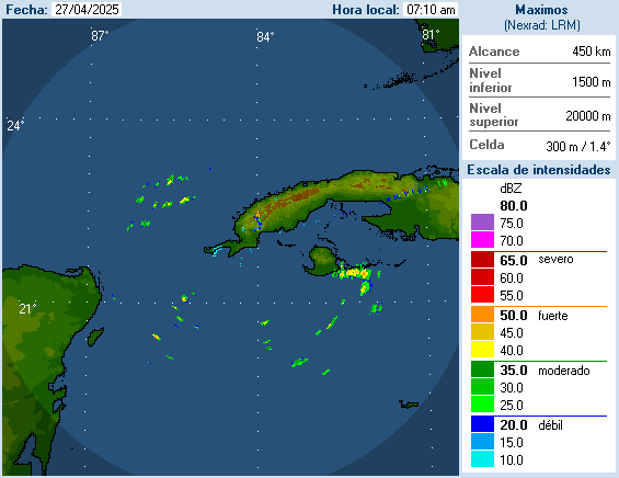
Watching the area near the western tip of Cuba
Moderator: S2k Moderators
Forum rules

The posts in this forum are NOT official forecasts and should not be used as such. They are just the opinion of the poster and may or may not be backed by sound meteorological data. They are NOT endorsed by any professional institution or STORM2K. For official information, please refer to products from the National Hurricane Center and National Weather Service.
Watching the area near the western tip of Cuba
0 likes
The following post is NOT an official forecast and should not be used as such. It is just the opinion of the poster and may or may not be backed by sound meteorological data. It is NOT endorsed by any professional institution including storm2k.org For Official Information please refer to the NHC and NWS products.
-
Tampa Bay Hurricane

- Category 5

- Posts: 5598
- Age: 38
- Joined: Fri Jul 22, 2005 7:54 pm
- Location: St. Petersburg, FL
Re: Watching the area near the western tip of Cuba
I can also see a circulation with areas of thunderstorms developing around it...
this area should move slowly west across the gulf with high pressure to its
north.
http://www.ssd.noaa.gov/goes/east/gmex/flash-avn.html
this area should move slowly west across the gulf with high pressure to its
north.
http://www.ssd.noaa.gov/goes/east/gmex/flash-avn.html
0 likes
-
otowntiger
- Category 5
- Posts: 1932
- Joined: Tue Aug 31, 2004 7:06 pm
Re: Watching the area near the western tip of Cuba
ehh, if there was something there it's not there now. Pretty quiet out there, which is fine by me. Being a homeowner with a high hurricane deductible has diminished my tropical enthusiasm somewhat. I'm still here of course and very interested, but I am not as disappointed as I may have been when the tropics are quiet.
0 likes
-
tropicwatch

- Category 5
- Posts: 3426
- Age: 62
- Joined: Sat Jun 02, 2007 10:01 am
- Location: Panama City Florida
- Contact:
0 likes
Tropicwatch
Agnes 72', Eloise 75, Elena 85', Kate 85', Charley 86', Florence 88', Beryl 94', Dean 95', Erin 95', Opal 95', Earl 98', Georges 98', Ivan 2004', Arlene 2005', Dennis 2005', Ida 2009' Debby 2012' Irma 2017' Michael 2018'
Agnes 72', Eloise 75, Elena 85', Kate 85', Charley 86', Florence 88', Beryl 94', Dean 95', Erin 95', Opal 95', Earl 98', Georges 98', Ivan 2004', Arlene 2005', Dennis 2005', Ida 2009' Debby 2012' Irma 2017' Michael 2018'
Re: Watching the area near the western tip of Cuba
Nothing right now but a mid level turning over western Cuba maybe in a day or 2 as it drifts westward.
I do see a hint of a trough between Fla. and the Bahamas
I do see a hint of a trough between Fla. and the Bahamas
0 likes
The following post is NOT an official forecast and should not be used as such. It is just the opinion of the poster and may or may not be backed by sound meteorological data. It is NOT endorsed by any professional institution including storm2k.org For Official Information please refer to the NHC and NWS products.
-
Tampa Bay Hurricane
- Category 5
- Posts: 5598
- Age: 38
- Joined: Fri Jul 22, 2005 7:54 pm
- Location: St. Petersburg, FL
-
wxman57

- Moderator-Pro Met

- Posts: 23120
- Age: 68
- Joined: Sat Jun 21, 2003 8:06 pm
- Location: Houston, TX (southwest)
Re: Watching the area near the western tip of Cuba
Nothing to see here, folks. Time to move on...
0 likes
-
Tampa Bay Hurricane
- Category 5
- Posts: 5598
- Age: 38
- Joined: Fri Jul 22, 2005 7:54 pm
- Location: St. Petersburg, FL
Re: Watching the area near the western tip of Cuba
It is nice to have some of the rain showers though considering the humidity today
lol
I do not expect any development but this might be the northern end of the tropical
wave over the Caribbean.
A trough is evident between Florida and the Bahamas
http://www.ssd.noaa.gov/goes/east/gmex/flash-avn.html
I am not expecting development with any of these features at this time.
lol
I do not expect any development but this might be the northern end of the tropical
wave over the Caribbean.
A trough is evident between Florida and the Bahamas
http://www.ssd.noaa.gov/goes/east/gmex/flash-avn.html
I am not expecting development with any of these features at this time.
0 likes
Re: Watching the area near the western tip of Cuba
Looking a tad better this morning, at the mid level, we'll see if the T-storms persist.
http://rammb.cira.colostate.edu/ramsdis ... _floater_1
http://rammb.cira.colostate.edu/ramsdis ... _floater_1
0 likes
The following post is NOT an official forecast and should not be used as such. It is just the opinion of the poster and may or may not be backed by sound meteorological data. It is NOT endorsed by any professional institution including storm2k.org For Official Information please refer to the NHC and NWS products.
-
Tampa Bay Hurricane
- Category 5
- Posts: 5598
- Age: 38
- Joined: Fri Jul 22, 2005 7:54 pm
- Location: St. Petersburg, FL
http://www.ssd.noaa.gov/goes/east/gmex/flash-avn.html
It does look better this morning we will see if it can persist.
It does look better this morning we will see if it can persist.
0 likes

-
Dean4Storms
- S2K Supporter

- Posts: 6358
- Age: 62
- Joined: Sun Aug 31, 2003 1:01 pm
- Location: Miramar Bch. FL
Re: Watching the area near the western tip of Cuba
It looks like something is trying to kick-on there but is too weak to break the boundaries of formation.
0 likes
Who is online
Users browsing this forum: Google Adsense [Bot], Ulf and 53 guests