2026 Indicators: SST's, MSLP, Shear, SAL, Steering, Instability (Day 16+ Climate Models)

This is the general tropical discussion area. Anyone can take their shot at predicting a storms path.

Moderator: S2k Moderators

Forum rules

The posts in this forum are NOT official forecasts and should not be used as such. They are just the opinion of the poster and may or may not be backed by sound meteorological data. They are NOT endorsed by any professional institution or STORM2K. For official information, please refer to products from the National Hurricane Center and National Weather Service.

Help Support Storm2K
Message
Author
User avatar
cycloneye
Admin
Admin
Posts: 148536
Age: 69
Joined: Thu Oct 10, 2002 10:54 am
Location: San Juan, Puerto Rico

2026 Indicators: SST's, MSLP, Shear, SAL, Steering, Instability (Day 16+ Climate Models)

#1 Postby cycloneye » Mon Dec 01, 2025 4:44 am

Here we go with the 2026 indicators thread. Look at the Early thoughts of the 2026 season thread made by Category5kaiju. It looks like the main factors that may guide how active the upcomming hurricane season be is how ENSO will behave by next summer (Check the 2026 ENSO Updates thread), how the NAO will be in terms of the sst's and how the West African Monsoon will be. Let's have good analysis and discussions. Note. Took out many links from past years indicators threads as they were not working.

https://www.ssd.noaa.gov/PS/TROP/TCFP/atlantic.html

https://www.longpaddock.qld.gov.au/soi/

https://www.cpc.ncep.noaa.gov/products/ ... .sprd2.png - NAO

https://www1.ncdc.noaa.gov/pub/data/cmb ... v5.amo.dat - AMO

https://www.cpc.ncep.noaa.gov/products/ ... rica.shtml - WAM

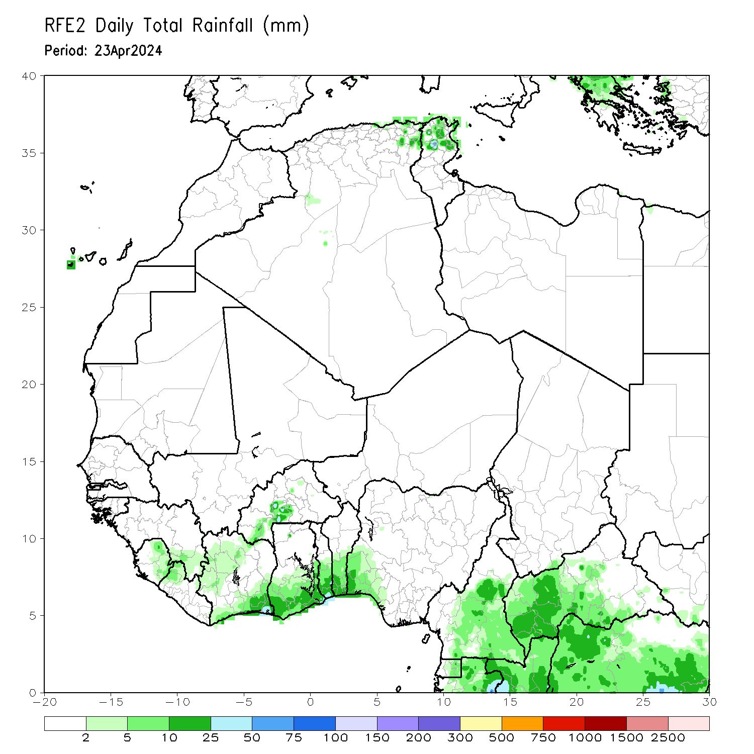
https://www.cpc.ncep.noaa.gov/products/ ... wa_obs.gif - Daily Obs of WAM

https://www.tropicaltidbits.com/analysis/ocean/

https://cyclonicwx.com/sst/

http://tropic.ssec.wisc.edu/real-time/sal/splitE.jpg

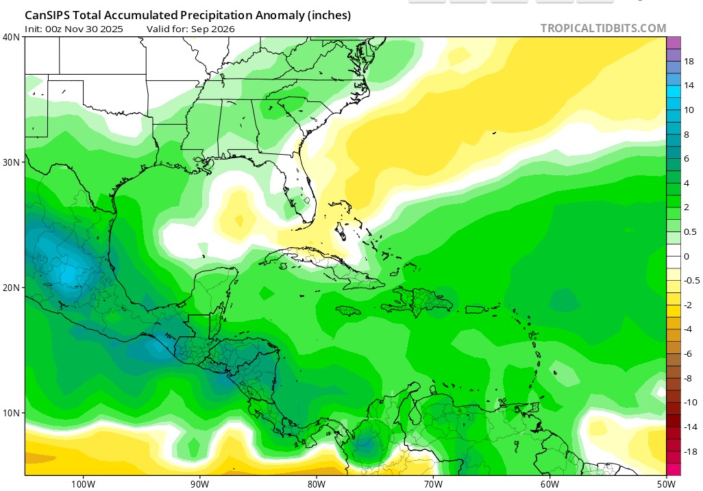
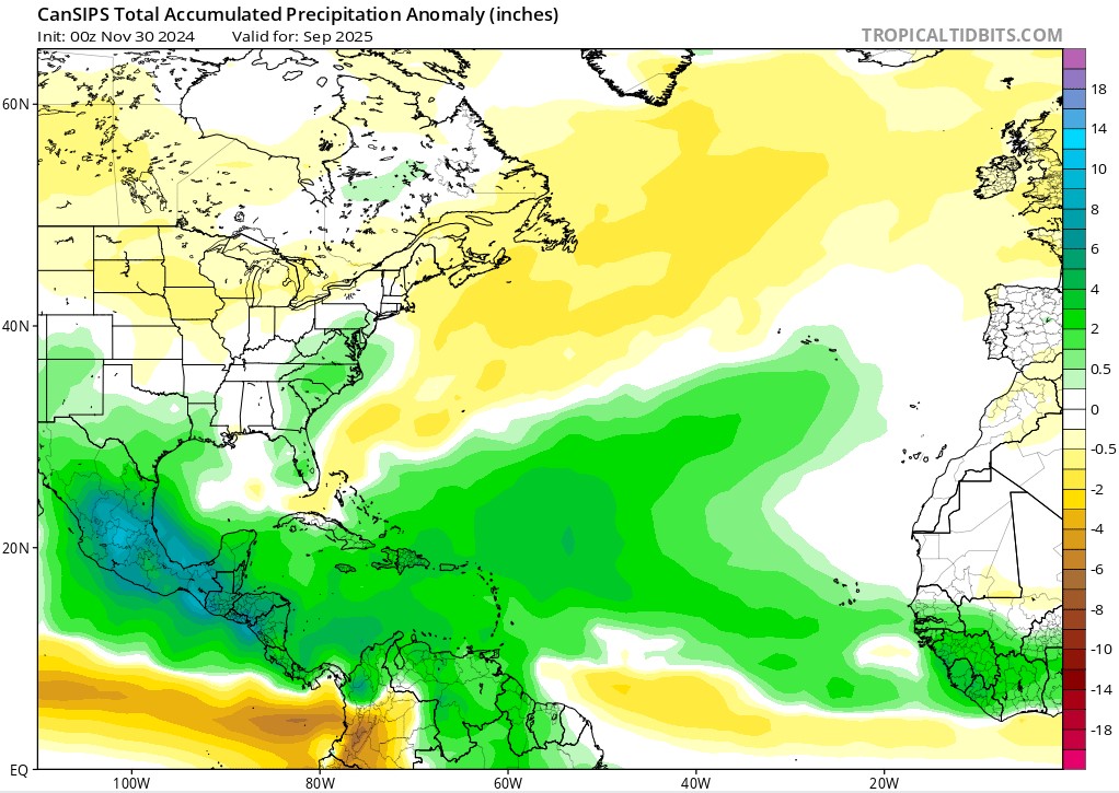
December CanSIPS for August:

Image

Image

Image

Image
1 likes   
Visit the Caribbean-Central America Weather Thread where you can find at first post web cams,radars
and observations from Caribbean basin members Click Here

User avatar
Category5Kaiju
Category 5
Category 5
Posts: 4300
Joined: Thu Dec 24, 2020 12:45 pm
Location: Seattle and Phoenix

Re: 2026 Indicators: SST's, MSLP, Shear, SAL, Steering, Instability (Day 16+ Climate Models)

#2 Postby Category5Kaiju » Mon Dec 01, 2025 12:48 pm

Aw dang, that sucks. Yeah, looks like Tropical Tidbits has quite a few 404 errors with those old links. :cry:

Anyways, interesting to see that at least at this point in time, the CANSIPS is predicting yet another year with a very warm Atlantic profile. Overall activity level is something we won't know until closer to the season, especially with the moving puzzle pieces of ENSO, WAM, etc.

However....my early inclination is to believe that assuming this very warm Atlantic look pans out next year, irregardless of total activity, we'll likely yet again have a season that features one or several storms that attain at least high-end Category 4 strength, if not even Category 5.
3 likes   
Unless explicitly stated, all info in my posts is based on my own opinions and observations. Tropical storms and hurricanes can be extremely dangerous. Refer to an accredited weather research agency or meteorologist if you need to make serious decisions regarding an approaching storm.

User avatar
FireRat
Category 5
Category 5
Posts: 1274
Age: 38
Joined: Sun Sep 26, 2010 11:38 pm
Location: North Carolina

Re: 2026 Indicators: SST's, MSLP, Shear, SAL, Steering, Instability (Day 16+ Climate Models)

#3 Postby FireRat » Mon Dec 01, 2025 3:20 pm

2026 is going to be interesting to track, especially after all the crazy seasons lately, especially with such a tricky 2025. Next year will probably throw its own curveballs too, lets see how it shapes up over the next several months!
1 likes   
Georges '98, Irene '99, Frances '04, Jeanne '04, Katrina '05, Wilma '05, Gustav '08, Isaac '12, Matthew '16, Florence '18, Michael '18, Ian '22

User avatar
cycloneye
Admin
Admin
Posts: 148536
Age: 69
Joined: Thu Oct 10, 2002 10:54 am
Location: San Juan, Puerto Rico

Re: 2026 Indicators: SST's, MSLP, Shear, SAL, Steering, Instability (Day 16+ Climate Models)

#4 Postby cycloneye » Mon Dec 01, 2025 4:53 pm

Category5Kaiju wrote:Aw dang, that sucks. Yeah, looks like Tropical Tidbits has quite a few 404 errors with those old links. :cry:

Anyways, interesting to see that at least at this point in time, the CANSIPS is predicting yet another year with a very warm Atlantic profile. Overall activity level is something we won't know until closer to the season, especially with the moving puzzle pieces of ENSO, WAM, etc.

However....my early inclination is to believe that assuming this very warm Atlantic look pans out next year, irregardless of total activity, we'll likely yet again have a season that features one or several storms that attain at least high-end Category 4 strength, if not even Category 5.


Will be posting links that work at that first post. If anyone has new links, post them and I will add to the first post. Every link is important for this thread to have the members look at plenty of information.
0 likes   
Visit the Caribbean-Central America Weather Thread where you can find at first post web cams,radars
and observations from Caribbean basin members Click Here

Team Ghost
Tropical Low
Tropical Low
Posts: 18
Joined: Wed Nov 05, 2025 1:38 am

Re: 2026 Indicators: SST's, MSLP, Shear, SAL, Steering, Instability (Day 16+ Climate Models)u

#5 Postby Team Ghost » Mon Dec 01, 2025 5:00 pm

I see nothing to suggest a return of the West African Monsoon or a flip towards a negative AMO. There is also currently strong downwelling in the Equatorial Pacific, suggesting an El Niño pattern for the 2026-27 winter and likely a strong one at that with how quickly -ENSO conditions are terminating, and it appears that the PDO may flip positive within the next few months.

With this in mind, I cannot rationally justify 2026 being an active hurricane season. The expected profile for 2026 is a +AMO, suppressed WAM, a strong El Niño, with an uncertain PDO. In the satellite era, 1997 and 2015 are the only years that fit this profile; averaging the seasonal totals for these two years gives 9.5 storms, 3.5 hurricanes, 1.5 major hurricanes, and 52 ACE; and I have arbitrarily rounded these to 10 storms, 3 hurricanes, and 1 major hurricane (as I have explained in more detail on Category5Kaiju’s thread). I think slightly more activity is possible because of the uncertainty on the PDO and the degree of the potential El Niño, but I do not foresee totals surpassing the 1951-2020 climatological median at the moment.
Last edited by Team Ghost on Mon Dec 01, 2025 5:20 pm, edited 1 time in total.
0 likes   

User avatar
cycloneye
Admin
Admin
Posts: 148536
Age: 69
Joined: Thu Oct 10, 2002 10:54 am
Location: San Juan, Puerto Rico

Re: 2026 Indicators: SST's, MSLP, Shear, SAL, Steering, Instability (Day 16+ Climate Models)u

#6 Postby cycloneye » Mon Dec 01, 2025 5:18 pm

Team Ghost wrote:I see nothing to suggest a return of the West African Monsoon or a flip towards a negative AMO. There is also currently strong downwelling in the Equatorial Pacific, suggesting an El Niño pattern for the 2026-27 winter and likely a strong one at that with how quickly -ENSO conditions are terminating, and it appears that the PDO may flip positive within the next few months.

With this in mind, I cannot rationally justify 2026 being an active hurricane season. The expected profile for 2026 is a +AMO, suppressed WAM, a strong La Niña, with an uncertain PDO. In the satellite era, 1997 and 2015 are the only years that fit this profile; averaging the seasonal totals for these two years gives 9.5 storms, 3.5 hurricanes, 1.5 major hurricanes, and 52 ACE; and I have arbitrarily rounded these to 10 storms, 3 hurricanes, and 1 major hurricane (as I have explained in more detail on Category5Kaiju’s thread). I think slightly more activity is possible because of the uncertainty on the PDO and the degree of the potential El Niño, but I do not foresee totals surpassing the 1951-2020 climatological median at the moment.


A strong La Niña for summer of 2026?
0 likes   
Visit the Caribbean-Central America Weather Thread where you can find at first post web cams,radars
and observations from Caribbean basin members Click Here

Team Ghost
Tropical Low
Tropical Low
Posts: 18
Joined: Wed Nov 05, 2025 1:38 am

Re: 2026 Indicators: SST's, MSLP, Shear, SAL, Steering, Instability (Day 16+ Climate Models)u

#7 Postby Team Ghost » Mon Dec 01, 2025 5:20 pm

cycloneye wrote:
Team Ghost wrote:I see nothing to suggest a return of the West African Monsoon or a flip towards a negative AMO. There is also currently strong downwelling in the Equatorial Pacific, suggesting an El Niño pattern for the 2026-27 winter and likely a strong one at that with how quickly -ENSO conditions are terminating, and it appears that the PDO may flip positive within the next few months.

With this in mind, I cannot rationally justify 2026 being an active hurricane season. The expected profile for 2026 is a +AMO, suppressed WAM, a strong La Niña, with an uncertain PDO. In the satellite era, 1997 and 2015 are the only years that fit this profile; averaging the seasonal totals for these two years gives 9.5 storms, 3.5 hurricanes, 1.5 major hurricanes, and 52 ACE; and I have arbitrarily rounded these to 10 storms, 3 hurricanes, and 1 major hurricane (as I have explained in more detail on Category5Kaiju’s thread). I think slightly more activity is possible because of the uncertainty on the PDO and the degree of the potential El Niño, but I do not foresee totals surpassing the 1951-2020 climatological median at the moment.


A strong La Niña for summer of 2026?


I fixed my post.
1 likes   

User avatar
Category5Kaiju
Category 5
Category 5
Posts: 4300
Joined: Thu Dec 24, 2020 12:45 pm
Location: Seattle and Phoenix

Re: 2026 Indicators: SST's, MSLP, Shear, SAL, Steering, Instability (Day 16+ Climate Models)u

#8 Postby Category5Kaiju » Mon Dec 01, 2025 8:06 pm

Team Ghost wrote:I see nothing to suggest a return of the West African Monsoon or a flip towards a negative AMO. There is also currently strong downwelling in the Equatorial Pacific, suggesting an El Niño pattern for the 2026-27 winter and likely a strong one at that with how quickly -ENSO conditions are terminating, and it appears that the PDO may flip positive within the next few months.

With this in mind, I cannot rationally justify 2026 being an active hurricane season. The expected profile for 2026 is a +AMO, suppressed WAM, a strong El Niño, with an uncertain PDO. In the satellite era, 1997 and 2015 are the only years that fit this profile; averaging the seasonal totals for these two years gives 9.5 storms, 3.5 hurricanes, 1.5 major hurricanes, and 52 ACE; and I have arbitrarily rounded these to 10 storms, 3 hurricanes, and 1 major hurricane (as I have explained in more detail on Category5Kaiju’s thread). I think slightly more activity is possible because of the uncertainty on the PDO and the degree of the potential El Niño, but I do not foresee totals surpassing the 1951-2020 climatological median at the moment.


Is there a long-range model/resource you’re using that is predicting that next year is going to see a suppressed WAM again? I know of quite a few places to get extended ENSO predictions, on the other hand. But yeah, the WAM part interests me. I was just curious and would love to see where I could view something like that if possible!
1 likes   
Unless explicitly stated, all info in my posts is based on my own opinions and observations. Tropical storms and hurricanes can be extremely dangerous. Refer to an accredited weather research agency or meteorologist if you need to make serious decisions regarding an approaching storm.

User avatar
DorkyMcDorkface
Category 4
Category 4
Posts: 961
Age: 27
Joined: Mon Sep 30, 2019 1:32 pm
Location: Mid-Atlantic

Re: 2026 Indicators: SST's, MSLP, Shear, SAL, Steering, Instability (Day 16+ Climate Models)

#9 Postby DorkyMcDorkface » Mon Dec 01, 2025 8:26 pm

Curious to see how strong this impending Niño will get, as well as how warm the Atlantic will be. 2023 evidently proved +++AMO can counterbalance +++ENSO given we had 20 NS and 148 ACE during one of the strongest Niños in recent history. With that being said I have my doubts the tropical Atlantic will reach that level of extreme warmth this time around, and as a result we may see a more subdued season in comparison.
1 likes   
Please note the thougths expressed by this account are solely those of the user and are from a hobbyist perspective. For more comprehensive analysis, consult an actual professional meteorologist or meteorology agency.


Floyd 1999 | Isabel 2003 | Hanna 2008 | Irene 2011 | Sandy 2012 | Isaias 2020

Team Ghost
Tropical Low
Tropical Low
Posts: 18
Joined: Wed Nov 05, 2025 1:38 am

Re: 2026 Indicators: SST's, MSLP, Shear, SAL, Steering, Instability (Day 16+ Climate Models)u

#10 Postby Team Ghost » Mon Dec 01, 2025 11:31 pm

Category5Kaiju wrote:
Team Ghost wrote:I see nothing to suggest a return of the West African Monsoon or a flip towards a negative AMO. There is also currently strong downwelling in the Equatorial Pacific, suggesting an El Niño pattern for the 2026-27 winter and likely a strong one at that with how quickly -ENSO conditions are terminating, and it appears that the PDO may flip positive within the next few months.

With this in mind, I cannot rationally justify 2026 being an active hurricane season. The expected profile for 2026 is a +AMO, suppressed WAM, a strong El Niño, with an uncertain PDO. In the satellite era, 1997 and 2015 are the only years that fit this profile; averaging the seasonal totals for these two years gives 9.5 storms, 3.5 hurricanes, 1.5 major hurricanes, and 52 ACE; and I have arbitrarily rounded these to 10 storms, 3 hurricanes, and 1 major hurricane (as I have explained in more detail on Category5Kaiju’s thread). I think slightly more activity is possible because of the uncertainty on the PDO and the degree of the potential El Niño, but I do not foresee totals surpassing the 1951-2020 climatological median at the moment.


Is there a long-range model/resource you’re using that is predicting that next year is going to see a suppressed WAM again? I know of quite a few places to get extended ENSO predictions, on the other hand. But yeah, the WAM part interests me. I was just curious and would love to see where I could view something like that if possible!


You can choose long-range climate model that predicts velocity potential. These models are not reliable in and of themselves well in advance. (In fact, the CFSv2 does not even have a September 2026 output.) This is not the basis upon which I am predicting a suppressed West African Monsoon.

The basis is historic. In +AMO eras, moderate or stronger El Niño years after -ENSO years with a suppressed West African Monsoon tend to have a suppressed West African Monsoon as well. 1964 -> 1965, 1996 -> 1997, and 2001 -> 2002 are good examples of this.
0 likes   

User avatar
cycloneye
Admin
Admin
Posts: 148536
Age: 69
Joined: Thu Oct 10, 2002 10:54 am
Location: San Juan, Puerto Rico

Re: 2026 Indicators: SST's, MSLP, Shear, SAL, Steering, Instability (Day 16+ Climate Models)

#11 Postby cycloneye » Tue Dec 02, 2025 6:59 am

Added new links for NAO, AMO and WAM. If there are other ones, any member can bring them and I will add to first post.
0 likes   
Visit the Caribbean-Central America Weather Thread where you can find at first post web cams,radars
and observations from Caribbean basin members Click Here

User avatar
Blown Away
S2K Supporter
S2K Supporter
Posts: 10253
Joined: Wed May 26, 2004 6:17 am

Re: 2026 Indicators: SST's, MSLP, Shear, SAL, Steering, Instability (Day 16+ Climate Models)

#12 Postby Blown Away » Tue Dec 02, 2025 7:38 am

Image
November 2025 prediction for August 2026.

Image
November 2024 Prediction for August 2025.

I like to compare these long range model predictions. Similar patterns, maybe the GOA and CONUS get another break in 2026?
1 likes   
Hurricane Eye Experience: David 79, Irene 99, Frances 04, Jeanne 04, Wilma 05… Hurricane Brush Experience: Andrew 92, Erin 95, Floyd 99, Matthew 16, Irma 17, Ian 22, Nicole 22…


Return to “Talkin' Tropics”

Who is online

Users browsing this forum: No registered users and 62 guests