Gulf of Mexico (Is Invest 91L)
Moderator: S2k Moderators
Forum rules
The posts in this forum are NOT official forecasts and should not be used as such. They are just the opinion of the poster and may or may not be backed by sound meteorological data. They are NOT endorsed by any professional institution or STORM2K. For official information, please refer to products from the National Hurricane Center and National Weather Service.
- SouthFloridawx
- S2K Supporter

- Posts: 8346
- Age: 47
- Joined: Tue Jul 26, 2005 1:16 am
- Location: Sarasota, FL
- Contact:
Re: Gulf of Mexico area
The magic 8-Ball say,
" "
"
Sorry I don't control the Magic 8-Ball, I can only ask it a question.
Question: Will the trough in the Gulf turn into a tropical system?
http://web.ics.purdue.edu/~ssanty/cgi-bin/eightball.cgi
"
 "
"Sorry I don't control the Magic 8-Ball, I can only ask it a question.
Question: Will the trough in the Gulf turn into a tropical system?
http://web.ics.purdue.edu/~ssanty/cgi-bin/eightball.cgi
0 likes
- SouthFloridawx
- S2K Supporter

- Posts: 8346
- Age: 47
- Joined: Tue Jul 26, 2005 1:16 am
- Location: Sarasota, FL
- Contact:
Re: Gulf of Mexico area
000
ABNT20 KNHC 282332
TWOAT
TROPICAL WEATHER OUTLOOK
NWS TPC/NATIONAL HURRICANE CENTER MIAMI FL
800 PM EDT MON JUL 28 2008
FOR THE NORTH ATLANTIC...CARIBBEAN SEA AND THE GULF OF MEXICO...
SHOWER AND THUNDERSTORM ACTIVITY OVER THE NORTH-CENTRAL GULF OF
MEXICO IS ASSOCIATED WITH A WEAK SURFACE TROUGH OF LOW PRESSURE.
UPPER-LEVEL WINDS ARE FORECAST TO BE UNFAVORABLE FOR SIGNIFICANT
DEVELOPMENT OF THIS SYSTEM AS IT MOVES SLOWLY NORTH-NORTHWESTWARD
OVER THE NEXT DAY OR TWO.
ELSEWHERE...TROPICAL CYCLONE FORMATION IS NOT EXPECTED DURING THE
NEXT 48 HOURS.
$$
FORECASTER PASCH

0 likes
-
lonelymike
- S2K Supporter

- Posts: 634
- Joined: Sat Jul 26, 2008 10:12 am
- Location: walton county fla
-
SapphireSea
- Category 1

- Posts: 430
- Joined: Wed Aug 24, 2005 12:13 pm
- Location: Miami, FL
Re: Gulf of Mexico area
Looks like it will indeed be a rain-maker. I believe this one has an OK chance at development given all the parameters. I don't know to what extent, all depending on how much time it has before land interaction becomes a factor.
0 likes
-
Ed Mahmoud
Re: Gulf of Mexico area
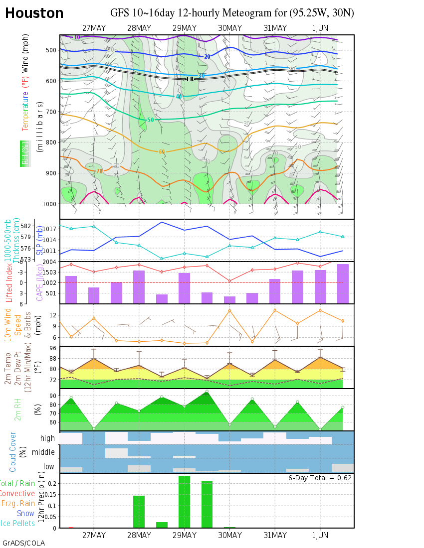
Cloud tops are warming, as 12Z GFS prediction of poof-ation seems well underway for blob watch system in North central GOMEX.
Lawn watering without interruption, 2 to 3 times weekly, seems to be in the cars for Southeast Texas for probably two weeks or more to come.
Last week's inch of rain from a distant Dolly already wiped by mid to upper 90s temps (35ºC), full sun, and lower than normal dewpoints.
12Z GFS shows no appreciable rain in HOU before August 11th, (ditto the 18Z GFS, BTW). By appreciable, I mean anything over a tenth in a day, which ain't that appreciable. And if it takes almost two weeks for the GFS to drop a total of about a half an inch of precip, my waterbill is in trouble.

0 likes
>>Looks like it will indeed be a rain-maker.
Maybe so. It doesn't look that involved though and maybe something to bring in some cloudiness and enhance the rainfall chances. I was over in Eunice this weekend, and it was easily 100+ on Sunday & the hottest day of the year for me so far. I got a sunburn from water reflecting off a swimming pool, and I have medium skin to begin with.
Steve
0 likes
-
Stormcenter
- S2K Supporter

- Posts: 6689
- Joined: Wed Sep 03, 2003 11:27 am
- Location: Houston, TX
- canetracker
- S2K Supporter

- Posts: 751
- Age: 63
- Joined: Wed Jul 27, 2005 8:49 pm
- Location: Suburbia New Orleans...Harahan, LA
Re: Gulf of Mexico area

Looks to be poofing tonight, maybe tomorrow??!! Regardless, it should be a rain maker.
0 likes
- MGC
- S2K Supporter

- Posts: 5940
- Joined: Sun Mar 23, 2003 9:05 pm
- Location: Pass Christian MS, or what is left.
Re: Gulf of Mexico area
Looks like a weak circulation south of the mouth of the Mississippi on shortwave IR tonight. Not much convection but it will be a good idea to watch this area as it is close to land (me).......MGC
0 likes
- wxman57
- Moderator-Pro Met

- Posts: 23175
- Age: 68
- Joined: Sat Jun 21, 2003 8:06 pm
- Location: Houston, TX (southwest)
Re: Gulf of Mexico area
Sabanic wrote:Looks like it has flared back up somewhat this morning.
And it appears to be moving inland into southeast Louisiana.
0 likes
Re: Gulf of Mexico area
MGC wrote:Looks like a weak circulation south of the mouth of the Mississippi on shortwave IR tonight. Not much convection but it will be a good idea to watch this area as it is close to land (me).......MGC
Yes MGC very tight little mid level spin, does deserve a close eye but i think it's suppose to move inland shortly.
My truck read 104 degrees for a short time yesterday in the middle of New Orleans, so clouds and some rain sounds sweet to me.
http://hadar.cira.colostate.edu/ramsdis ... at1_0.html
0 likes
-
stevetampa33614
Re: Gulf of Mexico area
The flare up is moving inland. But the core remains offshore. Really dont now what to think. Looks like the floater was canceled.
0 likes
-
Stormcenter
- S2K Supporter

- Posts: 6689
- Joined: Wed Sep 03, 2003 11:27 am
- Location: Houston, TX
Re: Gulf of Mexico area
stevetampa33614 wrote:The flare up is moving inland. But the core remains offshore. Really dont now what to think. Looks like the floater was canceled.
That's what I'm seeing too.
0 likes
-
stevetampa33614
Re: Gulf of Mexico area
Interesting, One of the bouys is picking up 120kt winds blow SE all day.
edit: Bouy is broke they just took it offline :/. Thats a relief.
edit: Bouy is broke they just took it offline :/. Thats a relief.
0 likes
- Pearl River
- S2K Supporter

- Posts: 825
- Age: 67
- Joined: Fri Dec 09, 2005 6:07 pm
- Location: SELa
Re: Gulf of Mexico area
Were getting ready to get a good frog strangler here at the UNO Technology Center.
0 likes
-
Stormcenter
- S2K Supporter

- Posts: 6689
- Joined: Wed Sep 03, 2003 11:27 am
- Location: Houston, TX
Re: Gulf of Mexico area
There is definitely a spin south of the SE LA. coastline....now whether or not
it's at the surface is another story. I don't think it's (the spin) moving much.
http://www.ssd.noaa.gov/goes/east/gmex/loop-vis.html
it's at the surface is another story. I don't think it's (the spin) moving much.
http://www.ssd.noaa.gov/goes/east/gmex/loop-vis.html
0 likes
Who is online
Users browsing this forum: Iceresistance, NotSparta and 36 guests


