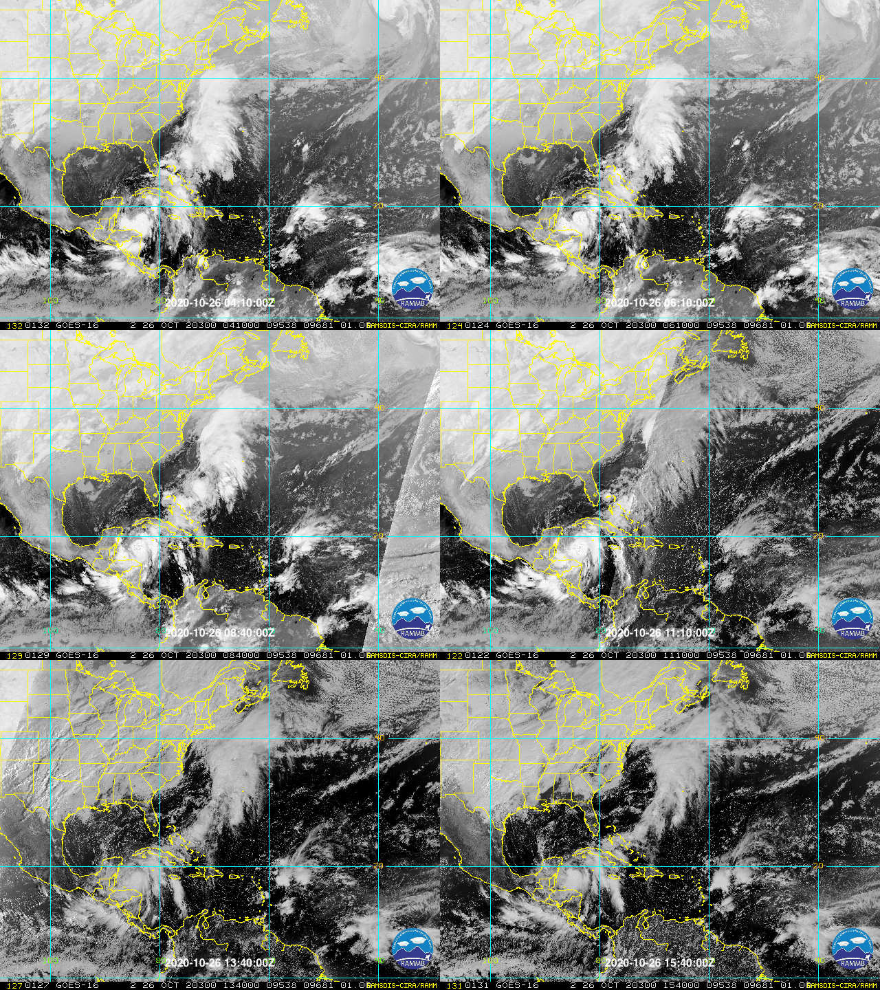
Area of disturbed weather entering the Caribbean (Is Invest 96L)

This is the general tropical discussion area. Anyone can take their shot at predicting a storms path.

Moderator: S2k Moderators

Forum rules

The posts in this forum are NOT official forecasts and should not be used as such. They are just the opinion of the poster and may or may not be backed by sound meteorological data. They are NOT endorsed by any professional institution or STORM2K. For official information, please refer to products from the National Hurricane Center and National Weather Service.

Help Support Storm2K
Message
Author
TheStormExpert

Re: Potential Eta's early November ETA (Let's break a forum record!)

#121 Postby TheStormExpert » Mon Oct 26, 2020 8:17 am

CrazyC83 wrote:
TheStormExpert wrote:

Well we know this won’t happen! :lol:

Probably YET ANOTHER Northern Gulf Threat threat if I had to guess. Teleconnections do not support a deep trough drawing NE towards the Florida peninsula anytime soon. That SE Ridge will hold firm.

2020 is the Northern Gulf Coasts 2004 for Florida.


That would completely deviate from climatology. I can't think of a storm ever hitting Texas or Louisiana in November.

Wasn’t quite Louisiana but Hurricane Ida in 2009 took a track towards the northern Gulf Coast in November.
0 likes   

User avatar
Ryxn
Category 1
Category 1
Posts: 314
Age: 25
Joined: Fri Sep 08, 2017 4:50 pm
Location: Toronto, Canada

Re: Tropical wave to move into the Caribbean for possible early-November development

#122 Postby Ryxn » Mon Oct 26, 2020 8:22 am

If Zeta somehow rapidly strengthens to a 115 mph Category 3 Hurricane and future Eta (barring no weak TS steals the name) reaches major hurricane strength as well next week, it would make Eta a 4th consecutive major hurricane (Delta, Epsilon, Zeta, Eta) which would be a tied record. There has only been 2 instances of a consecutive streak of over 3 major hurricanes since records began; 1926 and 1894 (and both of those years came close to an insane 5-major streak)

Longest Major Hurricane Streaks

Four
1926 (One, Two, Three, Four) [almost Five]
1894 (Three, Four, Five, Six) [almost Seven]

Three
2017 (Harvey, Irma, Jose)
2016 (Matthew, Nicole, Otto)
2010 (Igor, Julia, Karl)
2004 (Ivan, Jeanne, Karl) [If depressions are discluded]
1964 (Gladys, Hilda, Isbell)
1955 (Ione, Hilda, Janet)
1950 (Dog, Easy, Fox)
1886 (Five, Six, Seven)

Seasons that came close to reaching a record 4-major streak

2017 (Harvey, Irma, Jose was a 3-major streak but it could have smashed the record had Katia strengthened one category higher to major hurricane status extending the streak to a record insane 6 majors from Harvey to Maria. If Gert had been a major, there would have been a 4-major streak from Gert to Jose and if both had been majors, there would have been a streak of 7 from Gert to Maria. Crazy stuff)

1950 (Dog, Easy, Fox was a 3-major streak. There would have been a streak of 4 had Charlie or George strengthened 5 mph more to major hurricane status)

1933 (Eleven, Twelve, Fourteen were majors and there would have been a 4-major streak had Thirteen been a major)

1893 (Three, Four, Six were majors and there would have been a 4-major streak had Five been a major)

1886 (Five, Six, Seven was a 3-major streak. There would have been a streak of 4 had Eight been a major).

If 2020 achieves this streak of FOUR CONSECUTIVE MAJOR HURRICANES, it would be the first occurence in the satellite era and would add to the countless records the year already has. It is also possible that 1926 and 1894 don't hold the record as there could have been a short-lived, weak fish storm that was undetected in-between the major hurricanes of the streaks of those 2 years. We will never know.

Good morning Storm2k! What a time to be alive.
Last edited by Ryxn on Mon Oct 26, 2020 8:37 am, edited 5 times in total.
2 likes   

User avatar
ElectricStorm
Category 5
Category 5
Posts: 5017
Age: 24
Joined: Tue Aug 13, 2019 11:23 pm
Location: Skiatook, OK / Norman, OK

Re: Tropical wave to move into the Caribbean for possible early-November development

#123 Postby ElectricStorm » Mon Oct 26, 2020 8:25 am

Ryxn wrote:If Zeta rapidly strengthens to a 115 mph Category 3 Hurricane and future Eta (barring no weak TS steals the name) reaches major hurricane strength as well next week, it would make Eta the 4th consecutive major hurricane (Delta, Epsilon, Zeta, Eta) which would be a tied record. There has only been 2 instances of a consecutive streak of over 3 major hurricanes since records began; 1926 and 1894.

Longest Major Hurricane Streaks

Four
2020 (Delta, Epsilon, Zeta, Eta)
1926 (One, Two, Three, Four) almost Five
1894 (Three, Four, Five, Six)

Three
2017 (Harvey, Irma, Jose)
2016 (Matthew, Nicole, Otto)
2010 (Igor, Julia, Karl)
2004 (Ivan, Jeanne, Karl) [If depressions are discluded]
1964 (Gladys, Hilda, Isbell)
1955 (Ione, Hilda, Janet)
1950 (Dog, Easy, Fox)
1886 (Five, Six, Seven)

Seasons that came close to reaching a record 4-major streak

2017 (Harvey, Irma, Jose was a 3-major streak but it could have smashed the record had Katia strengthen one category higher to major hurricane status extending the streak to a record insane 6 majors from Harvey to Maria. If Gert had been a major, there would be a 4-major streak from Gert to Jose and if both had been majors, there would be a streak of 7 from Gert to Maria. Crazy stuff)

1950 (Dog, Easy, Fox was a 3-major streak. It would have been a streak of 4 had Charlie or George strengthened 5 mph more to major hurricane status)

1933 (Eleven, Twelve, Fourteen were majors and there would have been a 4-major streak had Thirteen been a major)

1893 (Three, Four, Six were majors there would have been a 4-major streak had Five been a major)

1886 (Five, Six, Seven was a 3-major streak. It would have been a streak of 4 had Eight been a major).

If 2020 achieves this streak of FOUR CONSECUTIVE MAJOR HURRICANES, it would be the first occurence in the satellite era and would add to the countless records the year already has. It is also possible that 1926 and 1894 don't hold the record as there could have been a short-lived, weak fish storm that was undetected in-between the major hurricanes of the streaks of those 2 years. We will never know.

Good morning Storm2k! What a time to be alive.

Zetas center is exposed again... Probably won't become a major but that would be pretty insane if it did
2 likes   
I am in no way a professional. Take what I say with a grain of salt as I could be totally wrong. Please refer to the NHC, NWS, or SPC for official information.

Boomer Sooner!

AutoPenalti
Category 5
Category 5
Posts: 4029
Age: 28
Joined: Mon Aug 17, 2015 4:16 pm
Location: Ft. Lauderdale, Florida

Re: Tropical wave to move into the Caribbean for possible early-November development

#124 Postby AutoPenalti » Mon Oct 26, 2020 9:10 am

GFS, Euro, CMC on board with development.

GFS 06z trough picks it up south of Jamaica and Cuba and takes it NE.
0 likes   
The posts in this forum are NOT official forecasts and should not be used as such. They are just the opinion of the poster and may or may not be backed by sound meteorological data. They are NOT endorsed by any professional institution or STORM2K. For official information, please refer to products from the NHC and NWS.


Model Runs Cheat Sheet:
GFS (5:30 AM/PM, 11:30 AM/PM)
HWRF, GFDL, UKMET, NAVGEM (6:30-8:00 AM/PM, 12:30-2:00 AM/PM)
ECMWF (1:45 AM/PM)

TCVN
is a weighted averaged

User avatar
aspen
Category 5
Category 5
Posts: 8812
Joined: Sat Oct 12, 2019 7:10 pm
Location: Connecticut, USA

Re: Tropical wave to move into the Caribbean for possible early-November development

#125 Postby aspen » Mon Oct 26, 2020 9:16 am

06z GFS-Para has this go due west and crashes it into Nicaragua as a 941 mbar Cat 4 in 228 hours.
2 likes   
Irene '11 Sandy '12 Hermine '16 5/15/2018 Derecho Fay '20 Isaias '20 Elsa '21 Henri '21 Ida '21

I am only a meteorology enthusiast who knows a decent amount about tropical cyclones. Look to the professional mets, the NHC, or your local weather office for the best information.

Ken711
Category 5
Category 5
Posts: 1074
Joined: Tue Aug 28, 2012 12:48 pm

Re: Tropical wave to move into the Caribbean for possible early-November development

#126 Postby Ken711 » Mon Oct 26, 2020 10:36 am

aspen wrote:06z GFS-Para has this go due west and crashes it into Nicaragua as a 941 mbar Cat 4 in 228 hours.


Due west? Is this just a bad model run.
0 likes   

AutoPenalti
Category 5
Category 5
Posts: 4029
Age: 28
Joined: Mon Aug 17, 2015 4:16 pm
Location: Ft. Lauderdale, Florida

Re: Tropical wave to move into the Caribbean for possible early-November development

#127 Postby AutoPenalti » Mon Oct 26, 2020 10:44 am

ICON develops a strengthening Eta, heads due West into CA.
0 likes   
The posts in this forum are NOT official forecasts and should not be used as such. They are just the opinion of the poster and may or may not be backed by sound meteorological data. They are NOT endorsed by any professional institution or STORM2K. For official information, please refer to products from the NHC and NWS.


Model Runs Cheat Sheet:
GFS (5:30 AM/PM, 11:30 AM/PM)
HWRF, GFDL, UKMET, NAVGEM (6:30-8:00 AM/PM, 12:30-2:00 AM/PM)
ECMWF (1:45 AM/PM)

TCVN
is a weighted averaged

User avatar
Spacecoast
Category 2
Category 2
Posts: 758
Joined: Thu Aug 31, 2017 2:03 pm

Re: Tropical wave to move into the Caribbean for possible early-November development

#128 Postby Spacecoast » Mon Oct 26, 2020 10:56 am

NAV joins CMC w/ genesis within 168 hrs
Image
Image
0 likes   

User avatar
SFLcane
S2K Supporter
S2K Supporter
Posts: 10162
Age: 47
Joined: Sat Jun 05, 2010 1:44 pm
Location: Lake Worth Florida

Re: Tropical wave to move into the Caribbean for possible early-November development

#129 Postby SFLcane » Mon Oct 26, 2020 10:57 am

AutoPenalti wrote:ICON develops a strengthening Eta, heads due West into CA.


Another model intensifying potential Eta. Run ends at 180 off CA not into. Para also went into CA but but moved offshore and redeveloped.
0 likes   

User avatar
gatorcane
S2K Supporter
S2K Supporter
Posts: 23689
Age: 47
Joined: Sun Mar 13, 2005 3:54 pm
Location: Boca Raton, FL

Re: Tropical wave to move into the Caribbean for possible early-November development

#130 Postby gatorcane » Mon Oct 26, 2020 11:32 am

The wave this storm spawns from looks vigorous. I can see why models develop. See bottom-right of image. But getting a significant storm to the Florida or even the US this late, while possible, is a tall order. Certainly Zeta is doing something historic so it is possible but not likely IMHO:

The Caribbean on the other hand, this could be a big problem for somebody :eek:

Image
2 likes   

underthwx
Category 5
Category 5
Posts: 2351
Joined: Sat Jul 30, 2011 2:14 pm
Location: Brazoria County Texas

Re: Tropical wave to move into the Caribbean for possible early-November development

#131 Postby underthwx » Mon Oct 26, 2020 11:39 am

gatorcane wrote:The wave this storm spawns from looks vigorous. I can see why models develop. See bottom-right of image. But getting a significant storm to the Florida or even the US this late, while possible, is a tall order. Certainly Zeta is doing something historic so it is possible but not likely IMHO:

The Caribbean on the other hand, this could be a big problem for somebody :eek:

https://i.postimg.cc/MpyBSj5h/4-ECDAA73-35-F0-4-CB0-BE8-C-495-CFF6-CCC22.gif


That is a big wave....will this be approaching the Eastern Carribean by the weekend?
0 likes   

User avatar
SFLcane
S2K Supporter
S2K Supporter
Posts: 10162
Age: 47
Joined: Sat Jun 05, 2010 1:44 pm
Location: Lake Worth Florida

Re: Tropical wave to move into the Caribbean for possible early-November development

#132 Postby SFLcane » Mon Oct 26, 2020 11:46 am

underthwx wrote:
gatorcane wrote:The wave this storm spawns from looks vigorous. I can see why models develop. See bottom-right of image. But getting a significant storm to the Florida or even the US this late, while possible, is a tall order. Certainly Zeta is doing something historic so it is possible but not likely IMHO:

The Caribbean on the other hand, this could be a big problem for somebody :eek:

https://i.postimg.cc/MpyBSj5h/4-ECDAA73-35-F0-4-CB0-BE8-C-495-CFF6-CCC22.gif


That is a big wave....will this be approaching the Eastern Carribean by the weekend?


Yes, this along with favorable MJO+CCKW will interact with the monsoon potentially sparking development.
0 likes   

User avatar
aspen
Category 5
Category 5
Posts: 8812
Joined: Sat Oct 12, 2019 7:10 pm
Location: Connecticut, USA

Re: Tropical wave to move into the Caribbean for possible early-November development

#133 Postby aspen » Mon Oct 26, 2020 11:54 am

12z GFS has a track very similar to the 1932 Cuba hurricane. Image if this becomes a Cat 5 as well.
0 likes   
Irene '11 Sandy '12 Hermine '16 5/15/2018 Derecho Fay '20 Isaias '20 Elsa '21 Henri '21 Ida '21

I am only a meteorology enthusiast who knows a decent amount about tropical cyclones. Look to the professional mets, the NHC, or your local weather office for the best information.

User avatar
SFLcane
S2K Supporter
S2K Supporter
Posts: 10162
Age: 47
Joined: Sat Jun 05, 2010 1:44 pm
Location: Lake Worth Florida

Re: Tropical wave to move into the Caribbean for possible early-November development

#134 Postby SFLcane » Mon Oct 26, 2020 11:56 am

aspen wrote:12z GFS has a track very similar to the 1932 Cuba hurricane. Image if this becomes a Cat 5 as well.


Gets tugged NE quickly because it develops another tc near the Bahamas.
0 likes   

User avatar
gatorcane
S2K Supporter
S2K Supporter
Posts: 23689
Age: 47
Joined: Sun Mar 13, 2005 3:54 pm
Location: Boca Raton, FL

Re: Tropical wave to move into the Caribbean for possible early-November development

#135 Postby gatorcane » Mon Oct 26, 2020 11:59 am

Oh Canada :eek:

Image
2 likes   

User avatar
aspen
Category 5
Category 5
Posts: 8812
Joined: Sat Oct 12, 2019 7:10 pm
Location: Connecticut, USA

Re: Tropical wave to move into the Caribbean for possible early-November development

#136 Postby aspen » Mon Oct 26, 2020 12:03 pm

It’s just crazy that this could end up being an AEW-based Caribbean Cruiser...in NOVEMBER. A genesis and track similar to the CMC, combined with the intensity of the GFS, could be the season’s 5th official major and potentially the highest ACE producer.
3 likes   
Irene '11 Sandy '12 Hermine '16 5/15/2018 Derecho Fay '20 Isaias '20 Elsa '21 Henri '21 Ida '21

I am only a meteorology enthusiast who knows a decent amount about tropical cyclones. Look to the professional mets, the NHC, or your local weather office for the best information.

User avatar
aspen
Category 5
Category 5
Posts: 8812
Joined: Sat Oct 12, 2019 7:10 pm
Location: Connecticut, USA

Re: Tropical wave to move into the Caribbean for possible early-November development

#137 Postby aspen » Mon Oct 26, 2020 12:09 pm

OHC map for Zeta shows that much of the Caribbean has very high OHC, easily capable of supporting a major alongside the >29C SSTs.
Image.
2 likes   
Irene '11 Sandy '12 Hermine '16 5/15/2018 Derecho Fay '20 Isaias '20 Elsa '21 Henri '21 Ida '21

I am only a meteorology enthusiast who knows a decent amount about tropical cyclones. Look to the professional mets, the NHC, or your local weather office for the best information.

User avatar
CyclonicFury
Category 5
Category 5
Posts: 2019
Age: 26
Joined: Sun Jul 02, 2017 12:32 pm
Location: NC
Contact:

Re: Tropical wave to move into the Caribbean for possible early-November development

#138 Postby CyclonicFury » Mon Oct 26, 2020 12:10 pm

aspen wrote:It’s just crazy that this could end up being an AEW-based Caribbean Cruiser...in NOVEMBER. A genesis and track similar to the CMC, combined with the intensity of the GFS, could be the season’s 5th official major and potentially the highest ACE producer.

This system has a chance to get the Atlantic to the 152.5 hyperactive ACE threshold.
2 likes   
NCSU B.S. in Meteorology Class of 2021. Tropical weather blogger at http://www.cyclonicfury.com. My forecasts and thoughts are NOT official, for official forecasts please consult the National Hurricane Center.

AutoPenalti
Category 5
Category 5
Posts: 4029
Age: 28
Joined: Mon Aug 17, 2015 4:16 pm
Location: Ft. Lauderdale, Florida

Re: Tropical wave to move into the Caribbean for possible early-November development

#139 Postby AutoPenalti » Mon Oct 26, 2020 12:12 pm


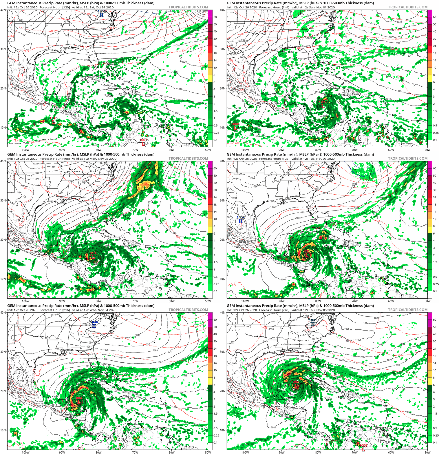
CMC gulf-bound?

Again...?
0 likes   
The posts in this forum are NOT official forecasts and should not be used as such. They are just the opinion of the poster and may or may not be backed by sound meteorological data. They are NOT endorsed by any professional institution or STORM2K. For official information, please refer to products from the NHC and NWS.


Model Runs Cheat Sheet:
GFS (5:30 AM/PM, 11:30 AM/PM)
HWRF, GFDL, UKMET, NAVGEM (6:30-8:00 AM/PM, 12:30-2:00 AM/PM)
ECMWF (1:45 AM/PM)

TCVN
is a weighted averaged

tomatkins
Tropical Storm
Tropical Storm
Posts: 222
Joined: Wed Sep 05, 2018 2:11 pm

Re: Tropical wave to move into the Caribbean for possible early-November development

#140 Postby tomatkins » Mon Oct 26, 2020 12:13 pm

SFLcane wrote:
AutoPenalti wrote:ICON develops a strengthening Eta, heads due West into CA.


Another model intensifying potential Eta. Run ends at 180 off CA not into. Para also went into CA but but moved offshore and redeveloped.

That run ends with 2 TCs in the Caribbean, and another one approaching the LA. Seems um...unlikely.
0 likes   


Return to “Talkin' Tropics”

Who is online

Users browsing this forum: duilaslol and 78 guests