


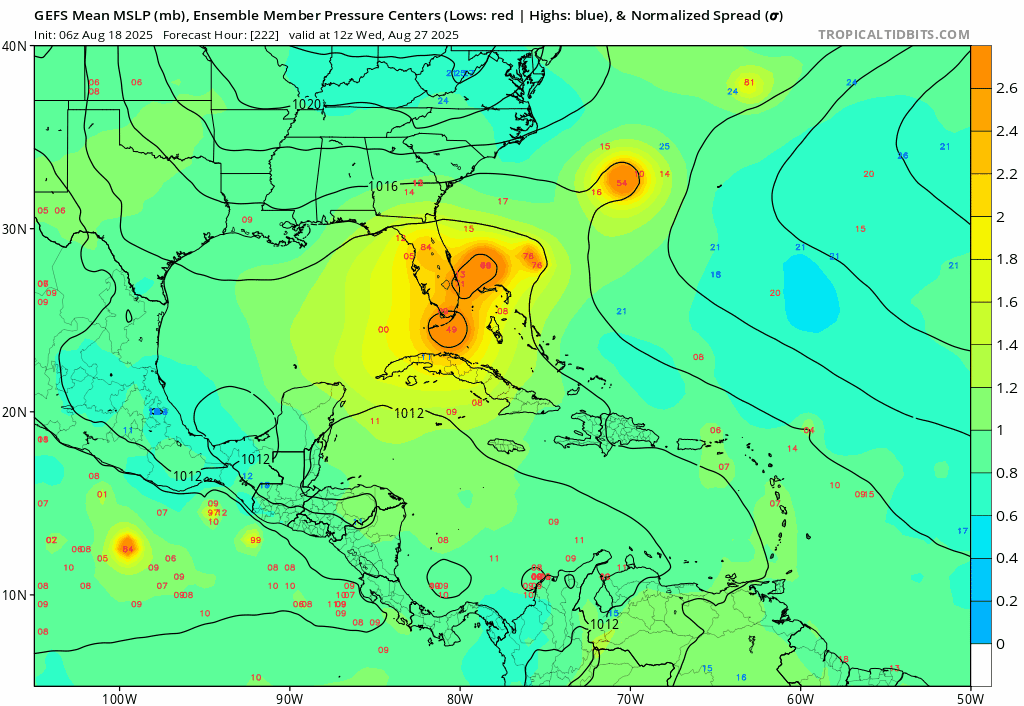
jlauderdal wrote:
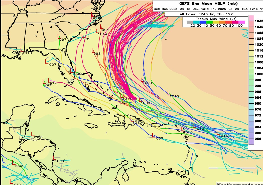
222 hours out, we will take it then recurve on the next few cycles. What we dont want to see is a repeat of 1935.
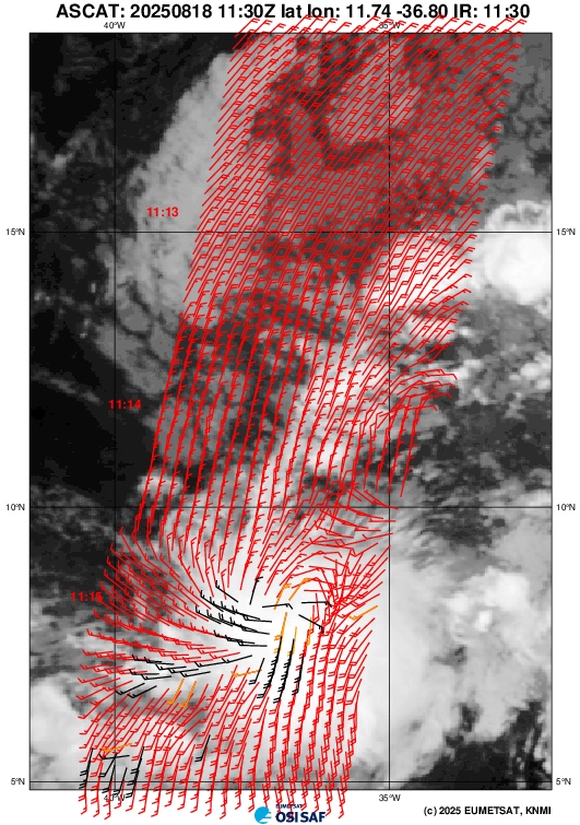
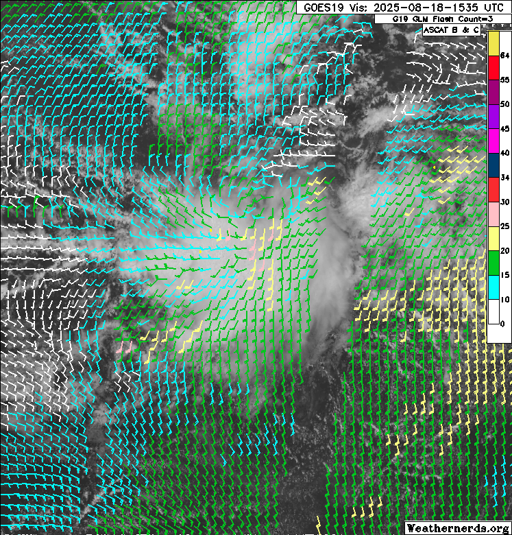
Yeah, the SW Atlantic is ripe for development and this has the potential to be a TD to hurricane in a 3 day period like the GFS has shown. Many Bahama/SFL examples of quick developing storms in the past.


