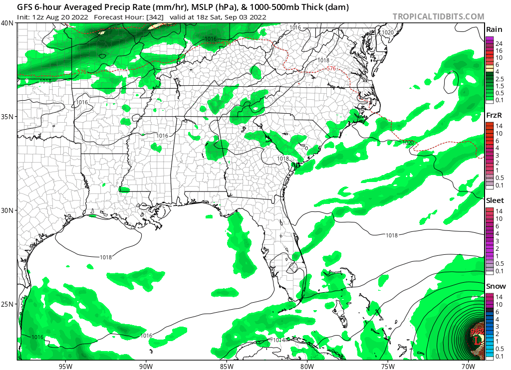
2022 Global Model Runs Discussion (Out thru day 16)

This is the general tropical discussion area. Anyone can take their shot at predicting a storms path.

Moderator: S2k Moderators

Forum rules

The posts in this forum are NOT official forecasts and should not be used as such. They are just the opinion of the poster and may or may not be backed by sound meteorological data. They are NOT endorsed by any professional institution or STORM2K. For official information, please refer to products from the National Hurricane Center and National Weather Service.

Help Support Storm2K
Message
Author
User avatar
Spacecoast
Category 2
Category 2
Posts: 687
Joined: Thu Aug 31, 2017 2:03 pm

Re: 2022 Global Model Runs Discussion (Out thru day 16)

#1701 Postby Spacecoast » Sat Aug 20, 2022 12:22 pm

toad strangler wrote:
SouthFLTropics wrote:Obviously it is way out in fantasy range but the the ridging on the 12z GFS is concerning. One other observation to note is how dry it has been in South Florida over the summer. I'd dare say we are well below average rainfall for this Summer. Something I've learned from years of experience is that Mother Nature always makes up for itself one way or another. We are due for some significant rainfall at some point.


yep, FAR FLUNG 12z GFS with a Dorian like scare.

Image
Bears watching.....
3 likes   

User avatar
NotSparta
Professional-Met
Professional-Met
Posts: 1660
Age: 22
Joined: Fri Aug 18, 2017 8:24 am
Location: Naples, FL
Contact:

Re: 2022 Global Model Runs Discussion (Out thru day 16)

#1702 Postby NotSparta » Sat Aug 20, 2022 12:22 pm

Can't wait for it to get dropped when it gets offshore :lol:
5 likes   
This post was probably an opinion of mine, and in no way is official. Please refer to http://www.hurricanes.gov for official tropical analysis and advisories.

My website, with lots of tropical wx graphics, including satellite and recon: http://cyclonicwx.com

User avatar
Teban54
Category 5
Category 5
Posts: 1983
Joined: Sat May 19, 2018 1:19 pm

Re: 2022 Global Model Runs Discussion (Out thru day 16)

#1703 Postby Teban54 » Sat Aug 20, 2022 12:25 pm

While the attention is understandably on the second wave, I find it interesting that 6z and 12z GFS both send the first wave (TS or remnants) into Hispaniola where the vorticity gets destroyed. This could be concerning if it went a bit further north or south.

GFS seems to be on a southward trend with respect to the first wave in the long range. Earlier runs typically sent it to the north of GA, with some runs showing RI there, similar to what the 12z run today does with the second wave.
4 likes   

User avatar
AtlanticWind
S2K Supporter
S2K Supporter
Posts: 1809
Age: 65
Joined: Sun Aug 08, 2004 9:57 pm
Location: Plantation,Fla

Re: 2022 Global Model Runs Discussion (Out thru day 16)

#1704 Postby AtlanticWind » Sat Aug 20, 2022 12:36 pm

Teban54 wrote:While the attention is understandably on the second wave, I find it interesting that 6z and 12z GFS both send the first wave (TS or remnants) into Hispaniola where the vorticity gets destroyed. This could be concerning if it went a bit further north or south.

GFS seems to be on a southward trend with respect to the first wave in the long range. Earlier runs typically sent it to the north of GA, with some runs showing RI there, similar to what the 12z run today does with the second wave.


Always concerning if a system ends up north of the G.A. approaching the S.E. bahamas this time of year
The GFS has been going back and forth on this wave but this is still pretty long range.
These are always the type of situations I monitor this time of year being in S. Florida

Its the 1935 type of storm, or Katrina if it had a little more time type of situation.
They dont happen that often but something to keep an eye on.
0 likes   

User avatar
Blown Away
S2K Supporter
S2K Supporter
Posts: 9874
Joined: Wed May 26, 2004 6:17 am

Re: 2022 Global Model Runs Discussion (Out thru day 16)

#1705 Postby Blown Away » Sat Aug 20, 2022 12:48 pm

Image
1 likes   
Hurricane Eye Experience: David 79, Irene 99, Frances 04, Jeanne 04, Wilma 05... EYE COMING MY WAY IN 2024…
Hurricane Brush Experience: Andrew 92, Erin 95, Floyd 99, Matthew 16, Irma 17, Ian 22, Nicole 22…

BobHarlem
Category 5
Category 5
Posts: 1668
Joined: Thu Oct 20, 2005 6:11 pm

Re: 2022 Global Model Runs Discussion (Out thru day 16)

#1706 Postby BobHarlem » Sat Aug 20, 2022 12:52 pm

12z GFS and Canadian have the gulf system showing up late this coming week, CMC is over to South Texas, while GFS is over by Pensacola. Split the difference and the Midway point is near Galveston
1 likes   

User avatar
boca
Category 5
Category 5
Posts: 6306
Age: 59
Joined: Mon Dec 15, 2003 8:49 am
Location: Boca Raton,FL

Re: 2022 Global Model Runs Discussion (Out thru day 16)

#1707 Postby boca » Sat Aug 20, 2022 12:54 pm

It’s not to common to get a hurricane coming in from the east or SE into Florida because the Bermuda high usually allows these storm to turn north in the Bahamas. Andrew was the exception because the high was building and forced it west. In this case their is always a trough that will eventually pick it up more often than not before it gets here just my opinion.
0 likes   

User avatar
Blown Away
S2K Supporter
S2K Supporter
Posts: 9874
Joined: Wed May 26, 2004 6:17 am

Re: 2022 Global Model Runs Discussion (Out thru day 16)

#1708 Postby Blown Away » Sat Aug 20, 2022 1:07 pm

boca wrote:It’s not to common to get a hurricane coming in from the east or SE into Florida because the Bermuda high usually allows these storm to turn north in the Bahamas. Andrew was the exception because the high was building and forced it west. In this case their is always a trough that will eventually pick it up more often than not before it gets here just my opinion.


Past 30 yrs, Andrew, Erin, George, Katrina, Frances, Jeanne, Irma. Average every 4-5 years a SE FL Area hurricane landfall from the E/SE. Probably the highest probability in CONUS. Not counting numerous brush hurricanes.
2 likes   
Hurricane Eye Experience: David 79, Irene 99, Frances 04, Jeanne 04, Wilma 05... EYE COMING MY WAY IN 2024…
Hurricane Brush Experience: Andrew 92, Erin 95, Floyd 99, Matthew 16, Irma 17, Ian 22, Nicole 22…

User avatar
toad strangler
S2K Supporter
S2K Supporter
Posts: 4178
Joined: Sun Jul 28, 2013 3:09 pm
Location: Earth
Contact:

Re: 2022 Global Model Runs Discussion (Out thru day 16)

#1709 Postby toad strangler » Sat Aug 20, 2022 1:17 pm

boca wrote:It’s not to common to get a hurricane coming in from the east or SE into Florida because the Bermuda high usually allows these storm to turn north in the Bahamas. Andrew was the exception because the high was building and forced it west. In this case their is always a trough that will eventually pick it up more often than not before it gets here just my opinion.


The Florida east coast has seen 29 hurricane landfalls since 1871. One every 5-6 years, although obviously return rates are not close to easy math like that lol. We are currently in the 2nd longest dry spell since the modern period began in 1850.

So while it’s standard climo for a recurve to happen before a FL strike as the long range 12z GFS was starting to show, it’s not historically rare to get a hurricane into the coast.
5 likes   

sma10
Category 5
Category 5
Posts: 1709
Joined: Tue Aug 02, 2005 1:13 pm

Re: 2022 Global Model Runs Discussion (Out thru day 16)

#1710 Postby sma10 » Sat Aug 20, 2022 1:22 pm

boca wrote:It’s not to common to get a hurricane coming in from the east or SE into Florida because the Bermuda high usually allows these storm to turn north in the Bahamas. Andrew was the exception because the high was building and forced it west. In this case their is always a trough that will eventually pick it up more often than not before it gets here just my opinion.


Understandably, this is just recency bias. If you had lived in S FL in the 1940's, your viewpoint would've been "why do these hurricanes keep attacking us every year"? :D
2 likes   

sma10
Category 5
Category 5
Posts: 1709
Joined: Tue Aug 02, 2005 1:13 pm

Re: 2022 Global Model Runs Discussion (Out thru day 16)

#1711 Postby sma10 » Sat Aug 20, 2022 1:27 pm

toad strangler wrote:
boca wrote:It’s not to common to get a hurricane coming in from the east or SE into Florida because the Bermuda high usually allows these storm to turn north in the Bahamas. Andrew was the exception because the high was building and forced it west. In this case their is always a trough that will eventually pick it up more often than not before it gets here just my opinion.


The Florida east coast has seen 29 hurricane landfalls since 1871. One every 5-6 years, although obviously return rates are not close to easy math like that lol. We are currently in the 2nd longest dry spell since the modern period began in 1850.

So while it’s standard climo for a recurve to happen before a FL strike as the long range 12z GFS was starting to show, it’s not historically rare to get a hurricane into the coast.


Yes, in fact I remember hearing in an interview with an NHC forecaster many years ago that S FL is the most vulnerable area of the continental US, simply by the way it juts out geographically. It's all down to ridge/trough luck whether it gets hit
0 likes   

User avatar
skyline385
Category 5
Category 5
Posts: 2573
Age: 33
Joined: Wed Aug 26, 2020 11:15 pm
Location: Houston TX

Re: 2022 Global Model Runs Discussion (Out thru day 16)

#1712 Postby skyline385 » Sat Aug 20, 2022 1:32 pm

sma10 wrote:
toad strangler wrote:
boca wrote:It’s not to common to get a hurricane coming in from the east or SE into Florida because the Bermuda high usually allows these storm to turn north in the Bahamas. Andrew was the exception because the high was building and forced it west. In this case their is always a trough that will eventually pick it up more often than not before it gets here just my opinion.


The Florida east coast has seen 29 hurricane landfalls since 1871. One every 5-6 years, although obviously return rates are not close to easy math like that lol. We are currently in the 2nd longest dry spell since the modern period began in 1850.

So while it’s standard climo for a recurve to happen before a FL strike as the long range 12z GFS was starting to show, it’s not historically rare to get a hurricane into the coast.


Yes, in fact I remember hearing in an interview with an NHC forecaster many years ago that S FL is the most vulnerable area of the continental US, simply by the way it juts out geographically. It's all down to ridge/trough luck whether it gets hit


Yea you can see it on the NOAA hurricane return period maps as well

Image
1 likes   

User avatar
Spacecoast
Category 2
Category 2
Posts: 687
Joined: Thu Aug 31, 2017 2:03 pm

Re: 2022 Global Model Runs Discussion (Out thru day 16)

#1713 Postby Spacecoast » Sat Aug 20, 2022 1:33 pm

12z GEFS: Compared to 6z. Most members north of 20N, 60W, but on more of WNW trajectory.
Image
Image

and 12z Euro:
Image
Last edited by Spacecoast on Sat Aug 20, 2022 2:29 pm, edited 1 time in total.
0 likes   

User avatar
Hurricaneman
Category 5
Category 5
Posts: 7284
Age: 43
Joined: Tue Aug 31, 2004 3:24 pm
Location: central florida

Re: 2022 Global Model Runs Discussion (Out thru day 16)

#1714 Postby Hurricaneman » Sat Aug 20, 2022 2:17 pm

What the 12zGFS shows for the wave currently over Mali shows development starting in 5 days and it already has an advantage over the wave at 20w as it has a MLC so wouldn’t be surprised if that wave near Mali also gets lemoned tomorrow or early Tuesday
0 likes   

User avatar
skyline385
Category 5
Category 5
Posts: 2573
Age: 33
Joined: Wed Aug 26, 2020 11:15 pm
Location: Houston TX

Re: 2022 Global Model Runs Discussion (Out thru day 16)

#1715 Postby skyline385 » Sat Aug 20, 2022 3:15 pm

Both 12Z GEFS and EPS looking very similar again (similar to 0Z) which suggests some actual TS probabilities instead of busts.

Most of the members are out to sea from the MDR wave but what's interesting is that EPS is also picking up more strongly now on the wave which the GFS first showed coming off-shore near Venezuela. Both ensembles have activity popping off the wave forming in the Caribbean now which probably is something to keep an eye out for.

Image
Image
Last edited by skyline385 on Sat Aug 20, 2022 3:22 pm, edited 1 time in total.
1 likes   

User avatar
AJC3
Admin
Admin
Posts: 3881
Age: 60
Joined: Tue Aug 31, 2004 7:04 pm
Location: West Melbourne, Florida
Contact:

Re: 2022 Global Model Runs Discussion (Out thru day 16)

#1716 Postby AJC3 » Sat Aug 20, 2022 3:18 pm

This post could also go into the (19W) wave thread, but since It does mention the wave currently over Africa, I'll post it here. This comparison of H85 vort progs will give you an idea of how much slower the 12Z OP-GFS is compared to the OP-ECM are with respect to the wave approaching 20W and the one behind it (currently over Mali) in about 6 days. The GFS does come pretty close to catching up to the ECM w/r/t the trailing wave by day 10.

Image
2 likes   

User avatar
Blown Away
S2K Supporter
S2K Supporter
Posts: 9874
Joined: Wed May 26, 2004 6:17 am

Re: 2022 Global Model Runs Discussion (Out thru day 16)

#1717 Postby Blown Away » Sat Aug 20, 2022 4:04 pm

skyline385 wrote:Both 12Z GEFS and EPS looking very similar again (similar to 0Z) which suggests some actual TS probabilities instead of busts.

Most of the members are out to sea from the MDR wave but what's interesting is that EPS is also picking up more strongly now on the wave which the GFS first showed coming off-shore near Venezuela. Both ensembles have activity popping off the wave forming in the Caribbean now which probably is something to keep an eye out for.

https://i.imgur.com/wDTMvVT.png
https://i.imgur.com/fhNs34T.png


Odd when GFS is left outlier and Euro is right outlier.
2 likes   
Hurricane Eye Experience: David 79, Irene 99, Frances 04, Jeanne 04, Wilma 05... EYE COMING MY WAY IN 2024…
Hurricane Brush Experience: Andrew 92, Erin 95, Floyd 99, Matthew 16, Irma 17, Ian 22, Nicole 22…

sma10
Category 5
Category 5
Posts: 1709
Joined: Tue Aug 02, 2005 1:13 pm

Re: 2022 Global Model Runs Discussion (Out thru day 16)

#1718 Postby sma10 » Sat Aug 20, 2022 5:09 pm

Blown Away wrote:
skyline385 wrote:Both 12Z GEFS and EPS looking very similar again (similar to 0Z) which suggests some actual TS probabilities instead of busts.

Most of the members are out to sea from the MDR wave but what's interesting is that EPS is also picking up more strongly now on the wave which the GFS first showed coming off-shore near Venezuela. Both ensembles have activity popping off the wave forming in the Caribbean now which probably is something to keep an eye out for.

https://i.imgur.com/wDTMvVT.png
https://i.imgur.com/fhNs34T.png


Odd when GFS is left outlier and Euro is right outlier.


Definitely. It's all 300+ fantasy-land anyway, but interesting to see GFS pull that system so far to the west considering it's development point.
0 likes   

User avatar
toad strangler
S2K Supporter
S2K Supporter
Posts: 4178
Joined: Sun Jul 28, 2013 3:09 pm
Location: Earth
Contact:

Re: 2022 Global Model Runs Discussion (Out thru day 16)

#1719 Postby toad strangler » Sat Aug 20, 2022 5:10 pm

18z GFS isn’t dropping the 12z signal. Buckle up for an entertaining Happy Hour ride.
0 likes   

sma10
Category 5
Category 5
Posts: 1709
Joined: Tue Aug 02, 2005 1:13 pm

Re: 2022 Global Model Runs Discussion (Out thru day 16)

#1720 Postby sma10 » Sat Aug 20, 2022 5:14 pm

toad strangler wrote:18z GFS isn’t dropping the 12z signal. Buckle up for an entertaining Happy Hour ride.


Interesting to see if we actually get development. The cent atl ridge looks sturdy
0 likes   


Return to “Talkin' Tropics”

Who is online

Users browsing this forum: jgh, Sps123, Stratton23, Tx_Summer and 75 guests