Possible development SW of CV Islands (near 30W)
Moderator: S2k Moderators
Forum rules

The posts in this forum are NOT official forecasts and should not be used as such. They are just the opinion of the poster and may or may not be backed by sound meteorological data. They are NOT endorsed by any professional institution or STORM2K. For official information, please refer to products from the National Hurricane Center and National Weather Service.

-
Mecklenburg
Re: Possible development off W Africa (20-24 W)
the models are taking this one north of puerto rico following the footsteps of what would be a major hurricane from 93L... 2 another strong storms are following it too...
http://www.nco.ncep.noaa.gov/pmb/nwprod ... loop.shtml
http://www.nco.ncep.noaa.gov/pmb/nwprod ... loop.shtml
0 likes
-
HURAKAN

- Professional-Met

- Posts: 46086
- Age: 38
- Joined: Thu May 20, 2004 4:34 pm
- Location: Key West, FL
- Contact:
TROPICAL WEATHER OUTLOOK
NWS TPC/NATIONAL HURRICANE CENTER MIAMI FL
800 PM EDT SUN AUG 10 2008
FOR THE NORTH ATLANTIC...CARIBBEAN SEA AND THE GULF OF MEXICO...
A BROAD AREA OF LOW PRESSURE ASSOCIATED WITH A TROPICAL WAVE IS
LOCATED OVER THE CENTRAL ATLANTIC OCEAN ABOUT 1000 MILES EAST OF
THE WINDWARD ISLANDS. ALTHOUGH ASSOCIATED SHOWER AND THUNDERSTORM
ACTIVITY HAS DECREASED THIS EVENING...ENVIRONMENTAL CONDITIONS
APPEAR FAVORABLE FOR GRADUAL DEVELOPMENT...AND THIS SYSTEM HAS THE
POTENTIAL TO BECOME A TROPICAL DEPRESSION DURING THE NEXT COUPLE OF
DAYS AS IT MOVES WESTWARD AT 15 TO 20 MPH.
AN AREA OF DISTURBED WEATHER IS LOCATED OVER THE CENTRAL ATLANTIC
OCEAN ABOUT 700 MILES WEST-SOUTHWEST OF THE CAPE VERDE ISLANDS.
THIS SYSTEM HAS NOT BECOME ANY BETTER ORGANIZED DURING THE DAY AND
DEVELOPMENT...IF ANY...OF THIS SYSTEM SHOULD BE SLOW TO OCCUR
DURING THE NEXT COUPLE OF DAYS AS IT MOVES WESTWARD AT ABOUT 15
MPH.
 ANOTHER AREA OF SHOWERS AND THUNDERSTORMS...ASSOCIATED WITH A
TROPICAL WAVE...IS LOCATED A COUPLE HUNDRED MILES SOUTH OF THE CAPE
VERDE ISLANDS OVER THE EASTERN ATLANTIC OCEAN. ENVIRONMENTAL
CONDITIONS COULD FAVOR SOME SLOW DEVELOPMENT OF THIS SYSTEM AS IT
MOVES WESTWARD AT ABOUT 15 MPH.
ELSEWHERE.. TROPICAL CYCLONE FORMATION IS NOT EXPECTED DURING THE
NEXT 48 HOURS.
$$
FORECASTER BLAKE
NWS TPC/NATIONAL HURRICANE CENTER MIAMI FL
800 PM EDT SUN AUG 10 2008
FOR THE NORTH ATLANTIC...CARIBBEAN SEA AND THE GULF OF MEXICO...
A BROAD AREA OF LOW PRESSURE ASSOCIATED WITH A TROPICAL WAVE IS
LOCATED OVER THE CENTRAL ATLANTIC OCEAN ABOUT 1000 MILES EAST OF
THE WINDWARD ISLANDS. ALTHOUGH ASSOCIATED SHOWER AND THUNDERSTORM
ACTIVITY HAS DECREASED THIS EVENING...ENVIRONMENTAL CONDITIONS
APPEAR FAVORABLE FOR GRADUAL DEVELOPMENT...AND THIS SYSTEM HAS THE
POTENTIAL TO BECOME A TROPICAL DEPRESSION DURING THE NEXT COUPLE OF
DAYS AS IT MOVES WESTWARD AT 15 TO 20 MPH.
AN AREA OF DISTURBED WEATHER IS LOCATED OVER THE CENTRAL ATLANTIC
OCEAN ABOUT 700 MILES WEST-SOUTHWEST OF THE CAPE VERDE ISLANDS.
THIS SYSTEM HAS NOT BECOME ANY BETTER ORGANIZED DURING THE DAY AND
DEVELOPMENT...IF ANY...OF THIS SYSTEM SHOULD BE SLOW TO OCCUR
DURING THE NEXT COUPLE OF DAYS AS IT MOVES WESTWARD AT ABOUT 15
MPH.
TROPICAL WAVE...IS LOCATED A COUPLE HUNDRED MILES SOUTH OF THE CAPE
VERDE ISLANDS OVER THE EASTERN ATLANTIC OCEAN. ENVIRONMENTAL
CONDITIONS COULD FAVOR SOME SLOW DEVELOPMENT OF THIS SYSTEM AS IT
MOVES WESTWARD AT ABOUT 15 MPH.
ELSEWHERE.. TROPICAL CYCLONE FORMATION IS NOT EXPECTED DURING THE
NEXT 48 HOURS.
$$
FORECASTER BLAKE
0 likes
-
Mecklenburg
Re: Possible development off W Africa (20-24 W)
wow, code orange... i assume that at least one of these 3 waves would develop... not that the same poof curse again, it's getting very old....
0 likes
-
Category 5

- Category 5

- Posts: 10074
- Age: 35
- Joined: Sun Feb 11, 2007 10:00 pm
- Location: New Brunswick, NJ
- Contact:
Re: Possible development off W Africa (20-24 W)
Mecklenburg wrote:wow, code orange... i assume that at least one of these 3 waves would develop... not that the same poof curse again, it's getting very old....
Do you do anything besides complain about the atlantic not dishing out storms on demand?
On a constructive note, this is the nicest train we've seen all season. Considering conditions appears to be favorable enough, I'd be surprised if we didn't get at least Fay or maybe even Gustav out of it.
0 likes


-
HURAKAN
- Professional-Met
- Posts: 46086
- Age: 38
- Joined: Thu May 20, 2004 4:34 pm
- Location: Key West, FL
- Contact:
Re: Re:
RL3AO wrote:HURAKAN wrote:
Can anyone explain what DMIN means to this wave, it doesn't seem to be getting the subject!!!
Isn't it 1am or so over the wave?
Wait, I think I'm not the one getting the subject!!!
The normal human tendency to think that everything is like where you are.
0 likes
-
Hurricaneman13
- Tropical Low

- Posts: 33
- Joined: Tue Jul 22, 2008 10:33 pm
Re: Possible development off W Africa (20-24 W)
The wave looks pretty vigorous. It would be pretty interesting if we had all three of the systems develop and there would be a parade of storms like in 1995.
0 likes
-
jhamps10

2. A LARGE AREA OF DISORGANIZED SHOWERS AND THUNDERSTORMS IS LOCATED
OVER THE EASTERN ATLANTIC A COUPLE HUNDRED MILES SOUTHWEST OF THE
CAPE VERDE ISLANDS. SLOW DEVELOPMENT OF THIS SYSTEM IS POSSIBLE
DURING THE NEXT COUPLE OF DAYS AS IT MOVES WESTWARD AT ABOUT 15
MPH.
http://www.nhc.noaa.gov/gtwo/gtwo_atl_s ... 2#contents
Last edited by jhamps10 on Mon Aug 11, 2008 2:02 am, edited 1 time in total.
0 likes
-
jhamps10
-
jhamps10
-
jhamps10
very nice circular shape, looks like it is getting some outflow on it, nice areas of red in the center of convection, good news we can track most of this now from the central atlantic view of the satellite.

i'm going to take a conservative bet and say we get ourselves a new invest to track this afternoon.
i'm going to take a conservative bet and say we get ourselves a new invest to track this afternoon.
0 likes
-
carolina_73

- Tropical Storm

- Posts: 148
- Joined: Wed Jul 23, 2008 1:30 am
Re: Possible development off W Africa (near 30W)
It's also far enough away from 92L to not hinder development. I think this could become 93L later today. It actually looks more impressive than 92L at the moment.
0 likes
-
HURAKAN
- Professional-Met
- Posts: 46086
- Age: 38
- Joined: Thu May 20, 2004 4:34 pm
- Location: Key West, FL
- Contact:
Loop: http://oiswww.eumetsat.org/SDDI/cgi/lis ... 0#controls
Press Play and Fast. Frames of Animation: 12
Looks like in the loop that a MLC was covered by the burst of convection. Nice system.
Press Play and Fast. Frames of Animation: 12
Looks like in the loop that a MLC was covered by the burst of convection. Nice system.
0 likes
-
carolina_73
- Tropical Storm
- Posts: 148
- Joined: Wed Jul 23, 2008 1:30 am
Re:
HURAKAN wrote:Loop: http://oiswww.eumetsat.org/SDDI/cgi/lis ... 0#controls
Press Play and Fast. Frames of Animation: 12
Looks like in the loop that a MLC was covered by the burst of convection. Nice system.
Awesome!!! Thanks for the link. I think you might be right. As of right now it looks like this system could turn out to be the real player.
0 likes

-
carolina_73
- Tropical Storm
- Posts: 148
- Joined: Wed Jul 23, 2008 1:30 am
Re: Possible development off W Africa (near 30W)
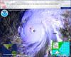
Nice visible there of possibly near future 93L 
0 likes
Who is online
Users browsing this forum: No registered users and 73 guests