Tropical Wave East of Lesser Antilles

This is the general tropical discussion area. Anyone can take their shot at predicting a storms path.

Moderator: S2k Moderators

Forum rules

The posts in this forum are NOT official forecasts and should not be used as such. They are just the opinion of the poster and may or may not be backed by sound meteorological data. They are NOT endorsed by any professional institution or STORM2K. For official information, please refer to products from the National Hurricane Center and National Weather Service.

Help Support Storm2K
Message
Author
User avatar
Gustywind
Category 5
Category 5
Posts: 12334
Joined: Mon Sep 03, 2007 7:29 am
Location: Baie-Mahault, GUADELOUPE

Re: Pouch 023L in West Africa

#21 Postby Gustywind » Tue Aug 26, 2014 2:06 pm

cycloneye wrote:Another perspective of this pouch/wave. Is going to be interesting to see how it does when it hits the water as is going to emerge south from where GFS has been showing in the runs and that is the latitude of the CV islands.

http://oi61.tinypic.com/1y50co.jpg

That's the 10000$ answer Cycloneye! :) Big POOF TEST for this pouch :P , matter of time now.
0 likes   

User avatar
gatorcane
S2K Supporter
S2K Supporter
Posts: 23689
Age: 47
Joined: Sun Mar 13, 2005 3:54 pm
Location: Boca Raton, FL

#22 Postby gatorcane » Tue Aug 26, 2014 2:27 pm

The ECMWF backed down on development now showing a vigorous wave traversing the MDR where it ends up a little NE of the Leewards and stretched out around 240 hours. Since the ECMWF is not good with showing genesis in the MDR, would still go with a blend of the GFS and ECMWF showing some development but not recurving the system as quickly as the GFS wants to recurve it due to it not deepening as quickly.
0 likes   

User avatar
Hammy
Category 5
Category 5
Posts: 5849
Age: 41
Joined: Fri May 25, 2012 5:25 pm
Contact:

#23 Postby Hammy » Tue Aug 26, 2014 2:41 pm

I would say this wave has a better chance than the others of developing where it's at, given the large area of SAL is no longer there--most of the drier air is further north or west and only pockets of dry air remain.
0 likes   
The above post is not official and should not be used as such. It is the opinion of the poster and may or may not be backed by sound meteorological data. It is not endorsed by any professional institution or storm2k.org. For official information, please refer to the NHC and NWS products.

User avatar
BigA
Professional-Met
Professional-Met
Posts: 1317
Joined: Sun Jul 24, 2005 10:56 pm

#24 Postby BigA » Tue Aug 26, 2014 4:20 pm

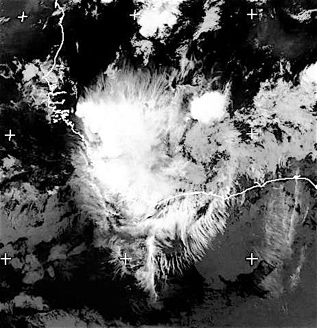
Right now the wave's vorticity maximum (I will refrain from calling it a circulation, though the spin is quite apparent on visible satellite) is in western Ghana at about 7 North. The majority of the convection is in a mesoscale convective system ahead of the vorticity max.

Most of the models show that the wave (or at least the vorticity) will gain substantial latitude before it leaves the African coast, and that it will exit between 12 and 15 North. Therefore, I would expect this to occur. However, if the system gains less latitude and comes off the coast at 9-10 North, quick recurvature as shown by the GFS is probably less likely.

It should be noted that not all the models show rapid recurvature in the eastern Atlantic, though most indicate some form of recurvature before the system gets too far west across the Atlantic. However, the ECMWF and UKMET, which keep it weaker/undeveloped, move it fairly straight westward through 240 and 144 hours respectively.

It's still well over Africa, so we've got plenty of time before development can even occur. The most interesting thing to watch now is whether the spin associated with the wave gains substantial latitude before it exits the coast.
0 likes   

User avatar
cycloneye
Admin
Admin
Posts: 143865
Age: 68
Joined: Thu Oct 10, 2002 10:54 am
Location: San Juan, Puerto Rico

Re: Pouch 023L in West Africa

#25 Postby cycloneye » Tue Aug 26, 2014 4:43 pm

:uarrow: Good analysis BigA. I agree that the latitude any spin emerges Africa will be key on future track. Here is the RAMSDIS loop of the eastern Atlantic so the peeps can follow this as soon it hits the water.You can refresh it every half an hour.

http://rammb.cira.colostate.edu/ramsdis ... display=12
0 likes   
Visit the Caribbean-Central America Weather Thread where you can find at first post web cams,radars
and observations from Caribbean basin members Click Here

User avatar
cycloneye
Admin
Admin
Posts: 143865
Age: 68
Joined: Thu Oct 10, 2002 10:54 am
Location: San Juan, Puerto Rico

Re: Pouch 023L in West Africa

#26 Postby cycloneye » Tue Aug 26, 2014 5:12 pm

Full Disk view.

Image
0 likes   
Visit the Caribbean-Central America Weather Thread where you can find at first post web cams,radars
and observations from Caribbean basin members Click Here

User avatar
cycloneye
Admin
Admin
Posts: 143865
Age: 68
Joined: Thu Oct 10, 2002 10:54 am
Location: San Juan, Puerto Rico

Re: Pouch 023L in West Africa

#27 Postby cycloneye » Tue Aug 26, 2014 6:19 pm

A tropical wave is forecast to move off the west coast of Africa
late this week. Conditions appear to be favorable for some
development thereafter while the system moves westward at 10 to 15
mph across the eastern Atlantic.
* Formation chance through 48 hours...low...near 0 percent.
* Formation chance through 5 days...medium...40 percent.
0 likes   
Visit the Caribbean-Central America Weather Thread where you can find at first post web cams,radars
and observations from Caribbean basin members Click Here

User avatar
Gustywind
Category 5
Category 5
Posts: 12334
Joined: Mon Sep 03, 2007 7:29 am
Location: Baie-Mahault, GUADELOUPE

Re: Pouch 023L in West Africa

#28 Postby Gustywind » Tue Aug 26, 2014 6:34 pm

cycloneye wrote:A tropical wave is forecast to move off the west coast of Africa
late this week. Conditions appear to be favorable for some
development thereafter while the system moves westward at 10 to 15
mph across the eastern Atlantic.
* Formation chance through 48 hours...low...near 0 percent.
* Formation chance through 5 days...medium...40 percent.


NHC continues to be very bullish on this one as the 2 latest TWO maintained a 40% of FC through 5 days. Pouch 023L continues to have my attention as surely many of the others members :)
0 likes   

User avatar
northjaxpro
S2K Supporter
S2K Supporter
Posts: 8900
Joined: Mon Sep 27, 2010 11:21 am
Location: Jacksonville, FL

#29 Postby northjaxpro » Tue Aug 26, 2014 6:51 pm

:uarrow: For sure, this wave is the most impressive one yet I have seen this season over Africa and it still is about 24-36 hours or so from emerging off the Africa coast.
0 likes   
NEVER, EVER SAY NEVER in the tropics and weather in general, and most importantly, with life itself!!

________________________________________________________________________________________

Fay 2008 Beryl 2012 Debby 2012 Colin 2016 Hermine 2016 Julia 2016 Matthew 2016 Irma 2017 Dorian 2019

User avatar
Gustywind
Category 5
Category 5
Posts: 12334
Joined: Mon Sep 03, 2007 7:29 am
Location: Baie-Mahault, GUADELOUPE

Re:

#30 Postby Gustywind » Tue Aug 26, 2014 7:01 pm

northjaxpro wrote::uarrow: For sure, this wave is the most impressive one yet I have seen this season over Africa and it still is about 24-36 hours or so from emerging off the Africa coast.

That's right, agree wit that :). We have to wait and see what could really happens from this one POOF or not is the big deal in store...
0 likes   

User avatar
cycloneye
Admin
Admin
Posts: 143865
Age: 68
Joined: Thu Oct 10, 2002 10:54 am
Location: San Juan, Puerto Rico

Re: Pouch 023L in West Africa

#31 Postby cycloneye » Tue Aug 26, 2014 8:07 pm

The latest synopsis from the pouch group.

http://www.met.nps.edu/~mtmontgo/storms2014/P23L.html


ECMWF: Analysis pouch looks distinct, but then tracks due north, which is unusual. Strengthens as it emerges from Africa, but OW decreases after 108 hours.

GFS: Develops, especially after 60 hours, as P23L is approaching the west African coast.

UKMET: Continues to forecast only modest strengthening, but OW values of ~6 x10⁻⁹ s-2 on Day 5 are higher than in the previous forecast.

NAVGEM: Unorganized with an erratic track for 48 hours. Distinct pouch then emerges from Africa with steady, moderate OW values.
0 likes   
Visit the Caribbean-Central America Weather Thread where you can find at first post web cams,radars
and observations from Caribbean basin members Click Here

User avatar
beoumont
Category 1
Category 1
Posts: 473
Joined: Sun Jul 10, 2011 4:13 pm
Location: East Central Florida
Contact:

Re: Pouch 023L in West Africa

#32 Postby beoumont » Tue Aug 26, 2014 8:52 pm

This is just beautiful. Cirrus spikes in every direction.

Image
0 likes   
List of 79 tropical cyclones intercepted by Richard Horodner:
http://www.canebeard.com/page/page/572246.htm

User avatar
cycloneye
Admin
Admin
Posts: 143865
Age: 68
Joined: Thu Oct 10, 2002 10:54 am
Location: San Juan, Puerto Rico

Re: Pouch 023L in West Africa

#33 Postby cycloneye » Tue Aug 26, 2014 9:04 pm

Here is a saved loop where you can see the spin behind the convection below the 10N latitude.

Image
0 likes   
Visit the Caribbean-Central America Weather Thread where you can find at first post web cams,radars
and observations from Caribbean basin members Click Here

User avatar
gatorcane
S2K Supporter
S2K Supporter
Posts: 23689
Age: 47
Joined: Sun Mar 13, 2005 3:54 pm
Location: Boca Raton, FL

#34 Postby gatorcane » Tue Aug 26, 2014 9:08 pm

:uarrow: Luis that is a great loop and certainly looks like we have arguably the strongest wave to roll off Africa this season so far.

Checking the SAL, looks like it is not nearly as bad as it has been out in the East Atlantic, which should allow for gradual development.

Image
0 likes   

User avatar
somethingfunny
ChatStaff
ChatStaff
Posts: 3926
Age: 36
Joined: Thu May 31, 2007 10:30 pm
Location: McKinney, Texas

#35 Postby somethingfunny » Tue Aug 26, 2014 9:19 pm

These are some gorgeous images and I am wondering if this will become an Invest before it lands in the water so that HWRF, GFDL, BAM, etc can operate.
0 likes   
I am not a meteorologist, and any posts made by me are not official forecasts or to be interpreted as being intelligent. These posts are just my opinions and are probably silly opinions.

User avatar
Hurricaneman
Category 5
Category 5
Posts: 7349
Age: 44
Joined: Tue Aug 31, 2004 3:24 pm
Location: central florida

Re: Pouch 023L in West Africa

#36 Postby Hurricaneman » Tue Aug 26, 2014 9:31 pm

This is one of those that could make it much farther west than modeled especially if it comes off at 9 to 10 north and or is weaker than modeled andvery possibly miss the connection to the eastern atlantic trough thats modeled to be there if its too far south and the next recurve opportunity would bring it dangerously close to the islands if that happens so this one even though modeled to turn out to sea still needs to be monitored as there have in the past been storms modeled to turn out to sea where this one is modeled only to miss the trough and head west to land and there are some examples

Frances in 2004
Isabel in 2003

so theres still a lot of time to watch this and hopefully it turns out to sea with the trough expected at 45W

edit: the Euro is a lot farther west because its weaker and it misses the eastern Atlantic trough

The posts in this forum are NOT official forecast and should not be used as such. They are just the opinion of the poster and may or may not be backed by sound meteorological data. They are NOT endorsed by any professional institution or storm2k.org. For official information, please refer to the NHC and NWS products
Last edited by Hurricaneman on Tue Aug 26, 2014 9:33 pm, edited 1 time in total.
0 likes   

User avatar
Gustywind
Category 5
Category 5
Posts: 12334
Joined: Mon Sep 03, 2007 7:29 am
Location: Baie-Mahault, GUADELOUPE

Re:

#37 Postby Gustywind » Tue Aug 26, 2014 9:32 pm

gatorcane wrote::uarrow: Luis that is a great loop and certainly looks like we have arguably the strongest wave to roll off Africa this season so far.

Checking the SAL, looks like it is not nearly as bad as it has been out in the East Atlantic, which should allow for gradual development.

Image

Yeah, you're definitely right Gator :) Hey guys, looks like another thing is cooking more east of Pouch 023L? We should keep an eye on this maybe "newly" pouch? IMO. Anyone see that? What do the models with this thing in the heels of 023L?
0 likes   

User avatar
Hurricaneman
Category 5
Category 5
Posts: 7349
Age: 44
Joined: Tue Aug 31, 2004 3:24 pm
Location: central florida

Re: Re:

#38 Postby Hurricaneman » Tue Aug 26, 2014 9:37 pm

Gustywind wrote:
gatorcane wrote::uarrow: Luis that is a great loop and certainly looks like we have arguably the strongest wave to roll off Africa this season so far.

Checking the SAL, looks like it is not nearly as bad as it has been out in the East Atlantic, which should allow for gradual development.

Image

Yeah, you're definitely right Gator :) Hey guys, looks like another thing is cooking more east of Pouch 023L? We should keep an eye on this maybe "newly" pouch? IMO. Anyone see that? What do the models with this thing in the heels of 023L?


A few days ago it was developing that area but it has been dropped but I wouldn't be surprised if the GFS and other models pick up on it again as its looking pretty good at the moment

As for pouch023L I think this may be the first major and possibly as they say red meat system since 2011 if the models are anywhere near correct

The posts in this forum are NOT official forecast and should not be used as such. They are just the opinion of the poster and may or may not be backed by sound meteorological data. They are NOT endorsed by any professional institution or storm2k.org. For official information, please refer to the NHC and NWS products
0 likes   

User avatar
gatorcane
S2K Supporter
S2K Supporter
Posts: 23689
Age: 47
Joined: Sun Mar 13, 2005 3:54 pm
Location: Boca Raton, FL

Re: Re:

#39 Postby gatorcane » Tue Aug 26, 2014 9:40 pm

I think development is going to be gradual. The GFS is all alone on it's rapid development so it's a little suspect. The GEM does not quickly develop this, but only gradually (that is usually a red flag if the GEM is not very bullish in the short to medium term) and the ECMWF and UKMET are not as bullish though show a vigorous wave.

Because development should be gradual, the pouch should move quite a bit to the west in the MDR, though as some mentioned the key is what latitude this wave ultimately emerges as to how far west it gets.

The posts in this forum are NOT official forecast and should not be used as such. They are just the opinion of the poster and may or may not be backed by sound meteorological data. They are NOT endorsed by any professional institution or storm2k.org. For official information, please refer to the NHC and NWS products
0 likes   

User avatar
Gustywind
Category 5
Category 5
Posts: 12334
Joined: Mon Sep 03, 2007 7:29 am
Location: Baie-Mahault, GUADELOUPE

Re: Re:

#40 Postby Gustywind » Tue Aug 26, 2014 9:46 pm

gatorcane wrote:I think development is going to be gradual. The GFS is all alone on it's rapid development so it's a little suspect. The GEM does not quickly develop this, but only gradually (that is usually a red flag if the GEM is not very bullish in the short to medium term) and the ECMWF and UKMET are not as bullish though show a vigorous wave.

Because development should be gradual, the pouch should move quite a bit to the west in the MDR, though as some mentioned the key is what latitude this wave ultimately emerges as to how far west it gets.

The posts in this forum are NOT official forecast and should not be used as such. They are just the opinion of the poster and may or may not be backed by sound meteorological data. They are NOT endorsed by any professional institution or storm2k.org. For official information, please refer to the NHC and NWS products

Thanks for this excellent analysis Gatorcane :), our members should appreciate your clarification :D
0 likes   


Return to “Talkin' Tropics”

Who is online

Users browsing this forum: No registered users and 133 guests