Possible Development in C Atlantic Wave (Is invest 92L)
Moderator: S2k Moderators
Forum rules

The posts in this forum are NOT official forecasts and should not be used as such. They are just the opinion of the poster and may or may not be backed by sound meteorological data. They are NOT endorsed by any professional institution or STORM2K. For official information, please refer to products from the National Hurricane Center and National Weather Service.
-
Weatherfreak14

- Category 5

- Posts: 1381
- Joined: Sat Sep 24, 2005 3:40 pm
- Location: Beaufort, SC
- Contact:
-
Mecklenburg
Re: Tropical Wave in the Central Atlantic (40w)
i believe all waves have a decent chance... now that the SAL is poofing, i don't know about the wind shear
0 likes
-
canetracker

- S2K Supporter

- Posts: 751
- Age: 63
- Joined: Wed Jul 27, 2005 8:49 pm
- Location: Suburbia New Orleans...Harahan, LA
Re: Re:
Mecklenburg wrote:HURAKAN wrote:
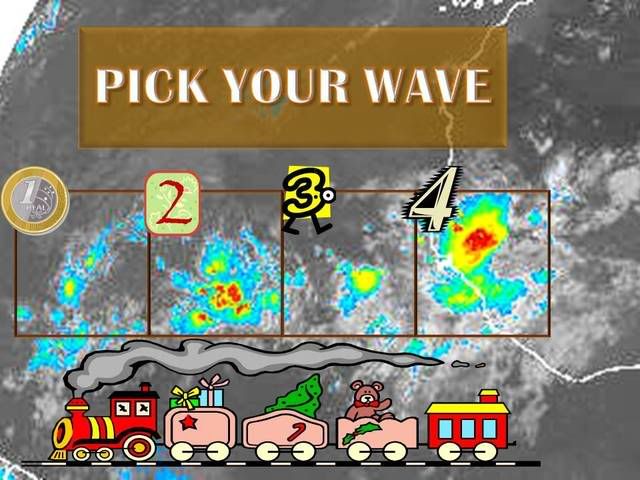
what a nice train... i will pick 1, 2 and 4
That is the greatest graphic I think I ever saw...LOL! If I am reading the model concensus correctly, 2 will possibly end up in the BOC with a possilbe northward trend and 3 could be a better player for development. So for now, I pick 2 and 3, but this is just my uneducated guess. Someone correct me if I am wrong. All these waves are so confusing.

Could wave #1 be the sacrificial wave regarding SAL?
0 likes


Re: Tropical Wave in the Central Atlantic (40w)
I can only see two on the atlantic sat I checked, looks like the farthest west is -45 and the next one is -30.
0 likes
-
Ed Mahmoud
Re: Tropical Wave in the Central Atlantic (40w)
0Z GFS initializes this as a closed low...
Not so sure about that.

Not so sure about that.
0 likes
-
cheezyWXguy

- Category 5
- Posts: 6282
- Joined: Mon Feb 13, 2006 12:29 am
- Location: Dallas, TX
Re: Tropical Wave in the Central Atlantic (40w)
Ed Mahmoud wrote:0Z GFS initializes this as a closed low...
Not so sure about that.
It doesnt matter. Thats not the wave that the gfs develops.
0 likes
Re: Tropical Wave in the Central Atlantic (40w)
I think # 1 has a "nice" S shape to it. Over the next couple of days, it will be in a very favorable environment in terms of upper winds and shear. Plus...the favorable MJO pulse is on the way back.
Honestly I expected this lull to last another 4 or 5 days...but looks like it will last only 2 days or so.
Behind that, # 2 sure has a shot too.
Looks like I'm not getting any time off next week...
MW
Honestly I expected this lull to last another 4 or 5 days...but looks like it will last only 2 days or so.
Behind that, # 2 sure has a shot too.
Looks like I'm not getting any time off next week...
MW
0 likes
-
jhamps10
Re: Tropical Wave in the Central Atlantic (40w)
MWatkins wrote:I think # 1 has a "nice" S shape to it. Over the next couple of days, it will be in a very favorable environment in terms of upper winds and shear. Plus...the favorable MJO pulse is on the way back.
Honestly I expected this lull to last another 4 or 5 days...but looks like it will last only 2 days or so.
Behind that, # 2 sure has a shot too.
Looks like I'm not getting any time off next week...
MW
if that.
also TWO is out, it's a code orange on both waves.
0 likes
Re: Tropical Wave in the Central Atlantic (40w)
jhamps10 wrote:MWatkins wrote:I think # 1 has a "nice" S shape to it. Over the next couple of days, it will be in a very favorable environment in terms of upper winds and shear. Plus...the favorable MJO pulse is on the way back.
Honestly I expected this lull to last another 4 or 5 days...but looks like it will last only 2 days or so.
Behind that, # 2 sure has a shot too.
Looks like I'm not getting any time off next week...
MW
if that.
also TWO is out, it's a code orange on both waves.
Really? Hmmm...time to start taking odds on how long it will be before we have 2 invests up in the Atlantic. I'm betting we'll have 2 by the end of the weekend...
MW
0 likes
-
cycloneye

- Admin

- Posts: 149505
- Age: 69
- Joined: Thu Oct 10, 2002 10:54 am
- Location: San Juan, Puerto Rico
Re: Tropical Wave in the Central Atlantic (40w)
ABNT20 KNHC 100548
TWOAT
TROPICAL WEATHER OUTLOOK
NWS TPC/NATIONAL HURRICANE CENTER MIAMI FL
200 AM EDT SUN AUG 10 2008
FOR THE NORTH ATLANTIC...CARIBBEAN SEA AND THE GULF OF MEXICO...
A LARGE TROPICAL WAVE LOCATED OVER THE CENTRAL ATLANTIC ABOUT 1300
MILES EAST OF THE WINDWARD ISLANDS IS PRODUCING LIMITED AND
DISORGANIZED SHOWERS AND THUNDERSTORMS. HOWEVER...UPPER-LEVEL
WINDS ARE EXPECTED TO BECOME MORE FAVORABLE FOR DEVELOPMENT OF THIS
SYSTEM DURING THE NEXT COUPLE OF DAYS AS IT CONTINUES WESTWARD AT
ABOUT 15 TO 20 MPH.
A SECOND AREA OF DISTURBED WEATHER IS LOCATED OVER THE FAR EASTERN
ATLANTIC ABOUT 500 MILES SOUTHWEST OF THE CAPE VERDE ISLANDS. SLOW
DEVELOPMENT OF THIS SYSTEM IS POSSIBLE AS IT MOVES WESTWARD AT
ABOUT 15 MPH.
ELSEWHERE.. TROPICAL CYCLONE FORMATION IS NOT EXPECTED DURING THE
NEXT 48 HOURS.
$$
FORECASTER RHOME
http://www.storm2k.org/weather/hw3.php? ... hwvmetric=
0 likes
-
Mecklenburg
Re: Tropical Wave in the Central Atlantic (40w)
wow, i never expected it to be orange now... let's make it three by tomorrow, when that wave off the african coast consolidates
0 likes

-
Stratosphere747
- Category 5
- Posts: 3772
- Joined: Thu Sep 11, 2003 8:34 pm
- Location: Surfside Beach/Freeport Tx
- Contact:


Re: Possible Development in Central Atlantic Wave (45w)
Morning folks. Both systems look good, but the first in particular seems to be developing a Low-level Circulation more so than its larger counterpart behind it. One can note the overall low level cloud motions around the convection starting to twist inwards into the convection. I would say this one has the most potential to develop more quickly out of the two. Assuming it develops, steering looks like this for lower-level systems:
http://cimss.ssec.wisc.edu/tropic/real- ... 8dlm1.html
Given that setup along with the latitude of the wave not being terrible high (Somewhere near 11-12N), steering would seemingly take it near the leewards in some form or fashion. From there on out its anybody's guess.
http://cimss.ssec.wisc.edu/tropic/real- ... 8dlm1.html
Given that setup along with the latitude of the wave not being terrible high (Somewhere near 11-12N), steering would seemingly take it near the leewards in some form or fashion. From there on out its anybody's guess.
0 likes
Who is online
Users browsing this forum: Iceresistance and 259 guests