2020 Global Model Runs Discussion (Out thru day 16)

This is the general tropical discussion area. Anyone can take their shot at predicting a storms path.

Moderator: S2k Moderators

Forum rules

The posts in this forum are NOT official forecasts and should not be used as such. They are just the opinion of the poster and may or may not be backed by sound meteorological data. They are NOT endorsed by any professional institution or STORM2K. For official information, please refer to products from the National Hurricane Center and National Weather Service.

Help Support Storm2K
Message
Author
User avatar
SFLcane
S2K Supporter
S2K Supporter
Posts: 10163
Age: 47
Joined: Sat Jun 05, 2010 1:44 pm
Location: Lake Worth Florida

Re: 2020 Global Model Runs Discussion (Out thru day 16)

#2121 Postby SFLcane » Sun Sep 06, 2020 7:13 pm

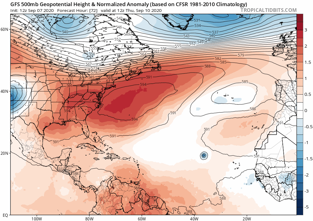
USTropics wrote:Here is an example of the GFS bias in over-doing troughs, and this is just a 3-5 day forecast trend (500mb height anomalies):
https://i.ibb.co/jRdZBhm/gfs-z500a-us-fh72-trend.gif

This a known bias in both the current GFS and still the GFS-para (with slight improvements):
https://i.imgur.com/niVQUN9.png

Those cold temps getting all the way to the GOM? Looking less likely now. Here is the GFS 5-7 day trend again:
https://i.ibb.co/r3c7s59/gfs-T2ma-us-fh72-trend-1.gif

5 day forecast on the 12z ECMWF run:
https://i.ibb.co/X2vK6Xy/ecmwf-T850a-us-fh0-120.gif

Here is a view of the 5-7 day forecast trend by the GFS (500mb height anomalies):
https://i.ibb.co/VvDPvdF/gfs-z500a-atl-fh120-trend.gif

Operational models are all over the place. Just for fun, here is the 10-12 day trend of the GFS:
https://i.ibb.co/2FDyFyc/gfs-z500a-atl-fh240-trend.gif

How this all plays out? No idea, and I don't believe anyone can say with much confidence what will happen 5+ days out. As stated last week by some of us on here, model verification scores were going to take a hit due to the amplified pattern change (partly attributed to two consecutive recurving typhoons). I think odds still favor some recurving systems, but it's definitely not set in stone. If these troughs aren't as deep (and we've seen the models are having issues already with this), they could just as easily scoot over the top and amplify ridging. For now we'll have to see what actually forms (and becomes the dominant system if multiple systems form) and how the models continue to adjust to the 500mb pattern. The ensembles provide the best tool for that.


Excellent points.. Thankfully have yet to see single deterministic run of any model get anywhere near the US as of yet.
2 likes   

User avatar
Hammy
Category 5
Category 5
Posts: 5849
Age: 42
Joined: Fri May 25, 2012 5:25 pm
Contact:

Re: 2020 Global Model Runs Discussion (Out thru day 16)

#2122 Postby Hammy » Mon Sep 07, 2020 2:32 am

Models seem like they're backing off on intensity of anything that comes out of that monsoon gyre in the Atlantic--a few days ago we had two recurving hurricanes, now we have two medium-duration tropical storms and a hurricane on the third system (future-94L)

GFS two days ago had three systems by Friday, now only has two--Cat 1 at most coming out of any of them.

CMC no longer does anything with 93L (which it previously developed off and on) and has no hurricanes in the MDR until Sep 15--and no majors through the 17th.

Euro similarly keeps both TD17 and 93L as tropical storms for the entire period and no longer shows future 94L becoming a hurricane until the 240h point.

Even the formerly bullish GFS-Para only gives us a Jerry-esque Cat 1 out of 93L and a depression out of the system behind it.

This has me wondering if the models don't handle the monsoon trough setups well, and are doing the same as they do in the EPAC--developing more (and stronger) storms than actually play out, as it fails to detect development from more isolated waves as we saw with earlier storms.
0 likes   
The above post is not official and should not be used as such. It is the opinion of the poster and may or may not be backed by sound meteorological data. It is not endorsed by any professional institution or storm2k.org. For official information, please refer to the NHC and NWS products.

Shell Mound
Category 5
Category 5
Posts: 2434
Age: 32
Joined: Thu Sep 07, 2017 3:39 pm
Location: St. Petersburg, FL → Scandinavia

Re: 2020 Global Model Runs Discussion (Out thru day 16)

#2123 Postby Shell Mound » Mon Sep 07, 2020 2:56 am

Hammy wrote:This has me wondering if the models don't handle the monsoon trough setups well

Models never handle monsoonal troughs well. Many years’ experience makes that clear. :wink:
4 likes   
CVW / MiamiensisWx / Shell Mound
The posts in this forum are NOT official forecasts and should not be used as such. They are just the opinion of the poster and may or may not be backed by sound meteorological data. They are NOT endorsed by any professional institution or STORM2K. For official information, please refer to products from the NHC and NWS.

User avatar
aspen
Category 5
Category 5
Posts: 8818
Joined: Sat Oct 12, 2019 7:10 pm
Location: Connecticut, USA

Re: 2020 Global Model Runs Discussion (Out thru day 16)

#2124 Postby aspen » Mon Sep 07, 2020 7:45 am

Shockingly, the models did very well predicting TD18’s quick genesis after its precursor wave exited Africa. Let’s see if they’re right again with Sally.

After Sally, the GFS, Euro, and CMC appear to show a tropical wave emerging into the Atlantic in 7-9 days. They don’t really do anything with it, but it bears watching to see if the models end up catching onto it, because it’ll be at a low latitude like future Sally.
1 likes   
Irene '11 Sandy '12 Hermine '16 5/15/2018 Derecho Fay '20 Isaias '20 Elsa '21 Henri '21 Ida '21

I am only a meteorology enthusiast who knows a decent amount about tropical cyclones. Look to the professional mets, the NHC, or your local weather office for the best information.

Nuno
Category 2
Category 2
Posts: 597
Joined: Fri Aug 30, 2019 8:35 am
Location: Coral Gables, FL

Re: 2020 Global Model Runs Discussion (Out thru day 16)

#2125 Postby Nuno » Mon Sep 07, 2020 9:25 am

Shell Mound wrote:
Hammy wrote:This has me wondering if the models don't handle the monsoon trough setups well

Models never handle monsoonal troughs well. Many years’ experience makes that clear. :wink:


Yeah its pretty clear the models aren't handling this set up well. Given the inconsistencies I'm not looking at them beyond 48 hrs except for laffs.
1 likes   
Andrew (1992), Irene (1999), Frances (2004), Katrina (2005), Wilma (2005), Fay (2008), Irma (2017), Eta (2020), Ian (2022)

User avatar
Jr0d
S2K Supporter
S2K Supporter
Posts: 1409
Joined: Tue Aug 27, 2019 10:52 am
Location: Cayo Hueso

Re: 2020 Global Model Runs Discussion (Out thru day 16)

#2126 Postby Jr0d » Mon Sep 07, 2020 11:12 am

It is almost comical how landfall biased this board can be. The models show a strike 10 days out, everyone is on board and start trying to guess where it will make landfall.

When all global models are showing OTS with the current systems, the consensus is the models are on crack and can't be trusted.

I posted this on the now Paulette thread, given the pattern, the CONUS will not be impacted by a Cape Verde system in the next week++.
3 likes   

User avatar
aspen
Category 5
Category 5
Posts: 8818
Joined: Sat Oct 12, 2019 7:10 pm
Location: Connecticut, USA

Re: 2020 Global Model Runs Discussion (Out thru day 16)

#2127 Postby aspen » Mon Sep 07, 2020 11:47 am

Today’s 12z GFS run pumps out a ton of ACE over the next ten days. By 240 hours, it has C3 Hurricane Paulette east of Bermuda, C1 Hurricane Rene SW of the Azores, C1 Hurricane Sally in the MDR, and TS Teddy near the SEUS coast. Paulette and Rene remain weak for a while until findings more favorable conditions after five days, near Bermuda for Paulette and in the further North Atlantic for Rene.
3 likes   
Irene '11 Sandy '12 Hermine '16 5/15/2018 Derecho Fay '20 Isaias '20 Elsa '21 Henri '21 Ida '21

I am only a meteorology enthusiast who knows a decent amount about tropical cyclones. Look to the professional mets, the NHC, or your local weather office for the best information.

Nuno
Category 2
Category 2
Posts: 597
Joined: Fri Aug 30, 2019 8:35 am
Location: Coral Gables, FL

Re: 2020 Global Model Runs Discussion (Out thru day 16)

#2128 Postby Nuno » Mon Sep 07, 2020 11:58 am

Jr0d wrote:It is almost comical how landfall biased this board can be. The models show a strike 10 days out, everyone is on board and start trying to guess where it will make landfall.

When all global models are showing OTS with the current systems, the consensus is the models are on crack and can't be trusted.

I posted this on the now Paulette thread, given the pattern, the CONUS will not be impacted by a Cape Verde system in the next week++.


Is it landfall bias? I'm pretty sure you're exaggerating for effect given that few model runs have shown any landfalls for any systems five days out let alone ten, Laura aside :lol: Or...it could be that given how poorly the models have performed overall coupled with run-to-run inconsistencies of various atmospheric features and setups its just wise to not put so much stock into them until the storms have developed a bit more?

I'd wager on an eventual recurvature down the line, but declarative statements and absolutes aren't necessary peak season.
4 likes   
Andrew (1992), Irene (1999), Frances (2004), Katrina (2005), Wilma (2005), Fay (2008), Irma (2017), Eta (2020), Ian (2022)

User avatar
Hypercane_Kyle
Category 5
Category 5
Posts: 3354
Joined: Sat Mar 07, 2015 7:58 pm
Location: Cape Canaveral, FL

Re: 2020 Global Model Runs Discussion (Out thru day 16)

#2129 Postby Hypercane_Kyle » Mon Sep 07, 2020 12:00 pm

Going to be tough to have any system in the MDR approach land with so many storms out there breaking down the ridge.
5 likes   
My posts are my own personal opinion, defer to the National Hurricane Center (NHC) and other NOAA products for decision making during hurricane season.

Fancy1001
Category 1
Category 1
Posts: 452
Joined: Thu Jul 16, 2020 10:16 pm

Re: 2020 Global Model Runs Discussion (Out thru day 16)

#2130 Postby Fancy1001 » Mon Sep 07, 2020 12:08 pm

aspen wrote:Today’s 12z GFS run pumps out a ton of ACE over the next ten days. By 240 hours, it has C3 Hurricane Paulette east of Bermuda, C1 Hurricane Rene SW of the Azores, C1 Hurricane Sally in the MDR, and TS Teddy near the SEUS coast. Paulette and Rene remain weak for a while until findings more favorable conditions after five days, near Bermuda for Paulette and in the further North Atlantic for Rene.

Icky Vicky shows up at the end, so the real question is will we get wilfred before the end of september.
2 likes   

User avatar
aspen
Category 5
Category 5
Posts: 8818
Joined: Sat Oct 12, 2019 7:10 pm
Location: Connecticut, USA

Re: 2020 Global Model Runs Discussion (Out thru day 16)

#2131 Postby aspen » Mon Sep 07, 2020 12:14 pm

Hypercane_Kyle wrote:Going to be tough to have any system in the MDR approach land with so many storms out there breaking down the ridge.

A MDR storm could attempt to threaten land if it remains at a low latitude like future Sally, of if it gets yeeted towards the west via Fujiwhara interactions with another system.
2 likes   
Irene '11 Sandy '12 Hermine '16 5/15/2018 Derecho Fay '20 Isaias '20 Elsa '21 Henri '21 Ida '21

I am only a meteorology enthusiast who knows a decent amount about tropical cyclones. Look to the professional mets, the NHC, or your local weather office for the best information.

User avatar
gatorcane
S2K Supporter
S2K Supporter
Posts: 23691
Age: 47
Joined: Sun Mar 13, 2005 3:54 pm
Location: Boca Raton, FL

Re: 2020 Global Model Runs Discussion (Out thru day 16)

#2132 Postby gatorcane » Mon Sep 07, 2020 12:21 pm

The 12Z GFS shows a very progressive 500mb pattern with each trough getting progressively stronger as well. Difficult to get the current Cape Verde storms anywhere close to the CONUS with this pattern. Something would have to be very far south and travel through the Caribbean recurving across the Western Caribbean:

Image
Last edited by gatorcane on Mon Sep 07, 2020 12:24 pm, edited 1 time in total.
2 likes   

User avatar
aspen
Category 5
Category 5
Posts: 8818
Joined: Sat Oct 12, 2019 7:10 pm
Location: Connecticut, USA

Re: 2020 Global Model Runs Discussion (Out thru day 16)

#2133 Postby aspen » Mon Sep 07, 2020 12:23 pm

The GFS seems to be back to its old self in the 12z run. It has:
—Cat 3 Hurricane Paulette and Cat 1 Hurricane Rene wandering around for 7+ days
—Cat 1/2 Hurricane Sally wandering around for a while as well
—TS or Hurricane Teddy forming off of the SEUS coast in 10 days and riding up the east coast
—Cat 3 Hurricane Vicky barreling towards the Leeward Islands at the end of the run

That would be a season total of 20/11/3 or 20/12/3 and likely >110 ACE by September 23rd if this run were to verify exactly (obviously, it won’t).
2 likes   
Irene '11 Sandy '12 Hermine '16 5/15/2018 Derecho Fay '20 Isaias '20 Elsa '21 Henri '21 Ida '21

I am only a meteorology enthusiast who knows a decent amount about tropical cyclones. Look to the professional mets, the NHC, or your local weather office for the best information.

LarryWx
S2K Supporter
S2K Supporter
Posts: 6326
Joined: Sun Sep 07, 2003 2:04 pm
Location: GA

Re: 2020 Global Model Runs Discussion (Out thru day 16)

#2134 Postby LarryWx » Mon Sep 07, 2020 12:29 pm

Jr0d wrote:It is almost comical how landfall biased this board can be. The models show a strike 10 days out, everyone is on board and start trying to guess where it will make landfall.

When all global models are showing OTS with the current systems, the consensus is the models are on crack and can't be trusted.

I posted this on the now Paulette thread, given the pattern, the CONUS will not be impacted by a Cape Verde system in the next week++.


Any wx board discussing the tropics is inherently going to be much more interested in a TC that threatens the most members of that board and will thus generate more activity when there is a threat. In many cases, it isn’t that most want a hit right in their area although obviously some do and some even chase. It is more that it is much more interesting (not necessarily a “desirable interesting”) when there is a potential threat and will thus generate much more discussion. So, along with that, there will tend to be more speculation about a model run being off when it has OTS vs the other way around.

I’ll put it another way. Let’s say we were in another world where the frequency and strength of TCs was the same but in which TCs for whatever meteorological reason never have a chance to impact the US. Of course, there’d be far, far less posting and probably no tropical wx based forum with majority living in the US. I certainly wouldn’t post nearly as much and probably wouldn’t even be a member or even read the board.

Let’s face it. The much more desirable (for most like me) “fish storm” outcome is a much less “interesting” outcome. In other words, “interesting” does not at all equate to “desirable” for most. “Boring” is the most desirable for most.
7 likes   
Personal Forecast Disclaimer:
The posts in this forum are NOT official forecasts and should not be used as such. They are just the opinion of the poster and may or may not be backed by sound meteorological data. They are NOT endorsed by any professional institution or storm2k.org. For official information, please refer to the NHC and NWS products.

User avatar
Hypercane_Kyle
Category 5
Category 5
Posts: 3354
Joined: Sat Mar 07, 2015 7:58 pm
Location: Cape Canaveral, FL

Re: 2020 Global Model Runs Discussion (Out thru day 16)

#2135 Postby Hypercane_Kyle » Mon Sep 07, 2020 1:41 pm

Euro remains very wishy-washy on the future intensity of any of these storms. Potent hurricane in the MDR in the 00z is now a weak tropical storm on the 12z, another storm behind it that barely existed in the 00z run. Very poor consistency.
1 likes   
My posts are my own personal opinion, defer to the National Hurricane Center (NHC) and other NOAA products for decision making during hurricane season.

supercane4867
Category 5
Category 5
Posts: 4966
Joined: Wed Nov 14, 2012 10:43 am

Re: 2020 Global Model Runs Discussion (Out thru day 16)

#2136 Postby supercane4867 » Mon Sep 07, 2020 2:11 pm

5 active systems on the 12z euro. Cyclonefest

Image
9 likes   

LarryWx
S2K Supporter
S2K Supporter
Posts: 6326
Joined: Sun Sep 07, 2003 2:04 pm
Location: GA

Re: 2020 Global Model Runs Discussion (Out thru day 16)

#2137 Postby LarryWx » Mon Sep 07, 2020 2:11 pm

For the record, I thought it would be appropriate to post this in here, which is hour 228 of the 12Z Euro:

Yes, that is Rene moving SOUTHWARD near 23N, 49W back toward the MDR at hour 228 on this 12Z Euro map WSW of potential TD 20! Meanwhile, the wave inside Africa is near the NE Caribbean. Potential TD 21 is just off Africa! Paulette is moving NE over the N Atl. So, there are a whopping 5 TCs at 0Z on 9/17 on this Euro run. If we added the low SW of Bermuda, which is already dissipated by then, that would mean SIX systems to follow just over the next 10 days!!

By the way, if the Bermuda low were to become a TD, potential TD 20 could be TD 21, and potential TD 21 could be TD 22. Unreal!!

Image
3 likes   
Personal Forecast Disclaimer:
The posts in this forum are NOT official forecasts and should not be used as such. They are just the opinion of the poster and may or may not be backed by sound meteorological data. They are NOT endorsed by any professional institution or storm2k.org. For official information, please refer to the NHC and NWS products.

Aric Dunn
Category 5
Category 5
Posts: 21238
Age: 42
Joined: Sun Sep 19, 2004 9:58 pm
Location: Ready for the Chase.
Contact:

Re: 2020 Global Model Runs Discussion (Out thru day 16)

#2138 Postby Aric Dunn » Mon Sep 07, 2020 2:13 pm

LarryWx wrote:For the record, I thought it would be appropriate to post this in here, which is hour 228 of the 12Z Euro:

Yes, that is Rene moving SOUTHWARD near 23N, 49W back toward the MDR at hour 228 on this 12Z Euro map WSW of potential TD 20! Meanwhile, the wave inside Africa is near the NE Caribbean. Potential TD 21 is just off Africa! Paulette is moving NE over the N Atl. So, there are a whopping 5 TCs at 0Z on 9/17 on this Euro run. If we added the low SW of Bermuda, which is already dissipated by then, that would mean SIX systems to follow just over the next 10 days!!

By the way, if the Bermuda low were to become a TD, potential TD 20 could be TD 21, and potential TD 21 could be TD 22. Unreal!!

https://i.imgur.com/czhcKWm.png


don't discount the NW carrib either..
2 likes   
Note: If I make a post that is brief. Please refer back to previous posts for the analysis or reasoning. I do not re-write/qoute what my initial post said each time.
If there is nothing before... then just ask :)

Space & Atmospheric Physicist, Embry-Riddle Aeronautical University,
I believe the sky is falling...

LarryWx
S2K Supporter
S2K Supporter
Posts: 6326
Joined: Sun Sep 07, 2003 2:04 pm
Location: GA

Re: 2020 Global Model Runs Discussion (Out thru day 16)

#2139 Postby LarryWx » Mon Sep 07, 2020 2:48 pm

Here on this 216 hour map of the 12Z EPS, those just offshore the SE US, the TD over FL, and the H in the E GOM are from Paulette. The one SW of PR and the 2 NE of PR (yes, there are 2) are from Rene. The two in the E Caribbean are from the wave currently inside Africa. The one on the NC coast is from the low now SW of Bermuda:

Image
5 likes   
Personal Forecast Disclaimer:
The posts in this forum are NOT official forecasts and should not be used as such. They are just the opinion of the poster and may or may not be backed by sound meteorological data. They are NOT endorsed by any professional institution or storm2k.org. For official information, please refer to the NHC and NWS products.

LarryWx
S2K Supporter
S2K Supporter
Posts: 6326
Joined: Sun Sep 07, 2003 2:04 pm
Location: GA

Re: 2020 Global Model Runs Discussion (Out thru day 16)

#2140 Postby LarryWx » Mon Sep 07, 2020 3:14 pm

Here is the hour 360 of the 12Z EPS: all or most of these 13 appear to be from a combo of Rene and the wave currently inside Africa with most from the wave inside Africa but at least two and probably at least 3 from Rene. I know that the one just offshore NW FL and the one just offshore NE MX are from Rene:

Image
6 likes   
Personal Forecast Disclaimer:
The posts in this forum are NOT official forecasts and should not be used as such. They are just the opinion of the poster and may or may not be backed by sound meteorological data. They are NOT endorsed by any professional institution or storm2k.org. For official information, please refer to the NHC and NWS products.


Return to “Talkin' Tropics”

Who is online

Users browsing this forum: Hurrilurker, jaguars_22 and 55 guests