Spacecoast wrote:https://i.ibb.co/mhLFC6R/two-atl-5d0.png
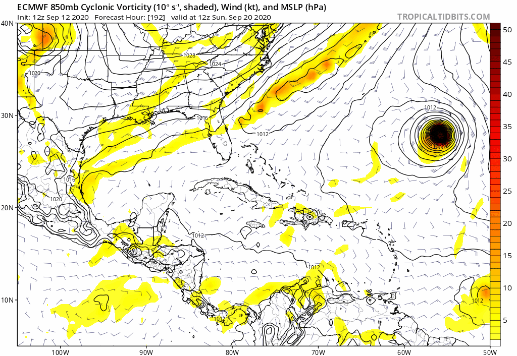
Yea, take a look at the GFS 00z run for the vorticity crossing Florida into the Gulf this weekend. See 850mb vorticity.....18z Monday is interesting as it heads toward NOrleans.
Moderator: S2k Moderators


Spacecoast wrote:https://i.ibb.co/mhLFC6R/two-atl-5d0.png


Hurricaneman wrote:Is it me or is the GFS setting up the beginning of a monsoon gyre in the western Caribbean at the end of the run


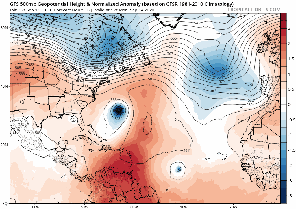
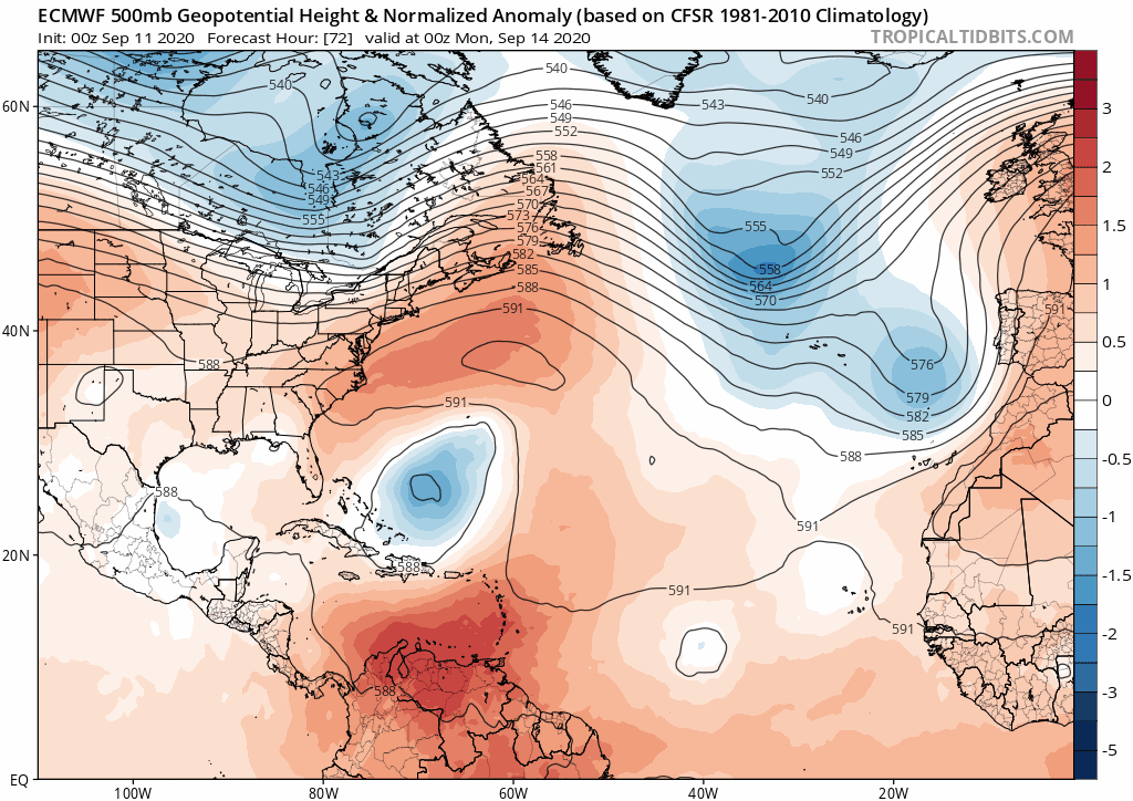
SFLcane wrote:Euro long range with another low rider near the Caribbean islands.
toad strangler wrote:SFLcane wrote:Euro long range with another low rider near the Caribbean islands.
Let's see if the cue ball is hit true this time.
St0rmTh0r wrote:toad strangler wrote:SFLcane wrote:Euro long range with another low rider near the Caribbean islands.
Let's see if the cue ball is hit true this time.
Just absolutely insane activity right now with a la nina now in place the season will get worse than it has been.

toad strangler wrote:SFLcane wrote:Euro long range with another low rider near the Caribbean islands.
Let's see if the cue ball is hit true this time.

SFLcane wrote:12z Euro a tad weaker has a TC moving into the Caribbean.
https://i.postimg.cc/HsRgSmtr/4-C795-F80-EF37-4-DD0-B4-B9-E402-DCC0-ECA0.gif


WeatherEmperor wrote:The 12z Canadian shows this Caribbean low rider as well
https://uploads.tapatalk-cdn.com/20200912/943fe3613bb918b1fd5949819206badb.jpg
Sent from my iPhone using Tapatalk
SFLcane wrote:WeatherEmperor wrote:The 12z Canadian shows this Caribbean low rider as well
https://uploads.tapatalk-cdn.com/20200912/943fe3613bb918b1fd5949819206badb.jpg
Sent from my iPhone using Tapatalk
With all these troughs that “ can ” get interesting.
Users browsing this forum: pepecool20, zal0phus and 53 guests


