ENSO Updates (2007 thru 2023)

This is the general tropical discussion area. Anyone can take their shot at predicting a storms path.

Moderator: S2k Moderators

Forum rules

The posts in this forum are NOT official forecasts and should not be used as such. They are just the opinion of the poster and may or may not be backed by sound meteorological data. They are NOT endorsed by any professional institution or STORM2K. For official information, please refer to products from the National Hurricane Center and National Weather Service.

Help Support Storm2K
Message
Author
User avatar
cycloneye
Admin
Admin
Posts: 139604
Age: 67
Joined: Thu Oct 10, 2002 10:54 am
Location: San Juan, Puerto Rico

Re: ENSO:Majority of Models (Weak El Nino on ASO)

#2341 Postby cycloneye » Mon Jul 23, 2012 6:25 am

cycloneye wrote:The uptick streak of the daily SOI is over after 14 days as it went negative on Sunday.

http://www.longpaddock.qld.gov.au/seaso ... soivalues/


The daily SOI is now with two days in a row in negative.
0 likes   
Visit the Caribbean-Central America Weather Thread where you can find at first post web cams,radars
and observations from Caribbean basin members Click Here

User avatar
cycloneye
Admin
Admin
Posts: 139604
Age: 67
Joined: Thu Oct 10, 2002 10:54 am
Location: San Juan, Puerto Rico

Re: ENSO: CPC 7/23/12 Update=Nino 3.4 warms up to +0.5C

#2342 Postby cycloneye » Mon Jul 23, 2012 9:24 am

Climate Prediction Center 7/23/12 Weekly Update

IMO,is inevitable at this point that El Nino will be declared officially in the next 3 to 4 weeks if things continue to behave as it is doing presently. This update has Nino 3.4 warming again (+0.5C) after cooling a little bit in the past couple of weeks.

http://www.cpc.ncep.noaa.gov/products/a ... ts-web.pdf

Image
0 likes   
Visit the Caribbean-Central America Weather Thread where you can find at first post web cams,radars
and observations from Caribbean basin members Click Here

User avatar
NDG
S2K Supporter
S2K Supporter
Posts: 14947
Joined: Sun Jul 09, 2006 10:14 pm
Location: Orlando, FL

Re: ENSO Updates / SOI continues on uptick

#2343 Postby NDG » Mon Jul 23, 2012 9:34 am

:uarrow: Not surprised at all :wink:
Very likely now that the Atlantic season will come to an abrupt end after the peak of the season, IMO.

NDG wrote:

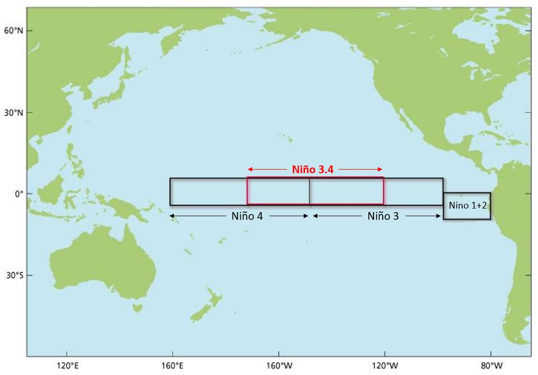
Yes, it has warmed up again during this week, I will not be surprised if next week's weekly update is raised back up to at last .5 deg C above average for Nino 3.4
0 likes   

User avatar
cycloneye
Admin
Admin
Posts: 139604
Age: 67
Joined: Thu Oct 10, 2002 10:54 am
Location: San Juan, Puerto Rico

Re: ENSO: CPC 7/23/12 Update=Nino 3.4 warms up to +0.5C

#2344 Postby cycloneye » Mon Jul 23, 2012 10:07 am

For the newbies and for those who dont know a lot about these numbers of the Nino regions (1+2/3/3.4 and 4) and in which areas they cover,here is the graphic.

Image
0 likes   
Visit the Caribbean-Central America Weather Thread where you can find at first post web cams,radars
and observations from Caribbean basin members Click Here

User avatar
cycloneye
Admin
Admin
Posts: 139604
Age: 67
Joined: Thu Oct 10, 2002 10:54 am
Location: San Juan, Puerto Rico

Re: ENSO: CPC 7/23/12 Update=Nino 3.4 warms up to +0.5C

#2345 Postby cycloneye » Mon Jul 23, 2012 10:25 am

This is off-topic because is Talking Tropics forum,but a heads up about how next winter in the U.S will be like depends on how strong El Nino will be from the moment it is declared officially going ahead until the end of 2012 and early 2013. For those newbies that only come to Talking Tropics forum ,we have a Winter forum where all discussions about that period are posted.

Winter Weather Forum
0 likes   
Visit the Caribbean-Central America Weather Thread where you can find at first post web cams,radars
and observations from Caribbean basin members Click Here

User avatar
Kingarabian
S2K Supporter
S2K Supporter
Posts: 15462
Joined: Sat Aug 08, 2009 3:06 am
Location: Honolulu, Hawaii

#2346 Postby Kingarabian » Mon Jul 23, 2012 12:48 pm

Wait so why did the SOI go up anyway?
0 likes   
RIP Kobe Bryant

Ntxw
Storm2k Moderator
Storm2k Moderator
Posts: 21565
Joined: Wed Oct 21, 2009 6:34 pm
Location: DFW, Texas

Re:

#2347 Postby Ntxw » Mon Jul 23, 2012 1:05 pm

Kingarabian wrote:Wait so why did the SOI go up anyway?


MJO leaving tropical pacific to Indian Ocean. Allowed high pressure to build over Tahiti which in response SOI rose.
0 likes   
The above post and any post by Ntxw is NOT an official forecast and should not be used as such. It is just the opinion of the poster and may or may not be backed by sound meteorological data. It is NOT endorsed by any professional institution including Storm2k. For official information, please refer to NWS products.

  Help support Storm2K!
Help Support Storm2K

User avatar
TropicalAnalystwx13
Category 5
Category 5
Posts: 2109
Age: 26
Joined: Tue Jul 19, 2011 8:20 pm
Location: Wilmington, NC
Contact:

#2348 Postby TropicalAnalystwx13 » Mon Jul 23, 2012 3:01 pm

El Nino cannot be declared anytime soon because the ONI has to remain above 0.5C for three consecutive months. That puts the declaration date in October at the earliest.
0 likes   

User avatar
wxman57
Moderator-Pro Met
Moderator-Pro Met
Posts: 22506
Age: 66
Joined: Sat Jun 21, 2003 8:06 pm
Location: Houston, TX (southwest)

Re:

#2349 Postby wxman57 » Mon Jul 23, 2012 3:07 pm

TropicalAnalystwx13 wrote:El Nino cannot be declared anytime soon because the ONI has to remain above 0.5C for three consecutive months. That puts the declaration date in October at the earliest.


That is true, though its impact could be felt closer to the onset of warmer temps in the Tropical Pacific.
0 likes   

User avatar
cycloneye
Admin
Admin
Posts: 139604
Age: 67
Joined: Thu Oct 10, 2002 10:54 am
Location: San Juan, Puerto Rico

Re: ENSO: CPC 7/23/12 Update=Nino 3.4 warms up to +0.5C

#2350 Postby cycloneye » Tue Jul 24, 2012 6:09 pm

The July Eurosip forecast is for between Weak and Moderate El Nino thru the end of 2012.

Image
0 likes   
Visit the Caribbean-Central America Weather Thread where you can find at first post web cams,radars
and observations from Caribbean basin members Click Here

Frank2
Category 5
Category 5
Posts: 4061
Joined: Mon Jul 25, 2005 12:47 pm

Re: ENSO: CPC 7/23/12 Update=Nino 3.4 warms up to +0.5C

#2351 Postby Frank2 » Wed Jul 25, 2012 7:54 am

TWC mentioned the EPAC warming last evening - an El Nino event would be good for the trough-stricken areas of the midwest and plains, because they cause increased rainfall in those areas as seen during past events...

Any pro met comments would be appreciated...
0 likes   

User avatar
cycloneye
Admin
Admin
Posts: 139604
Age: 67
Joined: Thu Oct 10, 2002 10:54 am
Location: San Juan, Puerto Rico

Re: ENSO: CPC 7/23/12 Update=Nino 3.4 warms up to +0.5C

#2352 Postby cycloneye » Wed Jul 25, 2012 8:26 am

Nino 3.4 continues to warm after the CPC 7/23/12 update of +0.5C,now up to +0.68C rounding to +0.7C according to the Aussies data.Ntxw,has the new Kelvin Wave rolled thru the Equatorial Pacific?

Image
0 likes   
Visit the Caribbean-Central America Weather Thread where you can find at first post web cams,radars
and observations from Caribbean basin members Click Here

User avatar
NDG
S2K Supporter
S2K Supporter
Posts: 14947
Joined: Sun Jul 09, 2006 10:14 pm
Location: Orlando, FL

Re: ENSO: CPC 7/23/12 Update=Nino 3.4 warms up to +0.5C

#2353 Postby NDG » Wed Jul 25, 2012 8:31 am

No pro here, but IMO not all El Ninos have equally effects. I think that once we see a good positive NAO pattern set up, the Plains might see relief.
0 likes   

weatherdude1108
Category 5
Category 5
Posts: 4174
Joined: Tue Dec 13, 2011 1:04 pm
Location: Northwest Austin/Cedar Park, TX

Re: ENSO: CPC 7/23/12 Update=Nino 3.4 warms up to +0.5C

#2354 Postby weatherdude1108 » Wed Jul 25, 2012 8:40 am

NDG wrote:No pro here, but IMO not all El Ninos have equally effects. I think that once we see a good positive NAO pattern set up, the Plains might see relief.


What about Texas? West to Central Texas is still in bad shape and needs major relief, not to mention the Colorado and Medina River systems and their associated lakes.
0 likes   

HURRICANELONNY
Category 5
Category 5
Posts: 1381
Joined: Wed May 07, 2003 6:48 am
Location: HOLLYWOOD.FL

Re: ENSO Updates

#2355 Postby HURRICANELONNY » Wed Jul 25, 2012 10:48 am

They didn't say how strong El Nino could get. This story was in todays USA TODAY. 7/25/2012

http://www.usatoday.com/weather/climate ... 56257174/1
0 likes   
hurricanelonny

Ntxw
Storm2k Moderator
Storm2k Moderator
Posts: 21565
Joined: Wed Oct 21, 2009 6:34 pm
Location: DFW, Texas

Re: ENSO Updates

#2356 Postby Ntxw » Wed Jul 25, 2012 11:15 am

Cycloneye, the MJO is very weak and over the Maritimes. What appears to be happening is convection is flaring up throughout the tropical Pacific especially over the international dateline and WPAC. Nino 4's warm up lately is allowing full progression and no block to westerlies and playing a big role. It's now becoming likely a feedback effect to El Nino may be occuring. A few posts ago I made mention that a permanent convection feed (subtropical jet) sets up during true El Nino conditions. This has the possibilities of becoming such a feature.

Note: The MJO becomes less reliable as we leave the neutral state. Example El Nino regenerates convection in the Pacific no matter what state the MJO is in and La Nina suppresses convection and keeps the MJO in the Indian Ocean. So going forward I think we should put less emphasis on what state MJO is in and more on activity in the tropical Pacific.

Notice the convective burst below Hawaii and it's eastward progression opposite of what is usually happening in the tropics.
http://www.cpc.ncep.noaa.gov/products/intraseasonal/irtempanim.shtml
0 likes   
The above post and any post by Ntxw is NOT an official forecast and should not be used as such. It is just the opinion of the poster and may or may not be backed by sound meteorological data. It is NOT endorsed by any professional institution including Storm2k. For official information, please refer to NWS products.


  Help support Storm2K!

Help Support Storm2K


User avatar
cycloneye
Admin
Admin
Posts: 139604
Age: 67
Joined: Thu Oct 10, 2002 10:54 am
Location: San Juan, Puerto Rico

Re: ENSO Updates

#2357 Postby cycloneye » Wed Jul 25, 2012 11:27 am

Ntxw wrote:Cycloneye, the MJO is very weak and over the Maritimes. What appears to be happening is convection is flaring up throughout the tropical Pacific especially over the international dateline and WPAC. Nino 4's warm up lately is allowing full progression and no block to westerlies and playing a big role. It's now becoming likely a feedback effect to El Nino may be occuring. A few posts ago I made mention that a permanent convection feed (subtropical jet) sets up during true El Nino conditions. This has the possibilities of becoming such a feature.

Note: The MJO becomes less reliable as we leave the neutral state. Example El Nino regenerates convection in the Pacific no matter what state the MJO is in and La Nina suppresses convection and keeps the MJO in the Indian Ocean. So going forward I think we should put less emphasis on what state MJO is in and more on activity in the tropical Pacific.

Notice the convective burst below Hawaii and it's eastward progression opposite of what is usually happening in the tropics.
http://www.cpc.ncep.noaa.gov/products/intraseasonal/irtempanim.shtml


Thank you for the clear explanation of what is going on with ENSO. It looks like El Nino will be declared sooner rather than later.
0 likes   
Visit the Caribbean-Central America Weather Thread where you can find at first post web cams,radars
and observations from Caribbean basin members Click Here

Frank2
Category 5
Category 5
Posts: 4061
Joined: Mon Jul 25, 2005 12:47 pm

Re: ENSO Updates

#2358 Postby Frank2 » Wed Jul 25, 2012 2:45 pm

What's almost funny is the uncertainty many long-range forecasts had - first they said lesser than average, then they said above average, now some say both - but leaning towards lesser...

And that's why the old-timers at the NHC didn't like those 6-month forecasts - even CSU has discontinued their December forecast because it was determined to be unreliable...

Frank
0 likes   

Ntxw
Storm2k Moderator
Storm2k Moderator
Posts: 21565
Joined: Wed Oct 21, 2009 6:34 pm
Location: DFW, Texas

#2359 Postby Ntxw » Wed Jul 25, 2012 8:31 pm

Medium and long range models are starting to pick up the prominent Kelvin wave/flare of convection recently in the WPAC and keeping it there even as the MJO remains weak. Look for some possible dramatic warming of Nino 4 and maybe 3.4 in the coming weeks.

Image
0 likes   
The above post and any post by Ntxw is NOT an official forecast and should not be used as such. It is just the opinion of the poster and may or may not be backed by sound meteorological data. It is NOT endorsed by any professional institution including Storm2k. For official information, please refer to NWS products.


  Help support Storm2K!

Help Support Storm2K


User avatar
South Texas Storms
Professional-Met
Professional-Met
Posts: 4034
Joined: Thu Jun 24, 2010 12:28 am
Location: Houston, TX

Re: ENSO Updates

#2360 Postby South Texas Storms » Thu Jul 26, 2012 1:12 pm

:uarrow:

So the mjo/convection being over the WPAC causes water temperatures to warm across the Nino region 4 and possibly 3.4 as well? Do you know why that occurs Ntxw?
0 likes   


Return to “Talkin' Tropics”

Who is online

Users browsing this forum: Cpv17, cycloneye, Google Adsense [Bot], Hypercane_Kyle, idaknowman, JaviT, lolitx, pepecool20, RomP, sphelps8681, TeamPlayersBlue, TheAustinMan, Tireman4, Wampadawg, weatherSnoop and 95 guests