ENSO Updates (2007 thru 2023)

This is the general tropical discussion area. Anyone can take their shot at predicting a storms path.

Moderator: S2k Moderators

Forum rules

The posts in this forum are NOT official forecasts and should not be used as such. They are just the opinion of the poster and may or may not be backed by sound meteorological data. They are NOT endorsed by any professional institution or STORM2K. For official information, please refer to products from the National Hurricane Center and National Weather Service.

Help Support Storm2K
Message
Author
Ntxw
Storm2k Moderator
Storm2k Moderator
Posts: 21565
Joined: Wed Oct 21, 2009 6:34 pm
Location: DFW, Texas

Re: ENSO Updates

#2361 Postby Ntxw » Thu Jul 26, 2012 1:51 pm

South Texas Storms wrote::uarrow:

So the mjo/convection being over the WPAC causes water temperatures to warm across the Nino region 4 and possibly 3.4 as well? Do you know why that occurs Ntxw?


The MJO does not directly warm it. If what I know is correct, Kelvin waves do. Kelvin waves are usually started by activity of the MJO. They are seen as rises in sea surface heights (expanding water warms) which in our case brings up the warmer sub-surface waters. Complicated reading but that's about as simple as I can think of to put it :lol:

Today's SST anomalies also points to 3 having 4c+ (however not in the calculated spots) areas. That is pretty dramatic compared to early in the month. Just about all important Enso regions had warming this week.

Image
0 likes   
The above post and any post by Ntxw is NOT an official forecast and should not be used as such. It is just the opinion of the poster and may or may not be backed by sound meteorological data. It is NOT endorsed by any professional institution including Storm2k. For official information, please refer to NWS products.

  Help support Storm2K!
Help Support Storm2K

User avatar
South Texas Storms
Professional-Met
Professional-Met
Posts: 4034
Joined: Thu Jun 24, 2010 12:28 am
Location: Houston, TX

Re: ENSO Updates

#2362 Postby South Texas Storms » Thu Jul 26, 2012 2:34 pm

Thanks for another good answer Ntxw. I hope I'm not bugging you with all of my questions lately. I'm just trying to learn more about ENSO right now (as our weather pattern in Texas is boring), and I'm really hopeful for a wet and cool winter here this year.

I have been looking at the CFSv1 and CFSv2 a lot lately, and they both have been agreeing on Nino 3.4 peaking at about 1.1 in October. I find that hard to believe as most Nino and Nina events typically peak in December or January, right?
0 likes   

Ntxw
Storm2k Moderator
Storm2k Moderator
Posts: 21565
Joined: Wed Oct 21, 2009 6:34 pm
Location: DFW, Texas

#2363 Postby Ntxw » Thu Jul 26, 2012 2:52 pm

Yeah lately the ENSO events have peaked NDJ. If it does in Oct, will probably at minimal hold steady through winter. That's the trend for the last decade or so at least. Models aren't so reliable that far anyway.
0 likes   
The above post and any post by Ntxw is NOT an official forecast and should not be used as such. It is just the opinion of the poster and may or may not be backed by sound meteorological data. It is NOT endorsed by any professional institution including Storm2k. For official information, please refer to NWS products.


  Help support Storm2K!

Help Support Storm2K


User avatar
South Texas Storms
Professional-Met
Professional-Met
Posts: 4034
Joined: Thu Jun 24, 2010 12:28 am
Location: Houston, TX

Re:

#2364 Postby South Texas Storms » Thu Jul 26, 2012 3:20 pm

Ntxw wrote:Yeah lately the ENSO events have peaked NDJ. If it does in Oct, will probably at minimal hold steady through winter. That's the trend for the last decade or so at least. Models aren't so reliable that far anyway.


Yeah I agree. So what is the best thing to do right now to forecast ENSO? Should I not rely on the models as much and just keep a close eye on the daily SOIs and weekly SST anomalies?
0 likes   

Ntxw
Storm2k Moderator
Storm2k Moderator
Posts: 21565
Joined: Wed Oct 21, 2009 6:34 pm
Location: DFW, Texas

#2365 Postby Ntxw » Thu Jul 26, 2012 4:05 pm

I think the latest model forecast is pretty reasonable in that it has the forecast around 1c by Oct. I would stick to that prediction for now. Then probably a little more warming through Dec. Anywhere between 0.8c and 1.5c is my guess for the spread. Nina/Nina/Nino, Nina/Neutral/Nino analogs continue to suggest that outcome.

Posted this link in the winter thread for ONI. MJJ probably ends up warm neutral and if August has appreciable warming then JJA MIGHT average out to be our first 0.5c (Nino).

http://www.cpc.ncep.noaa.gov...ensoyears.shtml
0 likes   
The above post and any post by Ntxw is NOT an official forecast and should not be used as such. It is just the opinion of the poster and may or may not be backed by sound meteorological data. It is NOT endorsed by any professional institution including Storm2k. For official information, please refer to NWS products.


  Help support Storm2K!

Help Support Storm2K


User avatar
South Texas Storms
Professional-Met
Professional-Met
Posts: 4034
Joined: Thu Jun 24, 2010 12:28 am
Location: Houston, TX

Re: ENSO Updates

#2366 Postby South Texas Storms » Thu Jul 26, 2012 4:50 pm

Yeah I agree with you on the between 0.8c and 1.5c spread.
Do the majority of the analogs indicate that Texas will see a wet and cool winter? Do you think we will?
I think we will.
0 likes   

User avatar
NDG
S2K Supporter
S2K Supporter
Posts: 14947
Joined: Sun Jul 09, 2006 10:14 pm
Location: Orlando, FL

Re: ENSO Updates

#2367 Postby NDG » Thu Jul 26, 2012 7:58 pm

Ntxw wrote:
South Texas Storms wrote::uarrow:

So the mjo/convection being over the WPAC causes water temperatures to warm across the Nino region 4 and possibly 3.4 as well? Do you know why that occurs Ntxw?


The MJO does not directly warm it. If what I know is correct, Kelvin waves do. Kelvin waves are usually started by activity of the MJO. They are seen as rises in sea surface heights (expanding water warms) which in our case brings up the warmer sub-surface waters. Complicated reading but that's about as simple as I can think of to put it :lol:

Today's SST anomalies also points to 3 having 4c+ (however not in the calculated spots) areas. That is pretty dramatic compared to early in the month. Just about all important Enso regions had warming this week.

http://i50.tinypic.com/2zyedet.gif


Hmm, I on the other hand think that Nino 3.4 has cooled down a tad so far this week. Might be back down to .4 deg C on next week's update.
0 likes   

User avatar
cycloneye
Admin
Admin
Posts: 139603
Age: 67
Joined: Thu Oct 10, 2002 10:54 am
Location: San Juan, Puerto Rico

Re: ENSO Updates

#2368 Postby cycloneye » Thu Jul 26, 2012 8:40 pm

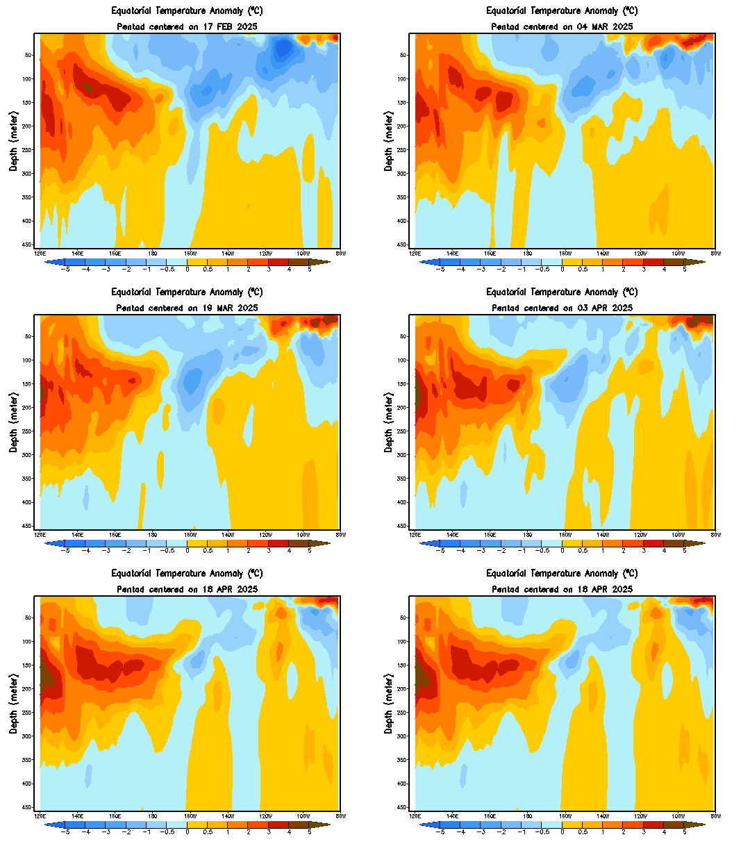
Look at all those warm waters at the subsurface poised to go up.

Image
0 likes   
Visit the Caribbean-Central America Weather Thread where you can find at first post web cams,radars
and observations from Caribbean basin members Click Here

OURAGAN
Category 1
Category 1
Posts: 445
Joined: Sat Aug 07, 2004 12:18 pm
Location: GUADELOUPE

Re: ENSO Updates

#2369 Postby OURAGAN » Thu Jul 26, 2012 8:48 pm

30 Days SOI now is positive at + 2,1

Image
0 likes   

User avatar
Kingarabian
S2K Supporter
S2K Supporter
Posts: 15462
Joined: Sat Aug 08, 2009 3:06 am
Location: Honolulu, Hawaii

#2370 Postby Kingarabian » Fri Jul 27, 2012 5:19 am

SOI is puzzling me.
0 likes   
RIP Kobe Bryant

User avatar
South Texas Storms
Professional-Met
Professional-Met
Posts: 4034
Joined: Thu Jun 24, 2010 12:28 am
Location: Houston, TX

Re: ENSO Updates

#2371 Postby South Texas Storms » Fri Jul 27, 2012 12:12 pm

Actually region 3.4 warmed up this week as cycloneye posted this on the previous page of this thread:
Nino 3.4 continues to warm after the CPC 7/23/12 update of +0.5C,now up to +0.68C rounding to +0.7C according to the Aussies data.


NDG wrote:
Ntxw wrote:
South Texas Storms wrote::uarrow:

So the mjo/convection being over the WPAC causes water temperatures to warm across the Nino region 4 and possibly 3.4 as well? Do you know why that occurs Ntxw?


The MJO does not directly warm it. If what I know is correct, Kelvin waves do. Kelvin waves are usually started by activity of the MJO. They are seen as rises in sea surface heights (expanding water warms) which in our case brings up the warmer sub-surface waters. Complicated reading but that's about as simple as I can think of to put it :lol:

Today's SST anomalies also points to 3 having 4c+ (however not in the calculated spots) areas. That is pretty dramatic compared to early in the month. Just about all important Enso regions had warming this week.

http://i50.tinypic.com/2zyedet.gif


Hmm, I on the other hand think that Nino 3.4 has cooled down a tad so far this week. Might be back down to .4 deg C on next week's update.
0 likes   

User avatar
NDG
S2K Supporter
S2K Supporter
Posts: 14947
Joined: Sun Jul 09, 2006 10:14 pm
Location: Orlando, FL

Re: ENSO Updates

#2372 Postby NDG » Fri Jul 27, 2012 4:59 pm

South Texas Storms wrote:Actually region 3.4 warmed up this week as cycloneye posted this on the previous page of this thread:
Nino 3.4 continues to warm after the CPC 7/23/12 update of +0.5C,now up to +0.68C rounding to +0.7C according to the Aussies data.


I have my questions regarding the graphic below posted by cycloneye, from the Aussies data. It shows that in late June Nino 3.4 was +0.7C, when we know that it was not according to the CPC. I wonder if they go by a different average deg C number.

Image
0 likes   

User avatar
cycloneye
Admin
Admin
Posts: 139603
Age: 67
Joined: Thu Oct 10, 2002 10:54 am
Location: San Juan, Puerto Rico

Re:

#2373 Postby cycloneye » Sat Jul 28, 2012 7:51 pm

Kingarabian wrote:SOI is puzzling me.


Now up to +3.5 on the 30 day SOI.
0 likes   
Visit the Caribbean-Central America Weather Thread where you can find at first post web cams,radars
and observations from Caribbean basin members Click Here

User avatar
South Texas Storms
Professional-Met
Professional-Met
Posts: 4034
Joined: Thu Jun 24, 2010 12:28 am
Location: Houston, TX

Re: Re:

#2374 Postby South Texas Storms » Sun Jul 29, 2012 11:43 am

cycloneye wrote:
Kingarabian wrote:SOI is puzzling me.


Now up to +3.5 on the 30 day SOI.


Looking at the latest models, the SOI should be moderately negative for the next several days.
0 likes   

Ntxw
Storm2k Moderator
Storm2k Moderator
Posts: 21565
Joined: Wed Oct 21, 2009 6:34 pm
Location: DFW, Texas

#2375 Postby Ntxw » Mon Jul 30, 2012 9:10 am

Indeed ENSO has warmed up a touch this week. I'll wait for Cycloneye to post the official numbers.

It appears that the recent weeks of SOI+ was just noise. We've had two weeks of warming despite positive SOI's taking hold. However, as the SOI indicates, atmospheric patterns are still not solid Nino yet.
0 likes   
The above post and any post by Ntxw is NOT an official forecast and should not be used as such. It is just the opinion of the poster and may or may not be backed by sound meteorological data. It is NOT endorsed by any professional institution including Storm2k. For official information, please refer to NWS products.


  Help support Storm2K!

Help Support Storm2K


User avatar
cycloneye
Admin
Admin
Posts: 139603
Age: 67
Joined: Thu Oct 10, 2002 10:54 am
Location: San Juan, Puerto Rico

Re: ENSO: CPC 7/30/12 Update=Nino 3.4 warms up to +0.6C

#2376 Postby cycloneye » Mon Jul 30, 2012 9:14 am

Climate Prediction Center 7/30/12 Update

Nino 3.4 goes up to +0.6C. Last week's update was at +0.5C.

http://www.cpc.ncep.noaa.gov/products/a ... ts-web.pdf

Image
0 likes   
Visit the Caribbean-Central America Weather Thread where you can find at first post web cams,radars
and observations from Caribbean basin members Click Here

User avatar
SoupBone
Category 5
Category 5
Posts: 3073
Joined: Tue Sep 20, 2005 5:24 pm

Re: ENSO: CPC 7/30/12 Update=Nino 3.4 warms up to +0.6C

#2377 Postby SoupBone » Tue Jul 31, 2012 11:36 am

Anyone notice the daily SOI tanking hard?

Down to -27.45
0 likes   

User avatar
South Texas Storms
Professional-Met
Professional-Met
Posts: 4034
Joined: Thu Jun 24, 2010 12:28 am
Location: Houston, TX

Re: ENSO: CPC 7/30/12 Update=Nino 3.4 warms up to +0.6C

#2378 Postby South Texas Storms » Tue Jul 31, 2012 1:32 pm

SoupBone wrote:Anyone notice the daily SOI tanking hard?

Down to -27.45


Yeah the models have been indicating that would happen for several days now. They show it continuing for a few more days as well.
0 likes   

Ntxw
Storm2k Moderator
Storm2k Moderator
Posts: 21565
Joined: Wed Oct 21, 2009 6:34 pm
Location: DFW, Texas

Re: ENSO: CPC 7/30/12 Update=Nino 3.4 warms up to +0.6C

#2379 Postby Ntxw » Tue Jul 31, 2012 1:58 pm

To add with modeling, medium-long range models hint at a crash in Tahiti pressures sometime mid August. If this is true we may see some impressive long term dips in the SOI here in the coming weeks.
0 likes   
The above post and any post by Ntxw is NOT an official forecast and should not be used as such. It is just the opinion of the poster and may or may not be backed by sound meteorological data. It is NOT endorsed by any professional institution including Storm2k. For official information, please refer to NWS products.


  Help support Storm2K!

Help Support Storm2K


User avatar
Kingarabian
S2K Supporter
S2K Supporter
Posts: 15462
Joined: Sat Aug 08, 2009 3:06 am
Location: Honolulu, Hawaii

#2380 Postby Kingarabian » Tue Jul 31, 2012 2:29 pm

I have a question though, does the CPC use the SOI's readings in any of it's forecasts and updates?
0 likes   
RIP Kobe Bryant


Return to “Talkin' Tropics”

Who is online

Users browsing this forum: cajungal, Cpv17, cycloneye, Google [Bot], Google Adsense [Bot], HurakaYoshi, jaguars_22, Javlin, JtSmarts, KirbyDude25, lilbump3000, lolitx, NotSparta, sphelps8681, StormWeather, Stormybajan, Tx_Summer, Wampadawg and 115 guests