


TS Florence,Analysis,Sat Pics Thread #6
Moderator: S2k Moderators
Forum rules

The posts in this forum are NOT official forecasts and should not be used as such. They are just the opinion of the poster and may or may not be backed by sound meteorological data. They are NOT endorsed by any professional institution or STORM2K. For official information, please refer to products from the National Hurricane Center and National Weather Service.
-
Derek Ortt
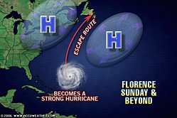
THE FOLLOWING IMAGE, WHILE HOSTED ON THE NWHHC SITE, IS NOT IN ANY WAY ASSOCIATED WITH THE NWHHC. IT IS MERELY A PHOTO E-MAILED TO ME BY ANOTHER POSTER, THAT I AM DISPLAYING ON NWHHC ON A TEMPORARY BASIS. DO NOT USE THIS AS AN NWHHC FORECAST
http://www.nwhhc.com/Florence.jpg
This is Storms in NC's thoughts
http://www.nwhhc.com/Florence.jpg
This is Storms in NC's thoughts
0 likes


-
Derek Ortt
-
Lowpressure

- S2K Supporter

- Posts: 2032
- Age: 59
- Joined: Sun Sep 14, 2003 9:17 am
- Location: Charlotte, North Carolina
-
storms in NC

- S2K Supporter
- Posts: 2338
- Joined: Thu Jul 28, 2005 2:58 pm
- Location: Wallace,NC 40 miles NE of Wilm
- Contact:
-
cycloneye

- Admin

- Posts: 149505
- Age: 69
- Joined: Thu Oct 10, 2002 10:54 am
- Location: San Juan, Puerto Rico
08/1745 UTC 23.7N 59.5W T3.5/3.5 06L -- Atlantic Ocean
At 5 PM,the winds will be bumped up if NHC follows SSD sat estimates of 3.5/3.5.
http://www.ssd.noaa.gov/PS/TROP/CI-chart.html
At 5 PM,the winds will be bumped up if NHC follows SSD sat estimates of 3.5/3.5.
http://www.ssd.noaa.gov/PS/TROP/CI-chart.html
0 likes
Visit the Caribbean-Central America Weather Thread where you can find at first post web cams,radars
and observations from Caribbean basin members Click Here
and observations from Caribbean basin members Click Here
-
Lowpressure
- S2K Supporter
- Posts: 2032
- Age: 59
- Joined: Sun Sep 14, 2003 9:17 am
- Location: Charlotte, North Carolina
-
gatorcane

- S2K Supporter
- Posts: 23708
- Age: 48
- Joined: Sun Mar 13, 2005 3:54 pm
- Location: Boca Raton, FL
Lowpressure wrote:If we should have learned anything this year so far, it is that nothing can't happen. Ernesto was a Mexico or Southern GOM system by all parameters. He ddid not even enter the GOM. Not saying anything about Flo, just be careful with the " it aint gonna happen" stuff.
true but ernesto was a very unique situation...in most cases the NHC does a good job with the tracks.
0 likes
-
Derek Ortt

UW - CIMSS
ADVANCED DVORAK TECHNIQUE
ADT - Version 7.1
Tropical Cyclone Intensity Algorithm
----- Current Analysis -----
Date : 08 SEP 2006 Time : 181500 UTC
Lat : 23:14:30 N Lon : 59:45:26 W
CI# /Pressure/ Vmax
3.3 / 996.4mb/ 51.0kt
6hr-Avg T# 3hr-Avg T# Adj T# Raw T#
3.3 3.4 3.2 3.2
Latitude bias adjustment to MSLP : +0.0mb
Center Temp : -60.4C Cloud Region Temp : -52.8C
Scene Type : UNIFORM CDO CLOUD REGION
Positioning Method : FORECAST INTERPOLATION
Ocean Basin : ATLANTIC
Dvorak CI > MSLP Conversion Used : ATLANTIC
Tno/CI Rules : Constraint Limits : NO LIMIT
Weakening Flag : OFF
Rapid Dissipation Flag : OFF
CIMSS estimates this afternoon give a 3.3 which is about 51kts.
0 likes
-
Derek Ortt
http://twister.sbs.ohio-state.edu/text/ ... s/06090817
GFDL shifted left, but it is too far south already
may not affect the overall track, but could mean a faster arrival in Bermuda... maybe Sunday evening
GFDL shifted left, but it is too far south already
may not affect the overall track, but could mean a faster arrival in Bermuda... maybe Sunday evening
0 likes
-
Derek Ortt
Who is online
Users browsing this forum: No registered users and 202 guests