
12z GFS... Still fantasy
Moderator: S2k Moderators


Blown Away wrote:https://i.imgur.com/5rAOX7x.gif
12z GFS... Still fantasy


blp wrote:EPS with a weak signal but starting to show something with same timing and origin of the GEFS.
https://i.ibb.co/2jr84JS/eps-lowlocs-watl-fh144-360.gif


Iceresistance wrote:I've been hearing on WxTwitter that there is a GFSv16.3, is that true?


LarryWx wrote:The 12Z GFS is through hour 252 with a 1002 mb low the weakest it has been in the Caribbean with this system since way back with the 0Z 10/21 run. It had had in nearly all of its runs since then (nine runs) hurricanes at that forecast time (as strong as 938 mb!). Even though I've been harping on the idea of a good chance for one more TC this season with significant land impacts based on the last nine La Niña seasons and 2/3 of La Niña seasons having had one form either in late Oct or Nov, this GFS E Caribbean TCG has continued to look ghosty to me based on a general lack of support by other models in the E Caribbean, the GFS seeming to involve something coming off of SA in this genesis (which the GFS suite has been wrong on a good number of times this season), and the rarity of TCG in the e Caribbean vs C or W Caribbean. I'm still on the alert for one more potentially impactful system this season but don't think this E Caribbean GFS TC is the one as it appears bogus to me.
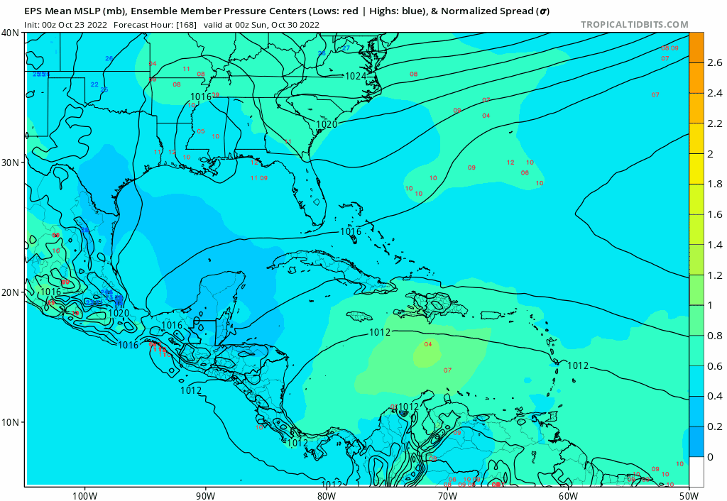
OTOH, a decent % of 0Z EPS members is hinting at TCG in the much more favored per climo W Caribbean near 10/31 to very early Nov as Gator mentioned. That is a much more believable possibility to me.
Edit: Despite the weaker start, the 12Z GFS run later goes ape shoot once again with this with a 952 mb H in the NE Caribbean on Nov 5th. I'm not believing it. It becomes a H on 11/4 vs 11/1 on the prior run.
Category5Kaiju wrote:LarryWx wrote:The 12Z GFS is through hour 252 with a 1002 mb low the weakest it has been in the Caribbean with this system since way back with the 0Z 10/21 run. It had had in nearly all of its runs since then (nine runs) hurricanes at that forecast time (as strong as 938 mb!). Even though I've been harping on the idea of a good chance for one more TC this season with significant land impacts based on the last nine La Niña seasons and 2/3 of La Niña seasons having had one form either in late Oct or Nov, this GFS E Caribbean TCG has continued to look ghosty to me based on a general lack of support by other models in the E Caribbean, the GFS seeming to involve something coming off of SA in this genesis (which the GFS suite has been wrong on a good number of times this season), and the rarity of TCG in the e Caribbean vs C or W Caribbean. I'm still on the alert for one more potentially impactful system this season but don't think this E Caribbean GFS TC is the one as it appears bogus to me.
OTOH, a decent % of 0Z EPS members is hinting at TCG in the much more favored per climo W Caribbean near 10/31 to very early Nov as Gator mentioned. That is a much more believable possibility to me.
Edit: Despite the weaker start, the 12Z GFS run later goes ape shoot once again with this with a 952 mb H in the NE Caribbean on Nov 5th. I'm not believing it. It becomes a H on 11/4 vs 11/1 on the prior run.
Yeah, a storm like Omar and Lenny is not something I'm going on bet on happening. Not that it cannot, but a Cat 4 storm that takes an eastward path through the Caribbean isn't exactly common
MetroMike wrote:The 18Z GFS is showing wildly different solutions and directions in the longer term. This run has it going West at least, unlike wrong way Lenny tracks. Will see if it reverses course in the next run.
LarryWx wrote:
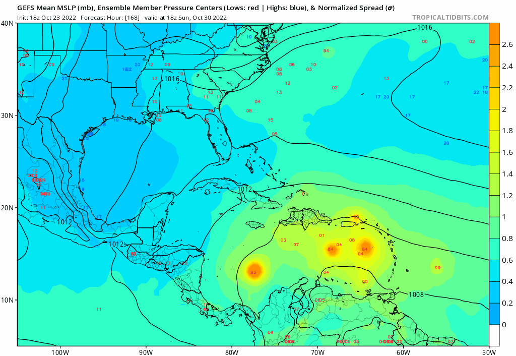
I still think the GFS is out to lunch with its climo unflavored E Caribbean geneses. The two recent runs being the weakest through late next week in the E Car are imho hinting to us that that is the case and that it will quite possibly stop showing E Car geneses within a few runs. OTOH, the 18Z GEFS is about as active with geneses in early November in the W Car as has been the case with any recent run. This is similar to the increased activity there on the two most recent EPS runs though the GEFS is quite a bit more active. Imho, it is the C or W Caribbean where we should be wary about a possible TCG next week rather than the E Car that the GFS has been insisting on.
Users browsing this forum: No registered users and 98 guests


