

Moderator: S2k Moderators


chris_fit wrote:Still there on the 18z GFS... Same time of genesis so time frame moving up. Let's see if how much this run ends.
HurricaneBelle wrote:chris_fit wrote:Still there on the 18z GFS... Same time of genesis so time frame moving up. Let's see if how much this run ends.
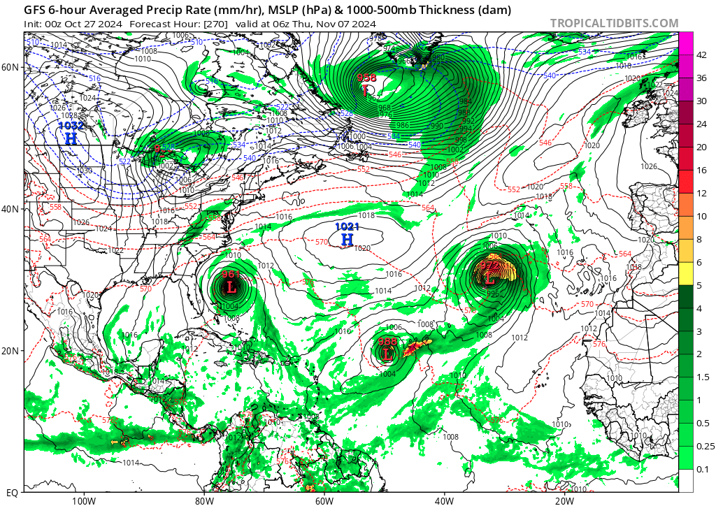
This one hits Haiti going through the Windward Passage, the Bahamas, heads back west and south to hit central Cuba, moves back NE through the Bahamas again and then OTS, nearly clipping Berumuda before being absorbed by a front.




ConvergenceZone wrote:Lots of folks were saying that this would be a back loaded season compared to a normal season. I guess we will have to wait and see if that's true. I mean October is normally fairly active anyway, since it's not that far from the September Peak. So I guess when they say backloaded they mean late October and November. I guess we will see if that's true.

sasha_B wrote:ConvergenceZone wrote:Lots of folks were saying that this would be a back loaded season compared to a normal season. I guess we will have to wait and see if that's true. I mean October is normally fairly active anyway, since it's not that far from the September Peak. So I guess when they say backloaded they mean late October and November. I guess we will see if that's true.
I mean, it's already fair to call it backloaded just on the basis of how much more active October has been this year relative to the typical peak months of August and September, even if Beryl is a pretty substantial 'counterweight' on the front end. In terms of ACE (not the best metric, but i think it works here), October 2024 was as active as August 2024 and September 2024 combined, and generated more than 3x the 1991-2020 climatological norm for the month; anything we see from here on out will just be pushing the load further back.


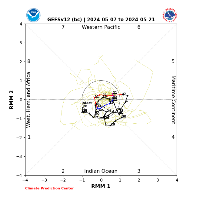
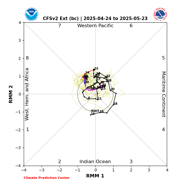
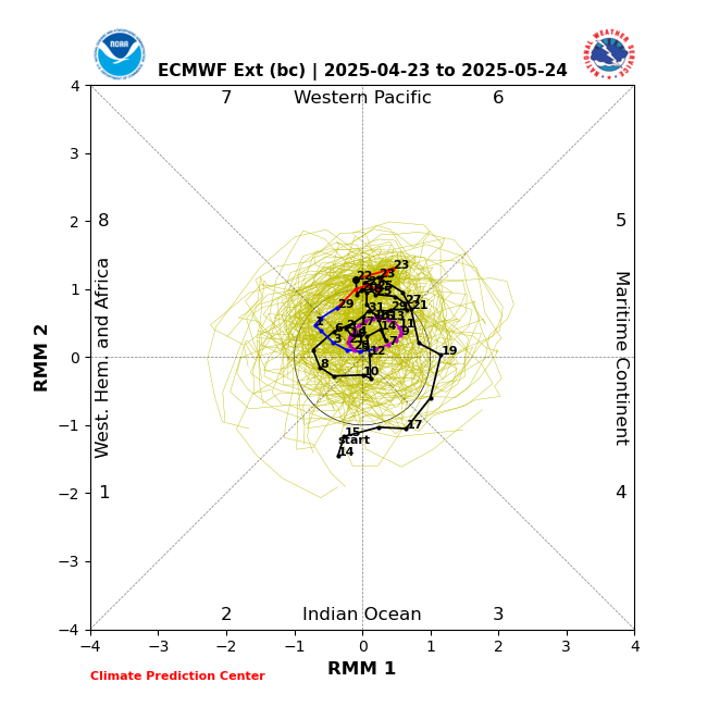
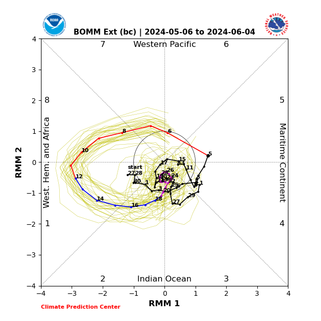
chaser1 wrote:Just as a reminder, exactly "which" particular models were forecasting the MJO to be enhancing 8 & 1 for the last few days of October and first week of November? Looking at Satellite, Caribbean basin conditions look rather volatile with nothing suggestive of impending development. Furthermore, model support for the SW Caribbean development has really dropped off. I wouldn't right-off November altogether but I'm beginning to think that the Atlantic's last "best shot" to produce an impactfull TC may have passed. My guess is that NHC may lower its TWO for the Southwest Caribbean to 0/20 at 8:00 am.
I just wish we had a Florida sweeping cold front to celebrate the season end.
Users browsing this forum: No registered users and 117 guests