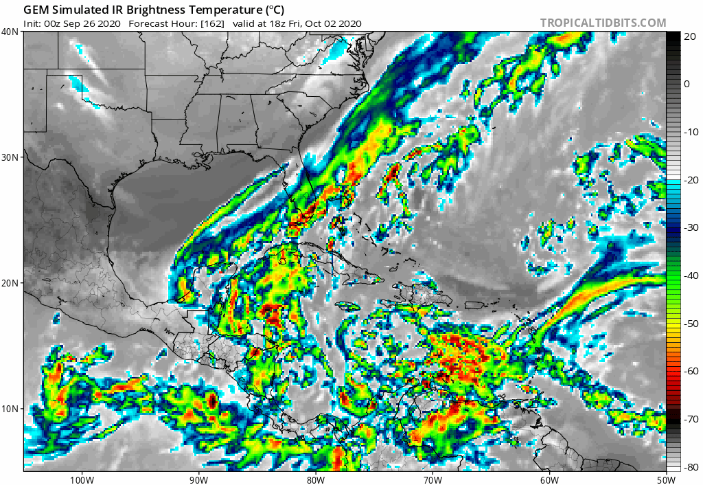
TheStormExpert wrote:A poorly organized 1004mb low is nothing to loose sleep over on the 18z GFS. Wake me up when things get more interesting.
Cat4 into Bahamas interesting enough?
Looks like Matthew.

Moderator: S2k Moderators


TheStormExpert wrote:A poorly organized 1004mb low is nothing to loose sleep over on the 18z GFS. Wake me up when things get more interesting.
SFLcane wrote:TheStormExpert wrote:A poorly organized 1004mb low is nothing to loose sleep over on the 18z GFS. Wake me up when things get more interesting.
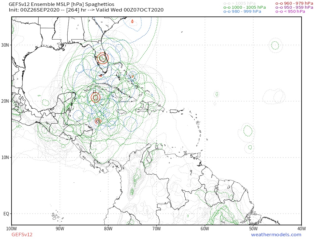
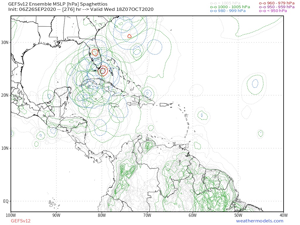
18z gfs ensembles still active paint a very different picture.
https://i.postimg.cc/9FYqmjqC/959-A87-C2-F928-46-FF-8-A55-5-BE109-F08-C25.jpg
Spacecoast wrote:TheStormExpert wrote:A poorly organized 1004mb low is nothing to loose sleep over on the 18z GFS. Wake me up when things get more interesting.
Cat4 into Bahamas interesting enough?
Looks like Matthew.
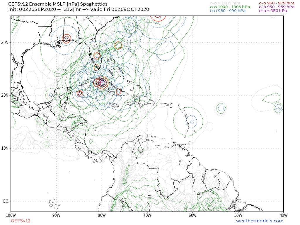
https://i.ibb.co/TkPrHG2/gfs-ememb-lowlocs-watl-fh222-330.gif


cheezyWXguy wrote:0z gefs may have the strongest signal for development it’s shown yet


N2FSU wrote:6z GFShttps://uploads.tapatalk-cdn.com/20200926/7594f2431ba6662ff4ac72766327c33d.jpg
https://uploads.tapatalk-cdn.com/20200926/ba11c66345aed78e0e034da78569406a.jpg
Sent from my iPhone using Tapatalk


gatorcane wrote:Wow models looks much more bullish.
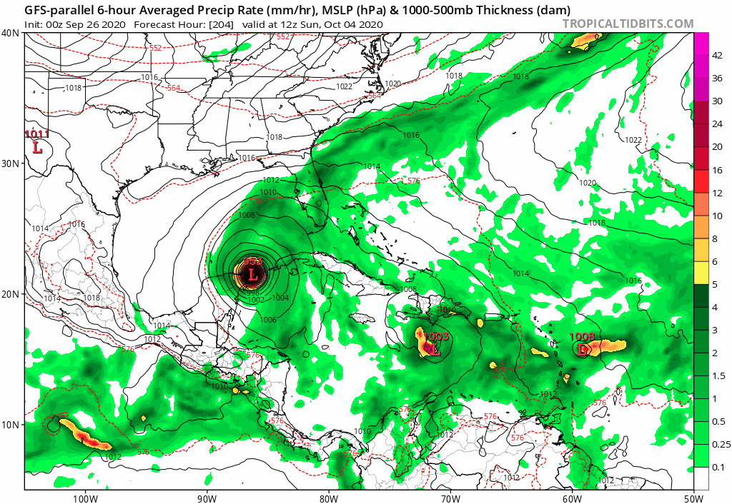
On a side note, peninsula Florida’s hurricane deflector shield activated on the GFS-P. One of these times it is going to fail us
https://i.postimg.cc/1Rbxq9Vt/gfsp-mslp-pcpn-watl-fh204-300.gif

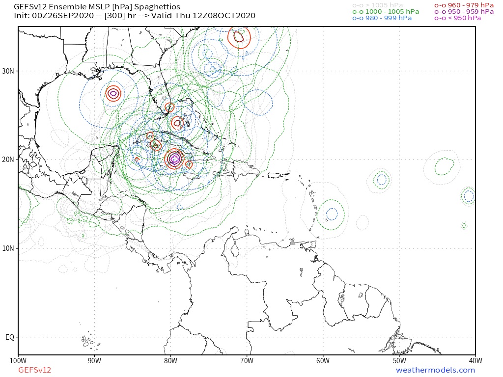
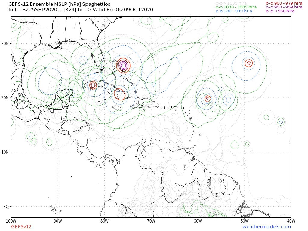
SFLcane wrote:Development starts near 130hrs with the GFS-P..
In the early development group on GEFS
https://i.imgur.com/3BdnRuk.gif
Users browsing this forum: cajungal and 143 guests
