Disturbance fizzeled in Eastern Atlantic

This is the general tropical discussion area. Anyone can take their shot at predicting a storms path.

Moderator: S2k Moderators

Forum rules

The posts in this forum are NOT official forecasts and should not be used as such. They are just the opinion of the poster and may or may not be backed by sound meteorological data. They are NOT endorsed by any professional institution or STORM2K. For official information, please refer to products from the National Hurricane Center and National Weather Service.

Help Support Storm2K
Message
Author
User avatar
Blown Away
S2K Supporter
S2K Supporter
Posts: 10140
Joined: Wed May 26, 2004 6:17 am

Re: Strong Wave in Eastern Atlantic

#301 Postby Blown Away » Tue Aug 04, 2009 3:36 pm

cycloneye wrote:HPC Discussion of the tropics in Atlantic

OUTLOOK: MEDIUM RANGE GUIDANCE IS SHOWING A GRADUAL TRANSITION ON
THE NORTHERN PORTIONS OF THE DOMAINS. ON DAYS 04-05...THE RIDGE
OVER THE WESTERN USA WILL RELOCATE TO THE EASTERN USA/WESTERN
ATLANTIC. IN-TANDEM...AN UPPER LEVEL TROUGH WILL THEN ESTABLISH
OVER THE WESTERN ATLANTIC TO NORTH OF THE ISLANDS. DOWNSTREAM FROM
THIS TROUGH...A RIDGE WILL GRADUALLY BUILD/ESTABLISH OVER THE
EASTERN ATLANTIC TO THE NORTH OF 20N. THIS CHANGE WILL COINCIDE
WITH AN INCREASE IN THE MJO...WHICH SHOULD LAST FOR TWO TO THREE
WEEKS. THIS WILL BRING US CLOSER TO THE TYPICAL/MORE SEASONAL
CLIMATOLOGICAL PATTERN OVER THE DOMAIN...AND LIKELY MAKE IT MORE
FAVORABLE FOR TROPICAL CYCLONE FORMATION.

http://www.hpc.ncep.noaa.gov/discussions/fxca20.html


Please correct me if I'm wrong, I read the E coast trough that normally protects the US EC will relocate N of the NE Caribbean islands, so if there is a system that misses that weakness there would be a blocking high that could make it more probable for a system to reach the Islands first and get pushed farther W towards the US? :sun:
0 likes   

User avatar
wxman57
Moderator-Pro Met
Moderator-Pro Met
Posts: 22951
Age: 67
Joined: Sat Jun 21, 2003 8:06 pm
Location: Houston, TX (southwest)

Re: Strong Wave in Eastern Atlantic

#302 Postby wxman57 » Tue Aug 04, 2009 3:40 pm

srainhoutx wrote:
cycloneye wrote:HPC Discussion of the tropics in Atlantic

OUTLOOK: MEDIUM RANGE GUIDANCE IS SHOWING A GRADUAL TRANSITION ON
THE NORTHERN PORTIONS OF THE DOMAINS. ON DAYS 04-05...THE RIDGE
OVER THE WESTERN USA WILL RELOCATE TO THE EASTERN USA/WESTERN
ATLANTIC. IN-TANDEM...AN UPPER LEVEL TROUGH WILL THEN ESTABLISH
OVER THE WESTERN ATLANTIC TO NORTH OF THE ISLANDS. DOWNSTREAM FROM
THIS TROUGH...A RIDGE WILL GRADUALLY BUILD/ESTABLISH OVER THE
EASTERN ATLANTIC TO THE NORTH OF 20N. [b]THIS CHANGE WILL COINCIDE
WITH AN INCREASE IN THE MJO...WHICH SHOULD LAST FOR TWO TO THREE
WEEKS.
THIS WILL BRING US CLOSER TO THE TYPICAL/MORE SEASONAL
CLIMATOLOGICAL PATTERN OVER THE DOMAIN...AND LIKELY MAKE IT MORE
FAVORABLE FOR TROPICAL CYCLONE FORMATION.

http://www.hpc.ncep.noaa.gov/discussions/fxca20.html
[/b]


Hmmm, where have I seen this before... :ggreen:


I saw that statement and am wondering what they're talking about as far as an MJO pulse. If you go to the MJO page, the MJO is extremely weak and stuck in the west Pacific, and forecast to remain there over the next two weeks:

http://www.cpc.ncep.noaa.gov/products/p ... /mjo.shtml

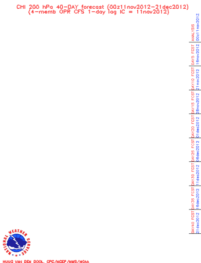
That said, the 40-day Chi forecast of rising/sinking air is going for rising air over the Atlantic Basin by the 20th of August. It's not really an MJO pulse, though.

Image
0 likes   

User avatar
cycloneye
Admin
Admin
Posts: 143879
Age: 68
Joined: Thu Oct 10, 2002 10:54 am
Location: San Juan, Puerto Rico

Re: Strong Wave in Eastern Atlantic

#303 Postby cycloneye » Tue Aug 04, 2009 3:42 pm

57,maybe they are using this graphic as their guide for the MJO forecast.

Image
0 likes   

Sanibel
Category 5
Category 5
Posts: 10375
Joined: Mon Aug 30, 2004 11:06 pm
Location: Offshore SW Florida

Re: Strong Wave in Eastern Atlantic

#304 Postby Sanibel » Tue Aug 04, 2009 3:57 pm

Tiny burst near the 30W center. Maybe it has enough to form further west?


You can see the dry hand of SAL on this wave in the Africa loop.
0 likes   

User avatar
Blown Away
S2K Supporter
S2K Supporter
Posts: 10140
Joined: Wed May 26, 2004 6:17 am

Re: Strong Wave in Eastern Atlantic

#305 Postby Blown Away » Tue Aug 04, 2009 4:10 pm

Sanibel wrote:Tiny burst near the 30W center. Maybe it has enough to form further west? You can see the dry hand of SAL on this wave in the Africa loop.


Maybe something will come together near 10N and between 31-35W?
0 likes   

HURRICANELONNY
Category 5
Category 5
Posts: 1383
Joined: Wed May 07, 2003 6:48 am
Location: HOLLYWOOD.FL

Re: Strong Wave in Eastern Atlantic

#306 Postby HURRICANELONNY » Tue Aug 04, 2009 4:13 pm

I can't believe this is not an invest. I've seen many waves that I wondered why they were invests. :roll:
0 likes   

User avatar
MGC
S2K Supporter
S2K Supporter
Posts: 5885
Joined: Sun Mar 23, 2003 9:05 pm
Location: Pass Christian MS, or what is left.

Re: Strong Wave in Eastern Atlantic

#307 Postby MGC » Tue Aug 04, 2009 4:27 pm

I don't see any development of this feature any time soon. Convection is just too scattered currently.....MGC
0 likes   

User avatar
Blown Away
S2K Supporter
S2K Supporter
Posts: 10140
Joined: Wed May 26, 2004 6:17 am

Re: Strong Wave in Eastern Atlantic

#308 Postby Blown Away » Tue Aug 04, 2009 4:32 pm

MGC wrote:I don't see any development of this feature any time soon. Convection is just too scattered currently.....MGC


I agree, but the whole cloud mass has a cyclonic rotation and over the past few hours the convection has been building in the area of where general circulation center may be, @10N/30W.
0 likes   

User avatar
Gustywind
Category 5
Category 5
Posts: 12334
Joined: Mon Sep 03, 2007 7:29 am
Location: Baie-Mahault, GUADELOUPE

#309 Postby Gustywind » Tue Aug 04, 2009 5:09 pm

Image
0 likes   

User avatar
cycloneye
Admin
Admin
Posts: 143879
Age: 68
Joined: Thu Oct 10, 2002 10:54 am
Location: San Juan, Puerto Rico

Re: Strong Wave in Eastern Atlantic

#310 Postby cycloneye » Tue Aug 04, 2009 5:09 pm

The system has been analized at 30W in the 18 UTC surface analysis,more eastward than the 12 UTC position at 34W.

Image
0 likes   

User avatar
SEASON_CANCELED
Category 3
Category 3
Posts: 887
Joined: Mon Jul 06, 2009 5:17 am
Location: 8 Bit Charlie Sheen

Re: Strong Wave in Eastern Atlantic

#311 Postby SEASON_CANCELED » Tue Aug 04, 2009 6:06 pm

lookin pretty lame as of last vis shot. Still some nice rotation at the mid and upper level Some tiny flare ups. Its got 48 hours to do something otherwise its straight in Guyana. still needs to be watched
0 likes   

User avatar
Gustywind
Category 5
Category 5
Posts: 12334
Joined: Mon Sep 03, 2007 7:29 am
Location: Baie-Mahault, GUADELOUPE

#312 Postby Gustywind » Tue Aug 04, 2009 6:23 pm

Sat pic of the East Atlantic: the activity of the twaves has begun slightly to heat up a bit...while shear is showing very little signs of "zen attitude"(relax) between the 10-15°N and 30W -60°W:cheesy: http://cimss.ssec.wisc.edu/tropic/real- ... g8sht.html
Image
0 likes   

Derek Ortt

Re: Strong Wave in Eastern Atlantic

#313 Postby Derek Ortt » Tue Aug 04, 2009 6:23 pm

wxman57 wrote:Take a look at the projected oceanic heat content in Felicia's path beyond 60 hrs, Ed:

ftp://ftp.tpc.ncep.noaa.gov/atcf/stext/ ... _ships.txt

After the next 12 hours, heat content begins dropping, down to zero after 72 hours. So it probably won't last to hit Hawaii.


I know this isnt the Felicia thread, but had Enrique weren't in the picture, I'd expect a similar evolution of Flossie which traversed over the same waters... an annular hurricane
0 likes   

User avatar
cycloneye
Admin
Admin
Posts: 143879
Age: 68
Joined: Thu Oct 10, 2002 10:54 am
Location: San Juan, Puerto Rico

Re: Strong Wave in Eastern Atlantic

#314 Postby cycloneye » Tue Aug 04, 2009 6:33 pm

540
ABNT20 KNHC 042333
TWOAT
TROPICAL WEATHER OUTLOOK
NWS TPC/NATIONAL HURRICANE CENTER MIAMI FL
800 PM EDT TUE AUG 4 2009

FOR THE NORTH ATLANTIC...CARIBBEAN SEA AND THE GULF OF MEXICO...

DISORGANIZED SHOWERS AND THUNDERSTORMS ABOUT 1000 MILES SOUTHWEST OF
THE CAPE VERDE ISLANDS ARE ASSOCIATED WITH A TROPICAL WAVE. ANY
DEVELOPMENT OF THIS SYSTEM WILL BE SLOW TO OCCUR AS IT MOVES
WESTWARD AT ABOUT 15 MPH. THERE IS A LOW CHANCE...LESS THAN 30
PERCENT...OF THIS SYSTEM BECOMING A TROPICAL CYCLONE DURING THE
NEXT 48 HOURS.

ELSEWHERE...TROPICAL CYCLONE FORMATION IS NOT EXPECTED DURING THE
NEXT 48 HOURS.

$$
FORECASTER SCHAUER CLARK/BRENNAN
0 likes   

User avatar
caribepr
Category 5
Category 5
Posts: 1794
Joined: Fri Sep 05, 2003 10:43 pm
Location: Culebra, PR 18.33 65.33

#315 Postby caribepr » Tue Aug 04, 2009 7:09 pm

and we like it like that!
0 likes   

User avatar
jasons2k
Storm2k Executive
Storm2k Executive
Posts: 8238
Age: 51
Joined: Wed Jul 06, 2005 12:32 pm
Location: The Woodlands, TX

#316 Postby jasons2k » Tue Aug 04, 2009 7:45 pm

It looked at its best two days ago...doesn't look like aything any time soon with this one.
0 likes   

User avatar
wxman57
Moderator-Pro Met
Moderator-Pro Met
Posts: 22951
Age: 67
Joined: Sat Jun 21, 2003 8:06 pm
Location: Houston, TX (southwest)

Re: Strong Wave in Eastern Atlantic

#317 Postby wxman57 » Tue Aug 04, 2009 8:00 pm

cycloneye wrote:The system has been analyzed at 30W in the 18 UTC surface analysis,more eastward than the 12 UTC position at 34W.

http://www.opc.ncep.noaa.gov/UA/Atl_Tropics.gif


Luis, the wave axis is actually even farther east, near 28W. It's clearly visible on satellite imagery. I'm not sure what the person making the analysis above was looking at when putting the axis at 30W. I've found that these charts have very poor continuity from day to day. The waves appear to jump all over the place, depending upon who's doing the drawing.

Regardless, there is the area of thunderstorms we've been monitoring and the wave axis well to the east in the wave "ridge" axis. They're two separate systems.
0 likes   

RL3AO
Moderator-Pro Met
Moderator-Pro Met
Posts: 16308
Joined: Thu Jun 14, 2007 10:03 pm
Location: NC

Re: Strong Wave in Eastern Atlantic

#318 Postby RL3AO » Tue Aug 04, 2009 10:01 pm

At 12z it was analyzed as a trough near the convection. The 8am TWD also mentioned that there could be a wave further east. At 18z they dropped the trough and introduced the wave which was always further east.
0 likes   

Sanibel
Category 5
Category 5
Posts: 10375
Joined: Mon Aug 30, 2004 11:06 pm
Location: Offshore SW Florida

Re: Strong Wave in Eastern Atlantic

#319 Postby Sanibel » Wed Aug 05, 2009 12:36 am

Just a hunch, but I think this one will re-burst further west.
0 likes   

User avatar
Fego
S2K Supporter
S2K Supporter
Posts: 767
Age: 65
Joined: Sun Apr 18, 2004 7:58 pm
Location: San Juan, Puerto Rico
Contact:

Re: Strong Wave in Eastern Atlantic

#320 Postby Fego » Wed Aug 05, 2009 12:43 am

Image

Still waiting for some action with this wave. May be I won't see any action but what I can really see is a face in the clouds. When you begin to see things, is time to hit the bed... :double:
0 likes   


Return to “Talkin' Tropics”

Who is online

Users browsing this forum: Google Adsense [Bot], MarioProtVI, Sciencerocks, StormWeather and 196 guests