Gulf of Mexico (Is Invest 91L)

This is the general tropical discussion area. Anyone can take their shot at predicting a storms path.

Moderator: S2k Moderators

Forum rules

The posts in this forum are NOT official forecasts and should not be used as such. They are just the opinion of the poster and may or may not be backed by sound meteorological data. They are NOT endorsed by any professional institution or STORM2K. For official information, please refer to products from the National Hurricane Center and National Weather Service.

Help Support Storm2K
Message
Author
User avatar
Kludge
S2K Supporter
S2K Supporter
Posts: 215
Joined: Thu Aug 26, 2004 9:03 pm
Location: Montgomery, Texas

Re: Gulf of Mexico area

#341 Postby Kludge » Sat Aug 02, 2008 9:33 am

srainhoutx wrote:I hear you Kludge. I felt guilty that I had almost 4 inches of rain from Dolly up here on the NW side. And the race is on to name something after our infamous Ed. :lol:


I think (hope) that Ed "van Winkle" has finally crashed for a while for some overdue shuteye. Let's hope that when he wakes up he'll have a TD to track to his lawn.
0 likes   

User avatar
canetracker
S2K Supporter
S2K Supporter
Posts: 751
Age: 62
Joined: Wed Jul 27, 2005 8:49 pm
Location: Suburbia New Orleans...Harahan, LA

Re: Gulf of Mexico area

#342 Postby canetracker » Sat Aug 02, 2008 9:46 am

Per the buoy link below, pressures are on the rise right now. However, Steve Lyons mentioned that it would take just a little drop to get something forming. Also the winds are still from the SW general direction.
http://www.pdfamily.com/weather/buoy/FLbuoy.php
0 likes   

User avatar
lrak
S2K Supporter
S2K Supporter
Posts: 1770
Age: 58
Joined: Thu Jun 21, 2007 2:48 pm
Location: Corpus Christi, TX

Re: Gulf of Mexico area

#343 Postby lrak » Sat Aug 02, 2008 10:11 am

If you look at the radar http://radar.weather.gov/radar.php?rid= ... 1&loop=yes

I see some sort of spin at 29.7N 86.0W. I know the radar is not the best tool but it sure looks like its starting something.

A type of Cristobal system maybe?

The long range radar looks even better http://radar.weather.gov/radar.php?prod ... X&loop=yes
0 likes   

User avatar
HURAKAN
Professional-Met
Professional-Met
Posts: 46086
Age: 38
Joined: Thu May 20, 2004 4:34 pm
Location: Key West, FL
Contact:

#344 Postby HURAKAN » Sat Aug 02, 2008 10:15 am

Image

Image
0 likes   

User avatar
HURAKAN
Professional-Met
Professional-Met
Posts: 46086
Age: 38
Joined: Thu May 20, 2004 4:34 pm
Location: Key West, FL
Contact:

#345 Postby HURAKAN » Sat Aug 02, 2008 10:17 am

Image
0 likes   

User avatar
KatDaddy
Category 5
Category 5
Posts: 2815
Joined: Mon Oct 21, 2002 6:23 pm
Location: League City, Texas

#346 Postby KatDaddy » Sat Aug 02, 2008 10:19 am

Joe B is posting while on vacation stating this not business as usual. He has some concerned about the N GOM and Texas. Last week he was not very concerned about the GOM disturbance but this time he a little more concerned. He thinks it will be more of a rain maker and "Where did this come from" rather than a Humberto.
I hope is 100% correct because we need the rain and not a hurricane.
0 likes   

User avatar
cycloneye
Admin
Admin
Posts: 145285
Age: 68
Joined: Thu Oct 10, 2002 10:54 am
Location: San Juan, Puerto Rico

Re: Gulf of Mexico area

#347 Postby cycloneye » Sat Aug 02, 2008 10:21 am

Recon tentavly for tommorow afternoon

Code: Select all

000
NOUS42 KNHC 021530
WEATHER RECONNAISSANCE FLIGHTS
CARCAH, NATIONAL HURRICANE CENTER, MIAMI, FL.
1130 AM EDT SAT 02 AUGUST 2008
SUBJECT: TROPICAL CYCLONE PLAN OF THE DAY (TCPOD)
         VALID 03/1100Z TO 04/1100Z AUGUST 2008
         TCPOD NUMBER.....08-063

I.  ATLANTIC REQUIREMENTS
    1. SUSPECT AREA --GULF OF MEXICO
       FLIGHT ONE  TEAL 70        FLIGHT TWO  --TEAL 71
       A. 03/1800Z                A. 04/0600Z-1200Z
       B. AFXXX 01BBA INVEST      B. AFXXX 0205A CYCLONE
       C. 03/1600Z                C. 04/0400Z
       D. 28.5N 86.5W             D. 28.2N 88.0W
       E. 03/1700 TO 04/0000Z     E. 04/0500 TO 1200Z
       F. SFC TO 10,000FT         F. SFC TO 10,000FT
    2. SUCCEEDING DAY OUTLOOK: CONTINUE 6 HRLY FIXES IF SYSTEM
       DEVELOPS


http://www.nhc.noaa.gov/text/MIAREPRPD.shtml?
0 likes   

RL3AO
Moderator-Pro Met
Moderator-Pro Met
Posts: 16308
Joined: Thu Jun 14, 2007 10:03 pm
Location: NC

#348 Postby RL3AO » Sat Aug 02, 2008 10:28 am

Sounds like we should get a TWO mention at 18z and maybe 91L today.


Image
0 likes   

User avatar
KWT
Category 5
Category 5
Posts: 31415
Joined: Tue Aug 17, 2004 11:02 am
Location: UK!!!

#349 Postby KWT » Sat Aug 02, 2008 10:35 am

Hmmm we do need to watch this closely given recon are watching this. I suppose it makes sense though just in case something does form.

Got to admit there does seem to be some rotation present on the radar but thats obviously at a higher level.

This will probably eventually be 91L I reckon.
0 likes   

Honeyko

#350 Postby Honeyko » Sat Aug 02, 2008 10:53 am

I don't see any indication that the whole mess is going to shift far enough south to amount to much before moving back onshore in LA.
0 likes   

Ed Mahmoud

Re:

#351 Postby Ed Mahmoud » Sat Aug 02, 2008 10:53 am

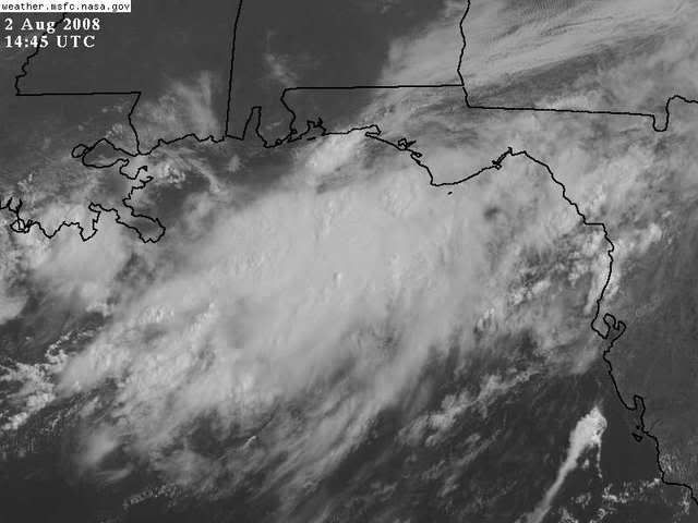
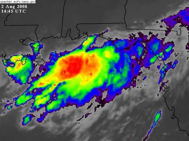
KatDaddy wrote:Joe B is posting while on vacation stating this not business as usual. He has some concerned about the N GOM and Texas. Last week he was not very concerned about the GOM disturbance but this time he a little more concerned. He thinks it will be more of a rain maker and "Where did this come from" rather than a Humberto.
I hope is 100% correct because we need the rain and not a hurricane.


JB posted, see essentially the WRF scenario, the 1964 early August A storm (Abby?), landfall near Matagorda, about 1000 mb, 40 or 50 knots. He is more enthusiastic about this than either Atlantic invest.

He should be near Texas by now, I hope his son Garrett gets a 40 or 50 mph TS to make his family road trip memorable.
0 likes   

Ed Mahmoud

Re:

#352 Postby Ed Mahmoud » Sat Aug 02, 2008 10:54 am

Honeyko wrote:I don't see any indication that the whole mess is going to shift far enough south to amount to much before moving back onshore in LA.


Indeed, the GFS scenario.
0 likes   

Ed Mahmoud

Re: Gulf of Mexico area= Recon for tommorow (If Necessary)

#353 Postby Ed Mahmoud » Sat Aug 02, 2008 10:56 am

12Z NAM, still a tropical storm or depression, but not quite as impressive as earlier runs.

Image
0 likes   

User avatar
KWT
Category 5
Category 5
Posts: 31415
Joined: Tue Aug 17, 2004 11:02 am
Location: UK!!!

#354 Postby KWT » Sat Aug 02, 2008 10:58 am

Looks like a fairly wet TD/minimal TS to me Ed, I see no reason why that can't occur either if this does start to show signs of a lower level circulation.
0 likes   

User avatar
HURAKAN
Professional-Met
Professional-Met
Posts: 46086
Age: 38
Joined: Thu May 20, 2004 4:34 pm
Location: Key West, FL
Contact:

#355 Postby HURAKAN » Sat Aug 02, 2008 10:58 am

Image

An area of low pressure with lots of convection in the Gulf of Mexico may just become our next tropical system, that is if it doesn't get sheared apart and stays over the warm water. An upper-level trough over the East Coast could be the trigger this disturbance needs to realize its potential. If the above holds true, development of this system could occur as early as Monday and with a westerly track, landfall along the Texas coast could occur as early as Tuesday.

Story By AccuWeather.com Meteorologist Eric Reese.

Link: http://www.accuweather.com/news-story.a ... &article=4
0 likes   

User avatar
cycloneye
Admin
Admin
Posts: 145285
Age: 68
Joined: Thu Oct 10, 2002 10:54 am
Location: San Juan, Puerto Rico

Re: Gulf of Mexico area= Recon for tommorow (If Necessary)

#356 Postby cycloneye » Sat Aug 02, 2008 11:02 am

:uarrow: And they didnt mentioned the two invests?
0 likes   

Ed Mahmoud

Re: Gulf of Mexico area= Recon for tommorow (If Necessary)

#357 Postby Ed Mahmoud » Sat Aug 02, 2008 11:05 am

Just checked the databuoys off Alabama and Florida. No big pressure falls, no East winds, whatever circulation there is is aloft.

But models didn't predict surface low this early.
0 likes   

Ed Mahmoud

Re: Gulf of Mexico area= Recon for tommorow (If Necessary)

#358 Postby Ed Mahmoud » Sat Aug 02, 2008 11:07 am

12Z GFS- no surface circulation (but a suggestion of lower pressure in bend in isobars), but rain. Decent 850 mb vort max hugs Louisiana coast, precluding surface development.

Image
0 likes   

Ed Mahmoud

Re: Gulf of Mexico area= Recon for tommorow (If Necessary)

#359 Postby Ed Mahmoud » Sat Aug 02, 2008 11:08 am

12Z GFS- who needs a surface low. Let 90L be Edouard!

Image


Rain, glorious rain!


Edit to add- 90L can be Edouard, but Gustywind and Abajan seem cool, may it miss their islands!
0 likes   

User avatar
wxman57
Moderator-Pro Met
Moderator-Pro Met
Posts: 22978
Age: 67
Joined: Sat Jun 21, 2003 8:06 pm
Location: Houston, TX (southwest)

Re: Gulf of Mexico area= Recon for tommorow (If Necessary)

#360 Postby wxman57 » Sat Aug 02, 2008 11:10 am

Ed Mahmoud wrote:Just checked the databuoys off Alabama and Florida. No big pressure falls, no East winds, whatever circulation there is is aloft.

But models didn't predict surface low this early.


I was going to mention the same thing. I'm looking at a surface plot of the northern Gulf with a satellite overlay on my GARP workstation. Pretty much straight westerly winds all across the northern Gulf at about 10-15 kts. Pressures in the Gulf 1015-1016mb. This is just an upper-level feature for now. I'm hoping that we at least get some rain out of it. My bushes are dying.
0 likes   


Return to “Talkin' Tropics”

Who is online

Users browsing this forum: Google Adsense [Bot], KeysRedWine and 22 guests