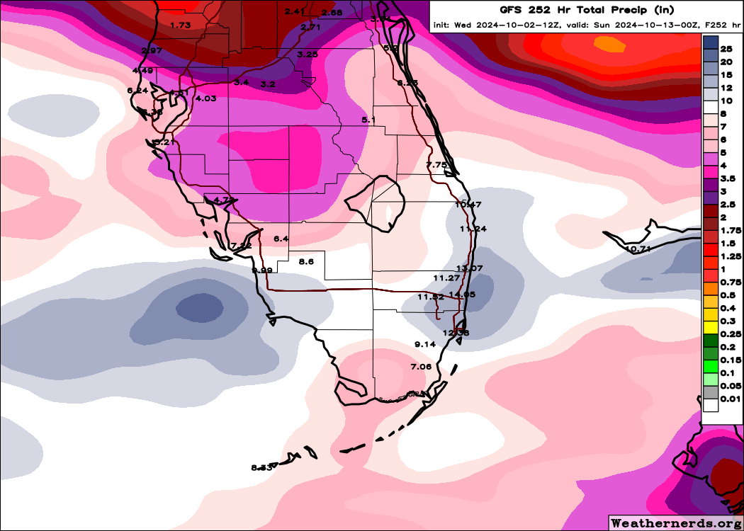
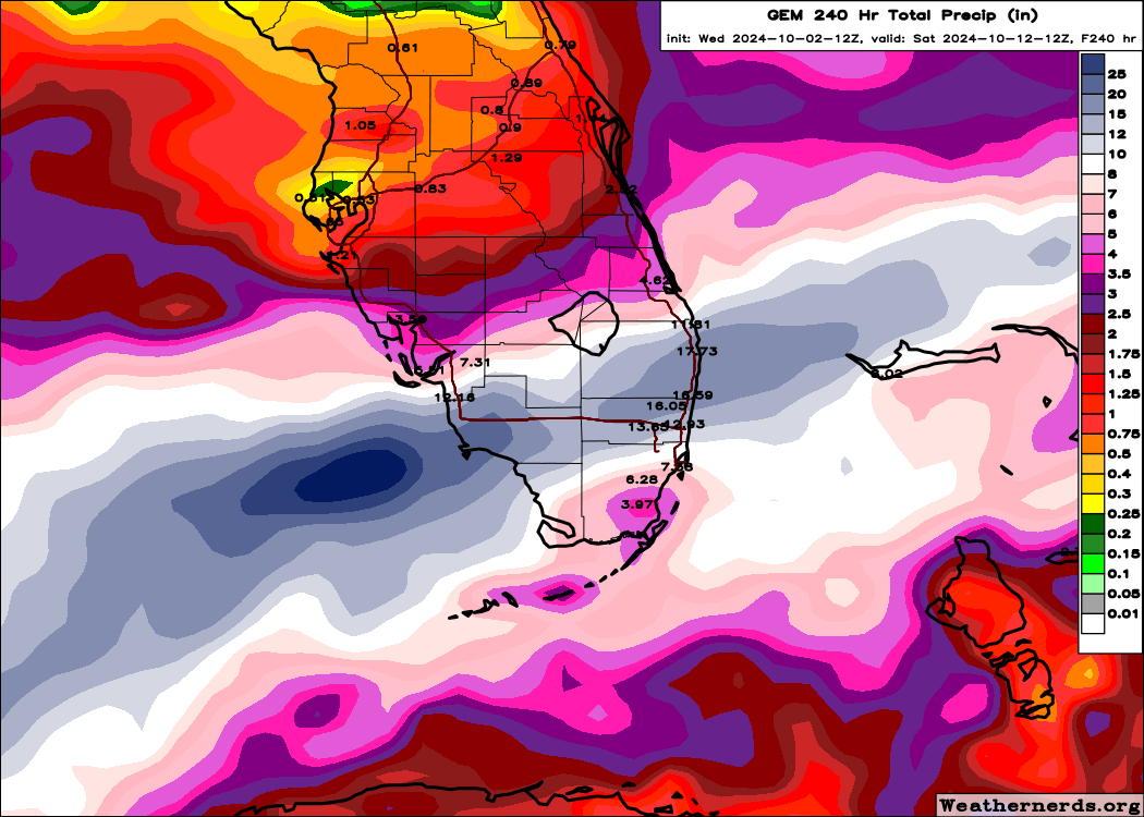
wxman57 wrote:All models are in good agreement on a low forming on the cold front in the SW Gulf this weekend. Even the GFS has come to its senses after yesterday's 18Z run. Models indicate a double low structure - one in the central Gulf and another in the BoC Sunday/Monday. Wind offshore Louisiana and across much of the northern Gulf NE-ENE 25-30 mph. It doesn't look like the low will be tropical, but I wouldn't rule out the NHC calling it a subtropical depression or storm. Bottom line is that no matter how its officially classified, the impacts will be the same. Windy, rough conditions across the Gulf through early next week and some rain for south Florida by Tuesday.
Very grateful for all the insight found here and for all the extra work of love that you, other professionals, and kind weather-enthusiasts put into just offering the best kind of help that can be offered in advance: forewarning. I have read the info from NHC as well, and what now appears on the weather apps, but the prognosis seems a bit unclear. Would you mind expounding a bit on the ETA of the rains for the West Coast of Florida?