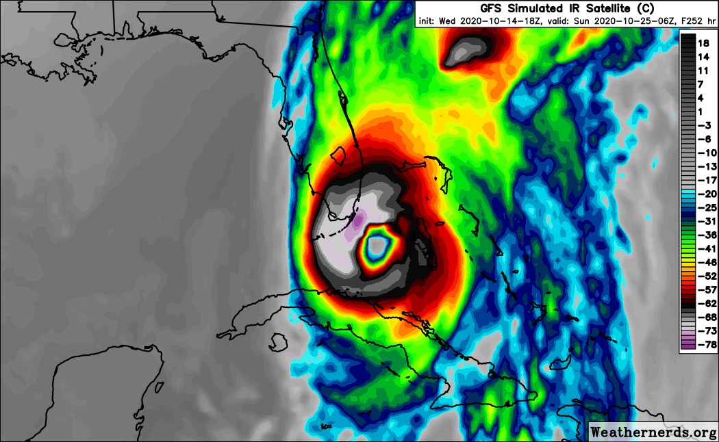
SFLcane wrote:18z GFS stronger and further west...
Yep, looks like the 18z may be ready to party.
Moderator: S2k Moderators


SFLcane wrote:18z GFS stronger and further west...


SFLcane wrote:18z GFS stronger and further west...
gatorcane wrote:If the Euro is correct with the subtropical TC that might be enough to shear anything in the WCAR keeping it weak.
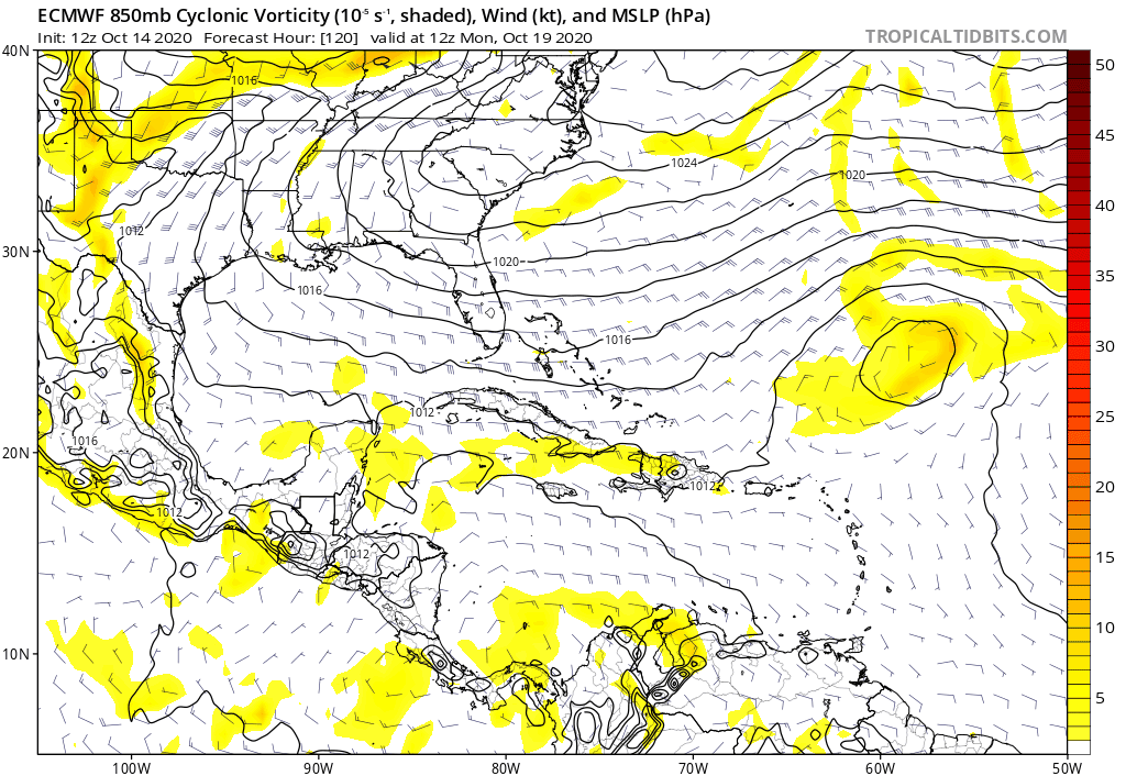
Interesting wrinkle which may throw a wrench in the GFS monster Caribbean storm idea:
https://i.postimg.cc/d0gQcTp9/ecmwf-uv850-vort-watl-fh120-240-2.gif


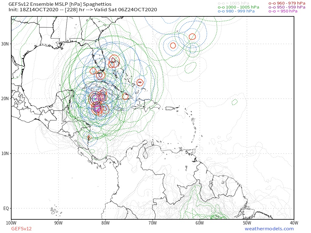
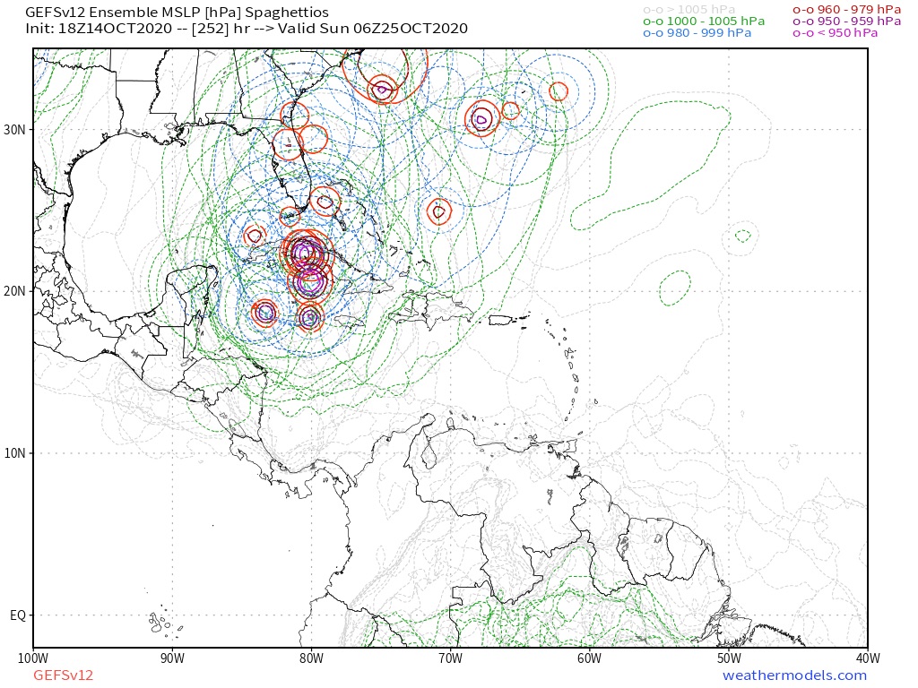
SouthFLTropics wrote:Looks like it will still slide east of the peninsula on this run but it will definitely be closer.
SFLcane wrote:SouthFLTropics wrote:Looks like it will still slide east of the peninsula on this run but it will definitely be closer.
Ouch! Northern quadrant into SFL...


Users browsing this forum: Google Adsense [Bot] and 57 guests


