Without all the shear it seems like this would be a good bet to develop.
Area of disturbed weather in SW Caribbean (Is invest 96L)
Moderator: S2k Moderators
Forum rules
The posts in this forum are NOT official forecasts and should not be used as such. They are just the opinion of the poster and may or may not be backed by sound meteorological data. They are NOT endorsed by any professional institution or STORM2K. For official information, please refer to products from the National Hurricane Center and National Weather Service.
-
- Admin
- Posts: 20012
- Age: 62
- Joined: Sun Aug 27, 2006 8:23 pm
- Location: Florence, KY (name is Mark)
Re: Area of disturbed weather in the SW Caribbean
Look at the extreme shear.

Without all the shear it seems like this would be a good bet to develop.
0 likes
Re: Area of disturbed weather in the SW Caribbean
That's cool. A little swirl-up right off Bocas Del Toro, Panama (which I've visited).
I think EPAC has it. No doubt about persistence.
0 likes
- Blown Away
- S2K Supporter
- Posts: 10152
- Joined: Wed May 26, 2004 6:17 am
Re: Area of disturbed weather in the SW Caribbean
I know it's late November, but IMO this area should be a "Code Yellow" at this point.
http://www.ssd.noaa.gov/goes/east/carb/loop-avn.html
0 likes
Re: Area of disturbed weather in the SW Caribbean
I'm surprised that this thread isn't busier than it is.Their is a mid level circulation down there. As far as at the surface I don't think its their quite yet, but spin is definitely there.
http://www.ssd.noaa.gov/goes/east/watl/loop-avn.html
0 likes
- wxman57
- Moderator-Pro Met
- Posts: 22984
- Age: 67
- Joined: Sat Jun 21, 2003 8:06 pm
- Location: Houston, TX (southwest)
Re: Area of disturbed weather in the SW Caribbean
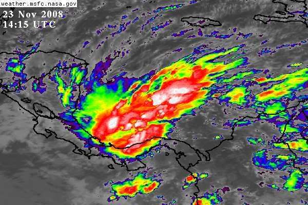
Blown_away wrote:I know it's late November, but IMO this area should be a "Code Yellow" at this point.
http://www.ssd.noaa.gov/goes/east/carb/loop-avn.html
It has about zero chance of developing in a high-shear environment. This season is over.
0 likes
- cycloneye
- Admin
- Posts: 145629
- Age: 68
- Joined: Thu Oct 10, 2002 10:54 am
- Location: San Juan, Puerto Rico
Re: Area of disturbed weather in the SW Caribbean
NHC is paying attention!
000
ABNT20 KNHC 222351
TWOAT
TROPICAL WEATHER OUTLOOK
NWS TPC/NATIONAL HURRICANE CENTER MIAMI FL
700 PM EST SAT NOV 22 2008
FOR THE NORTH ATLANTIC...CARIBBEAN SEA AND THE GULF OF MEXICO...
A BROAD LOW PRESSURE SYSTEM LOCATED JUST EAST OF THE PANAMA-COSTA
RICA BORDER IS PRODUCING WIDESPREAD CLOUDINESS AND SCATTERED
THUNDERSTORMS OVER MOST OF THE SOUTHWESTERN CARIBBEAN SEA AND
ADJACENT LAND AREAS. THE SYSTEM IS DRIFTING WESTWARD AND FURTHER
DEVELOPMENT...IF ANY...SHOULD BE SLOW TO OCCUR DUE TO LAND
INTERACTION. HOWEVER...HEAVY RAINFALL CAUSING LOCALIZED FLOODING
WILL BE POSSIBLE OVER MUCH OF PANAMA...COSTA RICA...AND NICARAGUA
DURING THE NEXT COUPLE OF DAYS.
ELSEWHERE...TROPICAL CYCLONE FORMATION IS NOT EXPECTED DURING THE
NEXT 48 HOURS.
$$
FORECASTER STEWART
http://www.nhc.noaa.gov/text/refresh/MI ... 2351.shtml
0 likes
- wxman57
- Moderator-Pro Met
- Posts: 22984
- Age: 67
- Joined: Sat Jun 21, 2003 8:06 pm
- Location: Houston, TX (southwest)
Re: Area of disturbed weather in the SW Caribbean
They mention it because it will bring rain to Central America, not because it will develop.
0 likes
This is like an episode of ER.
The patient (The 2008 Tropical Atlantic Hurricane Season) has been coding for 30 minutes, paddles used several times; yet one intern refuses to "call it".
No pulse......... charge to 300................ CLEAR.......... BOOM (and then thump)
(use your imagination!)
The patient (The 2008 Tropical Atlantic Hurricane Season) has been coding for 30 minutes, paddles used several times; yet one intern refuses to "call it".
No pulse......... charge to 300................ CLEAR.......... BOOM (and then thump)
(use your imagination!)
0 likes
- TheEuropean
- Professional-Met
- Posts: 1796
- Age: 59
- Joined: Tue Sep 20, 2005 3:17 pm
- Location: Voerde, Germany
- Contact:
000
ABNT20 KNHC 230611
TWOAT
TROPICAL WEATHER OUTLOOK
NWS TPC/NATIONAL HURRICANE CENTER MIAMI FL
100 AM EST SUN NOV 23 2008
FOR THE NORTH ATLANTIC...CARIBBEAN SEA AND THE GULF OF MEXICO...
A BROAD LOW PRESSURE SYSTEM LOCATED JUST EAST OF THE PANAMA-COSTA
RICA BORDER CONTINUES TO PRODUCE WIDESPREAD CLOUDINESS AND SCATTERED
THUNDERSTORMS OVER MOST OF THE SOUTHWESTERN CARIBBEAN SEA AND
ADJACENT LAND AREAS. THE SYSTEM IS DRIFTING SLOWLY WESTWARD AND
FURTHER DEVELOPMENT...IF ANY...SHOULD BE SLOW TO OCCUR DUE TO LAND
INTERACTION. HOWEVER...HEAVY RAINFALL CAUSING LOCALIZED FLOODING
WILL BE POSSIBLE OVER MUCH OF PANAMA...COSTA RICA...AND NICARAGUA
DURING THE NEXT COUPLE OF DAYS.
ELSEWHERE...TROPICAL CYCLONE FORMATION IS NOT EXPECTED DURING THE
NEXT 48 HOURS.
$$
FORECASTER STEWART
http://www.nhc.noaa.gov/text/refresh/MI ... 0611.shtml
0 likes
-
- Admin
- Posts: 20012
- Age: 62
- Joined: Sun Aug 27, 2006 8:23 pm
- Location: Florence, KY (name is Mark)
Re: Area of disturbed weather in the SW Caribbean
Orange is my favorite color.

Even more shear than the last time I posted the graphic.

Even more shear than the last time I posted the graphic.
0 likes
- gatorcane
- S2K Supporter
- Posts: 23692
- Age: 47
- Joined: Sun Mar 13, 2005 3:54 pm
- Location: Boca Raton, FL
Re: Area of disturbed weather in the SW Caribbean
Impressive convection for late November. A stronger-than-normal front pushing down into the SW Carib has again created a focal point for convection (its the same front that is bringing the prolonged period of below normal temps across Florida since the beginning of last week)


0 likes
- HURAKAN
- Professional-Met
- Posts: 46086
- Age: 38
- Joined: Thu May 20, 2004 4:34 pm
- Location: Key West, FL
- Contact:


Odette:
"As the 2003 Atlantic hurricane season came to a nominal close on 30 November, a stationary front extended across eastern Cuba southwestward into the southwestern Caribbean Sea. An area of low pressure developed in the frontal zone on 1 December just north of Panama, where it remained nearly stationary for a couple of days while the front gradually retreated northward and separated from the surface low. During this time, convection increased and became organized, and by 3 December, a distinct mid-level circulation had developed about 120 n mi north of the surface center. A weak tropical wave moved into the area and this event coincided with an increase in the overall organization of the system early on 4 December. A tropical depression formed at 1200 UTC that day about 300 n mi south of Kingston, Jamaica."
Link: http://www.nhc.noaa.gov/2003odette.shtml?
0 likes
- cycloneye
- Admin
- Posts: 145629
- Age: 68
- Joined: Thu Oct 10, 2002 10:54 am
- Location: San Juan, Puerto Rico
Re: Area of disturbed weather in the SW Caribbean
Not bad looking for late november,even in that area,but shear is horrible and land are the negative factors for it to not try to bloosom.

0 likes
Re: Area of disturbed weather in the SW Caribbean
Exactly Gatorcane, as unscientific as it sounds the front pushes the tropical conditions down into one corner and concentrates them there. They then brew up and form.
The shear is high, I'm surprised it even formed at all. This could spring north, who knows?
I bet they are flooding there in Panama/Costa Rica with three days of rain so far.
The shear is high, I'm surprised it even formed at all. This could spring north, who knows?
I bet they are flooding there in Panama/Costa Rica with three days of rain so far.
0 likes
- cycloneye
- Admin
- Posts: 145629
- Age: 68
- Joined: Thu Oct 10, 2002 10:54 am
- Location: San Juan, Puerto Rico
Re: Area of disturbed weather in SW Caribbean (Is invest 96L)
I didnt expected this to be a invest,but they have it up.Thread is locked as the information about this system can be found in the 96L Thread at Active Storms Forum.
0 likes
Who is online
Users browsing this forum: AnnularCane, Google [Bot], Google Adsense [Bot], Hurricane2000, jhpigott, Majestic-12 [Bot], NotSparta, ScottNAtlanta, zzzh and 74 guests