2012 EPAC season

This is the general tropical discussion area. Anyone can take their shot at predicting a storms path.

Moderator: S2k Moderators

Forum rules

The posts in this forum are NOT official forecasts and should not be used as such. They are just the opinion of the poster and may or may not be backed by sound meteorological data. They are NOT endorsed by any professional institution or STORM2K. For official information, please refer to products from the National Hurricane Center and National Weather Service.

Help Support Storm2K
Message
Author
User avatar
Yellow Evan
Professional-Met
Professional-Met
Posts: 16058
Age: 26
Joined: Fri Jul 15, 2011 12:48 pm
Location: Henderson, Nevada/Honolulu, HI
Contact:

Re: 2012 EPAC season

#41 Postby Yellow Evan » Mon May 14, 2012 5:44 pm

cycloneye wrote:Maybe I am wrong about this, but if I remember,the last TC that formed in the EPAC before May 15 was in 1996.


You are correct.
0 likes   

User avatar
cycloneye
Admin
Admin
Posts: 143927
Age: 68
Joined: Thu Oct 10, 2002 10:54 am
Location: San Juan, Puerto Rico

Re: 2012 EPAC season

#42 Postby cycloneye » Mon May 14, 2012 6:39 pm

I found the track of that 1996 storm not named.

Image
0 likes   
Visit the Caribbean-Central America Weather Thread where you can find at first post web cams,radars
and observations from Caribbean basin members Click Here

User avatar
Yellow Evan
Professional-Met
Professional-Met
Posts: 16058
Age: 26
Joined: Fri Jul 15, 2011 12:48 pm
Location: Henderson, Nevada/Honolulu, HI
Contact:

#43 Postby Yellow Evan » Mon May 14, 2012 6:53 pm

That was the pre-season storm I was talking about a few posts above. Also sunk a ship :(
0 likes   

User avatar
cycloneye
Admin
Admin
Posts: 143927
Age: 68
Joined: Thu Oct 10, 2002 10:54 am
Location: San Juan, Puerto Rico

Re: 2012 EPAC season

#44 Postby cycloneye » Mon May 14, 2012 9:42 pm

The first named storm (Aletta) is officially now at EPAC. Now the question is,how many more will form down the road and if the CA and Mexican coast will be threatened by systems or they all go harmless to open sea.
0 likes   
Visit the Caribbean-Central America Weather Thread where you can find at first post web cams,radars
and observations from Caribbean basin members Click Here

User avatar
cycloneye
Admin
Admin
Posts: 143927
Age: 68
Joined: Thu Oct 10, 2002 10:54 am
Location: San Juan, Puerto Rico

Re: 2012 EPAC season

#45 Postby cycloneye » Tue May 15, 2012 6:42 am

First Tropical Weather Outlook of 2012 EPAC season

TROPICAL WEATHER OUTLOOK
NWS NATIONAL HURRICANE CENTER MIAMI FL
500 AM PDT TUE MAY 15 2012

FOR THE EASTERN NORTH PACIFIC...EAST OF 140 DEGREES WEST LONGITUDE..

THE NATIONAL HURRICANE CENTER IS ISSUING ADVISORIES ON TROPICAL
STORM ALETTA...LOCATED ABOUT 640 MILES SOUTH-SOUTHWEST OF MANZANILLO
MEXICO.

ELSEWHERE...TROPICAL CYCLONE FORMATION IS NOT EXPECTED DURING THE
NEXT 48 HOURS.

TODAY MARKS THE FIRST DAY OF THE EASTERN NORTH PACIFIC HURRICANE
SEASON...WHICH WILL RUN UNTIL NOVEMBER 30. LONG-TERM AVERAGES FOR
THE NUMBER OF NAMED STORMS...HURRICANES...AND MAJOR HURRICANES ARE
15...9...AND 4...RESPECTIVELY.

THE LIST OF NAMES FOR 2012 IS AS FOLLOWS:

NAME PRONUNCIATION NAME PRONUNCIATION
-------------------------------------------------------------
ALETTA A LET- AH MIRIAM MEER- YIM
BUD BUHD NORMAN NOR- MUHN
CARLOTTA KAR LOT- UH OLIVIA UH LIV- EE UH
DANIEL DAN- YUHL PAUL PALL
EMILIA EE MILL- YA ROSA ROH- ZUH
FABIO FAH- BEE O SERGIO SIR- GEE OH
GILMA GIL- MAH TARA TAIR- UH
HECTOR HEHK- TOR VICENTE VEE CEN- TAY
ILEANA ILL AY AH- NAH WILLA WIH- LAH
JOHN JAHN XAVIER ZAY- VEE UR
KRISTY KRIS- TEE YOLANDA YO LAHN- DA
LANE LAYNE ZEKE ZEEK

THIS PRODUCT...THE TROPICAL WEATHER OUTLOOK...BRIEFLY DESCRIBES
SIGNIFICANT AREAS OF DISTURBED WEATHER AND THEIR POTENTIAL FOR
TROPICAL CYCLONE FORMATION DURING THE NEXT 48 HOURS. THE ISSUANCE
TIMES OF THIS PRODUCT ARE 5 AM...11 AM...5 PM...AND 11 PM PDT.
AFTER THE CHANGE TO STANDARD TIME IN NOVEMBER...THE ISSUANCE TIMES
ARE 4 AM...10 AM...4 PM...AND 10 PM PST.

A SPECIAL TROPICAL WEATHER OUTLOOK WILL BE ISSUED TO PROVIDE
UPDATES...AS NECESSARY...IN BETWEEN THE REGULARLY SCHEDULED
ISSUANCES OF THE TROPICAL WEATHER OUTLOOK. SPECIAL TROPICAL WEATHER
OUTLOOKS WILL BE ISSUED UNDER THE SAME WMO AND AWIPS HEADERS AS THE
REGULAR TROPICAL WEATHER OUTLOOKS.

A STANDARD PACKAGE OF PRODUCTS...CONSISTING OF THE TROPICAL CYCLONE
PUBLIC ADVISORY...THE FORECAST/ADVISORY...THE CYCLONE DISCUSSION...
AND A WIND SPEED PROBABILITY PRODUCT...IS ISSUED EVERY SIX HOURS
FOR ALL ONGOING TROPICAL CYCLONES. IN ADDITION...A SPECIAL
ADVISORY PACKAGE MAY BE ISSUED AT ANY TIME TO ADVISE OF SIGNIFICANT
UNEXPECTED CHANGES OR TO MODIFY WATCHES OR WARNINGS.

THE TROPICAL CYCLONE UPDATE IS A BRIEF STATEMENT TO INFORM OF
SIGNIFICANT CHANGES IN A TROPICAL CYCLONE OR TO POST OR CANCEL
WATCHES OR WARNINGS. IT IS USED IN LIEU OF OR TO PRECEDE THE
ISSUANCE OF A SPECIAL ADVISORY PACKAGE. TROPICAL CYCLONE
UPDATES...WHICH CAN BE ISSUED AT ANY TIME...CAN BE FOUND UNDER WMO
HEADER WTPZ61-65 KNHC...AND UNDER AWIPS HEADER MIATCUEP1-5.

ALL NATIONAL HURRICANE CENTER TEXT AND GRAPHICAL PRODUCTS ARE
AVAILABLE ON THE WEB AT http://WWW.HURRICANES.GOV. SIGN UP FOR PRODUCT
UPDATES BY EMAIL AT http://WWW.HURRICANES.GOV/SIGNUP.SHTML...IN ALL LOWER
CASE. YOU CAN ALSO INTERACT WITH NHC ON FACEBOOK AT
http://WWW.FACEBOOK.COM/US.NOAA.NATIONA ... CENTER.GOV. NOTIFICATIONS
ARE AVAILABLE VIA TWITTER WHEN SELECT NATIONAL HURRICANE CENTER
PRODUCTS ARE ISSUED. INFORMATION ABOUT OUR EAST PACIFIC TWITTER
FEED IS AVAILABLE AT http://WWW.HURRICANES.GOV/TWITTER.SHTML...IN ALL
LOWER CASE.

&&
PUBLIC ADVISORIES ON TROPICAL STORM ALETTA ARE ISSUED UNDER WMO
HEADER WTPZ31 KNHC AND UNDER AWIPS HEADER MIATCPEP1.
FORECAST/ADVISORIES ON ALETTA ARE ISSUED UNDER WMO HEADER
WTPZ21 KNHC AND UNDER AWIPS HEADER MIATCMEP1.

$$
FORECASTER BROWN
0 likes   
Visit the Caribbean-Central America Weather Thread where you can find at first post web cams,radars
and observations from Caribbean basin members Click Here

User avatar
Yellow Evan
Professional-Met
Professional-Met
Posts: 16058
Age: 26
Joined: Fri Jul 15, 2011 12:48 pm
Location: Henderson, Nevada/Honolulu, HI
Contact:

Re: 2012 EPAC season

#46 Postby Yellow Evan » Tue May 15, 2012 8:36 am

cycloneye wrote:The first named storm (Aletta) is officially now at EPAC. Now the question is,how many more will form down the road and if the CA and Mexican coast will be threatened by systems or they all go harmless to open sea.


Models think there will be a hurricane near the Mexican coast later this week/early next week.
0 likes   

User avatar
cycloneye
Admin
Admin
Posts: 143927
Age: 68
Joined: Thu Oct 10, 2002 10:54 am
Location: San Juan, Puerto Rico

Re: 2012 EPAC season

#47 Postby cycloneye » Tue May 15, 2012 1:03 pm

Here comes what may be Bud.

TROPICAL WEATHER OUTLOOK
NWS NATIONAL HURRICANE CENTER MIAMI FL
1100 AM PDT TUE MAY 15 2012

FOR THE EASTERN NORTH PACIFIC...EAST OF 140 DEGREES WEST LONGITUDE..

THE NATIONAL HURRICANE CENTER IS ISSUING ADVISORIES ON TROPICAL
STORM ALETTA...LOCATED ABOUT 850 MILES SOUTH OF THE SOUTHERN TIP
OF BAJA CALIFORNIA.

A LARGE AREA OF DISTURBED WEATHER HAS FORMED SEVERAL HUNDRED MILES
SOUTH OF THE GULF OF TEHUANTEPEC. ENVIRONMENTAL CONDITIONS APPEAR
CONDUCIVE FOR GRADUAL DEVELOPMENT OF THIS SYSTEM DURING THE NEXT
COUPLE OF DAYS. THIS SYSTEM HAS A LOW CHANCE...10 PERCENT...OF
BECOMING A TROPICAL CYCLONE DURING THE NEXT 48 HOURS.

$$
FORECASTER BROWN
0 likes   
Visit the Caribbean-Central America Weather Thread where you can find at first post web cams,radars
and observations from Caribbean basin members Click Here

User avatar
Hurricane Jed
Category 2
Category 2
Posts: 545
Age: 37
Joined: Mon Jan 24, 2011 3:36 pm
Location: Cen Tex

#48 Postby Hurricane Jed » Tue May 15, 2012 1:33 pm

According to weatherunisys. Last time there were 2 tropical cyclones in the EPAC in May was 2007 with Tropical Storms Alvin and Barbara. It also happened in 1956, Hurricane #1 and TS #2 and in 1984 with TS Alma and Hurricane Boris.
0 likes   

User avatar
Cyclenall
Category 5
Category 5
Posts: 6665
Joined: Thu Jun 08, 2006 10:01 pm
Location: Ontario, Canada

Re: 2012 EPAC season

#49 Postby Cyclenall » Tue May 15, 2012 1:40 pm

Yellow Evan wrote:
cycloneye wrote:The first named storm (Aletta) is officially now at EPAC. Now the question is,how many more will form down the road and if the CA and Mexican coast will be threatened by systems or they all go harmless to open sea.


Models think there will be a hurricane near the Mexican coast later this week/early next week.

Yeah there is some model consistently with a new significant tropical system that comes fairly close to Mexico; not too dissimilar to Adolph 01' which I keep referencing. Not sure about strength and this one is for 6 days from now. Buddy boy wants to make an appearance.

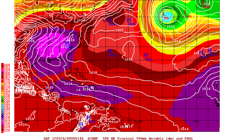
cycloneye wrote:Here comes what may be Bud.

Already. There is a nice amount of convective energy around there, guaranteed something will pop from that location at some point.
0 likes   

User avatar
Yellow Evan
Professional-Met
Professional-Met
Posts: 16058
Age: 26
Joined: Fri Jul 15, 2011 12:48 pm
Location: Henderson, Nevada/Honolulu, HI
Contact:

#50 Postby Yellow Evan » Tue May 15, 2012 9:02 pm

Just hope it does not kill anyone.
0 likes   

User avatar
Cyclenall
Category 5
Category 5
Posts: 6665
Joined: Thu Jun 08, 2006 10:01 pm
Location: Ontario, Canada

Official Prediction

#51 Postby Cyclenall » Thu May 17, 2012 8:51 pm

A little late but here:

My 2012 North Eastern Pacific Hurricane Season Prediction is as follows:

23/14/7 (Final)

ACE: 169

These are some point form notes on my thoughts for this season:

- At least one category 5 hurricane will form
- There will be two major hurricane landfalls on the mainland Mexican coastline this season and one below major intensity further east.
- An increase in long tracked tropical cyclones heading towards the Cpac basin
- In the "Hyperactive" category for season classifications
- One Annular tropical cyclone will form during the season
- May will be very active if not hyper-active with a record of 3 TC's forming by June 1 2012

Note: None of this is based on scientific data or factual evidence. These are general thoughts that I have on what I think will happen.
0 likes   

User avatar
Yellow Evan
Professional-Met
Professional-Met
Posts: 16058
Age: 26
Joined: Fri Jul 15, 2011 12:48 pm
Location: Henderson, Nevada/Honolulu, HI
Contact:

Re: Official Prediction

#52 Postby Yellow Evan » Thu May 17, 2012 10:00 pm

Cyclenall wrote:A little late but here:

My 2012 North Eastern Pacific Hurricane Season Prediction is as follows:

23/14/7 (Final)

ACE: 169

These are some point form notes on my thoughts for this season:

- At least one category 5 hurricane will form
- There will be two major hurricane landfalls on the mainland Mexican coastline this season and one below major intensity further east.
- An increase in long tracked tropical cyclones heading towards the Cpac basin
- In the "Hyperactive" category for season classifications
- One Annular tropical cyclone will form during the season
- May will be very active if not hyper-active with a record of 3 TC's forming by June 1 2012

Note: None of this is based on scientific data or factual evidence. These are general thoughts that I have on what I think will happen.


That is quite a prediction.
0 likes   

User avatar
cycloneye
Admin
Admin
Posts: 143927
Age: 68
Joined: Thu Oct 10, 2002 10:54 am
Location: San Juan, Puerto Rico

Re: 2012 EPAC season

#53 Postby cycloneye » Fri May 18, 2012 4:48 pm

Maybe we may see soon invest 93E from the disturbance SE of 92E. Models develop another system behind 92E.

Image

Uploaded with imageshack.us
0 likes   
Visit the Caribbean-Central America Weather Thread where you can find at first post web cams,radars
and observations from Caribbean basin members Click Here

User avatar
Hurricane Jed
Category 2
Category 2
Posts: 545
Age: 37
Joined: Mon Jan 24, 2011 3:36 pm
Location: Cen Tex

#54 Postby Hurricane Jed » Fri May 18, 2012 5:34 pm

Lining them up one after another. Hmmm could we see a record breaking 3 tropical cyclones in May?
0 likes   

User avatar
Yellow Evan
Professional-Met
Professional-Met
Posts: 16058
Age: 26
Joined: Fri Jul 15, 2011 12:48 pm
Location: Henderson, Nevada/Honolulu, HI
Contact:

#55 Postby Yellow Evan » Fri May 18, 2012 5:44 pm

Another system? Wow.
0 likes   

User avatar
Kingarabian
S2K Supporter
S2K Supporter
Posts: 15829
Joined: Sat Aug 08, 2009 3:06 am
Location: Honolulu, Hawaii

#56 Postby Kingarabian » Fri May 18, 2012 6:12 pm

Ya cuz the Atlantic is all like "yo, Mr. Pacific I'm not in the mood to develop anything right now"
0 likes   
RIP Kobe Bryant

User avatar
Yellow Evan
Professional-Met
Professional-Met
Posts: 16058
Age: 26
Joined: Fri Jul 15, 2011 12:48 pm
Location: Henderson, Nevada/Honolulu, HI
Contact:

#57 Postby Yellow Evan » Fri May 18, 2012 10:42 pm

Lol, I guess it is true. Well the EPAC is on to a big start, that is for sure.
0 likes   

User avatar
Rgv20
S2K Supporter
S2K Supporter
Posts: 2466
Age: 38
Joined: Wed Jan 05, 2011 5:42 pm
Location: Edinburg/McAllen Tx

#58 Postby Rgv20 » Sun May 20, 2012 1:44 am

0zECMWF has a 984mb Tropical System hugging the Mexican Coast 6 days from now... :eek:

Image
0 likes   
The following post is NOT an official forecast and should not be used as such. It is just the opinion of the poster and may or may not be backed by sound meteorological data. It is NOT endorsed by any professional institution including storm2k.org For Official Information please refer to the NHC and NWS products.

User avatar
Yellow Evan
Professional-Met
Professional-Met
Posts: 16058
Age: 26
Joined: Fri Jul 15, 2011 12:48 pm
Location: Henderson, Nevada/Honolulu, HI
Contact:

#59 Postby Yellow Evan » Sun May 20, 2012 6:07 pm

Wow, antoher system? omg.
0 likes   

User avatar
cycloneye
Admin
Admin
Posts: 143927
Age: 68
Joined: Thu Oct 10, 2002 10:54 am
Location: San Juan, Puerto Rico

Re: 2012 EPAC season

#60 Postby cycloneye » Thu May 24, 2012 10:11 am

NOAA EPAC outlook:Near normal season is expected.

http://www.noaanews.noaa.gov/stories201 ... eason.html
0 likes   
Visit the Caribbean-Central America Weather Thread where you can find at first post web cams,radars
and observations from Caribbean basin members Click Here


Return to “Talkin' Tropics”

Who is online

Users browsing this forum: AnnularCane, Google Adsense [Bot], MarioProtVI, MetroMike and 222 guests