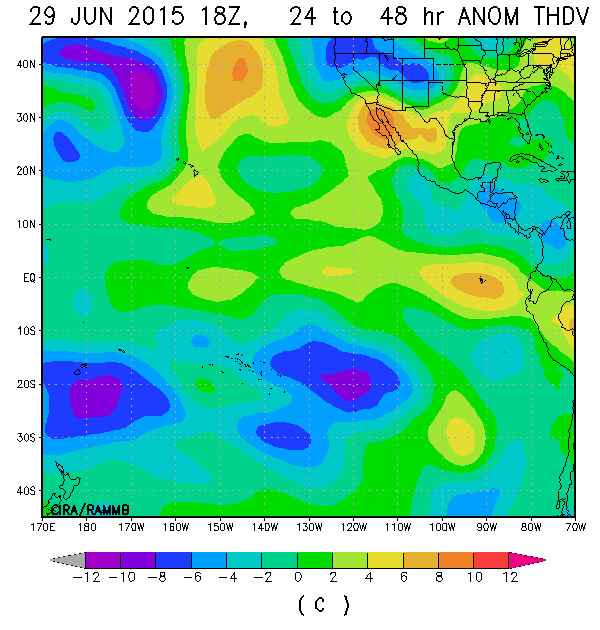
I'm getting frustrated. GFS seems to agree on raging wind shear oer the basin for the next 16 days, despite CCKW/MJO lurking nearby.
Why on earth can't the wind shear cooperate the on year we have record SST's for us to have a 1992-esque season?
2015 EPAC Season
Moderator: S2k Moderators
Forum rules

The posts in this forum are NOT official forecasts and should not be used as such. They are just the opinion of the poster and may or may not be backed by sound meteorological data. They are NOT endorsed by any professional institution or STORM2K. For official information, please refer to products from the National Hurricane Center and National Weather Service.
-
Yellow Evan

- Professional-Met

- Posts: 16213
- Age: 27
- Joined: Fri Jul 15, 2011 12:48 pm
- Location: Henderson, Nevada/Honolulu, HI
- Contact:
-
gatorcane

- S2K Supporter

- Posts: 23703
- Age: 47
- Joined: Sun Mar 13, 2005 3:54 pm
- Location: Boca Raton, FL
Re:
Yellow Evan wrote:I'm getting frustrated. GFS seems to agree on raging wind shear oer the basin for the next 16 days, despite CCKW/MJO lurking nearby.
Why on earth can't the wind shear cooperate the on year we have record SST's for us to have a 1992-esque season?
Yeah it's a bit strange. Seems like the EPAC should be in overdrive by now but it is not even with this El Nino and above normal SSTs.
This wind shear seems to be not only capping the Atlantic at the moment but it has spread into the EPAC as well. Things were so favorable just a couple of weeks ago and how quickly they have changed.
A lot of times if the EPAC is quiet the Atlantic gets going but that is not even the case here.
0 likes


Thats because we are about to get a very strong MJO event over the WPAC, subsidence rules elsewhere. CPAC will be next and then EPAC, this WWB is very impressive, development will come in bursts once it arrives.
0 likes
The above post and any post by Ntxw is NOT an official forecast and should not be used as such. It is just the opinion of the poster and may or may not be backed by sound meteorological data. It is NOT endorsed by any professional institution including Storm2k. For official information, please refer to NWS products.
Help support Storm2K!
-
Kingarabian

- S2K Supporter
- Posts: 16296
- Joined: Sat Aug 08, 2009 3:06 am
- Location: Honolulu, Hawaii
Re:
Yellow Evan wrote:I'm getting frustrated. GFS seems to agree on raging wind shear oer the basin for the next 16 days, despite CCKW/MJO lurking nearby.
Why on earth can't the wind shear cooperate the on year we have record SST's for us to have a 1992-esque season?
There will always be storms that models initially don't sniff out.
0 likes
RIP Kobe Bryant
-
Yellow Evan
- Professional-Met
- Posts: 16213
- Age: 27
- Joined: Fri Jul 15, 2011 12:48 pm
- Location: Henderson, Nevada/Honolulu, HI
- Contact:
Re: Re:
Kingarabian wrote:Yellow Evan wrote:I'm getting frustrated. GFS seems to agree on raging wind shear over the basin for the next 16 days, despite CCKW/MJO lurking nearby.
Why on earth can't the wind shear cooperate the on year we have record SST's for us to have a 1992-esque season?
There will always be storms that models initially don't sniff out.
I know that as well as anyone, but idk, just don't feel particularly confident. When the EPAC will become active is a very tricky forecast without any clear signals from the guidance.
I did say the same thing last July and look what happened in August.
0 likes
-
Yellow Evan
- Professional-Met
- Posts: 16213
- Age: 27
- Joined: Fri Jul 15, 2011 12:48 pm
- Location: Henderson, Nevada/Honolulu, HI
- Contact:
Re: Re:
gatorcane wrote:Yellow Evan wrote:I'm getting frustrated. GFS seems to agree on raging wind shear oer the basin for the next 16 days, despite CCKW/MJO lurking nearby.
Why on earth can't the wind shear cooperate the on year we have record SST's for us to have a 1992-esque season?
Yeah it's a bit strange. Seems like the EPAC should be in overdrive by now but it is not even with this El Nino and above normal SSTs.
This wind shear seems to be not only capping the Atlantic at the moment but it has spread into the EPAC as well. Things were so favorable just a couple of weeks ago and how quickly they have changed.
A lot of times if the EPAC is quiet the Atlantic gets going but that is not even the case here.
You'd think we're in a Modoki with this kind of shear, but we are not.
I know the WPAC is in overdrive right now, stealing all the upward motion thought, but with a KW looming and MJO heading for the the CPAC, you'd think there'd be at least a storm in the long range.
Last edited by Yellow Evan on Fri Jun 26, 2015 2:34 pm, edited 1 time in total.
0 likes
-
Yellow Evan
- Professional-Met
- Posts: 16213
- Age: 27
- Joined: Fri Jul 15, 2011 12:48 pm
- Location: Henderson, Nevada/Honolulu, HI
- Contact:
Re:
Ntxw wrote:Thats because we are about to get a very strong MJO event over the WPAC, subsidence rules elsewhere. CPAC will be next and then EPAC, this WWB is very impressive, development will come in bursts once it arrives.
Yes, but the models aren't aren't too keen on the EPAc. That's why I'm not too confident yet, even though they bring in a KW very soon, and eventually bring MJO in.
0 likes
-
Yellow Evan
- Professional-Met
- Posts: 16213
- Age: 27
- Joined: Fri Jul 15, 2011 12:48 pm
- Location: Henderson, Nevada/Honolulu, HI
- Contact:
Re:
gatorcane wrote:12Z GEM seems to develop something but nothing very strong.
Sorta, but it's the CMC.
0 likes
-
Yellow Evan
- Professional-Met
- Posts: 16213
- Age: 27
- Joined: Fri Jul 15, 2011 12:48 pm
- Location: Henderson, Nevada/Honolulu, HI
- Contact:
Cloudiness and thunderstorms located about 1600 miles east-
southeast of the Big Island of Hawaii are associated with a trough
of low pressure. Some slow development of this system is possible
during the next few days before upper-level winds become unfavorable
for tropical cyclone formation. This system is expected to move
west-northwestward into the Central Pacific Hurricane Center's area
of responsibility within a couple of days.
* Formation chance through 48 hours...low...10 percent
* Formation chance through 5 days...low...20 percent
0 likes
-
Yellow Evan
- Professional-Met
- Posts: 16213
- Age: 27
- Joined: Fri Jul 15, 2011 12:48 pm
- Location: Henderson, Nevada/Honolulu, HI
- Contact:
-
Yellow Evan
- Professional-Met
- Posts: 16213
- Age: 27
- Joined: Fri Jul 15, 2011 12:48 pm
- Location: Henderson, Nevada/Honolulu, HI
- Contact:
Cloudiness and showers associated with a trough of low pressure
located about 1600 miles east-southeast of the Big Island of Hawaii
have changed little in organization. However, some slow development
of this disturbance is possible during the next few days before
upper-level winds become unfavorable for tropical cyclone
formation. This system is expected to move west-northwestward into
the Central Pacific Hurricane Center's area of responsibility within
a couple of days.
* Formation chance through 48 hours...low...10 percent
* Formation chance through 5 days...low...20 percent
0 likes
-
Yellow Evan
- Professional-Met
- Posts: 16213
- Age: 27
- Joined: Fri Jul 15, 2011 12:48 pm
- Location: Henderson, Nevada/Honolulu, HI
- Contact:
A broad area of low pressure located about 1400 miles east-southeast
of the Big Island of Hawaii is producing disorganized showers and
thunderstorms. Some slow development of this disturbance is possible
during the next couple of days before upper-level winds become
unfavorable for tropical cyclone formation. This system is expected
to move west-northwestward into the Central Pacific Hurricane
Center's area of responsibility later today or on Sunday.
* Formation chance through 48 hours...low...20 percent
* Formation chance through 5 days...low...20 percent
Now 90C I think
0 likes
-
Yellow Evan
- Professional-Met
- Posts: 16213
- Age: 27
- Joined: Fri Jul 15, 2011 12:48 pm
- Location: Henderson, Nevada/Honolulu, HI
- Contact:

-
Yellow Evan
- Professional-Met
- Posts: 16213
- Age: 27
- Joined: Fri Jul 15, 2011 12:48 pm
- Location: Henderson, Nevada/Honolulu, HI
- Contact:


Bad way to end June UGH
Yellow Evan wrote:GFS continues to show nothing still despite an upcoming KW.
I really don't know what's causing the shear to be high, but right now, I am very disappointed.
It fits in with the rest of Earth's weather during the last 6 days, nothing but boring same old. Disappointed is an understatement, not following anything really. The "action" is really on the west side with the heat, your lucky in my view. I would have thought a quickly strengthening El Nino would have more than this!
0 likes
-
gatorcane
- S2K Supporter
- Posts: 23703
- Age: 47
- Joined: Sun Mar 13, 2005 3:54 pm
- Location: Boca Raton, FL
Nothing really showing up in MU through 16 days, maybe some weak low at the very end of the run in fantasy land.
Odd the EPAC is so quiet for sure, given the developing "super" El Niño.
Goes to show warm SSTs are not enough, no matter how much above normal the SSTs are running. If shear is around, that will squash development.
Odd the EPAC is so quiet for sure, given the developing "super" El Niño.
Goes to show warm SSTs are not enough, no matter how much above normal the SSTs are running. If shear is around, that will squash development.
0 likes


-
Yellow Evan
- Professional-Met
- Posts: 16213
- Age: 27
- Joined: Fri Jul 15, 2011 12:48 pm
- Location: Henderson, Nevada/Honolulu, HI
- Contact:
Then again it's only June 29 and we're mostly waiting for MJO to come around. The WPAC is stealing the upward motion right now. It might be too late for a 1992-seque season, but nevertheless, this isn't that atypical of El Nino (they usually have a big lull thrown in).
How fast this Nino weakens will be key in our chances for a 1992-esque season in future years.
How fast this Nino weakens will be key in our chances for a 1992-esque season in future years.
0 likes
Who is online
Users browsing this forum: Ulf and 45 guests