

Sent from my iPhone using Tapatalk
Moderator: S2k Moderators


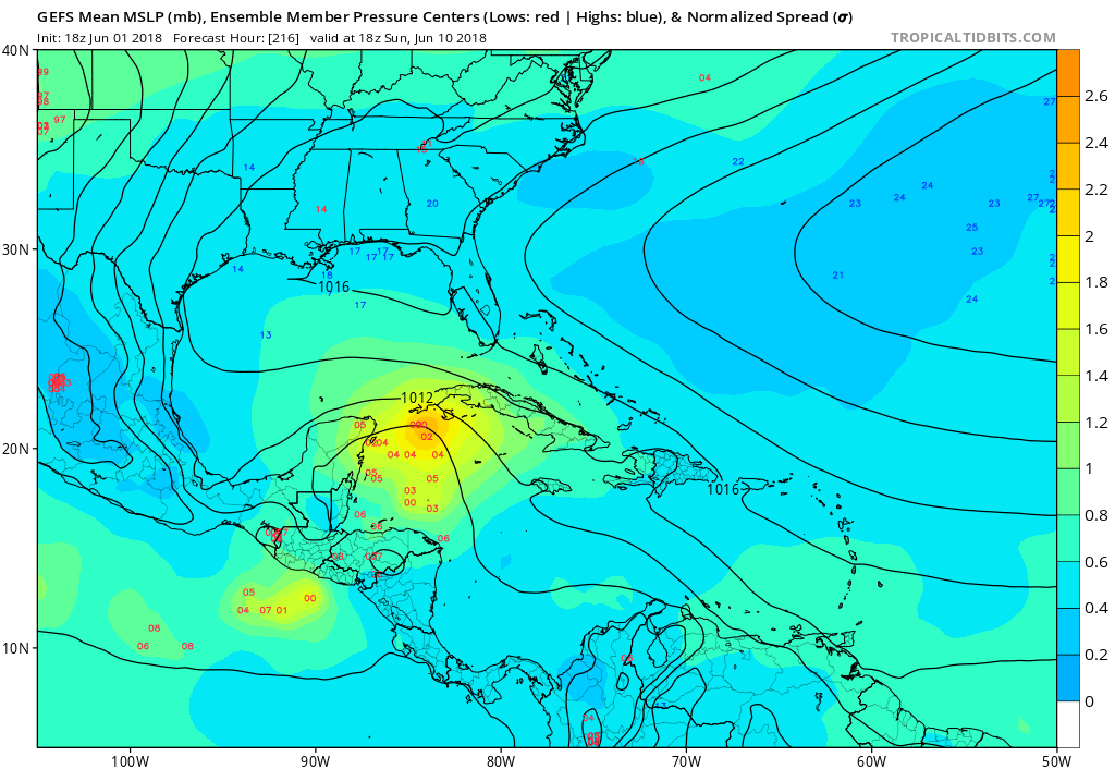
WeatherEmperor wrote:A closer look at the 12z GFS and ECMWF 240hrs. Main difference is the Euro only goes for EPAC developmeny while the GFS has something in the EPAC and WCaribean.
Sent from my iPhone using Tapatalk
TheStormExpert wrote:I wouldn’t say the three models are inline. The Euro has nothing but high pressure in the Western Caribbean in 10 days.
https://twitter.com/toddkimberlain/status/1002619984613462016

TheStormExpert wrote:12z Euro Ensembles have nada on the Caribbean side.
12z GFS Ensembles didn’t run on Tropical Tidbits, anyone know what they show?
Aric Dunn wrote:18z GFS has a more pronounced monsoon trough..

LarryWx wrote:Aric Dunn wrote:18z GFS has a more pronounced monsoon trough..
The Happy Hour GEFS didn't disappoint as regards its reputation. It has about double the # of TC geneses as the 12Z GEFS and they start on the same day, 6/10, followed by a general track N to FL.
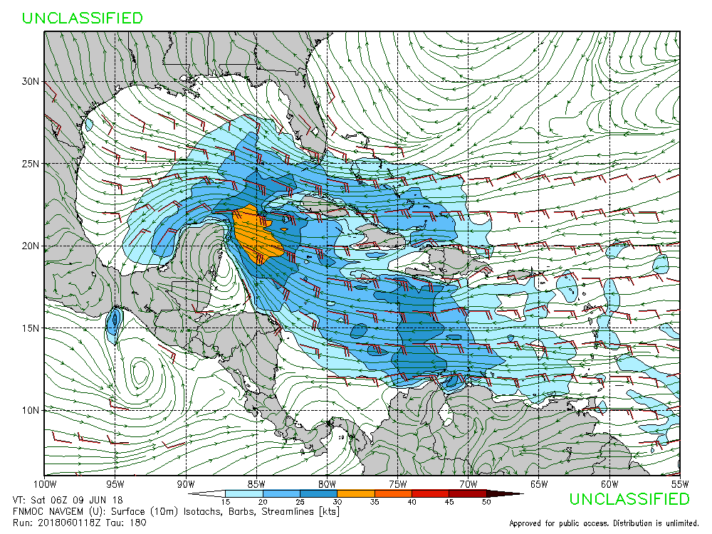
blp wrote:18z Navgem starting to buy into the idea of action in the NW Caribbean.
https://www.fnmoc.navy.mil/wxmap_cgi/dynamic/NVG/2018060118/nvg10.usf.180.troplant.gif
https://www.fnmoc.navy.mil/wxmap_cgi/dynamic/NVG/2018060118/nvg10.prp.180.troplant.gif

floridasun78 wrote:blp wrote:18z Navgem starting to buy into the idea of action in the NW Caribbean.
https://www.fnmoc.navy.mil/wxmap_cgi/dynamic/NVG/2018060118/nvg10.usf.180.troplant.gif
https://www.fnmoc.navy.mil/wxmap_cgi/dynamic/NVG/2018060118/nvg10.prp.180.troplant.gif
i cannot get page fox block links

Weather150 wrote:floridasun78 wrote:blp wrote:18z Navgem starting to buy into the idea of action in the NW Caribbean.
https://www.fnmoc.navy.mil/wxmap_cgi/dynamic/NVG/2018060118/nvg10.usf.180.troplant.gif
https://www.fnmoc.navy.mil/wxmap_cgi/dynamic/NVG/2018060118/nvg10.prp.180.troplant.gif
i cannot get page fox block links
Me as well.

Tampa Bay Hurricane wrote:Gfs, navgem, fv3, gefs ensembles on board- could see something in 10 days! Really active pattern- esp with the positive mjo swinging back in at that time frame. I wonder if this season will feature hyperactive homebrew with the mdr being so cold. A month ago who would have thunk Alberto would have happened. Think we will see something like a sheared TS come out of the Caribbean and reach moderate strength like Alberto did.
La Breeze wrote:Tampa Bay Hurricane wrote:Gfs, navgem, fv3, gefs ensembles on board- could see something in 10 days! Really active pattern- esp with the positive mjo swinging back in at that time frame. I wonder if this season will feature hyperactive homebrew with the mdr being so cold. A month ago who would have thunk Alberto would have happened. Think we will see something like a sheared TS come out of the Caribbean and reach moderate strength like Alberto did.
Tampa Bay Hurricane, where do you think this sheared TS may head and what areas may be impacted? Wondering, because I was going to head to the Keys on the 9th and stay there a week - now, I'm not so sure I want to do that.

Users browsing this forum: Google [Bot] and 173 guests


