


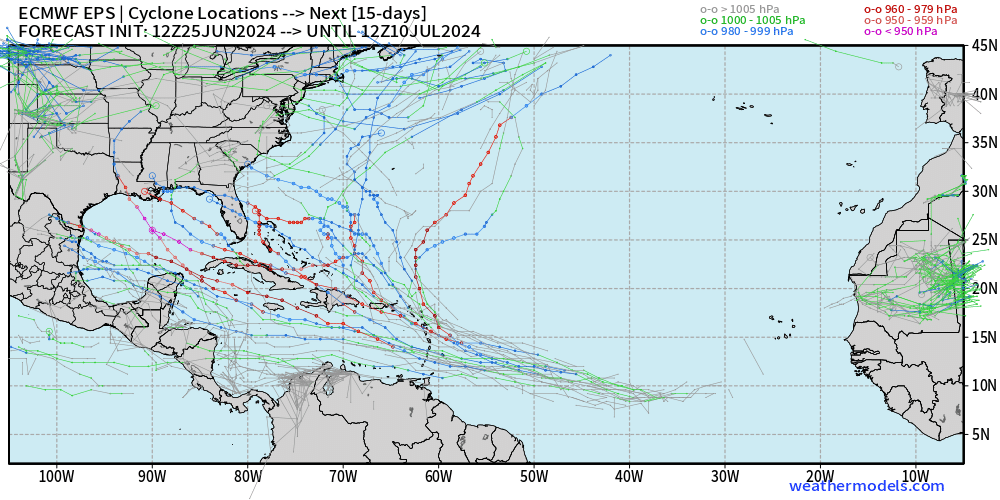
This can be tracked on the 00z ECMWF run (now the second run in a row showing development):

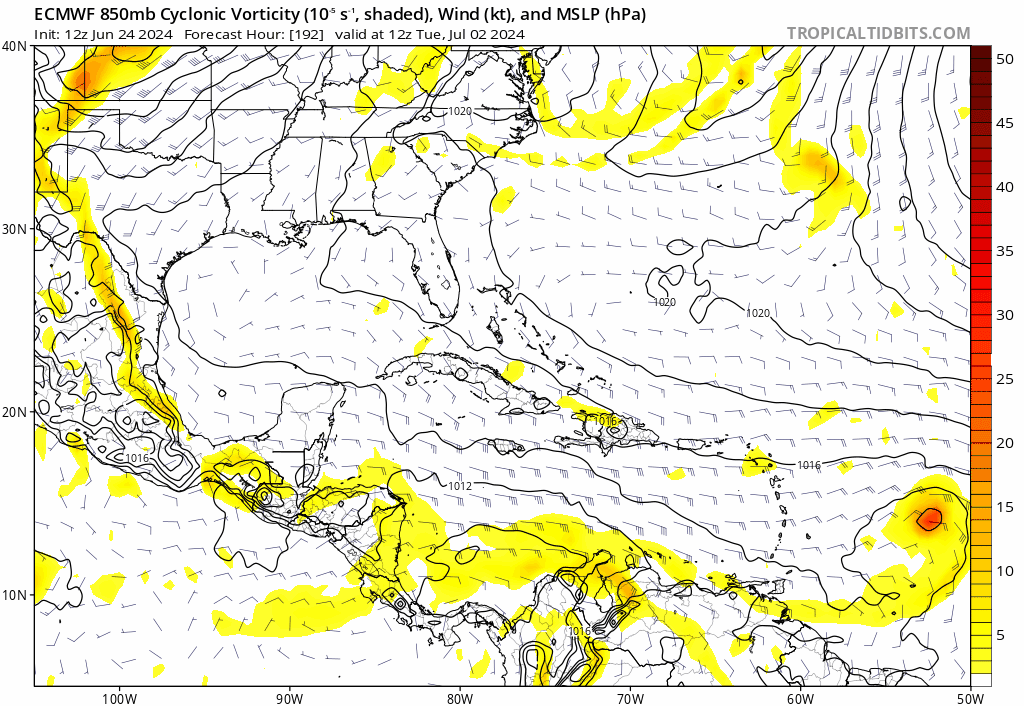
While the other global models have varying speeds with the tropical waves progression through the Atlantic, all are now showing development (GFS, ECMWF, CMC, and ICON):


 "
"