2014 EPAC Season

This is the general tropical discussion area. Anyone can take their shot at predicting a storms path.

Moderator: S2k Moderators

Forum rules

The posts in this forum are NOT official forecasts and should not be used as such. They are just the opinion of the poster and may or may not be backed by sound meteorological data. They are NOT endorsed by any professional institution or STORM2K. For official information, please refer to products from the National Hurricane Center and National Weather Service.

Help Support Storm2K
Message
Author
User avatar
Hurricane_Luis
Category 2
Category 2
Posts: 723
Age: 26
Joined: Sat Jun 23, 2012 3:14 pm
Location: Tiptree, Essex, United Kingdom
Contact:

Re: 2014 EPAC Season

#501 Postby Hurricane_Luis » Thu Jun 19, 2014 6:12 am

euro6208 wrote:GFS developing a tropical cyclone in the central pacific then crosses it over to the WPAC...


Image

There is a disturbance between 135W and 125W and another behind that crossing 110W.
0 likes   

hurricanes1234
Category 5
Category 5
Posts: 2904
Joined: Sat Jul 28, 2012 6:19 pm
Location: Trinidad and Tobago

#502 Postby hurricanes1234 » Thu Jun 19, 2014 7:46 am

In my opinion, that area could show up on the TWO if it maintains or improves its organisation. However, the latest run on the GFS isn't showing much from this, except a 1007 mbar low/depression.
0 likes   
PLEASE NOTE: With the exception of information from weather agencies that I may copy and paste here, my posts will NEVER be official, since I am NOT a meteorologist. They are solely my amateur opinion, and may or may not be accurate. Therefore, please DO NOT use them as official details, particularly when making important decisions. Thank you.

User avatar
NDG
S2K Supporter
S2K Supporter
Posts: 14947
Joined: Sun Jul 09, 2006 10:14 pm
Location: Orlando, FL

Re: 2014 EPAC Season

#503 Postby NDG » Thu Jun 19, 2014 8:52 am

:uarrow: There's not much model support and even the 1007mb forecasted low pressure is not much of a low pressure considering is in the deep tropics.
May have to wait until July for action to pick back up in the EPAC, too much sinking air motion in this part of the world right now.
0 likes   

User avatar
Yellow Evan
Professional-Met
Professional-Met
Posts: 15960
Age: 25
Joined: Fri Jul 15, 2011 12:48 pm
Location: Henderson, Nevada/Honolulu, HI
Contact:

Re: 2014 EPAC Season

#504 Postby Yellow Evan » Thu Jun 19, 2014 10:55 am

NDG wrote::uarrow: There's not much model support and even the 1007mb forecasted low pressure is not much of a low pressure considering is in the deep tropics.
May have to wait until July for action to pick back up in the EPAC, too much sinking air motion in this part of the world right now.


Is it an indication to MJO is coming back after vanished for six weeks? Granted I know it's not in the EPAC yet, but if that is case we know it will only be a matter of time before it gets there.
0 likes   

User avatar
NDG
S2K Supporter
S2K Supporter
Posts: 14947
Joined: Sun Jul 09, 2006 10:14 pm
Location: Orlando, FL

Re: 2014 EPAC Season

#505 Postby NDG » Thu Jun 19, 2014 4:26 pm

:uarrow: It has been weakening during the past few days but it could gain some strength as it enters the EPAC by early July, IMO, like it did back in late May. Don't pay attention to the UKMET, it is lost, lol.

Image
0 likes   

stormcruisin

#506 Postby stormcruisin » Thu Jun 19, 2014 10:47 pm

http://www.ssd.noaa.gov/goes/east/watl/flash-vis.html

Image

Looks to be puffin its chest up atm.
0 likes   

User avatar
Yellow Evan
Professional-Met
Professional-Met
Posts: 15960
Age: 25
Joined: Fri Jul 15, 2011 12:48 pm
Location: Henderson, Nevada/Honolulu, HI
Contact:

Re: 2014 EPAC Season

#507 Postby Yellow Evan » Fri Jun 20, 2014 10:49 am

Image

0z GFS was very aggressive with a system in the long range. 6z is less aggressive, but hey, we are seeing consistency. It's been in the rounds for 5 runs now. I will say that given it's northerly location, suggest a hurricane will be hard to come by for late June, but in July, SST's warm up a bit in time for its 1st peak. Still, given it is still early July, it may be difficult. However, given the MJO forecast, I think something around that time is still very possible.
0 likes   

CrazyC83
Professional-Met
Professional-Met
Posts: 33398
Joined: Tue Mar 07, 2006 11:57 pm
Location: Deep South, for the first time!

#508 Postby CrazyC83 » Fri Jun 20, 2014 11:04 am

I agree the MJO will be huge for the EPAC.

Why is it that the EPAC has spawned monsters this year (especially considering the time of year) so far yet the rest of the world is struggling?
0 likes   

User avatar
Yellow Evan
Professional-Met
Professional-Met
Posts: 15960
Age: 25
Joined: Fri Jul 15, 2011 12:48 pm
Location: Henderson, Nevada/Honolulu, HI
Contact:

Re:

#509 Postby Yellow Evan » Fri Jun 20, 2014 1:29 pm

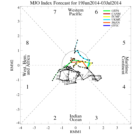
CrazyC83 wrote:I agree the MJO will be huge for the EPAC.

Why is it that the EPAC has spawned monsters this year (especially considering the time of year) so far yet the rest of the world is struggling?


El nino favors EPAC and it peaks sooner than everyone else.
0 likes   

User avatar
Hurricane_Luis
Category 2
Category 2
Posts: 723
Age: 26
Joined: Sat Jun 23, 2012 3:14 pm
Location: Tiptree, Essex, United Kingdom
Contact:

Re: 2014 EPAC Season

#510 Postby Hurricane_Luis » Fri Jun 20, 2014 2:49 pm

Invest 95E is up. Could see Douglas out of this one.
0 likes   

hurricanes1234
Category 5
Category 5
Posts: 2904
Joined: Sat Jul 28, 2012 6:19 pm
Location: Trinidad and Tobago

#511 Postby hurricanes1234 » Sat Jun 21, 2014 1:25 pm

Invest 95E could be soon succumbing to hostile conditions present in the open waters.

The GFS seems to be developing a sub 985 mbar system towards the end of the run. Thoughts on this, anyone?
0 likes   
PLEASE NOTE: With the exception of information from weather agencies that I may copy and paste here, my posts will NEVER be official, since I am NOT a meteorologist. They are solely my amateur opinion, and may or may not be accurate. Therefore, please DO NOT use them as official details, particularly when making important decisions. Thank you.

User avatar
Yellow Evan
Professional-Met
Professional-Met
Posts: 15960
Age: 25
Joined: Fri Jul 15, 2011 12:48 pm
Location: Henderson, Nevada/Honolulu, HI
Contact:

Re: 2014 EPAC Season

#512 Postby Yellow Evan » Sat Jun 21, 2014 2:19 pm

Image

GFS shows two systems.
0 likes   

hurricanes1234
Category 5
Category 5
Posts: 2904
Joined: Sat Jul 28, 2012 6:19 pm
Location: Trinidad and Tobago

#513 Postby hurricanes1234 » Sat Jun 21, 2014 9:53 pm

This is the furthest south I've seen waters at more than 28°C. Usually, below Panama, waters are much cooler than this, and show up reddish brown on this image, normally. But now, it's orange! :eek:

Image
0 likes   
PLEASE NOTE: With the exception of information from weather agencies that I may copy and paste here, my posts will NEVER be official, since I am NOT a meteorologist. They are solely my amateur opinion, and may or may not be accurate. Therefore, please DO NOT use them as official details, particularly when making important decisions. Thank you.

User avatar
Yellow Evan
Professional-Met
Professional-Met
Posts: 15960
Age: 25
Joined: Fri Jul 15, 2011 12:48 pm
Location: Henderson, Nevada/Honolulu, HI
Contact:

Re:

#514 Postby Yellow Evan » Sun Jun 22, 2014 12:07 am

hurricanes1234 wrote:This is the furthest south I've seen waters at more than 28°C. Usually, below Panama, waters are much cooler than this, and show up reddish brown on this image, normally. But now, it's orange! :eek:

Image


Did you recall seeing any cool SST's during 2006 and 2009 off the Panama coast. I don't, but my memory could be off :P
0 likes   

User avatar
Yellow Evan
Professional-Met
Professional-Met
Posts: 15960
Age: 25
Joined: Fri Jul 15, 2011 12:48 pm
Location: Henderson, Nevada/Honolulu, HI
Contact:

Re: 2014 EPAC Season

#515 Postby Yellow Evan » Sun Jun 22, 2014 12:23 am

Image

GFS develops this around 200 hours out.

Also shows something near the CPAc
0 likes   

hurricanes1234
Category 5
Category 5
Posts: 2904
Joined: Sat Jul 28, 2012 6:19 pm
Location: Trinidad and Tobago

#516 Postby hurricanes1234 » Mon Jun 23, 2014 12:53 pm

Something else to look out for other than 95E.

2. A low pressure area could form to the south of Mexico by late this
week, and some development of this system is possible thereafter
while it moves west-northwestward.
* Formation chance through 48 hours...low...near 0 percent.
* Formation chance through 5 days...low...20 percent.
0 likes   
PLEASE NOTE: With the exception of information from weather agencies that I may copy and paste here, my posts will NEVER be official, since I am NOT a meteorologist. They are solely my amateur opinion, and may or may not be accurate. Therefore, please DO NOT use them as official details, particularly when making important decisions. Thank you.

User avatar
Yellow Evan
Professional-Met
Professional-Met
Posts: 15960
Age: 25
Joined: Fri Jul 15, 2011 12:48 pm
Location: Henderson, Nevada/Honolulu, HI
Contact:

Re: 2014 EPAC Season

#517 Postby Yellow Evan » Mon Jun 23, 2014 1:04 pm

Image

This is the one on the TWO. Needs to be watched closely IMO. GFS brings it onshore as a strengthening TS near Colima.

Image

System #2. Now shows a Kiko 13 like track.
0 likes   

User avatar
Yellow Evan
Professional-Met
Professional-Met
Posts: 15960
Age: 25
Joined: Fri Jul 15, 2011 12:48 pm
Location: Henderson, Nevada/Honolulu, HI
Contact:

Re: 2014 EPAC Season

#518 Postby Yellow Evan » Mon Jun 23, 2014 1:39 pm

Image

CMC brings this close to the coast, like a Dora 05.

Image

CMC hints at two more systems within 10 days
0 likes   

User avatar
Yellow Evan
Professional-Met
Professional-Met
Posts: 15960
Age: 25
Joined: Fri Jul 15, 2011 12:48 pm
Location: Henderson, Nevada/Honolulu, HI
Contact:

Re: 2014 EPAC Season

#519 Postby Yellow Evan » Mon Jun 23, 2014 4:50 pm

Image

HWRF shows this, but further west.
0 likes   

User avatar
Kingarabian
S2K Supporter
S2K Supporter
Posts: 15461
Joined: Sat Aug 08, 2009 3:06 am
Location: Honolulu, Hawaii

Re: 2014 EPAC Season

#520 Postby Kingarabian » Mon Jun 23, 2014 5:57 pm

Yellow Evan wrote:[img][/img]

HWRF shows this, but further west.


Would like to see the HWRF verify true once again. This model has done pretty well so far. 5 more days until development...
0 likes   
RIP Kobe Bryant


Return to “Talkin' Tropics”

Who is online

Users browsing this forum: Brent, cainjamin, Cutt, duilaslol, Emmett_Brown, Google Adsense [Bot], HurakaYoshi, KirbyDude25, LarryWx, TheAustinMan, Tx_Summer, Wampadawg and 103 guests