

Shell Mound wrote:LarryWx wrote:12Z EPS day 10: further E vs 0Z EPS though S of operational
https://i.imgur.com/SONQxsd.png
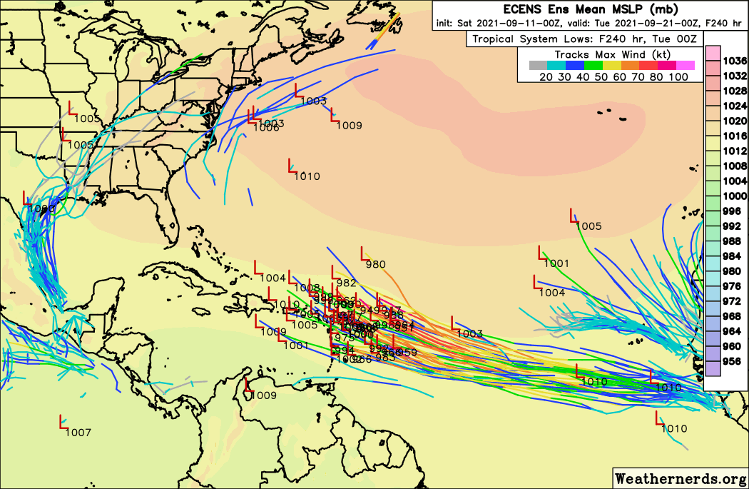
The bears aren’t eating crow this time.At this point this will likely be a westerly version of Larry, but not so far west as to impact the Caribbean/CONUS.
In late Aug, I had said that the SE US was safe from Larry from the start and felt the first half of Sept was looking good for the SE. The second half is up in the air imo for the entire E coast and that includes with regard to the MDR and thus this system along others. In the satellite era, the CONUS has been hit on 9/20+ by a storm forming E of 50W in the MDR on average once every 11 years. It has been 19 years since the last one.


 .
.


