For those who have not seen the RECON plan for tomorrow:
ATLANTIC REQUIREMENTS
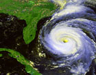
1. FLIGHT ONE AREA OFF SOUTH CAROLINA
A. 09/1200Z
B. AFXXX 01AAA INVEST
C. 09/0930Z
D. 31.8N 79.4W
E. 09/1100Z-09/1800Z
F. SFC TO 10,000FT
http://www.nhc.noaa.gov/text/MIAREPRPD.shtml?
SUBTROPICAL STORM ANDREA, Analysis, Sat Pics, Models Thread
Moderator: S2k Moderators
Forum rules

The posts in this forum are NOT official forecasts and should not be used as such. They are just the opinion of the poster and may or may not be backed by sound meteorological data. They are NOT endorsed by any professional institution or STORM2K. For official information, please refer to products from the National Hurricane Center and National Weather Service.
-
HURAKAN

- Professional-Met

- Posts: 46086
- Age: 38
- Joined: Thu May 20, 2004 4:34 pm
- Location: Key West, FL
- Contact:
TROPICAL WEATHER DISCUSSION
NWS TPC/NATIONAL HURRICANE CENTER MIAMI FL
205 PM EDT TUE MAY 08 2007
...SPECIAL FEATURE...
A NON-TROPICAL LOW PRESSURE SYSTEM...CENTERED NEAR 30.5N77W...OR
ABOUT 230 MILES EAST-SOUTHEAST OF THE GEORGIA AND SOUTH CAROLINA
COASTS...HAS BEEN MOVING SLOWLY WESTWARD AT 5 TO 10 MPH. THIS
SYSTEM IS PRODUCING GALE-FORCE WINDS AND HEAVY SURF ALONG THE
COASTS OF NORTH CAROLINA...SOUTH CAROLINA...AND GEORGIA...WITH
STRONGER WINDS OFFSHORE. THE 12Z QUIKSCAT PASS SHOWED 35-40 KT
WINDS OFF THE SOUTHEAST COAST. THESE WINDS ARE CONTINUING TO
PRODUCE A SIGNIFICANT SWELL EVENT FOR THE SOUTHEAST U.S. COAST
AND THE BAHAMAS. BUOY 41010 CONTINUES TO REPORT SEAS NEAR 20 FT.
ASSOCIATED SHOWER ACTIVITY HAS INCREASED SINCE YESTERDAY...BUT
NO SIGNIFICANT STRENGTHENING OF THIS SYSTEM IS EXPECTED. THE LOW
IS BEING MONITORED FOR SIGNS OF TROPICAL OR SUBTROPICAL CYCLONE
DEVELOPMENT...AND AN AIR FORCE RESERVE RECONNAISSANCE AIRCRAFT
WILL BE AVAILABLE TO INVESTIGATE THE SYSTEM TOMORROW
MORNING...IF NECESSARY. PLEASE REFER TO THE HIGH SEAS FORECAST
AND STATEMENTS FROM LOCAL WEATHER SERVICE OFFICES FOR MORE
DETAILS.
http://www.nhc.noaa.gov/text/refresh/MI ... 1714.shtml?
0 likes
-
cycloneye

- Admin

- Posts: 148755
- Age: 69
- Joined: Thu Oct 10, 2002 10:54 am
- Location: San Juan, Puerto Rico
skysummit wrote:12z Tropical Guidance....

Is there a text of the model run? The link to the texts doesn't work for me.
0 likes
Visit the Caribbean-Central America Weather Thread where you can find at first post web cams,radars
and observations from Caribbean basin members Click Here
and observations from Caribbean basin members Click Here
-
skysummit

- S2K Supporter

- Posts: 5305
- Age: 50
- Joined: Tue Aug 31, 2004 11:09 pm
- Location: Ponchatoula, LA
- Contact:
cycloneye wrote:skysummit wrote:12z Tropical Guidance....
Is there a text of the model run? The link to the texts doesn't work for me.
I didn't see one yet. I got that off the NHC's ftp site. Here's the GFDL:
ATTENTION...NATIONAL HURRICANE CENTER
NCEP COUPLED GFDL HURRICANE MODEL FORECAST MADE FOR
TROPICAL STORM INVEST 90L
INITIAL TIME 12Z MAY 8
DISCLAIMER ... THIS INFORMATION IS PROVIDED AS GUIDANCE. IT
REQUIRES INTERPRETATION BY HURRICANE SPECIALISTS AND SHOULD
NOT BE CONSIDERED AS A FINAL PRODUCT. PLEASE SEE THE TPC/NHC
OFFICIAL FORECAST.
FORECAST STORM POSITION
HOUR LATITUDE LONGITUDE HEADING/SPEED(KT)
0 30.3 77.3 255./ 9.9
6 30.3 77.8 280./ 4.0
12 30.4 78.1 286./ 3.1
18 31.1 78.6 320./ 7.8
24 31.6 79.5 302./ 8.9
30 31.9 80.2 293./ 7.2
36 32.0 81.0 274./ 6.4
42 31.7 81.6 249./ 6.1
48 31.7 81.7 240./ .7
54 31.8 82.3 277./ 5.0
60 31.4 83.0 243./ 6.6
66 31.0 83.5 230./ 6.1
72 30.5 83.5 186./ 4.7
78 30.5 83.2 84./ 2.3
84 30.6 83.5 278./ 1.9
90 30.5 84.1 261./ 5.3
96 30.4 84.3 247./ 2.3
102 30.5 84.3 340./ 1.1
108 30.5 84.6 282./ 2.1
114 30.6 84.8 281./ 1.4
120 30.7 84.7 4./ 1.5
126 31.0 84.9 330./ 3.7
0 likes
-
Evil Jeremy

- S2K Supporter
- Posts: 5463
- Age: 32
- Joined: Mon Apr 10, 2006 2:10 pm
- Location: Los Angeles, CA
-
cycloneye
- Admin
- Posts: 148755
- Age: 69
- Joined: Thu Oct 10, 2002 10:54 am
- Location: San Juan, Puerto Rico
Ok skysummit,it now works as they released the GFDL text. 
For those who dont have the link to the texts of the models here it is:
Text of model runs
For those who dont have the link to the texts of the models here it is:
Text of model runs
0 likes
Visit the Caribbean-Central America Weather Thread where you can find at first post web cams,radars
and observations from Caribbean basin members Click Here
and observations from Caribbean basin members Click Here


-
Stratusxpeye

- Category 2

- Posts: 686
- Joined: Tue Jun 07, 2005 10:40 am
- Location: Tampa, Florida
- Contact:
So by these main page on the weather channel is this now a subtropical storm? Meaning that it would be named soon? Maybe after recon goes in if it doesnt die before than. http://www.weather.com/newscenter/tropi ... enter_news
0 likes
-
HURAKAN
- Professional-Met
- Posts: 46086
- Age: 38
- Joined: Thu May 20, 2004 4:34 pm
- Location: Key West, FL
- Contact:
Stratusxpeye wrote:So by these main page on the weather channel is this now a subtropical storm? Meaning that it would be named soon? Maybe after recon goes in if it doesnt die before than. http://www.weather.com/newscenter/tropi ... enter_news
TWC is going at full force with this system.
"During the overnight hours of Monday into Tuesday, the extratropical low evolved into a subtropical storm. A subtropical storm has a few characteristics of both an extratropical low and a tropical cyclone. First, it has convection, or thunderstorm activity, around a well-defined center of circulation. Second, it has become detached from its associated fronts (cold, warm, occluded). Finally, it has sustained gale/tropical storm force winds."
0 likes


-
Evil Jeremy
- S2K Supporter
- Posts: 5463
- Age: 32
- Joined: Mon Apr 10, 2006 2:10 pm
- Location: Los Angeles, CA


Interesting article from our local news here in Orlando regarding the storm.
http://www.local6.com/weather/13278106/detail.html
Debbie
http://www.local6.com/weather/13278106/detail.html
Debbie
0 likes
-
Evil Jeremy
- S2K Supporter
- Posts: 5463
- Age: 32
- Joined: Mon Apr 10, 2006 2:10 pm
- Location: Los Angeles, CA
-
seaswing

- S2K Supporter
- Posts: 561
- Joined: Sun Aug 31, 2003 11:56 am
- Location: High Springs, FL/just NW of Gainesville
oh but guys, we need this rain so desparately! seriously, I have friends that are under mandatory evacuation for wildfires right now. It is so smoky in Gainesville right now that people are using their headlights. I really hope this thing doesn't loop back out to sea.... if we don't get some rain, our area is going to be devastated. Not to mention the air quality makes it hard to breathe.....
0 likes
Who is online
Users browsing this forum: Ulf and 60 guests