2018 Indicators: SST's / MSLP / Sal / Steering / Shear / Instability (Graphic updates at first post)

This is the general tropical discussion area. Anyone can take their shot at predicting a storms path.

Moderator: S2k Moderators

Forum rules

The posts in this forum are NOT official forecasts and should not be used as such. They are just the opinion of the poster and may or may not be backed by sound meteorological data. They are NOT endorsed by any professional institution or STORM2K. For official information, please refer to products from the National Hurricane Center and National Weather Service.

Help Support Storm2K
Message
Author
User avatar
NDG
S2K Supporter
S2K Supporter
Posts: 14942
Joined: Sun Jul 09, 2006 10:14 pm
Location: Orlando, FL

Re: 2018 Indicators: SST's / MSLP / Sal / Steering / Shear / Instability (Graphic updates at first post)

#701 Postby NDG » Thu Jul 26, 2018 1:53 pm

chaser1 wrote:
stormlover2013 wrote:https://www.wunderground.com/cat6/High-Octane-Hurricane-Fuel-Gulf-Mexico-2-Loop-Current-Eddies


Not sure if others are having similar difficulties but this link keeps coming back as a "dead link".


Here's what the article says:


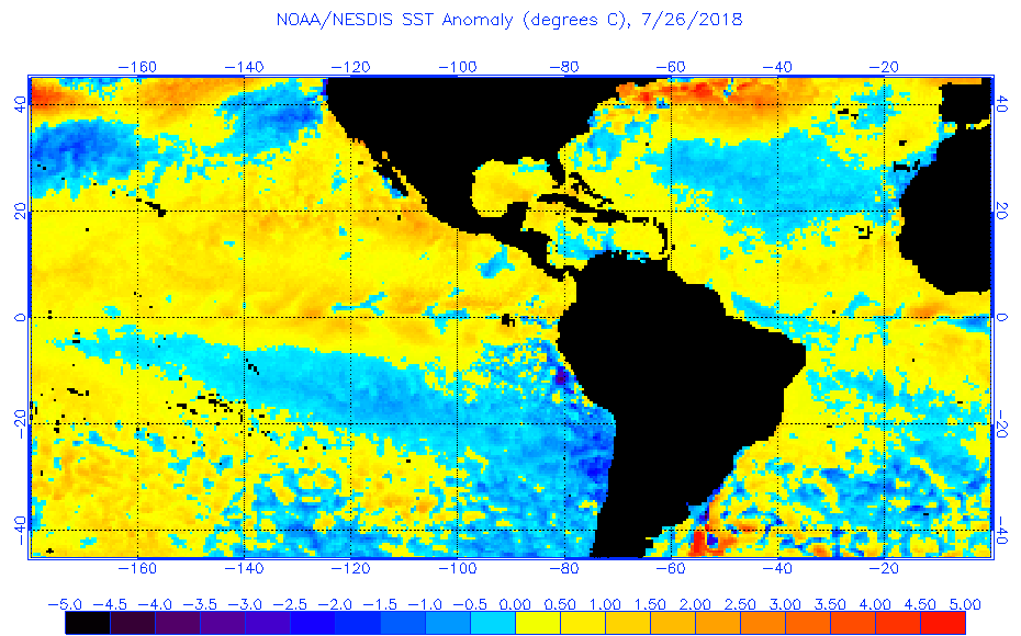
There’s potential trouble cooking in the Gulf of Mexico for the coming peak portion of the Atlantic hurricane season: a near-record amount of heat energy in the ocean waters. Sea surface temperatures (SSTs) are near average, 29° – 30° C (84° – 86° F) in the eastern Gulf, where persistent cloud cover and windy conditions in recent days have acted to keep SSTs from warming to above-average levels. However, SSTs are 30° – 31°C (86° - 88°F) in the central and western Gulf, more than 1°C (1.8°F) above average. That’s a lot of heat in the waters for potential hurricanes to feast on.
But SSTs don’t tell the whole story. When a slow-moving hurricane traverses a shallow area of warm ocean waters, the hurricane’s powerful winds will churn up cold waters from the depths, cooling the surface and putting the brakes on any rapid intensification the hurricane may have had in mind. But when unusually warm ocean waters extend to great depth—down 100 meters or more below the surface—the hurricane’s churning winds simply stir up more warm water, allowing dangerous rapid intensification to occur if wind shear is low. Last year’s trio of great hurricanes—Harvey, Irma, and Maria—all underwent rapid intensification into major hurricanes when they were located over waters with above-average SSTs, where the warm waters extended to great depth. Thus, total Ocean Heat Content (OHC) is a key metric used to determine the potential for hurricane rapid intensification
Meet the Loop Current
In the Gulf of Mexico, the deepest warm water is found in the Loop Current--an ocean current that transports warm Caribbean water through the Yucatan Channel between Cuba and Mexico. The current flows northward into the Gulf of Mexico, then loops southeastward just south of the Florida Keys (where it is called the Florida Current), and then goes just west of the westernmost Bahamas. Here, the waters of the Loop Current flow northward along the U.S. coast and become the Gulf Stream. With current speeds of about 1.8 mph (0.8 m/s), the Loop Current is one of the fastest currents in the Atlantic Ocean. The current is about 200 - 300 km (125 - 190 miles) wide, and 800 meters (2600 feet) deep, and is present in the Gulf of Mexico about 95% of the time. During summer and fall, the Loop Current provides a deep (80 - 150 meter) layer of very warm water that can provide a huge energy source for any hurricanes aspiring to become rapidly intensifying major hurricanes.

The Loop Current commonly bulges out in the northern Gulf of Mexico and sometimes will shed a clockwise rotating ring of warm water that separates from the main current (Figure 2). This ring of warm water slowly drifts west-southwestward towards Texas or Mexico at about 2 – 3 miles per day. This feature is called a "Loop Current ring", "Loop Current eddy", or "warm core ring", and can provide a key source of energy to fuel rapid intensification of hurricanes that cross the Gulf (in addition to the Loop Current itself). The Loop Current pulsates in a quasi-regular fashion and sheds rings every 6 to 11 months. When a Loop Current eddy breaks off in the Gulf of Mexico at the height of hurricane season, it can lead to a dangerous situation where a vast reservoir of energy is available to any hurricane that might cross over. This occurred in 2005, when a Loop Current eddy separated in July, just before Hurricane Katrina passed over and "bombed" into a Category 5 hurricane. The eddy remained in the Gulf and slowly drifted westward during September. Hurricane Rita passed over the same Loop Current eddy three weeks after Katrina, and also explosively deepened to a Category 5 storm.

Even when a Loop Current eddy has been separated from the Loop Current for more than a year, it can still provide a potent source of heat energy for a hurricane. Hurricane Harvey of 2017 was fueled by an old Loop Current eddy that had migrated to the coast of Texas, a full 16 months after it had broken off from the Loop Current. This heat energy contributed to Hurricane Harvey’s record rains. A 2018 paper by Kevin Trenberth of the National Center for Atmospheric Research, Hurricane Harvey Links to Ocean Heat Content and Climate Change Adaptation concluded: “The bottom line is that the total observed OHC change is remarkably compatible with the total energy released by precipitation and, unsurprisingly, reflects strong energy exchanges during the hurricane. Accordingly, the record high OHC values not only increased the latent heat which fueled the storm itself, likely increasing its size and intensity, but also likely contributed substantially to the flooding caused by rainfall on land. The implication is that if the OHC had been less, then the rainfall amounts would also have been less.
Two Loop Current eddies in the Gulf for the 2018 hurricane season
A large warm eddy broke off of the Loop Current in February 2018, and has drifted slowly west-southwest during the year, arriving in late July to a position about 300 miles east of the Texas/Mexico and border and 400 miles south of western Louisiana (Figure 3). As if that weren’t enough, we had a new and larger warm eddy break off from the Loop Current in late June. That eddy is located a few hundred miles west of the southwest coast of Florida. Both of these eddies are capable of supplying major heat energy to tropical cyclones that might get loose in the Gulf. The total amount of heat energy in the Gulf right now is at near-record levels for this time of year—similar to last year’s levels, and far higher than what was observed during the nasty Hurricane Season of 2005.


Image
Image
4 likes   

User avatar
NotSparta
Professional-Met
Professional-Met
Posts: 1660
Age: 22
Joined: Fri Aug 18, 2017 8:24 am
Location: Naples, FL
Contact:

Re: 2018 Indicators: SST's / MSLP / Sal / Steering / Shear / Instability (Graphic updates at first post)

#702 Postby NotSparta » Thu Jul 26, 2018 2:15 pm

NDG wrote:
chaser1 wrote:
stormlover2013 wrote:https://www.wunderground.com/cat6/High-Octane-Hurricane-Fuel-Gulf-Mexico-2-Loop-Current-Eddies


Not sure if others are having similar difficulties but this link keeps coming back as a "dead link".


Here's what the article says:


-snip-

Both of these eddies are capable of supplying major heat energy to tropical cyclones that might get loose in the Gulf. The total amount of heat energy in the Gulf right now is at near-record levels for this time of year—similar to last year’s levels, and far higher than what was observed during the nasty Hurricane Season of 2005.


[img]https://i.imgur.com/mtGHXVx.png[/mg]
[img]https://i.imgur.com/K8nNiAL.jpg[/mg]


Wasn't it the record warm MDR w/ lower than avg MSLPs there that really made the season? The GoM was very warm last yr as it said yet there were much fewer TCs there than 2005
0 likes   
This post was probably an opinion of mine, and in no way is official. Please refer to http://www.hurricanes.gov for official tropical analysis and advisories.

My website, with lots of tropical wx graphics, including satellite and recon: http://cyclonicwx.com

Alyono
Professional-Met
Professional-Met
Posts: 6961
Joined: Fri Apr 26, 2013 3:52 pm
Location: Texas Coast

Re: 2018 Indicators: SST's / MSLP / Sal / Steering / Shear / Instability (Graphic updates at first post)

#703 Postby Alyono » Thu Jul 26, 2018 2:20 pm

NotSparta wrote:
NDG wrote:
chaser1 wrote:
Not sure if others are having similar difficulties but this link keeps coming back as a "dead link".


Here's what the article says:


-snip-

Both of these eddies are capable of supplying major heat energy to tropical cyclones that might get loose in the Gulf. The total amount of heat energy in the Gulf right now is at near-record levels for this time of year—similar to last year’s levels, and far higher than what was observed during the nasty Hurricane Season of 2005.


[img]https://i.imgur.com/mtGHXVx.png[/mg]
[img]https://i.imgur.com/K8nNiAL.jpg[/mg]


Wasn't it the record warm MDR w/ lower than avg MSLPs there that really made the season? The GoM was very warm last yr as it said yet there were much fewer TCs there than 2005


There were 5 hurricanes in the Gulf last year, with 2 other tropical storms

Franklin, Harvey, Irma, Katia, Nate

2005 had 7 canes and 11 named storms
1 likes   

txwatcher91
Category 5
Category 5
Posts: 1498
Joined: Tue Aug 02, 2005 2:29 pm

Re: 2018 Indicators: SST's / MSLP / Sal / Steering / Shear / Instability (Graphic updates at first post)

#704 Postby txwatcher91 » Thu Jul 26, 2018 2:23 pm

gatorcane wrote:Today's SST anomaly maps shows a swath of above normal SSTs from Africa through the deep MDR all the way through the Lesser Antilles and to the Bahamas/Florida with a cooler than normal subtropical Atlantic and much above normal northern Atlantic. This configuration is more conducive for Cape Verde activity than what we were seeing months ago.

Also NW Caribbean and southern GOM are much above normal now compared to months ago:

Image


This is strange. The map from Tropical Tidbits is showing a much different MDR anomaly, instead of above normal it shows well below normal. Any ideas why and which is right?
Image
0 likes   

User avatar
Kingarabian
S2K Supporter
S2K Supporter
Posts: 15461
Joined: Sat Aug 08, 2009 3:06 am
Location: Honolulu, Hawaii

Re: 2018 Indicators: SST's / MSLP / Sal / Steering / Shear / Instability (Graphic updates at first post)

#705 Postby Kingarabian » Thu Jul 26, 2018 2:33 pm

txwatcher91 wrote:
gatorcane wrote:Today's SST anomaly maps shows a swath of above normal SSTs from Africa through the deep MDR all the way through the Lesser Antilles and to the Bahamas/Florida with a cooler than normal subtropical Atlantic and much above normal northern Atlantic. This configuration is more conducive for Cape Verde activity than what we were seeing months ago.

Also NW Caribbean and southern GOM are much above normal now compared to months ago:

[img]https://s22.postimg.cc/9ywrp7z01/anomw.7.26.2018.gif[img]


This is strange. The map from Tropical Tidbits is showing a much different MDR anomaly, instead of above normal it shows well below normal. Any ideas why and which is right?
[img]https://www.tropicaltidbits.com/analysis/ocean/cdas-sflux_ssta_atl_1.png[img]


They're both iffy. The graphic provided by NESDIS has some climo issues, and the bottom one uses satellite data that can have bad data.
1 likes   
RIP Kobe Bryant

User avatar
CyclonicFury
Category 5
Category 5
Posts: 1977
Age: 25
Joined: Sun Jul 02, 2017 12:32 pm
Location: NC
Contact:

Re: 2018 Indicators: SST's / MSLP / Sal / Steering / Shear / Instability (Graphic updates at first post)

#706 Postby CyclonicFury » Thu Jul 26, 2018 2:34 pm

txwatcher91 wrote:
gatorcane wrote:Today's SST anomaly maps shows a swath of above normal SSTs from Africa through the deep MDR all the way through the Lesser Antilles and to the Bahamas/Florida with a cooler than normal subtropical Atlantic and much above normal northern Atlantic. This configuration is more conducive for Cape Verde activity than what we were seeing months ago.

Also NW Caribbean and southern GOM are much above normal now compared to months ago:

https://s22.postimg.cc/9ywrp7z01/anomw.7.26.2018.gif


This is strange. The map from Tropical Tidbits is showing a much different MDR anomaly, instead of above normal it shows well below normal. Any ideas why and which is right?
https://www.tropicaltidbits.com/analysi ... _atl_1.png

Most likely in between the two. The NOAA/NESDIS SST anomaly has a warm bias in the MDR because its base climatology is during a -AMO phase. The CDAS is prone to quick changes and is likely too cool due to SAL.
2 likes   
NCSU B.S. in Meteorology Class of 2021. Tropical weather blogger at http://www.cyclonicfury.com. My forecasts and thoughts are NOT official, for official forecasts please consult the National Hurricane Center.

User avatar
NDG
S2K Supporter
S2K Supporter
Posts: 14942
Joined: Sun Jul 09, 2006 10:14 pm
Location: Orlando, FL

Re: 2018 Indicators: SST's / MSLP / Sal / Steering / Shear / Instability (Graphic updates at first post)

#707 Postby NDG » Thu Jul 26, 2018 2:34 pm

txwatcher91 wrote:
gatorcane wrote:Today's SST anomaly maps shows a swath of above normal SSTs from Africa through the deep MDR all the way through the Lesser Antilles and to the Bahamas/Florida with a cooler than normal subtropical Atlantic and much above normal northern Atlantic. This configuration is more conducive for Cape Verde activity than what we were seeing months ago.

Also NW Caribbean and southern GOM are much above normal now compared to months ago:

https://s22.postimg.cc/9ywrp7z01/anomw.7.26.2018.gif


This is strange. The map from Tropical Tidbits is showing a much different MDR anomaly, instead of above normal it shows well below normal. Any ideas why and which is right?
https://www.tropicaltidbits.com/analysi ... _atl_1.png


This has talked about the before, the difference is because NOAA/NESDIS uses a much shorter span of years as their average (lower averaged SSTs) to compare to while the CDAS uses a larger span of years which gives them a different average (higher averaged SSTs) to compare to current SSTs.

Plus, CDAS measurents are done daily which can change really quickly while NESDIS uses the average over a number of days which does not change as quickly as daily numbers.
2 likes   

User avatar
NDG
S2K Supporter
S2K Supporter
Posts: 14942
Joined: Sun Jul 09, 2006 10:14 pm
Location: Orlando, FL

Re: 2018 Indicators: SST's / MSLP / Sal / Steering / Shear / Instability (Graphic updates at first post)

#708 Postby NDG » Thu Jul 26, 2018 2:39 pm

NotSparta wrote:
NDG wrote:
chaser1 wrote:
Not sure if others are having similar difficulties but this link keeps coming back as a "dead link".


Here's what the article says:


-snip-

Both of these eddies are capable of supplying major heat energy to tropical cyclones that might get loose in the Gulf. The total amount of heat energy in the Gulf right now is at near-record levels for this time of year—similar to last year’s levels, and far higher than what was observed during the nasty Hurricane Season of 2005.


[img]https://i.imgur.com/mtGHXVx.png[/mg]
[img]https://i.imgur.com/K8nNiAL.jpg[/mg]


Wasn't it the record warm MDR w/ lower than avg MSLPs there that really made the season? The GoM was very warm last yr as it said yet there were much fewer TCs there than 2005


In 2005 the majority of the MDR storms tracked towards the GOM is the big difference compared to last year, IMO.

Edit: the weird thing is that eventhough 2005's MDR was as warm if not warmer than 2017 there were no major hurricanes in the MDR east of the Lesser Antilles.
0 likes   

User avatar
Ian2401
Category 1
Category 1
Posts: 281
Joined: Thu Sep 14, 2017 5:55 pm
Location: Tallahassee, Florida
Contact:

Re: 2018 Indicators: SST's / MSLP / Sal / Steering / Shear / Instability (Graphic updates at first post)

#709 Postby Ian2401 » Thu Jul 26, 2018 3:41 pm

One interesting tidbit I would like to bring up is the current ENSO conditions compared to last years.

Here is the current SSTAs over the central pacific:
Image

Compare that to last year at the same time:
Image

The temperature profiles seem very similar, if not even a little cooler on average this year compared to last. At this point I just cannot see any kind of significant El Niño developing to affect the Atlantic hurricane season.
2 likes   
FSU '24 student pursuing a degree in meteorology. Consult NHC for official information.

User avatar
Kingarabian
S2K Supporter
S2K Supporter
Posts: 15461
Joined: Sat Aug 08, 2009 3:06 am
Location: Honolulu, Hawaii

Re: 2018 Indicators: SST's / MSLP / Sal / Steering / Shear / Instability (Graphic updates at first post)

#710 Postby Kingarabian » Thu Jul 26, 2018 3:45 pm

:uarrow:

Image
2 likes   
RIP Kobe Bryant

User avatar
NotSparta
Professional-Met
Professional-Met
Posts: 1660
Age: 22
Joined: Fri Aug 18, 2017 8:24 am
Location: Naples, FL
Contact:

Re: 2018 Indicators: SST's / MSLP / Sal / Steering / Shear / Instability (Graphic updates at first post)

#711 Postby NotSparta » Thu Jul 26, 2018 4:42 pm

Ian2401 wrote:One interesting tidbit I would like to bring up is the current ENSO conditions compared to last years.

Here is the current SSTAs over the central pacific:
[img]https://i.imgur.com/rPGR2k9.png[img]

Compare that to last year at the same time:
[img]https://i.imgur.com/A66ygV9.png[/mg]

The temperature profiles seem very similar, if not even a little cooler on average this year compared to last. At this point I just cannot see any kind of significant El Niño developing to affect the Atlantic hurricane season.


subsfc is much warmer, and La Niña bgd state is gone
1 likes   
This post was probably an opinion of mine, and in no way is official. Please refer to http://www.hurricanes.gov for official tropical analysis and advisories.

My website, with lots of tropical wx graphics, including satellite and recon: http://cyclonicwx.com

User avatar
Yellow Evan
Professional-Met
Professional-Met
Posts: 15960
Age: 25
Joined: Fri Jul 15, 2011 12:48 pm
Location: Henderson, Nevada/Honolulu, HI
Contact:

Re: 2018 Indicators: SST's / MSLP / Sal / Steering / Shear / Instability (Graphic updates at first post)

#712 Postby Yellow Evan » Thu Jul 26, 2018 5:25 pm

0 likes   

User avatar
Kingarabian
S2K Supporter
S2K Supporter
Posts: 15461
Joined: Sat Aug 08, 2009 3:06 am
Location: Honolulu, Hawaii

Re: 2018 Indicators: SST's / MSLP / Sal / Steering / Shear / Instability (Graphic updates at first post)

#713 Postby Kingarabian » Thu Jul 26, 2018 5:37 pm

Yellow Evan wrote:That's because CDAS is screwed up...

[tweet]https://twitter.com/philklotzbach/status/1022596268672016384[tweet]


Image

Looks like it's correcting back up now. I think it should level off at its most recent stable level which would be between -0.4C/-0.5C.
0 likes   
RIP Kobe Bryant

User avatar
NDG
S2K Supporter
S2K Supporter
Posts: 14942
Joined: Sun Jul 09, 2006 10:14 pm
Location: Orlando, FL

Re: 2018 Indicators: SST's / MSLP / Sal / Steering / Shear / Instability (Graphic updates at first post)

#714 Postby NDG » Thu Jul 26, 2018 11:08 pm

See the difference? A good 1C difference in many spots.

Image
Image
3 likes   

User avatar
SFLcane
S2K Supporter
S2K Supporter
Posts: 9626
Age: 46
Joined: Sat Jun 05, 2010 1:44 pm
Location: Lake Worth Florida

Re: 2018 Indicators: SST's / MSLP / Sal / Steering / Shear / Instability (Graphic updates at first post)

#715 Postby SFLcane » Fri Jul 27, 2018 7:50 am

0 likes   

User avatar
Kazmit
Category 5
Category 5
Posts: 1915
Age: 21
Joined: Mon Jul 25, 2016 8:49 am
Location: Williamsburg VA for college, Bermuda otherwise

Re: 2018 Indicators: SST's / MSLP / Sal / Steering / Shear / Instability (Graphic updates at first post)

#716 Postby Kazmit » Fri Jul 27, 2018 10:07 am

The SSTs in the subtropics have really taken a hit. They were well above normal a month ago.
0 likes   
Igor 2010, Sandy 2012, Fay 2014, Gonzalo 2014, Joaquin 2015, Nicole 2016, Humberto 2019

I am only a tropical weather enthusiast. My predictions are not official and may or may not be backed by sound meteorological data. For official information, please refer to the NHC and NWS products.

User avatar
Hammy
Category 5
Category 5
Posts: 5594
Age: 40
Joined: Fri May 25, 2012 5:25 pm
Contact:

Re: 2018 Indicators: SST's / MSLP / Sal / Steering / Shear / Instability (Graphic updates at first post)

#717 Postby Hammy » Fri Jul 27, 2018 1:53 pm

I'm thinking at this point we won't see anything else form until close to the third week of August. There's been nothing in the models, and the CFS, which has been consistently showing an average to active season from late August through October, has likewise shown virtually nothing prior to about the 18th.
0 likes   
The above post is not official and should not be used as such. It is the opinion of the poster and may or may not be backed by sound meteorological data. It is not endorsed by any professional institution or storm2k.org. For official information, please refer to the NHC and NWS products.

User avatar
galaxy401
Category 5
Category 5
Posts: 2300
Age: 29
Joined: Sat Aug 25, 2012 9:04 pm
Location: Casa Grande, Arizona

Re: 2018 Indicators: SST's / MSLP / Sal / Steering / Shear / Instability (Graphic updates at first post)

#718 Postby galaxy401 » Fri Jul 27, 2018 2:17 pm

That may be possible but the models did not do a good job in predicting Beryl and Chris's formation. Most of us thought nothing would form in July so we'll see if there are any disturbances possible in the next two weeks.
2 likes   
Got my eyes on moving right into Hurricane Alley: Florida.

User avatar
MetroMike
Category 3
Category 3
Posts: 834
Joined: Sun Aug 29, 2004 8:13 pm
Location: Tampa Bay
Contact:

Re: 2018 Indicators: SST's / MSLP / Sal / Steering / Shear / Instability (Graphic updates at first post)

#719 Postby MetroMike » Fri Jul 27, 2018 2:36 pm

Kazmit wrote:The SSTs in the subtropics have really taken a hit. They were well above normal a month ago.


That depends on what maps you look at. The MDR is what I look at, and right now the SST are normal to slightly above and trending up.
0 likes   

HURRICANELONNY
Category 5
Category 5
Posts: 1381
Joined: Wed May 07, 2003 6:48 am
Location: HOLLYWOOD.FL

Re: 2018 Indicators: SST's / MSLP / Sal / Steering / Shear / Instability (Graphic updates at first post)

#720 Postby HURRICANELONNY » Fri Jul 27, 2018 3:15 pm

I heard on the radio the the SST in Atlantic are at record lows. I didnt think that was the case but I guess so. :eek:
0 likes   
hurricanelonny


Return to “Talkin' Tropics”

Who is online

Users browsing this forum: BobHarlem, cainjamin, Cpv17, Craters, duilaslol, FLCrackerGirl, Texoz, Wampadawg and 98 guests