


Verification has shown guidance (especially the euro) too cold. We have seen this before...2012, I remember this event well I was burned hard not listening to what the PDO was signaling that year.

Moderator: S2k Moderators


stormwise wrote:
That area known as the manatu box has some very warm anom's beginning to show up on the plots.
tarheelprogrammer wrote:stormwise wrote:
That area known as the manatu box has some very warm anom's beginning to show up on the plots.
How does this effect the Atlantic Hurricane Season?
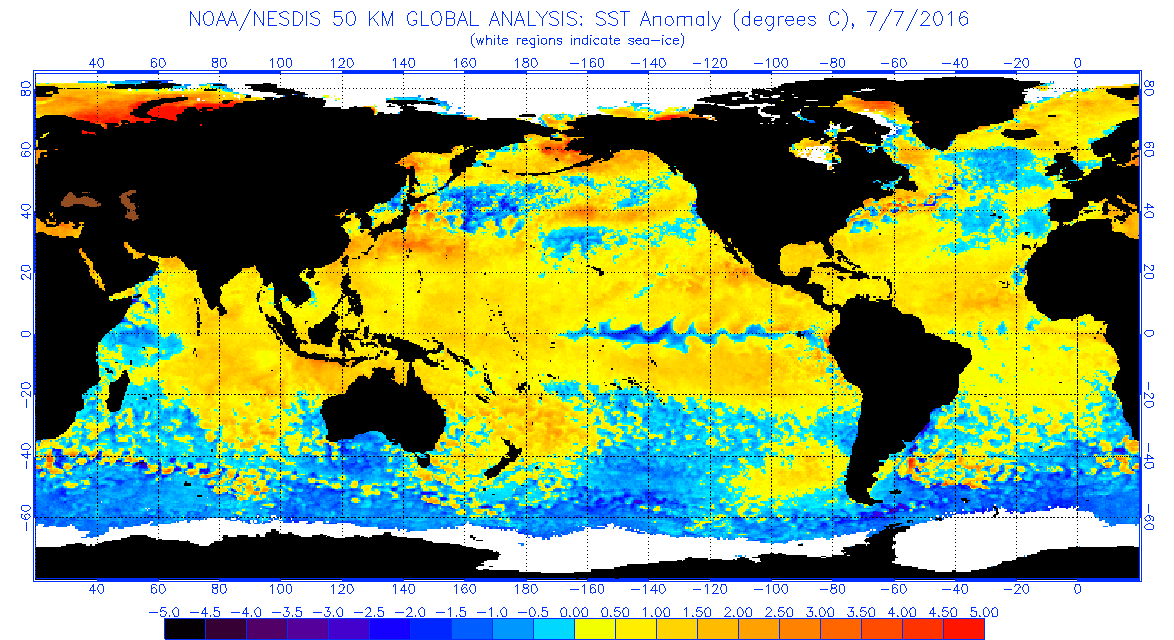


stormwise wrote:[img]https://i.imgsafe.org/ee5289d9b8.png[/ig]
That area known as the manatu box has some very warm anom's beginning to show up on the plots.
tarheelprogrammer wrote:stormwise wrote:
That area known as the manatu box has some very warm anom's beginning to show up on the plots.
How does this effect the Atlantic Hurricane Season?
Kingarabian wrote:stormwise wrote:[img]https://i.imgsafe.org/ee5289d9b8.png[/ig]
That area known as the manatu box has some very warm anom's beginning to show up on the plots.
Yeah this means the PDO has weakened some. However for it to flip negative, the anamolies near Alaska need to cool.


dexterlabio wrote:Would it be a first if a super El Nino year like 2015 precedes a neutral year? The big Nino events like in 1972, 1982, 1997 and 2009 were all followed by La Nina. Although someone could always argue that there's a first for everything...
Hunabku wrote:It's helpful to consider the PDO as an indicator of larger ENSO trends. Although it may give us insights on where ENSO is going, it actually tends to lag behind ENSO. Notice this year the PDO's relative monthly records peaked after Nino. Now the PDO seems to be catching up with SST drops that occurred month(s) prior in ENSO regions.
If there is verification of the ENSO model forecasts that bottom out during July/Aug at a weak Nina or neutral state, then I suspect that the PDO will bottom out some month(s) after that, likely before going negative. Also, it's hard to know how deep or lasting the current drop in the PDO will be as there is no subsurface temp mapping for PDO that I am aware of, and the PDO is significantly governed by atmospheric processes, which have lots of near-term variability within longer decadal trends
Users browsing this forum: No registered users and 145 guests


