Pouch P10L with low in Central Atlantic- (Is invest 91L)
Moderator: S2k Moderators
Forum rules

The posts in this forum are NOT official forecasts and should not be used as such. They are just the opinion of the poster and may or may not be backed by sound meteorological data. They are NOT endorsed by any professional institution or STORM2K. For official information, please refer to products from the National Hurricane Center and National Weather Service.
-
cycloneye

- Admin

- Posts: 149426
- Age: 69
- Joined: Thu Oct 10, 2002 10:54 am
- Location: San Juan, Puerto Rico
Re: Pouch P10L with low SW of CV islands
0 likes
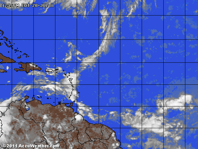
Visit the Caribbean-Central America Weather Thread where you can find at first post web cams,radars
and observations from Caribbean basin members Click Here
and observations from Caribbean basin members Click Here
-
Gustywind

- Category 5

- Posts: 12334
- Joined: Mon Sep 03, 2007 7:29 am
- Location: Baie-Mahault, GUADELOUPE
Re: Pouch P10L with low SW of CV islands
cycloneye wrote:
Nice loop Cycloneye
0 likes


-
Aric Dunn
- Category 5
- Posts: 21238
- Age: 43
- Joined: Sun Sep 19, 2004 9:58 pm
- Location: Ready for the Chase.
- Contact:
I think after looking at everything today and the trends I would wager a little money on this developing quicker than expected.
0 likes
Note: If I make a post that is brief. Please refer back to previous posts for the analysis or reasoning. I do not re-write/qoute what my initial post said each time.
If there is nothing before... then just ask
Space & Atmospheric Physicist, Embry-Riddle Aeronautical University,
I believe the sky is falling...
If there is nothing before... then just ask
Space & Atmospheric Physicist, Embry-Riddle Aeronautical University,
I believe the sky is falling...
-
Aric Dunn
- Category 5
- Posts: 21238
- Age: 43
- Joined: Sun Sep 19, 2004 9:58 pm
- Location: Ready for the Chase.
- Contact:
Re: Pouch P10L with low WSW of CV islands
This general area. looks to have the greatest vorticity and angular momentum and best chance to develop a LLC


0 likes
Note: If I make a post that is brief. Please refer back to previous posts for the analysis or reasoning. I do not re-write/qoute what my initial post said each time.
If there is nothing before... then just ask
Space & Atmospheric Physicist, Embry-Riddle Aeronautical University,
I believe the sky is falling...
If there is nothing before... then just ask
Space & Atmospheric Physicist, Embry-Riddle Aeronautical University,
I believe the sky is falling...
-
Aric Dunn
- Category 5
- Posts: 21238
- Age: 43
- Joined: Sun Sep 19, 2004 9:58 pm
- Location: Ready for the Chase.
- Contact:
Re:
psyclone wrote:this one sure does have that look. even if it doesn't develop it serves as an indication that the heart of the season is close at hand.
the low latitude give it a good chance. the area I circled should see a decent convective burst tonight and tomorrow and if it hold we will see a TC probably the following day.
0 likes
Note: If I make a post that is brief. Please refer back to previous posts for the analysis or reasoning. I do not re-write/qoute what my initial post said each time.
If there is nothing before... then just ask
Space & Atmospheric Physicist, Embry-Riddle Aeronautical University,
I believe the sky is falling...
If there is nothing before... then just ask
Space & Atmospheric Physicist, Embry-Riddle Aeronautical University,
I believe the sky is falling...
-
TropicalAnalystwx13

- Category 5
- Posts: 2109
- Age: 28
- Joined: Tue Jul 19, 2011 8:20 pm
- Location: Wilmington, NC
- Contact:
Re: Re:
Aric Dunn wrote:psyclone wrote:this one sure does have that look. even if it doesn't develop it serves as an indication that the heart of the season is close at hand.
the low latitude give it a good chance. the area I circled should see a decent convective burst tonight and tomorrow and if it hold we will see a TC probably the following day.
Saturday? That may be a little too early...I'm thinking more along the lines of Sunday-Tuesday.
0 likes
-
cycloneye
- Admin
- Posts: 149426
- Age: 69
- Joined: Thu Oct 10, 2002 10:54 am
- Location: San Juan, Puerto Rico
Re: Pouch P10L with low WSW of CV islands
IMO,NHC may start to mention it on the 8 PM TWO,followed by 91L being up overnight or Friday morning. All that,if trends continue like they are now.
0 likes
Visit the Caribbean-Central America Weather Thread where you can find at first post web cams,radars
and observations from Caribbean basin members Click Here
and observations from Caribbean basin members Click Here
-
Aric Dunn
- Category 5
- Posts: 21238
- Age: 43
- Joined: Sun Sep 19, 2004 9:58 pm
- Location: Ready for the Chase.
- Contact:
Re: Pouch P10L with low WSW of CV islands
cycloneye wrote:IMO,NHC may start to mention it on the 8 PM TWO,followed by 91L being up overnight or Friday morning. All that,if trends continue like they are now.
Right you would think so at least... but with what we just saw with 90L ... who knows.. lol
0 likes
Note: If I make a post that is brief. Please refer back to previous posts for the analysis or reasoning. I do not re-write/qoute what my initial post said each time.
If there is nothing before... then just ask
Space & Atmospheric Physicist, Embry-Riddle Aeronautical University,
I believe the sky is falling...
If there is nothing before... then just ask
Space & Atmospheric Physicist, Embry-Riddle Aeronautical University,
I believe the sky is falling...
-
Florida1118
Re: Pouch P10L with low WSW of CV islands
This season is going to suck alot more than 2010. Ya probably a 8pm mention of "some slow development is possible over the next fews days...20%" and gets Invested soon after IMO
0 likes
-
Aric Dunn
- Category 5
- Posts: 21238
- Age: 43
- Joined: Sun Sep 19, 2004 9:58 pm
- Location: Ready for the Chase.
- Contact:

Last edited by Aric Dunn on Thu Jul 28, 2011 2:57 pm, edited 1 time in total.
0 likes
Note: If I make a post that is brief. Please refer back to previous posts for the analysis or reasoning. I do not re-write/qoute what my initial post said each time.
If there is nothing before... then just ask
Space & Atmospheric Physicist, Embry-Riddle Aeronautical University,
I believe the sky is falling...
If there is nothing before... then just ask
Space & Atmospheric Physicist, Embry-Riddle Aeronautical University,
I believe the sky is falling...
-
TropicalAnalystwx13
- Category 5
- Posts: 2109
- Age: 28
- Joined: Tue Jul 19, 2011 8:20 pm
- Location: Wilmington, NC
- Contact:
-
WeatherEmperor
- S2K Supporter

- Posts: 4806
- Age: 42
- Joined: Thu Sep 04, 2003 2:54 pm
- Location: South Florida
Re: Pouch P10L with low WSW of CV islands
Florida1118 wrote:This season is going to suck alot more than 2010. Ya probably a 8pm mention of "some slow development is possible over the next fews days...20%" and gets Invested soon after IMO
What do you mean the season will suck a lot more than 2010? Do you mean that in terms of a lot of recurves or because you think more landfalls will happen?
0 likes
-
Florida1118
Re: Pouch P10L with low WSW of CV islands
WeatherEmperor wrote:Florida1118 wrote:This season is going to suck alot more than 2010. Ya probably a 8pm mention of "some slow development is possible over the next fews days...20%" and gets Invested soon after IMO
What do you mean the season will suck a lot more than 2010? Do you mean that in terms of a lot of recurves or because you think more landfalls will happen?
Im thinking more landfalls. I'd love if 2010 happened over and over.
0 likes
-
HurricaneWarning92
- Category 2

- Posts: 520
- Joined: Sat Jul 23, 2011 4:33 pm
- Location: Pembroke Pines, S. Florida (Lat: 26.00N, Lon: 80.22W)
Re: Pouch P10L with low WSW of CV islands
WeatherEmperor wrote:Florida1118 wrote:This season is going to suck alot more than 2010. Ya probably a 8pm mention of "some slow development is possible over the next fews days...20%" and gets Invested soon after IMO
What do you mean the season will suck a lot more than 2010? Do you mean that in terms of a lot of recurves or because you think more landfalls will happen?
I think he meant that there will be more landfalls. i read an article around May or June i believe on accuweather and they said that this season is expected to have more landfalling storms because the weather patterns are different than last years. Last year there was a huge trough that basically acted like a shield and "protected" the entire Southeastern coast. They dont expect that feature to be there this year, or at least not as strong.
0 likes
The posts in this forum are NOT official forecast and should not be used as such. They are just the opinion of the poster and may or may not be backed by sound meteorological data. They are NOT endorsed by any professional institution or storm2k.org. For official information, please refer to the NHC and NWS products.
-
WeatherEmperor
- S2K Supporter
- Posts: 4806
- Age: 42
- Joined: Thu Sep 04, 2003 2:54 pm
- Location: South Florida
Interesting. Does anybody have links to models that show what the upcoming patterns will look like for August? Correct me if I am wrong but the last couple of months or so have seen this huge ridge of high pressure near the east coast and very little dips in the jet stream. Will the pattern change to have more troughing in the East Coast?
0 likes
-
gatorcane

- S2K Supporter
- Posts: 23708
- Age: 48
- Joined: Sun Mar 13, 2005 3:54 pm
- Location: Boca Raton, FL
This system looks like it will face similar issues that 90L had when it was in that same area.
Notice all of the dry air over the MDR (orange shading in image below) - again typical of July.
WV image:
http://www.ssd.noaa.gov/goes/east/tatl/wv-l.jpg
Model support is there though, but none of them really deepen this system at all through 168 hours.
They just keep the system as a closed off low with the CMC as usual the most agressive.
I would say that some slow development is possible, but its going to be a long process again mostly because of the dry air it is going to face.
Then later on, one would expect there to be at least one TUTT somewhere in the Caribbean that may help further prevent development. In fact the GFS drops it at the end because of hostile upper-level conditions in the Central Caribbean.
Still about 2-3 weeks early for development in the MDR but we are getting closer and that dry air should move out over the next few weeks.
Last edited by gatorcane on Thu Jul 28, 2011 3:16 pm, edited 4 times in total.
0 likes
-
Aric Dunn
- Category 5
- Posts: 21238
- Age: 43
- Joined: Sun Sep 19, 2004 9:58 pm
- Location: Ready for the Chase.
- Contact:
Re:
WeatherEmperor wrote:Interesting. Does anybody have links to models that show what the upcoming patterns will look like for August? Correct me if I am wrong but the last couple of months or so have seen this huge ridge of high pressure near the east coast and very little dips in the jet stream. Will the pattern change to have more troughing in the East Coast?
Actually its been troughy on the east coast and strong ridge in the central us ( hence the heat ) the pattern is in the process of changing as the ridge as slid to east coast now.
0 likes
Note: If I make a post that is brief. Please refer back to previous posts for the analysis or reasoning. I do not re-write/qoute what my initial post said each time.
If there is nothing before... then just ask
Space & Atmospheric Physicist, Embry-Riddle Aeronautical University,
I believe the sky is falling...
If there is nothing before... then just ask
Space & Atmospheric Physicist, Embry-Riddle Aeronautical University,
I believe the sky is falling...
-
Aric Dunn
- Category 5
- Posts: 21238
- Age: 43
- Joined: Sun Sep 19, 2004 9:58 pm
- Location: Ready for the Chase.
- Contact:
Re:
gatorcane wrote:This system looks like it will face similar issues that 90L had when it was in that same area.
Notice all of the dry air over the MDR - again typical of July.
Model support is there though, but none of them really deepen this system at all through 168 hours.
They just keep the system as a closed off low with the CMC as usual the most agressive.
I would say that some slow development is possible, but its going to be a long process again mostly because of the dry air it is going to face:
WV image:
http://www.ssd.noaa.gov/goes/east/tatl/wv-l.jpg
you have to watch out for that.. thats upper level water vapor. and the TPW is quite high. Also this system has much more pronuced circulation and high vorticity. its also large and will draw in large amounts of moisture. I should have a higher chance to develop than 90L before the islands.
0 likes
Note: If I make a post that is brief. Please refer back to previous posts for the analysis or reasoning. I do not re-write/qoute what my initial post said each time.
If there is nothing before... then just ask
Space & Atmospheric Physicist, Embry-Riddle Aeronautical University,
I believe the sky is falling...
If there is nothing before... then just ask
Space & Atmospheric Physicist, Embry-Riddle Aeronautical University,
I believe the sky is falling...
Who is online
Users browsing this forum: No registered users and 278 guests