2019 Indicators: SST'S / Sal / MSLP / Steering / Shear / Instability (See updated graphics at first post)

This is the general tropical discussion area. Anyone can take their shot at predicting a storms path.

Moderator: S2k Moderators

Forum rules

The posts in this forum are NOT official forecasts and should not be used as such. They are just the opinion of the poster and may or may not be backed by sound meteorological data. They are NOT endorsed by any professional institution or STORM2K. For official information, please refer to products from the National Hurricane Center and National Weather Service.

Help Support Storm2K
Message
Author
User avatar
DioBrando
Category 4
Category 4
Posts: 917
Age: 27
Joined: Sun Aug 12, 2018 12:45 pm

Re: 2019 Indicators: SST'S / Sal / MSLP / Steering / Shear / Instability (See updated graphics at first post)

#821 Postby DioBrando » Mon Aug 12, 2019 1:18 pm

wxman57 wrote:
DioBrando wrote:oh and not to forget they were all during the cold period (before 1995)


Note that the Atlantic Multidecadal Oscillation is currently in a cool cycle which began in 2013 (Klotzbach/Gray method).
Image
1 likes   
blonde stacey (xe/xem/xir)

User avatar
CyclonicFury
Category 5
Category 5
Posts: 1977
Age: 25
Joined: Sun Jul 02, 2017 12:32 pm
Location: NC
Contact:

Re: 2019 Indicators: SST'S / Sal / MSLP / Steering / Shear / Instability (See updated graphics at first post)

#822 Postby CyclonicFury » Mon Aug 12, 2019 1:19 pm

wxman57 wrote:
DioBrando wrote:oh and not to forget they were all during the cold period (before 1995)


Note that the Atlantic Multidecadal Oscillation is currently in a cool cycle which began in 2013 (Klotzbach/Gray method).

Klotzbach's AMO actually turned positive in July FWIW.

Also, the Atlantic has not behaved like the cool cycle the last three years. Three consecutive above average seasons that were way more active than the 1970-94 average.
4 likes   
NCSU B.S. in Meteorology Class of 2021. Tropical weather blogger at http://www.cyclonicfury.com. My forecasts and thoughts are NOT official, for official forecasts please consult the National Hurricane Center.

User avatar
DioBrando
Category 4
Category 4
Posts: 917
Age: 27
Joined: Sun Aug 12, 2018 12:45 pm

Re: 2019 Indicators: SST'S / Sal / MSLP / Steering / Shear / Instability (See updated graphics at first post)

#823 Postby DioBrando » Mon Aug 12, 2019 1:22 pm

July 2019 AMO Index (Klotzbach website)

+1.87
0 likes   
blonde stacey (xe/xem/xir)

User avatar
DioBrando
Category 4
Category 4
Posts: 917
Age: 27
Joined: Sun Aug 12, 2018 12:45 pm

Re: 2019 Indicators: SST'S / Sal / MSLP / Steering / Shear / Instability (See updated graphics at first post)

#824 Postby DioBrando » Mon Aug 12, 2019 1:24 pm

CyclonicFury wrote:
wxman57 wrote:
DioBrando wrote:oh and not to forget they were all during the cold period (before 1995)


Note that the Atlantic Multidecadal Oscillation is currently in a cool cycle which began in 2013 (Klotzbach/Gray method).

Klotzbach's AMO actually turned positive in July FWIW.

Also, the Atlantic has not behaved like the cool cycle the last three years. Three consecutive above average seasons that were way more active than the 1970-94 average.


True, in fact I just literally quoted the AMO index in my last post in red.

How many more maps, models and graphs do I have to post to prove that things are changing without resorting to the use of cherry-picking?
2 likes   
blonde stacey (xe/xem/xir)

USTropics
Category 5
Category 5
Posts: 2422
Joined: Sun Aug 12, 2007 3:45 am
Location: Florida State University

Re: 2019 Indicators: SST'S / Sal / MSLP / Steering / Shear / Instability (See updated graphics at first post)

#825 Postby USTropics » Mon Aug 12, 2019 1:41 pm

Even if you were to disregard SSTAs, in a -AMO we should be seeing a very dry Sahel/inactive WAM and cooler boreal summers in Europe, the opposite is occurring.
5 likes   

User avatar
DioBrando
Category 4
Category 4
Posts: 917
Age: 27
Joined: Sun Aug 12, 2018 12:45 pm

Re: 2019 Indicators: SST'S / Sal / MSLP / Steering / Shear / Instability (See updated graphics at first post)

#826 Postby DioBrando » Mon Aug 12, 2019 1:44 pm

USTropics wrote:Even if you were to disregard SSTAs, in a -AMO we should be seeing a very dry Sahel/inactive WAM and cooler boreal summers in Europe, the opposite is occurring.

We here in Italy had multiple heatwaves, for example, even reaching 50 degrees celcius this summer. It was particularly extreme in France according to a friend who lives there!
And even more heatwaves coming to Italy this week!
3 likes   
blonde stacey (xe/xem/xir)

User avatar
wxman57
Moderator-Pro Met
Moderator-Pro Met
Posts: 22512
Age: 66
Joined: Sat Jun 21, 2003 8:06 pm
Location: Houston, TX (southwest)

Re: 2019 Indicators: SST'S / Sal / MSLP / Steering / Shear / Instability (See updated graphics at first post)

#827 Postby wxman57 » Mon Aug 12, 2019 2:02 pm

DioBrando wrote:
CyclonicFury wrote:
wxman57 wrote:
Note that the Atlantic Multidecadal Oscillation is currently in a cool cycle which began in 2013 (Klotzbach/Gray method).

Klotzbach's AMO actually turned positive in July FWIW.

Also, the Atlantic has not behaved like the cool cycle the last three years. Three consecutive above average seasons that were way more active than the 1970-94 average.


True, in fact I just literally quoted the AMO index in my last post in red.

How many more maps, models and graphs do I have to post to prove that things are changing without resorting to the use of cherry-picking?


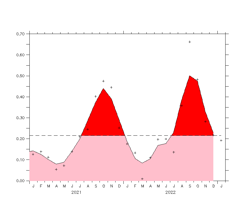
Note that I did not mention the July AMO value in my post above, only that the AMO appears to have shifted to a cool period starting in 2013, as can be seen below. That spike in July looks quite odd. I suspect that we will see a significant drop in August. During each cool AMO cycles there are years with spikes above normal, as with warm AMO cycles with cool spikes. Generally, though, the Atlantic is in a cool cycle. We won't know until the end of November whether the season averaged out as above or below-normal.

I sent a note to Klotzbach asking his opinion of the July upward spike in the AMO. Will let you know what he things about it.

Ok, enough of this. I now say we're going to see 50 named storms this season, happy?

Image
9 likes   

User avatar
wxman57
Moderator-Pro Met
Moderator-Pro Met
Posts: 22512
Age: 66
Joined: Sat Jun 21, 2003 8:06 pm
Location: Houston, TX (southwest)

Re: 2019 Indicators: SST'S / Sal / MSLP / Steering / Shear / Instability (See updated graphics at first post)

#828 Postby wxman57 » Mon Aug 12, 2019 2:13 pm

Klotzbach says that the warm AMO spike in July was due to a very negative AO/NAO. The warm spot that triggered the spike isn't expected to have any impact on the deep tropics, according to Phil. He thinks the spike is only temporary, going down in the coming months.

I asked Phil to clarify what the warm spike might mean as far as the rest of the season. He says that the AMO index during the summer has a fairly low correlation with hurricane activity peak-season.

The only changing I'm seeing out there is the Atlantic becoming more hostile than a month ago. Remember, less storms than normal does not mean no big threats.
7 likes   

shiny-pebble
Category 1
Category 1
Posts: 299
Joined: Thu Jul 05, 2018 1:38 pm

Re: RE: Re: 2019 Indicators: SST'S / Sal / MSLP / Steering / Shear / Instability (See updated graphics at first post)

#829 Postby shiny-pebble » Mon Aug 12, 2019 2:18 pm

DioBrando wrote:
CyclonicFury wrote:
wxman57 wrote:
Note that the Atlantic Multidecadal Oscillation is currently in a cool cycle which began in 2013 (Klotzbach/Gray method).

Klotzbach's AMO actually turned positive in July FWIW.

Also, the Atlantic has not behaved like the cool cycle the last three years. Three consecutive above average seasons that were way more active than the 1970-94 average.


True, in fact I just literally quoted the AMO index in my last post in red.

How many more maps, models and graphs do I have to post to prove that things are changing without resorting to the use of cherry-picking?
I respect your opinion, but weren't you saying literally a week ago that this season would be a bust and didn't you cancel it? Not much has happened in the past week that has made predicted conditions flip.

Sent from my LG-H700 using Tapatalk
1 likes   
Not an meteorologist! Just someone who is interested in weather. Please refer to the NHC and local weather officials to make decisions.
-Jack 8-)

User avatar
DioBrando
Category 4
Category 4
Posts: 917
Age: 27
Joined: Sun Aug 12, 2018 12:45 pm

Re: RE: Re: 2019 Indicators: SST'S / Sal / MSLP / Steering / Shear / Instability (See updated graphics at first post)

#830 Postby DioBrando » Mon Aug 12, 2019 2:27 pm

shiny-pebble wrote:
DioBrando wrote:
CyclonicFury wrote:Klotzbach's AMO actually turned positive in July FWIW.

Also, the Atlantic has not behaved like the cool cycle the last three years. Three consecutive above average seasons that were way more active than the 1970-94 average.


True, in fact I just literally quoted the AMO index in my last post in red.

How many more maps, models and graphs do I have to post to prove that things are changing without resorting to the use of cherry-picking?
I respect your opinion, but weren't you saying literally a week ago that this season would be a bust and didn't you cancel it? Not much has happened in the past week that has made predicted conditions flip.

Sent from my LG-H700 using Tapatalk

that's because i did a little research using maps, models and real-time sites to find out what the current conditions are and compared them to last week where large wads of tutts and shear was being displayed on maps (now they are trending towards clearing up.) dry air is the main issue right now promoted by a suppressed phase of the mjo. once that goes into a better phase, the sinking air can retreat and dry air can peter out. i compared trends opposed to what was actually going on at the meantime. then i had a look at the 2018 and 2017 threads to this one too. i then talked about this with some of my other real-life friends also interested in severe weather, tropical weather and climate change.
so that's why i decided to back off from abrupt season canceling.
i mean, i'm learning more about the weather and climate change and i only got into looking into it more since last year, so i'm looking at it from all different angles.
Last edited by DioBrando on Mon Aug 12, 2019 2:32 pm, edited 1 time in total.
4 likes   
blonde stacey (xe/xem/xir)

LarryWx
Category 5
Category 5
Posts: 5805
Joined: Sun Sep 07, 2003 2:04 pm
Location: GA

Re: 2019 Indicators: SST'S / Sal / MSLP / Steering / Shear / Instability (See updated graphics at first post)

#831 Postby LarryWx » Mon Aug 12, 2019 2:32 pm

The following 18 years had no August TC geneses on record:
1997, 1961, 1941, 1929, 1923, 1922, 1921, 1920, 1919, 1914, 1912, 1907, 1905, 1902, 1884, 1876, 1868, and 1857.

Note that during the satellite era, there have been only 2 in 59 years (3%). Pre-satellite era, when it was much easier to miss a fish storm, there were 16 in 109 years or a much higher 15%. So, the 3% is much more likely to be closer to reality.
1 likes   
Personal Forecast Disclaimer:
The posts in this forum are NOT official forecasts and should not be used as such. They are just the opinion of the poster and may or may not be backed by sound meteorological data. They are NOT endorsed by any professional institution or storm2k.org. For official information, please refer to the NHC and NWS products.

User avatar
wxman57
Moderator-Pro Met
Moderator-Pro Met
Posts: 22512
Age: 66
Joined: Sat Jun 21, 2003 8:06 pm
Location: Houston, TX (southwest)

Re: 2019 Indicators: SST'S / Sal / MSLP / Steering / Shear / Instability (See updated graphics at first post)

#832 Postby wxman57 » Mon Aug 12, 2019 2:33 pm

wxman57 wrote:
crownweather wrote:
wxman57 wrote:Our latest analogs from July, which included a projection of a weak El Nino (+0.5 to +0.6) were as follows:

1968 - 8/4/0 45 ACE
1976 - 10/6/2 84 ACE
1979 - 9/5/2 92 ACE
1993 - 8/4/1 39 ACE
1991 - 8/4/2 36 ACE

I'm checking with our long-range guy to see if he's computed the latest analogs based on warm-neutral conditions in the Nino 3.4 area. Note that a weak El Nino typically has little impact on Atlantic activity. It takes a moderate to strong El Nino to hinder development, so there should not be much change in the analogs going to warm-neutral. Note that the analog years may differ from Klotzbach as he uses current conditions while we look at predicted conditions across the tropics.


Interesting that all analog years had at least 1 tropical cyclone threat for the US East Coast. 1976 with Belle, 1979 with David (then Frederic into the Alabama coast), 1993 with Emily and 1991 with Bob. Finally, 1968 had Gladys into west Florida during October.


Yes, and I pointed that out in my outlook presentations this spring. I just got my coworker's new analogs based on warm-neutral in Nino 3.4:

1958 - 12/7/3 109 ACE
1959 - 14/7/2 77 ACE
1960 - 8/4/2 73 ACE
1968 - 8/4/0 45 ACE
1979 - 9/5/2 92 ACE
1980 - 11/9/2 149 ACE
1981 - 12/7/3 100 ACE
1993 - 8/4/1 39 ACE

Average is 10/6/2 with 86 ACE for those analogs. I plotted all Caribbean & U.S. hurricane landfalls for these analogs (below). I'm not seeing a pattern that is similar to 1980 out there. Allen was the first hurricane I ever worked. A number of hits along the East U.S. Coast in the analogs, despite the relatively low numbers and ACE for the analogs. Like I said, lower than average numbers doesn't mean a decreased risk of a hurricane landfall, necessarily.

http://wxman57.com/images/analogs.JPG


Note that my long-range guy for the past 30 years is out of the office today. He tells me that the analogs I posted above are mostly secondary and not primary analogs. He'll be in the office tomorrow to give me the primary analogs for Aug-Nov.
5 likes   

User avatar
NDG
S2K Supporter
S2K Supporter
Posts: 14950
Joined: Sun Jul 09, 2006 10:14 pm
Location: Orlando, FL

Re: 2019 Indicators: SST'S / Sal / MSLP / Steering / Shear / Instability (See updated graphics at first post)

#833 Postby NDG » Mon Aug 12, 2019 3:09 pm

wxman57 wrote:
wxman57 wrote:
crownweather wrote:
Interesting that all analog years had at least 1 tropical cyclone threat for the US East Coast. 1976 with Belle, 1979 with David (then Frederic into the Alabama coast), 1993 with Emily and 1991 with Bob. Finally, 1968 had Gladys into west Florida during October.


Yes, and I pointed that out in my outlook presentations this spring. I just got my coworker's new analogs based on warm-neutral in Nino 3.4:

1958 - 12/7/3 109 ACE
1959 - 14/7/2 77 ACE
1960 - 8/4/2 73 ACE
1968 - 8/4/0 45 ACE
1979 - 9/5/2 92 ACE
1980 - 11/9/2 149 ACE
1981 - 12/7/3 100 ACE
1993 - 8/4/1 39 ACE

Average is 10/6/2 with 86 ACE for those analogs. I plotted all Caribbean & U.S. hurricane landfalls for these analogs (below). I'm not seeing a pattern that is similar to 1980 out there. Allen was the first hurricane I ever worked. A number of hits along the East U.S. Coast in the analogs, despite the relatively low numbers and ACE for the analogs. Like I said, lower than average numbers doesn't mean a decreased risk of a hurricane landfall, necessarily.

http://wxman57.com/images/analogs.JPG


Note that my long-range guy for the past 30 years is out of the office today. He tells me that the analogs I posted above are mostly secondary and not primary analogs. He'll be in the office tomorrow to give me the primary analogs for Aug-Nov.


I just think that if the AMO does not go back to negative during the peak of the hurricane season the average ACE out of all of them might be too low. IMO.
3 likes   

User avatar
Emmett_Brown
Category 5
Category 5
Posts: 1344
Joined: Wed Aug 24, 2005 9:10 pm
Location: Sarasota FL

Re: 2019 Indicators: SST'S / Sal / MSLP / Steering / Shear / Instability (See updated graphics at first post)

#834 Postby Emmett_Brown » Mon Aug 12, 2019 3:36 pm

If you look at a longer range chart of the AMO, there are often pockets of cool years within an overall warm trend. For example, there was a pronounced 2-3 year dip into negative values in the late 1940s during the last positive AMO. It returned to positive until the 1960s, before finally flipping to negative, and staying mostly negative until the mid 1990's. So, we could easily see a return to the positive AMO before it finally ends in another decade or so. Or, this could indeed be the end of the recent positive AMO... But if so, that would make the recent positive AMO shorter than the previous cycle by about a decade. Also, 2017 had an ACE of 225, which is not characteristic of cold AMO (as CyclonicFury pointed out)
Last edited by Emmett_Brown on Mon Aug 12, 2019 3:57 pm, edited 2 times in total.
8 likes   

HURRICANELONNY
Category 5
Category 5
Posts: 1381
Joined: Wed May 07, 2003 6:48 am
Location: HOLLYWOOD.FL

Re: 2019 Indicators: SST'S / Sal / MSLP / Steering / Shear / Instability (See updated graphics at first post)

#835 Postby HURRICANELONNY » Mon Aug 12, 2019 3:46 pm

Now that's fake news. Can't believe they can get away posting that:
https://nypost.com/2019/08/12/us-could- ... perts-say/
:roll:
2 likes   
hurricanelonny

User avatar
AnnularCane
S2K Supporter
S2K Supporter
Posts: 2658
Joined: Thu Jun 08, 2006 9:18 am
Location: Wytheville, VA

Re: 2019 Indicators: SST'S / Sal / MSLP / Steering / Shear / Instability (See updated graphics at first post)

#836 Postby AnnularCane » Mon Aug 12, 2019 4:10 pm

HURRICANELONNY wrote:Now that's fake news. Can't believe they can get away posting that:
https://nypost.com/2019/08/12/us-could- ... perts-say/
:roll:


Well, that's certainly a way to get attention. :roll: Of course, the actual article says nine hurricanes could develop, not hit the US. I guess they want clicks.

Hey, I "could" win the lottery too! :lol:
0 likes   

LarryWx
Category 5
Category 5
Posts: 5805
Joined: Sun Sep 07, 2003 2:04 pm
Location: GA

Re: 2019 Indicators: SST'S / Sal / MSLP / Steering / Shear / Instability (See updated graphics at first post)

#837 Postby LarryWx » Mon Aug 12, 2019 4:10 pm

HURRICANELONNY wrote:Now that's fake news. Can't believe they can get away posting that:
https://nypost.com/2019/08/12/us-could- ... perts-say/
:roll:


So, the NY Post is taking the high end of the NHC 5-9 hurricane forecast range and saying the US could be hit with 9 Hs. Talk about a sensationalizing headline! Of course, one US H hit has already happened, Barry. So, I guess they're saying watch out for possibly 8 more H hits.
1 likes   
Personal Forecast Disclaimer:
The posts in this forum are NOT official forecasts and should not be used as such. They are just the opinion of the poster and may or may not be backed by sound meteorological data. They are NOT endorsed by any professional institution or storm2k.org. For official information, please refer to the NHC and NWS products.

hurricanehunter69
Category 1
Category 1
Posts: 331
Joined: Sun May 16, 2010 5:21 pm
Location: New Orleans

Re: 2019 Indicators: SST'S / Sal / MSLP / Steering / Shear / Instability (See updated graphics at first post)

#838 Postby hurricanehunter69 » Mon Aug 12, 2019 4:31 pm

Just like a pop corn thunderstorm...The tropics can heat up (flip the switch ) and become very active in quite a hurry! We have a warm-neutral ENSO, below average shear, and above average SST's. The tropics would likely be very active If it weren't for a significant outbreak of mid-level dry air, ( SAL ). I would still bet on a 2/1/0 line in August and 6/4/2 in Sept, 4/3/1 Oct and 1/1/0 the rest of the way. 15/9/3
5 likes   

User avatar
DioBrando
Category 4
Category 4
Posts: 917
Age: 27
Joined: Sun Aug 12, 2018 12:45 pm

Re: 2019 Indicators: SST'S / Sal / MSLP / Steering / Shear / Instability (See updated graphics at first post)

#839 Postby DioBrando » Mon Aug 12, 2019 4:38 pm

hurricanehunter69 wrote:Just like a pop corn thunderstorm...The tropics can heat up (flip the switch ) and become very active in quite a hurry! We have a warm-neutral ENSO, below average shear, and above average SST's. The tropics would likely be very active If it weren't for a significant outbreak of mid-level dry air, ( SAL ). I would still bet on a 2/1/0 line in August and 6/4/2 in Sept, 4/3/1 Oct and 1/1/0 the rest of the way. 15/9/3

THIS. In fact... lemme do a little made-up scenario based on your numbers.
Bolded names: majors
Italics: non-majors
(RED NAME = MOST INTENSE)

I've put some analogs for each name from the scenario based on what I think could happen based on state and models so far. Tell me if you (anyone) disagree with anything.

August
Chantal https://en.wikipedia.org/wiki/Tropical_Storm_Cindy_(2017)
Dorian - 1 https://en.wikipedia.org/wiki/2018_Atlantic_hurricane_season#Hurricane_Isaac

September
Erin https://en.wikipedia.org/wiki/2011_Atlantic_hurricane_season#Tropical_Storm_Jose
Fernand - 3 https://en.wikipedia.org/wiki/2014_Atlantic_hurricane_season#Hurricane_Edouard
Gabby - 1 https://en.wikipedia.org/wiki/Hurricane_Humberto_(2007)
Humberto - 4 https://en.wikipedia.org/wiki/Hurricane_Edouard_(1996) OR https://en.wikipedia.org/wiki/2003_Atlantic_hurricane_season#Hurricane_Fabian
Imelda - 2 https://en.wikipedia.org/wiki/Hurricane_Irene_(1999)
Jerry https://en.wikipedia.org/wiki/1998_Atlantic_hurricane_season#Tropical_Storm_Hermine

October
Karen - 2 https://en.wikipedia.org/wiki/Hurricane_Humberto_(2001)
Lorenzo - 4 https://en.wikipedia.org/wiki/Hurricane_Charley
Melissa https://en.wikipedia.org/wiki/2003_Atlantic_hurricane_season#Tropical_Storm_Mindy
Nestor - 1 https://en.wikipedia.org/wiki/2004_Atlantic_hurricane_season#Hurricane_Lisa

November
Olga https://en.wikipedia.org/wiki/2003_Atlantic_hurricane_season#Tropical_Storm_Peter

For Humberto, option 1 seems more likely than option 2.

Overall, this seems pretty feasible should the switch flip (that suppressed phase of the MJO and the dry air need to go otherwise it would be active!)
Does this seem like your scenario?
1 likes   
blonde stacey (xe/xem/xir)

LarryWx
Category 5
Category 5
Posts: 5805
Joined: Sun Sep 07, 2003 2:04 pm
Location: GA

Re: 2019 Indicators: SST'S / Sal / MSLP / Steering / Shear / Instability (See updated graphics at first post)

#840 Postby LarryWx » Mon Aug 12, 2019 5:09 pm

HURRICANELONNY wrote:Now that's fake news. Can't believe they can get away posting that:
https://nypost.com/2019/08/12/us-could- ... perts-say/
:roll:


The NY post headline says 9 Hs could hit the US in 2019 vs the record high of 7 (1886) back to 1851. So, this deserves two of these: :lol: :lol:
1 likes   
Personal Forecast Disclaimer:
The posts in this forum are NOT official forecasts and should not be used as such. They are just the opinion of the poster and may or may not be backed by sound meteorological data. They are NOT endorsed by any professional institution or storm2k.org. For official information, please refer to the NHC and NWS products.


Return to “Talkin' Tropics”

Who is online

Users browsing this forum: Jonny, WAcyclone and 29 guests