

bamajammer4eva wrote:JB now on board via twitter
@BigJoeBastardi
10m10 minutes ago
More
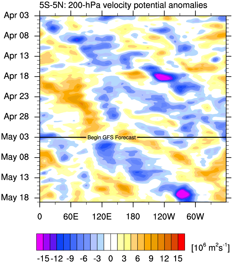
Okay NOW THE TROPICS HAVE MY ATTENTION! ECWMF move of MJO into phase 1 then perhaps 2/3 says to look out late next week and week after
@BigJoeBastardi
9m9 minutes ago
More
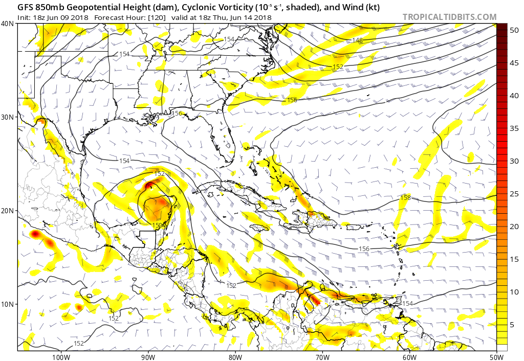
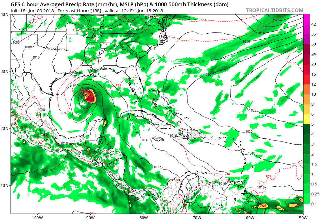
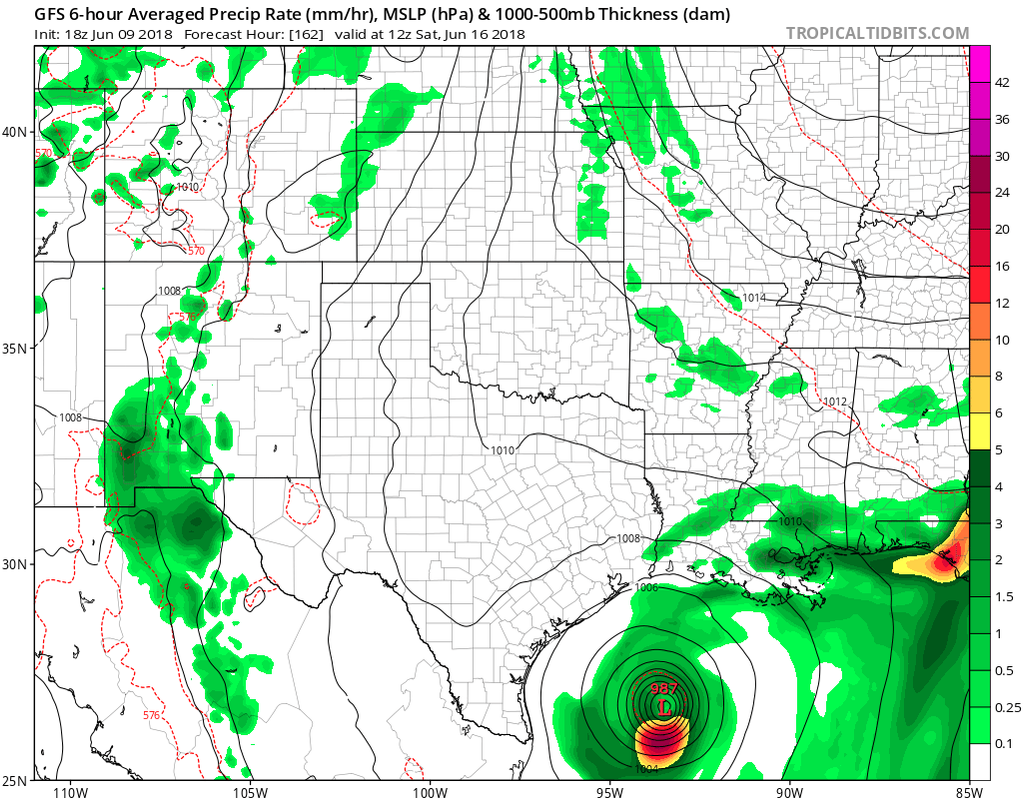
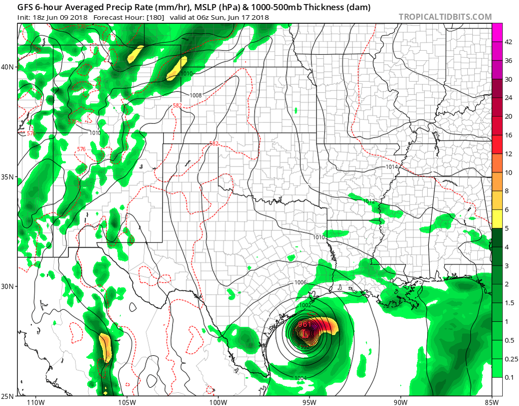
GFS still looks way overdone but western gulf is area I am watching in 6-10
I guess the only thing that is predictable in this whole situation is JB. lol


