GOM, homebrew?

This is the general tropical discussion area. Anyone can take their shot at predicting a storms path.

Moderator: S2k Moderators

Forum rules

The posts in this forum are NOT official forecasts and should not be used as such. They are just the opinion of the poster and may or may not be backed by sound meteorological data. They are NOT endorsed by any professional institution or STORM2K. For official information, please refer to products from the National Hurricane Center and National Weather Service.

Help Support Storm2K
Message
Author
User avatar
lrak
S2K Supporter
S2K Supporter
Posts: 1770
Age: 58
Joined: Thu Jun 21, 2007 2:48 pm
Location: Corpus Christi, TX

GOM, homebrew?

#1 Postby lrak » Sun Sep 21, 2008 12:24 pm

I wake up this afternoon (long night) and see low clouds moving fast down the coast and a brisk Northerly wind but with high pressure. The satellite loops show a broad circulation in the GOM and I was hoping a thread was already started to explain whats up? Anyone want to help out?

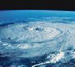
What tropical system are the Brownsville Mets talking about?

.MARINE...LIGHT TO MODERATE NE FLOW WILL CONTINUE INTO MID WEEK.
SEAS CURRENTLY RUNNING 2 TO 3 FEET WILL BEGIN TO CLIMB IN RESPONSE
TO TIGHTENING PRESSURE GRADIENT AS LOW PRESSURE STRUGGLES TO DEVELOP
MID WEEK IN THE TEXAS PANHANDLE. BRIEF SCA CRITERIA COULD RESULT.
GFS INDICATING COPIOUS UPPER LEVEL MOISTURE WITH A SERIES OF WEAK
SHORTWAVES THROUGH THE PERIOD. FIRST SLUG ARRIVING MONDAY FROM
TROPICAL SYSTEM ON THE MEXICAN WEST COAST
OVERLAPPING BROAD AREA OF
LIFT COULD RESULT IN ENHANCED SHOWERS AND HEAVY DOWNPOURS OVER THE
MARINE WATERS MONDAY AND TUESDAY.

http://www.crh.noaa.gov/product.php?sit ... glossary=1

http://radar.weather.gov/radar.php?rid= ... 1&loop=yes

Image
0 likes   

Weatherfreak000

#2 Postby Weatherfreak000 » Sun Sep 21, 2008 12:44 pm

Very interesting indeed...seems about stalled. Have to wait and see if anything develops out of this it's about that time of the year for a quick GOM TS.
0 likes   

User avatar
KatDaddy
Category 5
Category 5
Posts: 2815
Joined: Mon Oct 21, 2002 6:23 pm
Location: League City, Texas

#3 Postby KatDaddy » Sun Sep 21, 2008 2:11 pm

If anything else forms tropically in the GOM this season it will be time for W FLA to step up and take a hit. TX, LA, MS, AL are done with the hurricane season. I am ready for another 25 year break before I deal with another large hurricane.
0 likes   

caneman

Re: GOM, homebrew?

#4 Postby caneman » Sun Sep 21, 2008 2:22 pm

For the record KatDaddy. West FLorida was hit by Fay.
0 likes   

User avatar
KatDaddy
Category 5
Category 5
Posts: 2815
Joined: Mon Oct 21, 2002 6:23 pm
Location: League City, Texas

#5 Postby KatDaddy » Sun Sep 21, 2008 2:26 pm

In the blur of the last week I had overlooked that fact. Its been quite a hurricane season for the GOM and I am fairly certain the GOM is not done. Joe B is already hyping the S GOM next week.
0 likes   

SWLASTORMTRACKER
Tropical Wave
Tropical Wave
Posts: 6
Joined: Sun Jun 17, 2007 12:00 pm

Re: GOM, homebrew?

#6 Postby SWLASTORMTRACKER » Sun Sep 21, 2008 2:53 pm

KatDaddy wrote:In the blur of the last week I had overlooked that fact. Its been quite a hurricane season for the GOM and I am fairly certain the GOM is not done. Joe B is already hyping the S GOM next week.
Did he say where he thinks it might head if indeed something forms?
0 likes   

User avatar
catastrophic
Tropical Low
Tropical Low
Posts: 35
Joined: Wed Jul 23, 2008 1:50 pm
Location: palm bay FL

#7 Postby catastrophic » Sun Sep 21, 2008 3:12 pm

the area in the central gom looks intresting but i also noticed the area in the boc

ImageImage

http://www.ssd.noaa.gov/goes/east/gmex/loop-rgb.html iffyou look at thas loop it looks like there acirculation in the area in the boc
0 likes   

User avatar
lrak
S2K Supporter
S2K Supporter
Posts: 1770
Age: 58
Joined: Thu Jun 21, 2007 2:48 pm
Location: Corpus Christi, TX

Re:

#8 Postby lrak » Sun Sep 21, 2008 3:59 pm

catastrophic wrote:the area in the central gom looks intresting but i also noticed the area in the boc

ImageImage

http://www.ssd.noaa.gov/goes/east/gmex/loop-rgb.html iffyou look at thas loop it looks like there acirculation in the area in the boc


sure looks like a spin to me.

So something down there will move NE towards Florida?
0 likes   

User avatar
HURAKAN
Professional-Met
Professional-Met
Posts: 46086
Age: 38
Joined: Thu May 20, 2004 4:34 pm
Location: Key West, FL
Contact:

#9 Postby HURAKAN » Sun Sep 21, 2008 4:04 pm

I don't see any spin and conditions are not favorable for development. This convection is likely shear-induced.

Image
0 likes   

User avatar
Tampa Bay Hurricane
Category 5
Category 5
Posts: 5597
Age: 37
Joined: Fri Jul 22, 2005 7:54 pm
Location: St. Petersburg, FL

#10 Postby Tampa Bay Hurricane » Sun Sep 21, 2008 4:28 pm

On the infrared loops the area in the central gulf is
moving rapidly towards Florida- click on fronts and you
will see that the stationary front over central florida
is pulling this large area of convection with upper
level cyclonic turning towards Florida.
http://www.ssd.noaa.gov/GOES/EAST/gmex/loop-avn.html

The leading edge of the convective complex
should reach Florida within 24 hours.

I don't expect tropical development, but there appears to be an area
of low pressure over the central GOM, with east flow of clouds to the north, west
flow of clouds to the south- However, these appear to be UPPER LEVEL Winds, so
it looks like some sort of mid to upper level Low with instability fueling convection.

This should bring some heavy rain squalls to Florida in the next 24 hours. Nothing
serious, just areas of thunderstorms with strong gusty winds in the heavier
cells.
0 likes   

User avatar
lrak
S2K Supporter
S2K Supporter
Posts: 1770
Age: 58
Joined: Thu Jun 21, 2007 2:48 pm
Location: Corpus Christi, TX

Re:

#11 Postby lrak » Sun Sep 21, 2008 4:40 pm

HURAKAN wrote:I don't see any spin and conditions are not favorable for development. This convection is likely shear-induced.

Image


I respectfully disagree. :D

20.5n 96.0w is where I see an illusion.
0 likes   

User avatar
Tampa Bay Hurricane
Category 5
Category 5
Posts: 5597
Age: 37
Joined: Fri Jul 22, 2005 7:54 pm
Location: St. Petersburg, FL

#12 Postby Tampa Bay Hurricane » Sun Sep 21, 2008 4:43 pm

As a comfort for Texas/Louisiana/Mississippi residents impacted by
Ike/Gustav, it appears that the stationary front over florida
should protect you from any system that may form over the gulf.
The stationary front is drawing the convective moisture towards
florida:
http://www.ssd.noaa.gov/GOES/EAST/gmex/loop-avn.html

So it will water my lawn before the dry season sets in. And the stationary
front should protect the West/Central gulf coasts from any bad weather.
0 likes   

User avatar
Tampa Bay Hurricane
Category 5
Category 5
Posts: 5597
Age: 37
Joined: Fri Jul 22, 2005 7:54 pm
Location: St. Petersburg, FL

#13 Postby Tampa Bay Hurricane » Sun Sep 21, 2008 4:44 pm

Now as for the bay of campeche, looks like an area of cyclonic turning,
that may be something to watch. I don't know where it would go, it
is too early to tell; is there another trough forecasted to reach the
gulf later this week?
0 likes   

User avatar
HURAKAN
Professional-Met
Professional-Met
Posts: 46086
Age: 38
Joined: Thu May 20, 2004 4:34 pm
Location: Key West, FL
Contact:

#14 Postby HURAKAN » Sun Sep 21, 2008 4:46 pm

Image

There is nothing at the surface in the GOM.
0 likes   

User avatar
HURAKAN
Professional-Met
Professional-Met
Posts: 46086
Age: 38
Joined: Thu May 20, 2004 4:34 pm
Location: Key West, FL
Contact:

Re: Re:

#15 Postby HURAKAN » Sun Sep 21, 2008 4:49 pm

lrak wrote:
I respectfully disagree. :D

20.5n 96.0w is where I see an illusion.


I thought the area being discussed was the system in the central GOM. The area in the BOC looks interesting but close to land.
0 likes   

User avatar
Tampa Bay Hurricane
Category 5
Category 5
Posts: 5597
Age: 37
Joined: Fri Jul 22, 2005 7:54 pm
Location: St. Petersburg, FL

#16 Postby Tampa Bay Hurricane » Sun Sep 21, 2008 4:53 pm

Thank you Hurakan! It must then be a mid or upper level
disturbance, perhaps with cold air aloft that is maintaining
the convection over the Gulf. It is tough to find any upper
level low, however, and it might just be an area of heavy rain working eastward.
0 likes   

User avatar
Tampa Bay Hurricane
Category 5
Category 5
Posts: 5597
Age: 37
Joined: Fri Jul 22, 2005 7:54 pm
Location: St. Petersburg, FL

Re: Re:

#17 Postby Tampa Bay Hurricane » Sun Sep 21, 2008 4:54 pm

HURAKAN wrote:
lrak wrote:
I respectfully disagree. :D

20.5n 96.0w is where I see an illusion.


I thought the area being discussed was the system in the central GOM. The area in the BOC looks interesting but close to land.


I think both areas sort of got sucked into the thread.
The central one is shooting towards FL, but the BOC area I don't know where it might
go...
0 likes   

User avatar
lrak
S2K Supporter
S2K Supporter
Posts: 1770
Age: 58
Joined: Thu Jun 21, 2007 2:48 pm
Location: Corpus Christi, TX

Re: Re:

#18 Postby lrak » Sun Sep 21, 2008 4:56 pm

HURAKAN wrote:
lrak wrote:
I respectfully disagree. :D

20.5n 96.0w is where I see an illusion.


I thought the area being discussed was the system in the central GOM. The area in the BOC looks interesting but close to land.


I should of typed the coordinates in the beginning. My apologies, you guys are under the gun and good luck out there I hope that 93L is a big fish.
Last edited by lrak on Sun Sep 21, 2008 4:57 pm, edited 1 time in total.
0 likes   

User avatar
captain east
Tropical Storm
Tropical Storm
Posts: 213
Joined: Thu Aug 28, 2008 2:53 pm
Location: South East Florida

Re: GOM, homebrew?

#19 Postby captain east » Sun Sep 21, 2008 4:57 pm

When do you think this will reach Florida, I wanna know if it's gonna be a rainy day tomorrow..
0 likes   

User avatar
Tampa Bay Hurricane
Category 5
Category 5
Posts: 5597
Age: 37
Joined: Fri Jul 22, 2005 7:54 pm
Location: St. Petersburg, FL

Re: Re:

#20 Postby Tampa Bay Hurricane » Sun Sep 21, 2008 4:58 pm

lrak wrote:
HURAKAN wrote:
lrak wrote:
I respectfully disagree. :D

20.5n 96.0w is where I see an illusion.


I thought the area being discussed was the system in the central GOM. The area in the BOC looks interesting but close to land.


I should of typed the coordinates in the beginning. My apologizes, you guys are under the gun and good luck out there.


No worries- it is a GOM thread so both areas can be discussed. Irak I think impacts of the BOC area
will depend on whether or not any troughs near Texas in the next few days. And I will get some rain
tomorrow.
0 likes   


Return to “Talkin' Tropics”

Who is online

Users browsing this forum: Blown Away, Cpv17, fig, Keldeo1997, skillz305, Sps123, Stratton23, TallyTracker, Ulf, WaveBreaking and 75 guests