
Does the GFS have a problem with getting basins or MJOs stuck in one state and refusing to correctly model changes in favorability and MJO phase?
2022 EPAC Season
Moderator: S2k Moderators
Forum rules

The posts in this forum are NOT official forecasts and should not be used as such. They are just the opinion of the poster and may or may not be backed by sound meteorological data. They are NOT endorsed by any professional institution or STORM2K. For official information, please refer to products from the National Hurricane Center and National Weather Service.
Re: 2022 EPAC Season
Does the GFS have a problem with getting basins or MJOs stuck in one state and refusing to correctly model changes in favorability and MJO phase?
0 likes
Irene '11 Sandy '12 Hermine '16 5/15/2018 Derecho Fay '20 Isaias '20 Elsa '21 Henri '21 Ida '21
I am only a meteorology enthusiast who knows a decent amount about tropical cyclones. Look to the professional mets, the NHC, or your local weather office for the best information.
I am only a meteorology enthusiast who knows a decent amount about tropical cyclones. Look to the professional mets, the NHC, or your local weather office for the best information.
-
Yellow Evan

- Professional-Met

- Posts: 15951
- Age: 25
- Joined: Fri Jul 15, 2011 12:48 pm
- Location: Henderson, Nevada/Honolulu, HI
- Contact:
Re: 2022 EPAC Season
aspen wrote:
Does the GFS have a problem with getting basins or MJOs stuck in one state and refusing to correctly model changes in favorability and MJO phase?
Yes though I don’t think that’s the problem here. It also has been theorized to have issues with monsoon trough breakdowns.
0 likes
-
skyline385

- Category 5

- Posts: 2444
- Age: 33
- Joined: Wed Aug 26, 2020 11:15 pm
- Location: Palm Beach County FL
Re: 2022 EPAC Season
Looks like EPS also wants the party to continue, so probably not just a GFS issue. There is a good possibility of 2 more systems.


0 likes
-
Category5Kaiju
- Category 5
- Posts: 3344
- Age: 22
- Joined: Thu Dec 24, 2020 12:45 pm
- Location: Seattle
Re: 2022 EPAC Season
It's quite honestly very impressive to see how the EPAC is doing this in a La Nina state while the WPAC and Atlantic remain quiet, especially the former. I've never seen anything like this happen since I started tracking storms in detail in 2019; I know that's a limited sample size tho 
0 likes
Unless explicitly stated, all information covered in my posts is based on my opinions and observations. Please refer to a professional meteorologist or an accredited weather research agency otherwise, especially if serious decisions must be made in the event of a potentially life-threatening tropical storm or hurricane.
-
cycloneye

- Admin

- Posts: 139008
- Age: 67
- Joined: Thu Oct 10, 2002 10:54 am
- Location: San Juan, Puerto Rico
Re: 2022 EPAC Season
Offshore of Southern Mexico:
An area of disturbed weather associated with a trough of low
pressure has developed several hundred miles offshore of southern
Mexico. Some gradual development of this system is possible by this
weekend or early next week while it moves slowly westward to
west-northwestward at 5 to 10 mph.
* Formation chance through 48 hours...low...10 percent.
* Formation chance through 5 days...low...30 percent.
0 likes
Visit the Caribbean-Central America Weather Thread where you can find at first post web cams,radars
and observations from Caribbean basin members Click Here
and observations from Caribbean basin members Click Here

Re: 2022 EPAC Season
Category5Kaiju wrote:It's quite honestly very impressive to see how the EPAC is doing this in a La Nina state while the WPAC and Atlantic remain quiet, especially the former. I've never seen anything like this happen since I started tracking storms in detail in 2019; I know that's a limited sample size tho
Read something that showed some resemblance of an Atlantic Nina being supressive of waves into South America. Extrapolation one would think they would have a better shot at tracking over the EPAC in that path than usual. It's pretty uncommon to have a Pacific and Atlantic Nina, tendency being.. you guessed it third year Ninas. 2000 and 2011 have pretty comparable SSTA. North Pacific being a great match.


Source: https://cpaess.ucar.edu/sites/default/files/meetings/2020/presentations/kim-presentation.pdf
In short I'd guess that's the bar in terms of ACE for the EPAC between those two seasons.
3 likes
The above post and any post by Ntxw is NOT an official forecast and should not be used as such. It is just the opinion of the poster and may or may not be backed by sound meteorological data. It is NOT endorsed by any professional institution including Storm2k. For official information, please refer to NWS products.
Help support Storm2K!
-
Category5Kaiju
- Category 5
- Posts: 3344
- Age: 22
- Joined: Thu Dec 24, 2020 12:45 pm
- Location: Seattle
Re: 2022 EPAC Season
GFS seems to completely drop the 10/30 AOI and now developing canes in early August.
0 likes
Unless explicitly stated, all information covered in my posts is based on my opinions and observations. Please refer to a professional meteorologist or an accredited weather research agency otherwise, especially if serious decisions must be made in the event of a potentially life-threatening tropical storm or hurricane.
-
Kingarabian

- S2K Supporter

- Posts: 15432
- Joined: Sat Aug 08, 2009 3:06 am
- Location: Honolulu, Hawaii
Re: 2022 EPAC Season
Back to back runs on the GFS with delayed EPAC development. 00z GFS actually has some Caribbean and GOM development. Looks like its EPAC bias is slowly phasing out with each run. That being said, there is still a good chance for another system before August.
0 likes
RIP Kobe Bryant
-
Yellow Evan
- Professional-Met
- Posts: 15951
- Age: 25
- Joined: Fri Jul 15, 2011 12:48 pm
- Location: Henderson, Nevada/Honolulu, HI
- Contact:
Re: 2022 EPAC Season
This is why you look at the ensemble runs as well which still has activity in the last week of July.
0 likes
-
Yellow Evan
- Professional-Met
- Posts: 15951
- Age: 25
- Joined: Fri Jul 15, 2011 12:48 pm
- Location: Henderson, Nevada/Honolulu, HI
- Contact:
-
Yellow Evan
- Professional-Met
- Posts: 15951
- Age: 25
- Joined: Fri Jul 15, 2011 12:48 pm
- Location: Henderson, Nevada/Honolulu, HI
- Contact:
Re: 2022 EPAC Season
Ntxw wrote:Category5Kaiju wrote:It's quite honestly very impressive to see how the EPAC is doing this in a La Nina state while the WPAC and Atlantic remain quiet, especially the former. I've never seen anything like this happen since I started tracking storms in detail in 2019; I know that's a limited sample size tho
Read something that showed some resemblance of an Atlantic Nina being supressive of waves into South America. Extrapolation one would think they would have a better shot at tracking over the EPAC in that path than usual. It's pretty uncommon to have a Pacific and Atlantic Nina, tendency being.. you guessed it third year Ninas. 2000 and 2011 have pretty comparable SSTA. North Pacific being a great match.
https://i.imgur.com/Q3Pqy7K.png
https://i.imgur.com/hLkZWsx.png
https://i.imgur.com/OKq1Zd1.png
https://i.imgur.com/XTS2iFw.png
Source: https://cpaess.ucar.edu/sites/default/files/meetings/2020/presentations/kim-presentation.pdf
In short I'd guess that's the bar in terms of ACE for the EPAC between those two seasons.
First off all, there’s no Atlantic Niña right now at least yet though I would not be surprised if one occurs fairly soon. SST’s near the equator in the Atlantic are running near average. It also tends to lift the ITCZ northward, which limits early season activity in the ATL due to its proximity to the SAL, but if in association of a +AMM, weakens trades off of Africa and is linked with a stronger WAM. Most tropical waves make it to the EPAC regardless this time of year and even if they don’t the monsoon trough can act as a genesis source especially under the right intraseasonal base state.
With that said, anecdotally, the EPAC monsoon trough seems more equatorial than usual for a +AMO despite the -SPMM (perhaps because the equator is fairly warm), which is giving the systems more time over warm SSTs. La Niña shifting genesis further east has also helped for similar reasons. Reminds me a lot of the La Niña setups from the last -AMO, particularly in the 1970s.
3 likes
Re: 2022 EPAC Season
Yellow Evan wrote:First off all, there’s no Atlantic Niña right now at least yet though I would not be surprised if one occurs fairly soon. SST’s near the equator in the Atlantic are running near average. It also tends to lift the ITCZ northward, which limits early season activity in the ATL due to its proximity to the SAL, but if in association of a +AMM, weakens trades off of Africa and is linked with a stronger WAM. Most tropical waves make it to the EPAC regardless this time of year and even if they don’t the monsoon trough can act as a genesis source especially under the right intraseasonal base state.
With that said, anecdotally, the EPAC monsoon trough seems more equatorial than usual for a +AMO despite the -SPMM (perhaps because the equator is fairly warm), which is giving the systems more time over warm SSTs. La Niña shifting genesis further east has also helped for similar reasons. Reminds me a lot of the La Niña setups from the last -AMO, particularly in the 1970s.
It's very nice to see CFSv2 page from NOAA incorporate the Atlantic Nino forecasts and can only help with future predictability, more tools! You are correct it's currently not one but it is skewed cooler than the past several seasons, so I treated as trending in that direction specifically for ASO.
https://www.cpc.ncep.noaa.gov/products/CFSv2/CFSv2_body.html
0 likes
The above post and any post by Ntxw is NOT an official forecast and should not be used as such. It is just the opinion of the poster and may or may not be backed by sound meteorological data. It is NOT endorsed by any professional institution including Storm2k. For official information, please refer to NWS products.
Help support Storm2K!
Help support Storm2K!
-
skyline385
- Category 5
- Posts: 2444
- Age: 33
- Joined: Wed Aug 26, 2020 11:15 pm
- Location: Palm Beach County FL
Re: 2022 EPAC Season
Ntxw wrote:Yellow Evan wrote:First off all, there’s no Atlantic Niña right now at least yet though I would not be surprised if one occurs fairly soon. SST’s near the equator in the Atlantic are running near average. It also tends to lift the ITCZ northward, which limits early season activity in the ATL due to its proximity to the SAL, but if in association of a +AMM, weakens trades off of Africa and is linked with a stronger WAM. Most tropical waves make it to the EPAC regardless this time of year and even if they don’t the monsoon trough can act as a genesis source especially under the right intraseasonal base state.
With that said, anecdotally, the EPAC monsoon trough seems more equatorial than usual for a +AMO despite the -SPMM (perhaps because the equator is fairly warm), which is giving the systems more time over warm SSTs. La Niña shifting genesis further east has also helped for similar reasons. Reminds me a lot of the La Niña setups from the last -AMO, particularly in the 1970s.
It's very nice to see CFSv2 page from NOAA incorporate the Atlantic Nino forecasts and can only help with future predictability, more tools! You are correct it's currently not one but it is skewed cooler than the past several seasons, so I treated as trending in that direction specifically for ASO.
https://www.cpc.ncep.noaa.gov/products/CFSv2/CFSv2_body.html
Didn’t know they were doing that. On another note, this model forecast is kinda hilarious, they got all bases covered lol

0 likes
Re: 2022 EPAC Season
skyline385 wrote:Ntxw wrote:Yellow Evan wrote:First off all, there’s no Atlantic Niña right now at least yet though I would not be surprised if one occurs fairly soon. SST’s near the equator in the Atlantic are running near average. It also tends to lift the ITCZ northward, which limits early season activity in the ATL due to its proximity to the SAL, but if in association of a +AMM, weakens trades off of Africa and is linked with a stronger WAM. Most tropical waves make it to the EPAC regardless this time of year and even if they don’t the monsoon trough can act as a genesis source especially under the right intraseasonal base state.
With that said, anecdotally, the EPAC monsoon trough seems more equatorial than usual for a +AMO despite the -SPMM (perhaps because the equator is fairly warm), which is giving the systems more time over warm SSTs. La Niña shifting genesis further east has also helped for similar reasons. Reminds me a lot of the La Niña setups from the last -AMO, particularly in the 1970s.
It's very nice to see CFSv2 page from NOAA incorporate the Atlantic Nino forecasts and can only help with future predictability, more tools! You are correct it's currently not one but it is skewed cooler than the past several seasons, so I treated as trending in that direction specifically for ASO.
https://www.cpc.ncep.noaa.gov/products/CFSv2/CFSv2_body.html
Didn’t know they were doing that. On another note, this model forecast is kinda hilarious, they got all bases covered lol
https://uploads.tapatalk-cdn.com/20220721/4f0c464d27d44d902cb0fefb7cd0a584.jpg
It's a fairly new feature and not sure of the skill scores
0 likes
The above post and any post by Ntxw is NOT an official forecast and should not be used as such. It is just the opinion of the poster and may or may not be backed by sound meteorological data. It is NOT endorsed by any professional institution including Storm2k. For official information, please refer to NWS products.
Help support Storm2K!
Help support Storm2K!
-
Kingarabian
- S2K Supporter
- Posts: 15432
- Joined: Sat Aug 08, 2009 3:06 am
- Location: Honolulu, Hawaii
Re: 2022 EPAC Season
Yellow Evan wrote:This is why you look at the ensemble runs as well which still has activity in the last week of July.
They show a weak TC for the most part. Which is very possible.
0 likes
RIP Kobe Bryant

-
Yellow Evan
- Professional-Met
- Posts: 15951
- Age: 25
- Joined: Fri Jul 15, 2011 12:48 pm
- Location: Henderson, Nevada/Honolulu, HI
- Contact:
Re: 2022 EPAC Season
Kingarabian wrote:Yellow Evan wrote:This is why you look at the ensemble runs as well which still has activity in the last week of July.
They show a weak TC for the most part. Which is very possible.
Yes but they're of lower resolution than the operational so that's to be expected. The op GFS reminds me a bit of some of its pre-Darby and Estelle runs when the GFS dropped development for a little while due to showing the AEW interacting with the monsoon trough and becoming elongated and in both those cases, the GFS eventually brought it back and the system developed. This might not happen this go around but as long as this stays at a low latitude, it warrants keeping an eye on.
2 likes
-
Yellow Evan
- Professional-Met
- Posts: 15951
- Age: 25
- Joined: Fri Jul 15, 2011 12:48 pm
- Location: Henderson, Nevada/Honolulu, HI
- Contact:
Re: 2022 EPAC Season
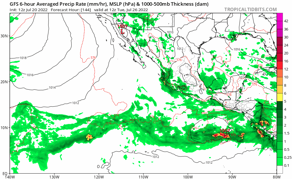
Actually 12z GFS never breaks down the monsoon trough from the 10/30 so losing confidence in that now.
0 likes
-
cycloneye
- Admin
- Posts: 139008
- Age: 67
- Joined: Thu Oct 10, 2002 10:54 am
- Location: San Juan, Puerto Rico
Re: 2022 EPAC Season
GFS now has only one developing at long range and has abandoned those 3-4 ones.
1 likes
Visit the Caribbean-Central America Weather Thread where you can find at first post web cams,radars
and observations from Caribbean basin members Click Here
and observations from Caribbean basin members Click Here
-
cycloneye
- Admin
- Posts: 139008
- Age: 67
- Joined: Thu Oct 10, 2002 10:54 am
- Location: San Juan, Puerto Rico
Re: 2022 EPAC Season
Euro forms the 10/30 AOI.

0 likes
Visit the Caribbean-Central America Weather Thread where you can find at first post web cams,radars
and observations from Caribbean basin members Click Here
and observations from Caribbean basin members Click Here