


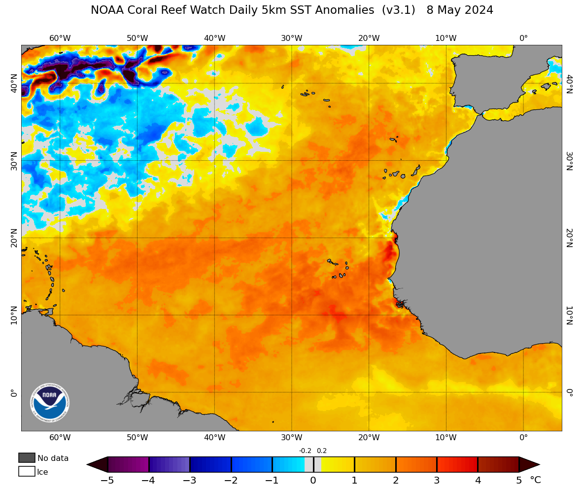
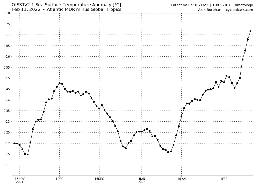
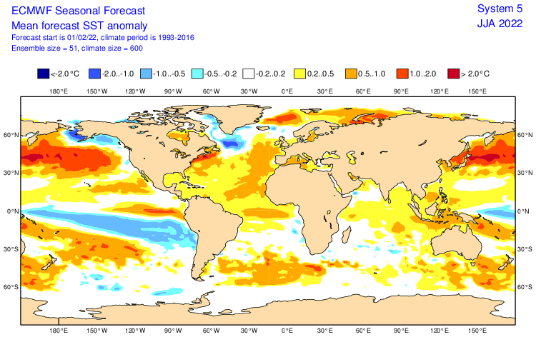
Is it early? Of course? Is this alarming for this part of the year? Well, considering most of the recent years started as -AMO and shifted to +AMO, this is indeed a new look for the Atlantic in February, with a slight but nevertheless +AMO. Oh, and the MDR sst anomalies. If we had this general look persist or strengthen going forward, then that's definitely something we must really start paying attention to.


