


tolakram wrote:SFLcane wrote:toad strangler wrote:
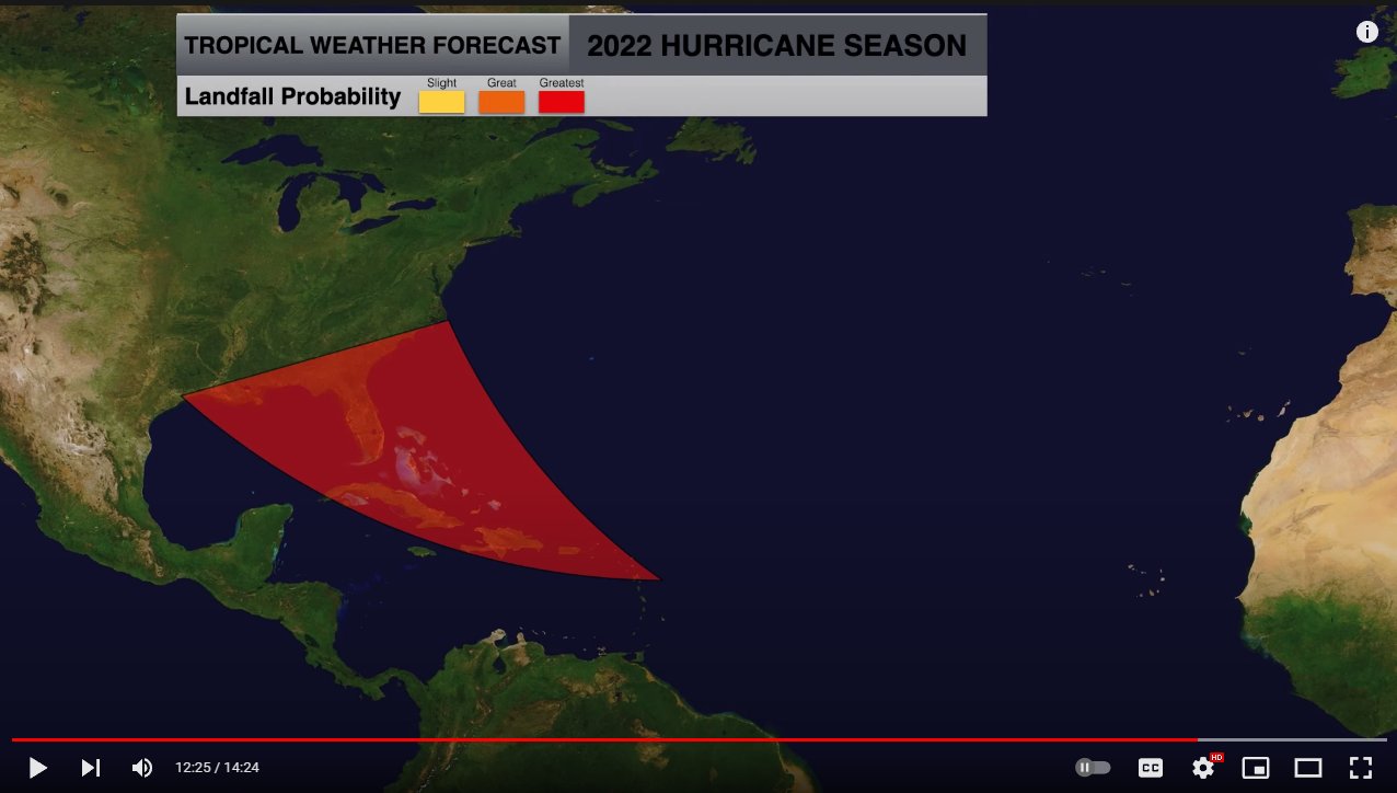
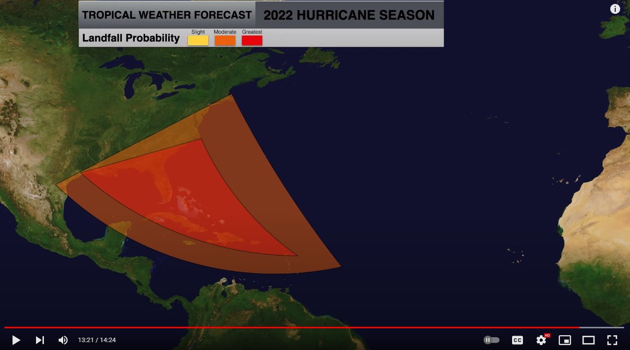
This guy is another one who mis reads the NOAA return rate maps as landfalls when in actuality they represent the return of a storms center within 50 nautical miles of a location. Huge difference.
Return rates? What is that? South Florida does not follow that at all as of late infact last time the eastcoast saw a big hurricane was i can't even remember maybe 2 decades ago. I for one think something large scale has changed maybe climate change which allows us to continue dodging storms on a yearly bases. We surely are not the hurricane capitol anymore. Who knows anymore
Those return rates include hurricanes that never made actual landfall. They always have. If they were close enough NOAA considers them to be impacts. It's that same criteria that makes Florida the 'hurricane capital'.
If those return were accurate metro dade and broward are wayyyyyyyy past due for a hurricane. There has been 0 major hurricane force winds in metro south florida for yrs. Many infact have no idea what its like going through a major hurricane. Trust me its a life changing experience that stays with you as i found out with Andrew. Lets hope the luck continues to roll


