underthwx wrote:cheezyWXguy wrote:Hurricaneman wrote:
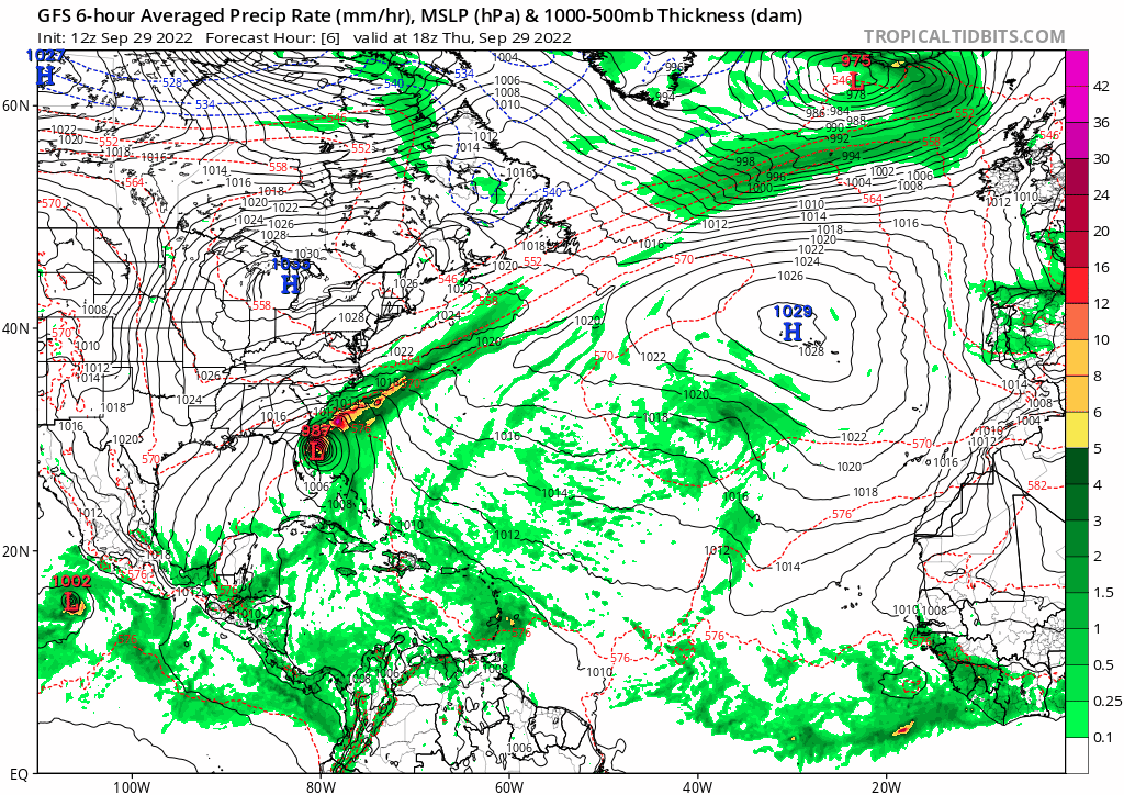
Another one to watch. I believe this comes from the wave south of former td11
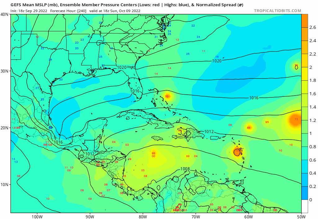
Yeah it concerns me that this isn’t the standard cag bias. Still a long way out so could be phantom, but I really don’t like the gefs’ tendency to turn it north into the gulf and then east into the same area hit by Ian
How accurate is this long range model, i am totally unfamiliar with this....thankyou!
It’s definitely not reliable that far out, this is fantasy land. The reason it concerns me at all is because we are getting into October, which climatologically favors a track like what we just saw with Ian for systems that make their way into the western Caribbean. There is some additional model support beyond the gefs, so it’s worth watching, but I would by no means take model output at face value this far out. Such a storm forming in such a location could easily bury itself in Central America, shear out, or never form to begin with, depending on how the pattern evolves.
I think this is also a good time to remind ourselves that climatology is a historical average of individual anomalies that gives a decent indicator of what a storm may do, should it form. It does not dictate what a storm will do.
Bottom line: it’s something to watch, but until we’re within 5 days of forecasted genesis, it’s nothing more than that.