

chaser1 wrote:How do ya explain the latest GFS run??
Movie Trailer: A NWS flunky, with some grudge against Purto Rico, acid tripping during his triple-shift at work who goes on to feed bad data into the upcoming forecast model run.
Speaking of acid tripping, have you seen the 6Z GFS with it having a second storm do a "wrong way Lenny" BEFORE it has the first one then make a u-turn and do something similar?
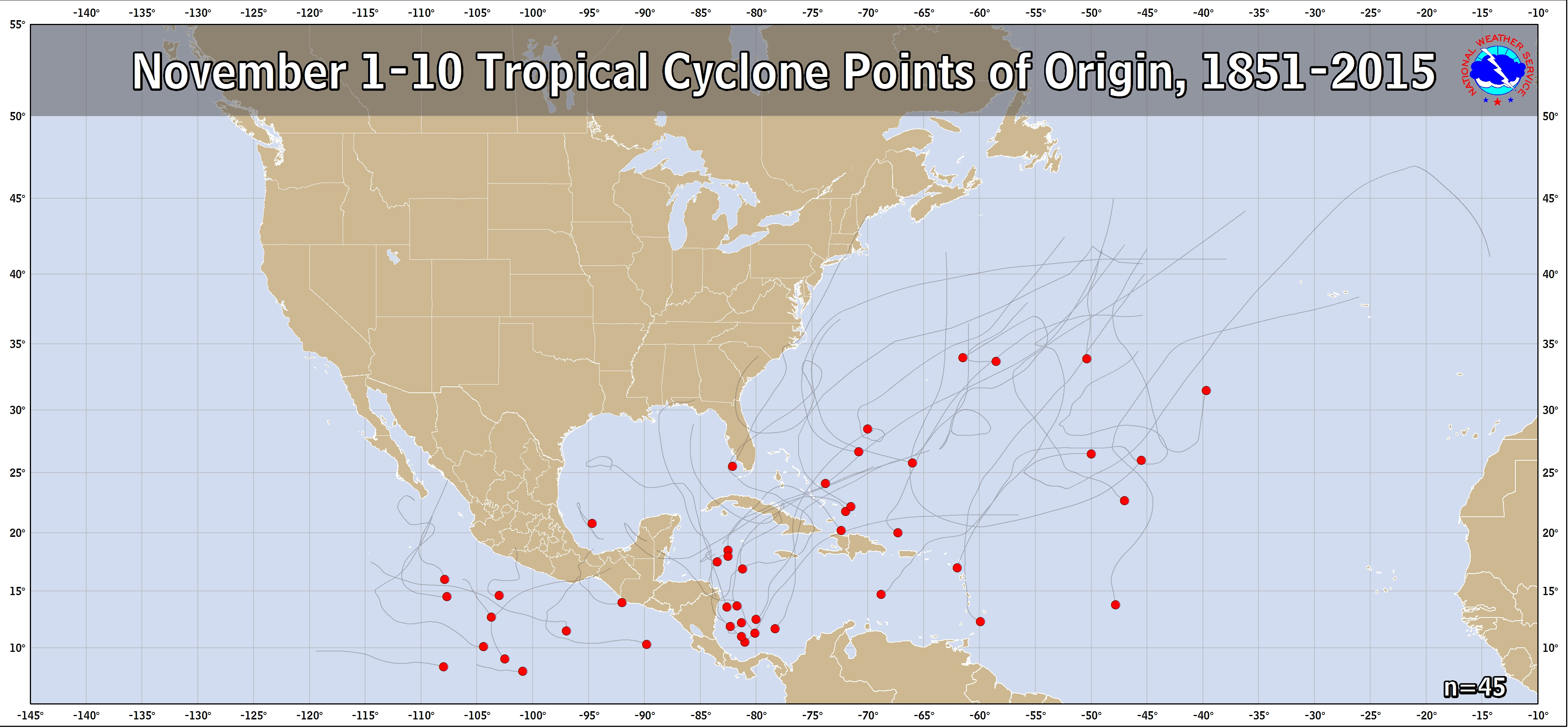
But to be more serious about a potential 2nd storm, the model consensus is suggesting that a 2nd TC may form in or near the SW Caribbean during the first few days of November. That includes the 0Z UKMET and yesterday's 12Z UKMET in addition to other models like the Euro, ICON, and GFS. The EPS, GEFS, and GEPS also are suggesting this has a good chance to occur in early November.
So, as crazy as it may sound, don't be surprised if both Lisa and Martin form in the Caribbean next week.


