Iceresistance wrote: could theoretically (Some models show it & some don't) make it into the Atlantic with the LLC and still named Agatha, or lose the LLC and regenerate as Alex.
Even if the system remained intact it would get a new name when it crosses over the Atlantic basin as the East Pacific names are for EPAC storms only. Also if an Atlantic(Caribbean) storm crosses Central America intact, it would also get a new name on the Pacific side, the same thing happens when an East Pacific storm crosses the international date line, they get a new name.
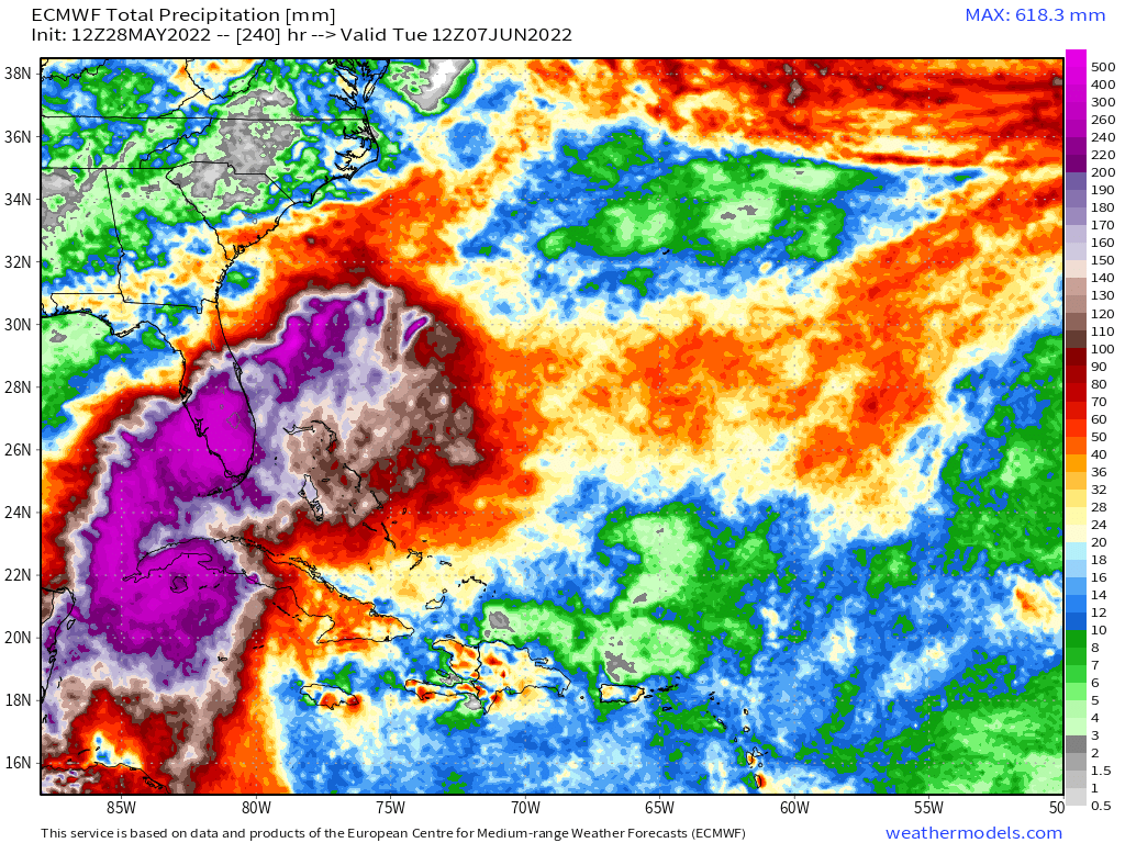
First Lemon of the year! I hoping the GFS solution actually pans out because I will be down in Puerto Rico and the GFS solution will be a swell maker for PR. I also do not want to be away if a storm hits home(Key West) as I would like to be able to make sure my boat is safe. The EURO and CMC are hinting at a significant storm heading towards South Florida.
That said, climatology rules this time of the year and the bullish models showing a potential hurricane are highly unlikely given shear factors...the water however is exceptionally hot in the gulf, even for this time of the year.