#166 Postby ouragans » Tue May 31, 2022 10:55 am
cycloneye wrote:The squadron will be ready for thursday afternoon.
WEATHER RECONNAISSANCE FLIGHTS
CARCAH, NATIONAL HURRICANE CENTER, MIAMI, FL.
1035 AM EDT TUE 31 MAY 2022
SUBJECT: TROPICAL CYCLONE PLAN OF THE DAY (TCPOD)
VALID 01/1100Z TO 02/1100Z JUNE 2022
TCPOD NUMBER.....22-005
I. ATLANTIC REQUIREMENTS
1. NEGATIVE RECONNAISSANCE REQUIREMENTS.
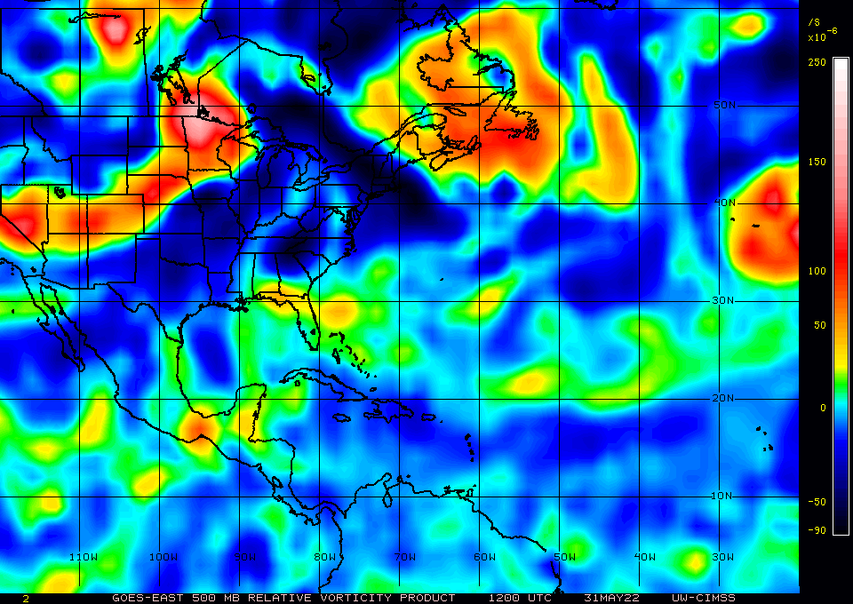
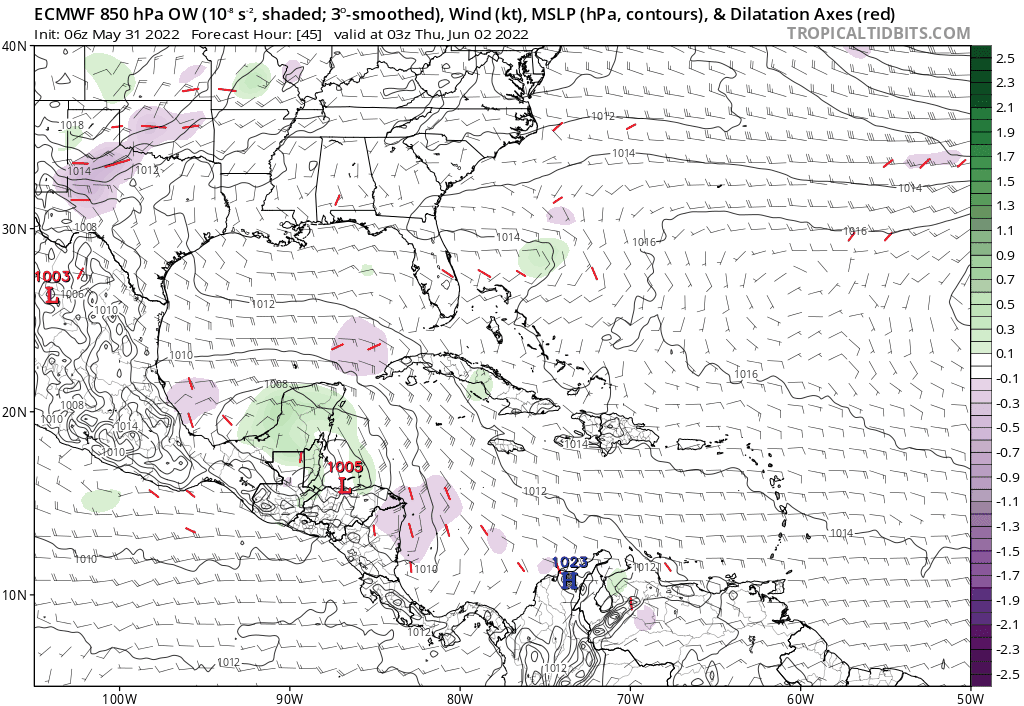
2. OUTLOOK FOR SUCCEEDING DAY: POSSIBLE LOW-LEVEL INVEST MISSION
EAST OF YUCATAN PENINSULA NEAR 19.0N 86.5W FOR 02/1830Z.
This position is SSE of Cozumel, Mexico. That would mean a NE-bound track from the actual position of the remnants
0 likes
Personal forecast disclaimer
This post is a personal point of view, not an information. Please refer to official statements for life-threatening decisions.
David '79, Frederic '79, Hugo '89, Iris, Luis & Marilyn '95, Georges '98, Lenny '99, Dean '07, Irma '17, Maria '17, Fiona '22, Philippe '23, Tammy '23
16°13'33.3,"6N -61°36'39.5"W


