Interesting Little Feature Northern GOM
Moderator: S2k Moderators
Forum rules
The posts in this forum are NOT official forecasts and should not be used as such. They are just the opinion of the poster and may or may not be backed by sound meteorological data. They are NOT endorsed by any professional institution or STORM2K. For official information, please refer to products from the National Hurricane Center and National Weather Service.
- tropicwatch
- Category 5

- Posts: 3205
- Age: 60
- Joined: Sat Jun 02, 2007 10:01 am
- Location: Panama City Florida
- Contact:
Interesting Little Feature Northern GOM
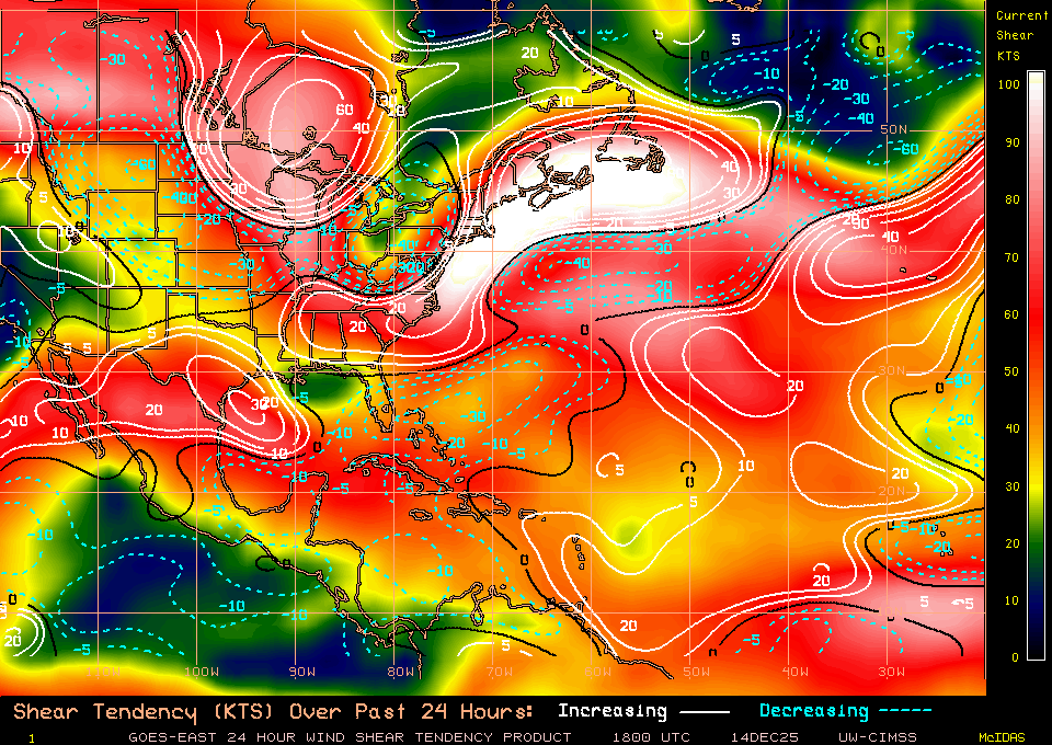
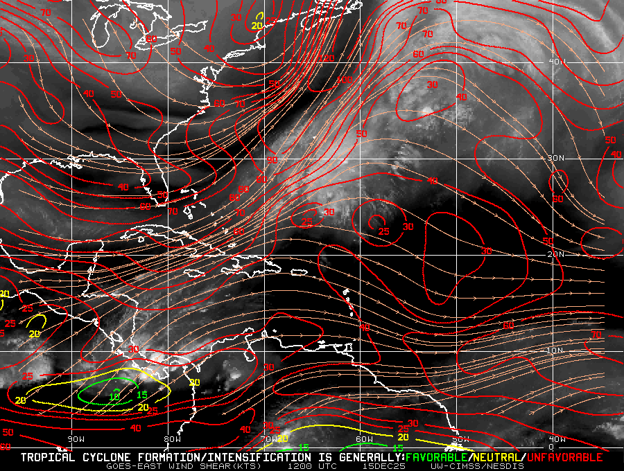
Noticed this morning convection and some 925mb vorticity in the northern Gulf of Mexico. It appears to be drifting south and possibly detaching from the latest front. The upper level conditions appear to be favorable. Could be the beginning of a home grown system if it persists. Something to watch.
925mb Vorticity
http://tropic.ssec.wisc.edu/real-time/windmain.php?&basin=atlantic&sat=wg8&prod=vor5&zoom=&time=
Wind shear
http://tropic.ssec.wisc.edu/real-time/windmain.php?&basin=atlantic&sat=wg8&prod=shr&zoom=&time=
Convection
https://weather.msfc.nasa.gov/goes/abi/goesEastconusband13.html
925mb Vorticity
http://tropic.ssec.wisc.edu/real-time/windmain.php?&basin=atlantic&sat=wg8&prod=vor5&zoom=&time=
Wind shear
http://tropic.ssec.wisc.edu/real-time/windmain.php?&basin=atlantic&sat=wg8&prod=shr&zoom=&time=
Convection
https://weather.msfc.nasa.gov/goes/abi/goesEastconusband13.html
2 likes
Tropicwatch
Agnes 72', Eloise 75, Elena 85', Kate 85', Charley 86', Florence 88', Beryl 94', Dean 95', Erin 95', Opal 95', Earl 98', Georges 98', Ivan 2004', Arlene 2005', Dennis 2005', Ida 2009' Debby 2012' Irma 2017' Michael 2018'
Agnes 72', Eloise 75, Elena 85', Kate 85', Charley 86', Florence 88', Beryl 94', Dean 95', Erin 95', Opal 95', Earl 98', Georges 98', Ivan 2004', Arlene 2005', Dennis 2005', Ida 2009' Debby 2012' Irma 2017' Michael 2018'
Re: Interesting Little Feature Northern GOM
Salute!
Yeah, I agree. Guess we Panhandle folks pay more attention to the Gulf as it heats up earlier than the Atlantic, maybe faster than the Caribb. Normally, we see the phenomena in fall when a front stalls out, huh?
Gums sends...
Yeah, I agree. Guess we Panhandle folks pay more attention to the Gulf as it heats up earlier than the Atlantic, maybe faster than the Caribb. Normally, we see the phenomena in fall when a front stalls out, huh?
Gums sends...
0 likes
- cycloneye
- Admin

- Posts: 139019
- Age: 67
- Joined: Thu Oct 10, 2002 10:54 am
- Location: San Juan, Puerto Rico
Re: Interesting Little Feature Northern GOM

1 likes
Visit the Caribbean-Central America Weather Thread where you can find at first post web cams,radars
and observations from Caribbean basin members Click Here
and observations from Caribbean basin members Click Here
Re: Interesting Little Feature Northern GOM
I too noticed this earlier this morning. This time of year, these features bear watching. Is this area the tail end of a front?
0 likes
- tropicwatch
- Category 5

- Posts: 3205
- Age: 60
- Joined: Sat Jun 02, 2007 10:01 am
- Location: Panama City Florida
- Contact:
Re: Interesting Little Feature Northern GOM
underthwx wrote:I too noticed this earlier this morning. This time of year, these features bear watching. Is this area the tail end of a front?
I believe so.
0 likes
Tropicwatch
Agnes 72', Eloise 75, Elena 85', Kate 85', Charley 86', Florence 88', Beryl 94', Dean 95', Erin 95', Opal 95', Earl 98', Georges 98', Ivan 2004', Arlene 2005', Dennis 2005', Ida 2009' Debby 2012' Irma 2017' Michael 2018'
Agnes 72', Eloise 75, Elena 85', Kate 85', Charley 86', Florence 88', Beryl 94', Dean 95', Erin 95', Opal 95', Earl 98', Georges 98', Ivan 2004', Arlene 2005', Dennis 2005', Ida 2009' Debby 2012' Irma 2017' Michael 2018'
- tropicwatch
- Category 5

- Posts: 3205
- Age: 60
- Joined: Sat Jun 02, 2007 10:01 am
- Location: Panama City Florida
- Contact:
Re: Interesting Little Feature Northern GOM
Convection is increasing now to watch for pressure drops.


1 likes
Tropicwatch
Agnes 72', Eloise 75, Elena 85', Kate 85', Charley 86', Florence 88', Beryl 94', Dean 95', Erin 95', Opal 95', Earl 98', Georges 98', Ivan 2004', Arlene 2005', Dennis 2005', Ida 2009' Debby 2012' Irma 2017' Michael 2018'
Agnes 72', Eloise 75, Elena 85', Kate 85', Charley 86', Florence 88', Beryl 94', Dean 95', Erin 95', Opal 95', Earl 98', Georges 98', Ivan 2004', Arlene 2005', Dennis 2005', Ida 2009' Debby 2012' Irma 2017' Michael 2018'
- MHC Tracking
- Tropical Storm

- Posts: 169
- Joined: Mon Mar 15, 2021 10:05 am
Re: Interesting Little Feature Northern GOM
Currently, not even the mesoscale models are picking up on this. We'll have to see if a response is shown at the 18z cycle.
1 likes
-
TallyTracker
- Category 2

- Posts: 584
- Joined: Thu Oct 11, 2018 2:46 pm
Re: Interesting Little Feature Northern GOM
I’ve seen quick spin up tropical storms from systems like this with little to no warning on occasion. Definitely something to keep an eye on though I doubt it will become more than a rain-maker for the northern Gulf Coast and Florida Peninsula.
Emily 2017 is a recent one. Went to work in the Tampa Area on a rainy day with little chance of development. By 9 am, a tropical storm was declared heading straight for me. Landfall occurred before noon as a 60 mph TS. Normally being under a TS Warning would have been a day off but it spun up so fast, my organization’s leadership had no time to react. By the time I went home Emily was a TD.
Emily 2017 is a recent one. Went to work in the Tampa Area on a rainy day with little chance of development. By 9 am, a tropical storm was declared heading straight for me. Landfall occurred before noon as a 60 mph TS. Normally being under a TS Warning would have been a day off but it spun up so fast, my organization’s leadership had no time to react. By the time I went home Emily was a TD.
0 likes
Fran '96, Georges '98, Gordon '00, Gabrielle '01, Charley '04, Frances '04, Jeanne '04, Barry '07, Fay '08, Debby '12, Matthew '16, Emily '17, Irma '17, Michael ‘18, Elsa ‘21, Fred ‘21, Mindy ‘21, Nicole ‘22, Idalia ‘23
Re: Interesting Little Feature Northern GOM
Used GOES-16 Snow/Ice Band to have a look at this system> The white clouds are low level clouds and the grey clouds are higher clouds, well they does seem to be rotations in the system, one is seen on the northern edge and they seem to be a larger rotation over all.
Source for those who want a closer look - https://col.st/IrxxN
Source for those who want a closer look - https://col.st/IrxxN
1 likes
- skyline385
- Category 5

- Posts: 2444
- Age: 33
- Joined: Wed Aug 26, 2020 11:15 pm
- Location: Palm Beach County FL
Interesting Little Feature Northern GOM
Last edited by skyline385 on Sat Jun 11, 2022 12:44 pm, edited 2 times in total.
0 likes
-
Aric Dunn
- Category 5

- Posts: 21228
- Age: 41
- Joined: Sun Sep 19, 2004 9:58 pm
- Location: Ready for the Chase.
- Contact:
Re: Interesting Little Feature Northern GOM
crossing over a bouy. it is a small mesovort but it is at the surface. pressure looks to be 1010 mb with background pressures elsewhere around 1014 to 1015.
Only needs to fire convection over that vort and it could spin up quick. though once off the SE coast it might have a better shot.
It could also stall in the NE gulf if it does pop some convection.
Only needs to fire convection over that vort and it could spin up quick. though once off the SE coast it might have a better shot.
It could also stall in the NE gulf if it does pop some convection.
3 likes
Note: If I make a post that is brief. Please refer back to previous posts for the analysis or reasoning. I do not re-write/qoute what my initial post said each time.
If there is nothing before... then just ask
Space & Atmospheric Physicist, Embry-Riddle Aeronautical University,
I believe the sky is falling...
If there is nothing before... then just ask
Space & Atmospheric Physicist, Embry-Riddle Aeronautical University,
I believe the sky is falling...
-
Nederlander
- S2K Supporter

- Posts: 1171
- Joined: Sat Jul 19, 2008 4:28 pm
- Location: Nederland, TX
Re: Interesting Little Feature Northern GOM
TallyTracker wrote:I’ve seen quick spin up tropical storms from systems like this with little to no warning on occasion. Definitely something to keep an eye on though I doubt it will become more than a rain-maker for the northern Gulf Coast and Florida Peninsula.
Emily 2017 is a recent one. Went to work in the Tampa Area on a rainy day with little chance of development. By 9 am, a tropical storm was declared heading straight for me. Landfall occurred before noon as a 60 mph TS. Normally being under a TS Warning would have been a day off but it spun up so fast, my organization’s leadership had no time to react. By the time I went home Emily was a TD.
Humberto - 2007 for me. Came out of nowhere. It went from disorganized convection from a front to a 90mph hurricane in about 24 hours. Crazy..
1 likes
- StPeteMike
- Category 1

- Posts: 355
- Joined: Thu Jun 07, 2018 11:26 pm
Re: Interesting Little Feature Northern GOM
I believe this is the feature GFS showed a potential of spinning up off the Carolinas, though seems to have dropped the possibility.
0 likes
The above post is not official and should not be used as such. It is the opinion of the poster and may or may not be backed by sound meteorological data. It is not endorsed by any professional institution or storm2k.org. For official information, please refer to the NHC and NWS products.
- tropicwatch
- Category 5

- Posts: 3205
- Age: 60
- Joined: Sat Jun 02, 2007 10:01 am
- Location: Panama City Florida
- Contact:
Re: Interesting Little Feature Northern GOM
Pressures do appear to be falling.


1 likes
Tropicwatch
Agnes 72', Eloise 75, Elena 85', Kate 85', Charley 86', Florence 88', Beryl 94', Dean 95', Erin 95', Opal 95', Earl 98', Georges 98', Ivan 2004', Arlene 2005', Dennis 2005', Ida 2009' Debby 2012' Irma 2017' Michael 2018'
Agnes 72', Eloise 75, Elena 85', Kate 85', Charley 86', Florence 88', Beryl 94', Dean 95', Erin 95', Opal 95', Earl 98', Georges 98', Ivan 2004', Arlene 2005', Dennis 2005', Ida 2009' Debby 2012' Irma 2017' Michael 2018'
- rolltide
- Tropical Storm

- Posts: 234
- Age: 63
- Joined: Thu Sep 09, 2004 5:33 pm
- Location: Pensacola Florida
Re: Interesting Little Feature Northern GOM
I'm watching an area about 150 or so miles due south of Mobile. With the vortex that it spit out the the northeast it seems like a new area of thunderstorms and slight rotation is in that area.
1 likes
- tropicwatch
- Category 5

- Posts: 3205
- Age: 60
- Joined: Sat Jun 02, 2007 10:01 am
- Location: Panama City Florida
- Contact:
Re: Interesting Little Feature Northern GOM
rolltide wrote:I'm watching an area about 150 or so miles due south of Mobile. With the vortex that it spit out the the northeast it seems like a new area of thunderstorms and slight rotation is in that area.
From a ship approximately 75 miles south of mobile. Don't know about the wind reading.
SHIP
Location: 29.4N 87.9W
06/11/2022 2000 UTC
Winds: W (260°) at 80.1 kts
Atmospheric Pressure: 29.85 in
Air Temperature: 83.7 °F
Dew Point: 74.8 °F
0 likes
Tropicwatch
Agnes 72', Eloise 75, Elena 85', Kate 85', Charley 86', Florence 88', Beryl 94', Dean 95', Erin 95', Opal 95', Earl 98', Georges 98', Ivan 2004', Arlene 2005', Dennis 2005', Ida 2009' Debby 2012' Irma 2017' Michael 2018'
Agnes 72', Eloise 75, Elena 85', Kate 85', Charley 86', Florence 88', Beryl 94', Dean 95', Erin 95', Opal 95', Earl 98', Georges 98', Ivan 2004', Arlene 2005', Dennis 2005', Ida 2009' Debby 2012' Irma 2017' Michael 2018'
- skyline385
- Category 5

- Posts: 2444
- Age: 33
- Joined: Wed Aug 26, 2020 11:15 pm
- Location: Palm Beach County FL
Re: Interesting Little Feature Northern GOM
tropicwatch wrote:rolltide wrote:I'm watching an area about 150 or so miles due south of Mobile. With the vortex that it spit out the the northeast it seems like a new area of thunderstorms and slight rotation is in that area.
From a ship approximately 75 miles south of mobile. Don't know about the wind reading.
SHIP
Location: 29.4N 87.9W
06/11/2022 2000 UTC
Winds: W (260°) at 80.1 kts
Atmospheric Pressure: 29.85 in
Air Temperature: 83.7 °F
Dew Point: 74.8 °F
80 kts that ship needs to calibrate its instruments
2 likes
Re: Interesting Little Feature Northern GOM
tropicwatch wrote:rolltide wrote:I'm watching an area about 150 or so miles due south of Mobile. With the vortex that it spit out the the northeast it seems like a new area of thunderstorms and slight rotation is in that area.
From a ship approximately 75 miles south of mobile. Don't know about the wind reading.
SHIP
Location: 29.4N 87.9W
06/11/2022 2000 UTC
Winds: W (260°) at 80.1 kts
Atmospheric Pressure: 29.85 in
Air Temperature: 83.7 °F
Dew Point: 74.8 °F
I saw that reading and the ship has been reporting 80mph winds for the last week. Looks like their anemometer is broken.

1 likes
Re: Interesting Little Feature Northern GOM
Seems to be in an area of favorable wind shear


0 likes
FSU '24 student pursuing a degree in meteorology. Consult NHC for official information.
- skyline385
- Category 5

- Posts: 2444
- Age: 33
- Joined: Wed Aug 26, 2020 11:15 pm
- Location: Palm Beach County FL
Re: Interesting Little Feature Northern GOM
Think those MSLP readings dont mean much, there is a low over the entire Gulf right now


1 likes
Who is online
Users browsing this forum: ColbyP06, duilaslol, StPeteMike and 57 guests


