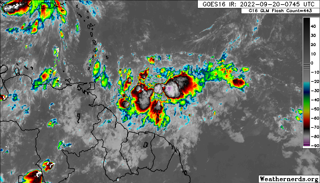
Deshaunrob17 wrote:Let’s take it step by step.. Firstly, Trinidad and Tobago/ Southern Windwards. I had my doubts yesterday with the GfS but based on satellite presentation this morning , I’m let to wonder!! GfS has shown a strong ts moving over T &T for a while now. This is a country that’s not used to these winds!!! That could be a problem!!! Flooding too!
Yepppp very well said! Looks like its gonna hug that 10N - 11N line and produce some flooding issues for Grenada and T&T. Couldve been worse for the other windward islands if Fiona's outflow wasnt squishing it, as it is right now! I dont really believe it can be named before the islands but I still think a TD or PTC is a possibility. Im very surprised this isnt an invest yet as it will start to affect the islands tomorrow... #wheres98L
 LMAO: Not even 1 minute after posting this apparently our tropical wave is now 98L, just my luck


