

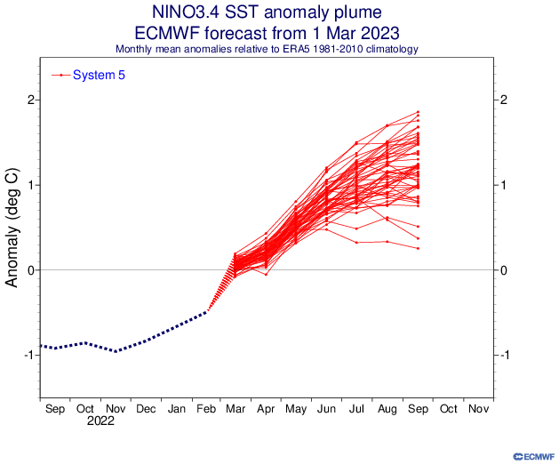
CyclonicFury wrote:The March ECMWF seasonal is out (and it goes through JAS). It does show El Nino conditions, but basin-wide warmth in the Atlantic. This seems to be a trend in the climate models, if it verifies the basin-wide warmth could cancel out some of the El Nino effects. It shows above-normal pressures in the tropical Atlantic and below-normal precipitation, but nothing that would go as far to say "season cancel." Through the end of September, the ECMWF calls for 90% of normal ACE in the Atlantic, with 10.7 tropical storms and 5.1 hurricanes. In the past, this model significantly underestimated Atlantic activity, but it seems the bias may have been over-corrected, as last year it was way too high with Atlantic activity.
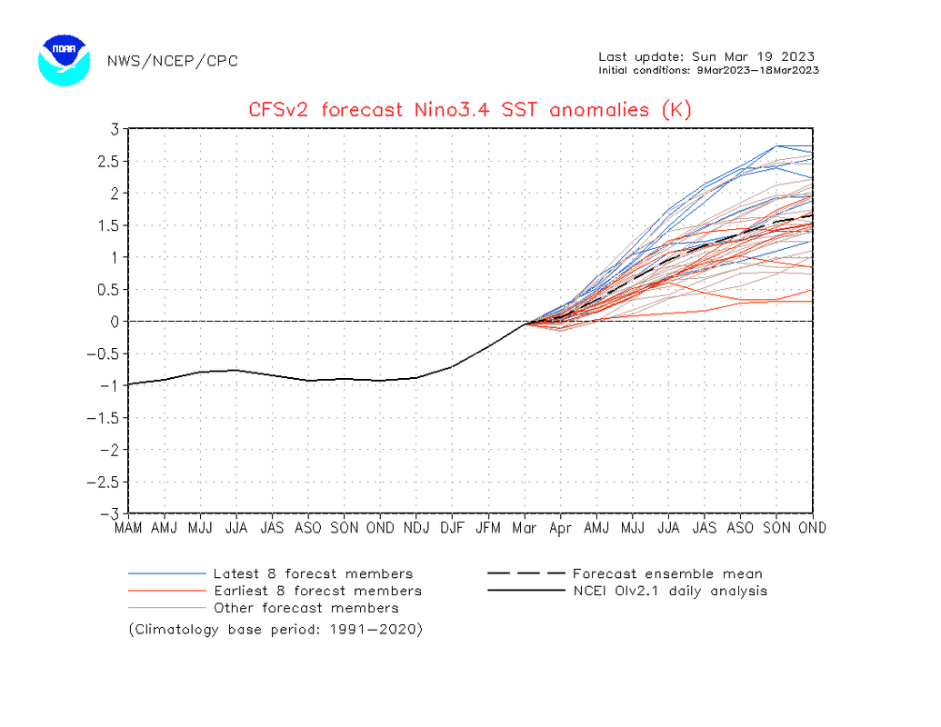
Nino 3.4 plume
https://i.imgur.com/vBNREsz.png
SST anomaly
https://i.imgur.com/jZc3c5G.png
Precipitation anomaly
https://i.imgur.com/lU3QMR6.png
MSLP anomaly tercile
https://i.imgur.com/inJc119.png
Atlantic ACE (90% of normal through September - sounds about right since El Nino seasons often end earlier).
https://i.imgur.com/lubqiI3.png
Tropical storms (10.7 through the end of September)
https://i.imgur.com/aEQU9Gg.png
Hurricanes (5.1 through the end of September)
https://i.imgur.com/RbRAvxW.png
It's kind of funny to see that the Atlantic has arguably the most favorable sst anomaly profile since 2020 (where the deep tropics are above average and a warm Canary Current already in place as iirc 2021 and 2022 were not as warm at this point in time), in a year that is expected to enter +ENSO territory rather than La Nina. Very curious to see what activity will look like assuming there is robust warmth in the basin by ASO. I agree, unlike many of the recent El Nino years (this also include 2018 for that matter), the Atlantic is starting off very strong and healthy with its sst anomalies, and if this holds we could potentially see a season more active than expected.
I can assure you that if we were in a first year La Nina with this warmth, we could potentially see a hyperactive season. El Nino or warm neutral might press the brakes a bit thankfully.


