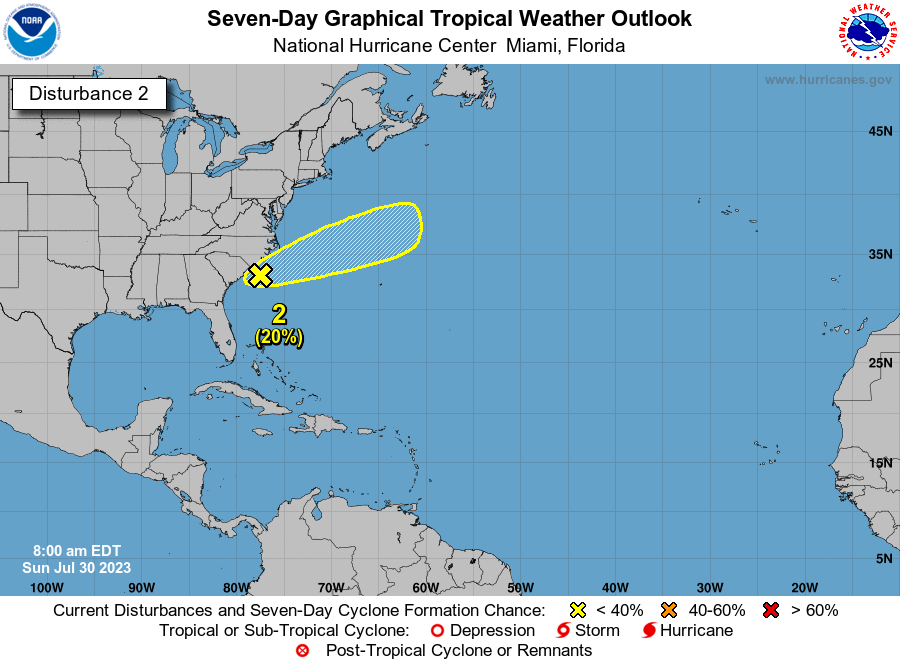
Shower and thunderstorm activity has increased in association with a
trough of low pressure that recently emerged off the Carolina
coastline, and is currently located about 100 miles south of
Wilmington, North Carolina. Environmental conditions appear
generally favorable for some additional development over the next
day or two as the system gradually accelerates east-northeastward
into the northwestern Atlantic ocean. Afterwards, this system is
likely to merge with a frontal boundary.
* Formation chance through 48 hours...low...20 percent.
* Formation chance through 7 days...low...20 percent.
Forecaster Papin