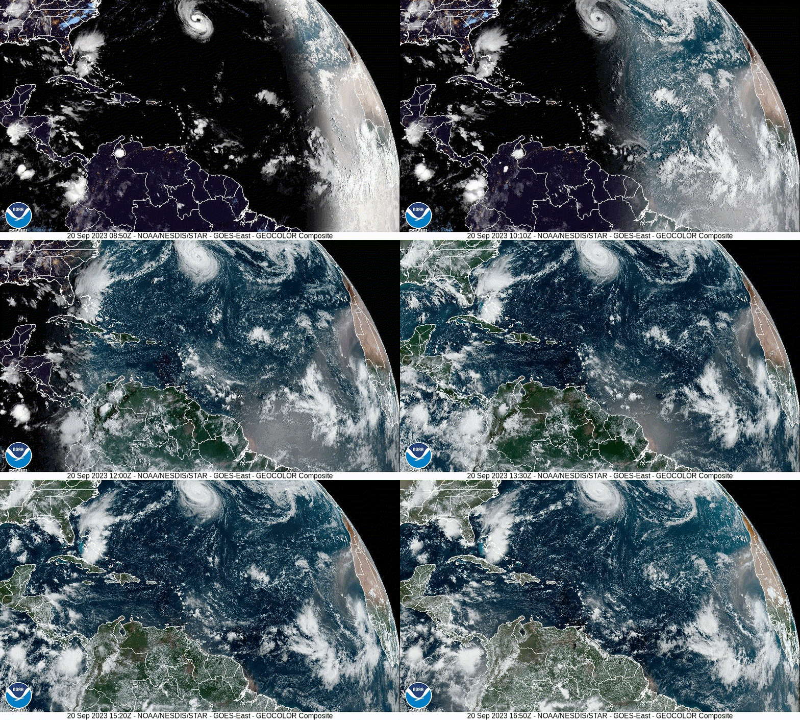
Tropical Wave SW of the Cabo Verde Islands (Is Invest 90L)

This is the general tropical discussion area. Anyone can take their shot at predicting a storms path.

Moderator: S2k Moderators

Forum rules

The posts in this forum are NOT official forecasts and should not be used as such. They are just the opinion of the poster and may or may not be backed by sound meteorological data. They are NOT endorsed by any professional institution or STORM2K. For official information, please refer to products from the National Hurricane Center and National Weather Service.

Help Support Storm2K
Message
Author
User avatar
Teban54
Category 5
Category 5
Posts: 1959
Joined: Sat May 19, 2018 1:19 pm

Re: Tropical Wave off the African Coast

#101 Postby Teban54 » Wed Sep 20, 2023 11:52 am

mantis83 wrote:concerning run for the islands and bahamas if latest gfs is correct. cmc recurves well north and east of islands, lets see what the euro says before sounding the alarms

So if a single run of a single model is further east, it's sufficient to be called a trend; but if a single run of a single model is further west, we have to see what others say before sounding the alarms?
6 likes   

User avatar
SFLcane
S2K Supporter
S2K Supporter
Posts: 9607
Age: 46
Joined: Sat Jun 05, 2010 1:44 pm
Location: Lake Worth Florida

Re: Tropical Wave off the African Coast

#102 Postby SFLcane » Wed Sep 20, 2023 11:56 am

Teban54 wrote:
mantis83 wrote:concerning run for the islands and bahamas if latest gfs is correct. cmc recurves well north and east of islands, lets see what the euro says before sounding the alarms

So if a single run of a single model is further east, it's sufficient to be called a trend; but if a single run of a single model is further west, we have to see what others say before sounding the alarms?


:roll:
6 likes   

User avatar
ScottNAtlanta
Category 5
Category 5
Posts: 1998
Joined: Sat May 25, 2013 3:11 pm
Location: Atlanta, GA

Re: Tropical Wave off the African Coast

#103 Postby ScottNAtlanta » Wed Sep 20, 2023 12:17 pm

I think it's a bit early to be getting worked up about a forecast model at 144 hrs out.
I just want 3 more hurricanes (out to sea preferred), and 30 more ACE points and my pre-season forecast will hit the bullseye (and sadly, I am probably under done)
0 likes   
The posts in this forum are NOT official forecast and should not be used as such. They are just the opinion of the poster and may or may not be backed by sound meteorological data. They are NOT endorsed by any professional institution or storm2k.org. For official information, please refer to the NHC and NWS products.

mantis83
Tropical Storm
Tropical Storm
Posts: 123
Joined: Fri Dec 05, 2003 4:47 pm

Re: Tropical Wave off the African Coast

#104 Postby mantis83 » Wed Sep 20, 2023 12:18 pm

Teban54 wrote:
mantis83 wrote:concerning run for the islands and bahamas if latest gfs is correct. cmc recurves well north and east of islands, lets see what the euro says before sounding the alarms

So if a single run of a single model is further east, it's sufficient to be called a trend; but if a single run of a single model is further west, we have to see what others say before sounding the alarms?

nope...unless it's a married run of a married model.. then yes! :double: j/k seriously tho i just prefer to put more weight towards the euro in most situations It could cave in one run towards the gfs tho, hopefully it stays away from land
1 likes   

mantis83
Tropical Storm
Tropical Storm
Posts: 123
Joined: Fri Dec 05, 2003 4:47 pm

Re: Tropical Wave off the African Coast

#105 Postby mantis83 » Wed Sep 20, 2023 12:31 pm

that was one wild gfs run as it rakes the islands, bounces off the florida force field, turns north thru the bahamas then due north until getting tugged back west towards boston all the while growing in size geez...
1 likes   

User avatar
wxman57
Moderator-Pro Met
Moderator-Pro Met
Posts: 22482
Age: 66
Joined: Sat Jun 21, 2003 8:06 pm
Location: Houston, TX (southwest)

Re: Tropical Wave off the African Coast

#106 Postby wxman57 » Wed Sep 20, 2023 12:38 pm

underthwx wrote:
Good morning wxman....could you explain why this system developing earlier, would possibly turn Northward,? It's my understanding that the system will be affected by some shear early in its evolution, which may keep it in check for some time? I appreciate it...


A weaker, non-developing tropical wave is steered westward by low-level easterly trades. Once a storm develops, it is steered by winds higher up in the atmosphere, which are generally not the same as the low-level easterly trades. In this case, there is a weakness in the upper-level ridge east of the Caribbean. A stronger storm would "feel" that weakness and turn to the north. A weaker wave would not feel the weakness, and it would be carried westward by the lower level winds.
13 likes   

User avatar
cycloneye
Admin
Admin
Posts: 139120
Age: 67
Joined: Thu Oct 10, 2002 10:54 am
Location: San Juan, Puerto Rico

Re: Tropical Wave off the African Coast

#107 Postby cycloneye » Wed Sep 20, 2023 12:52 pm

The merge is comming and the cone is more to the west.

Eastern Tropical Atlantic:
A tropical wave is currently located a couple of hundred miles
southeast of the Cabo Verde Islands. This system is expected
to merge with another disturbance located a few hundred miles to its
west in a few days. Environmental conditions are forecast to
be conducive for gradual development, and a tropical depression is
likely to form late this week or this weekend while the system moves
generally westward at 10 to 15 mph across the eastern and central
tropical Atlantic.
* Formation chance through 48 hours...low...10 percent.
* Formation chance through 7 days...high...70 percent.


Image
1 likes   
Visit the Caribbean-Central America Weather Thread where you can find at first post web cams,radars
and observations from Caribbean basin members Click Here

underthwx
Category 5
Category 5
Posts: 1928
Joined: Sat Jul 30, 2011 2:14 pm
Location: Brazoria County Texas

Re: Tropical Wave off the African Coast

#108 Postby underthwx » Wed Sep 20, 2023 1:01 pm

wxman57 wrote:
underthwx wrote:
Good morning wxman....could you explain why this system developing earlier, would possibly turn Northward,? It's my understanding that the system will be affected by some shear early in its evolution, which may keep it in check for some time? I appreciate it...


A weaker, non-developing tropical wave is steered westward by low-level easterly trades. Once a storm develops, it is steered by winds higher up in the atmosphere, which are generally not the same as the low-level easterly trades. In this case, there is a weakness in the upper-level ridge east of the Caribbean. A stronger storm would "feel" that weakness and turn to the north. A weaker wave would not feel the weakness, and it would be carried westward by the lower level winds.

Thanks for the informative reply....it reminds me of Dr. Neil Frank describing stronger systems moving along "rivers of air"...like you refer to....you are in good company Xman...
1 likes   

Sciencerocks
Category 5
Category 5
Posts: 7287
Age: 38
Joined: Thu Jul 06, 2017 1:51 am

Re: Tropical Wave off the African Coast

#109 Postby Sciencerocks » Wed Sep 20, 2023 1:39 pm

Image
1 likes   

User avatar
canebeard
Tropical Depression
Tropical Depression
Posts: 74
Joined: Sun Jul 05, 2009 4:06 pm
Contact:

Re: Tropical Wave off the African Coast

#110 Postby canebeard » Wed Sep 20, 2023 1:51 pm

underthwx wrote:
wxman57 wrote:
underthwx wrote:
Good morning wxman....could you explain why this system developing earlier, would possibly turn Northward,? It's my understanding that the system will be affected by some shear early in its evolution, which may keep it in check for some time? I appreciate it...


A weaker, non-developing tropical wave is steered westward by low-level easterly trades. Once a storm develops, it is steered by winds higher up in the atmosphere, which are generally not the same as the low-level easterly trades. In this case, there is a weakness in the upper-level ridge east of the Caribbean. A stronger storm would "feel" that weakness and turn to the north. A weaker wave would not feel the weakness, and it would be carried westward by the lower level winds.

Thanks for the informative reply....it reminds me of Dr. Neil Frank describing stronger systems moving along "rivers of air"...like you refer to....you are in good company Xman...


"There is a wolf out there, this time!" Neil Frank
2 likes   
List of 79 tropical cyclones intercepted by Richard Horodner:
http://www.canebeard.com/page/page/572246.htm
former storm2k screenname Beoumont 2009+

mantis83
Tropical Storm
Tropical Storm
Posts: 123
Joined: Fri Dec 05, 2003 4:47 pm

Re: Tropical Wave off the African Coast

#111 Postby mantis83 » Wed Sep 20, 2023 1:53 pm

12z euro remains consistent in showing a weaker system well north and east of the islands....gfs may be on an island too
0 likes   

MEANINGLESS_NUMBERS
Tropical Depression
Tropical Depression
Posts: 58
Joined: Mon Nov 02, 2020 1:43 pm

Re: Tropical Wave off the African Coast

#112 Postby MEANINGLESS_NUMBERS » Wed Sep 20, 2023 2:10 pm

mantis83 wrote:that was one wild gfs run as it rakes the islands, bounces off the florida force field, turns north thru the bahamas then due north until getting tugged back west towards boston all the while growing in size geez...


This would be a retirement candidate.
1 likes   

User avatar
canebeard
Tropical Depression
Tropical Depression
Posts: 74
Joined: Sun Jul 05, 2009 4:06 pm
Contact:

Re: Tropical Wave off the African Coast

#113 Postby canebeard » Wed Sep 20, 2023 2:14 pm

Analog. The "Great Hurricane Inez" (quote from NHC advisories while in central Caribbean) 1966, September 21-- Oct 11. Recon got a gust of 197 mph on 9/28/66. 927mb. 165 mph max sustained.

[imgur][/imgur]Image
3 likes   
List of 79 tropical cyclones intercepted by Richard Horodner:
http://www.canebeard.com/page/page/572246.htm
former storm2k screenname Beoumont 2009+

User avatar
Dynamic
Tropical Depression
Tropical Depression
Posts: 81
Joined: Wed Jul 19, 2006 2:11 pm

Re: Tropical Wave off the African Coast

#114 Postby Dynamic » Wed Sep 20, 2023 3:39 pm

wxman57 wrote:
underthwx wrote:
Good morning wxman....could you explain why this system developing earlier, would possibly turn Northward,? It's my understanding that the system will be affected by some shear early in its evolution, which may keep it in check for some time? I appreciate it...


A weaker, non-developing tropical wave is steered westward by low-level easterly trades. Once a storm develops, it is steered by winds higher up in the atmosphere, which are generally not the same as the low-level easterly trades. In this case, there is a weakness in the upper-level ridge east of the Caribbean. A stronger storm would "feel" that weakness and turn to the north. A weaker wave would not feel the weakness, and it would be carried westward by the lower level winds.


Hi,
With great respect I ask you this question to understand better. Why in this case a stronger system as suggested by GFS moves further west and a weaker one as suggested by Euro recurve before?
1 likes   

AutoPenalti
Category 5
Category 5
Posts: 3949
Age: 27
Joined: Mon Aug 17, 2015 4:16 pm
Location: Ft. Lauderdale, Florida

Re: Tropical Wave off the African Coast

#115 Postby AutoPenalti » Wed Sep 20, 2023 3:42 pm

0 likes   
The posts in this forum are NOT official forecasts and should not be used as such. They are just the opinion of the poster and may or may not be backed by sound meteorological data. They are NOT endorsed by any professional institution or STORM2K. For official information, please refer to products from the NHC and NWS.


Model Runs Cheat Sheet:
GFS (5:30 AM/PM, 11:30 AM/PM)
HWRF, GFDL, UKMET, NAVGEM (6:30-8:00 AM/PM, 12:30-2:00 AM/PM)
ECMWF (1:45 AM/PM)

TCVN
is a weighted averaged

User avatar
ElectricStorm
Category 5
Category 5
Posts: 4566
Age: 23
Joined: Tue Aug 13, 2019 11:23 pm
Location: Skiatook, OK / Norman, OK

Re: Tropical Wave off the African Coast

#116 Postby ElectricStorm » Wed Sep 20, 2023 5:26 pm

18z GFS similar to 12z through hour 186
1 likes   
I am in no way a professional. Take what I say with a grain of salt as I could be totally wrong. Please refer to the NHC, NWS, or SPC for official information.

Boomer Sooner!

User avatar
Category5Kaiju
Category 5
Category 5
Posts: 3360
Age: 22
Joined: Thu Dec 24, 2020 12:45 pm
Location: Seattle

Re: Tropical Wave off the African Coast

#117 Postby Category5Kaiju » Wed Sep 20, 2023 5:27 pm

Latest GFS run looks pretty ugly
0 likes   
Unless explicitly stated, all information covered in my posts is based on my opinions and observations. Please refer to a professional meteorologist or an accredited weather research agency otherwise, especially if serious decisions must be made in the event of a potentially life-threatening tropical storm or hurricane.

User avatar
cycloneye
Admin
Admin
Posts: 139120
Age: 67
Joined: Thu Oct 10, 2002 10:54 am
Location: San Juan, Puerto Rico

Re: Tropical Wave off the African Coast

#118 Postby cycloneye » Wed Sep 20, 2023 5:53 pm

GFS has been consistent run after run developing this wave.

Image
2 likes   
Visit the Caribbean-Central America Weather Thread where you can find at first post web cams,radars
and observations from Caribbean basin members Click Here

mantis83
Tropical Storm
Tropical Storm
Posts: 123
Joined: Fri Dec 05, 2003 4:47 pm

Re: Tropical Wave off the African Coast

#119 Postby mantis83 » Wed Sep 20, 2023 6:07 pm

wow! the 18z gfs run is even more crazy than the 12z run :eek: ...hopefully it won't verify
0 likes   

User avatar
ScottNAtlanta
Category 5
Category 5
Posts: 1998
Joined: Sat May 25, 2013 3:11 pm
Location: Atlanta, GA

Re: Tropical Wave off the African Coast

#120 Postby ScottNAtlanta » Wed Sep 20, 2023 6:14 pm

mantis83 wrote:wow! the 18z gfs run is even more crazy than the 12z run :eek: ...hopefully it won't verify

18z GFS goes through PR and Hispaniola turning north through the Bahamas until getting trapped and forced west to the Tidewater area of VA. If the system developing off of FL moves into that area before hand that could cause tremendous flooding if it were to verify.
0 likes   
The posts in this forum are NOT official forecast and should not be used as such. They are just the opinion of the poster and may or may not be backed by sound meteorological data. They are NOT endorsed by any professional institution or storm2k.org. For official information, please refer to the NHC and NWS products.


Return to “Talkin' Tropics”

Who is online

Users browsing this forum: Google [Bot], Teban54 and 179 guests